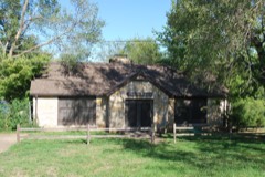
Block
From the record
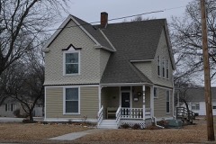
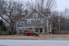
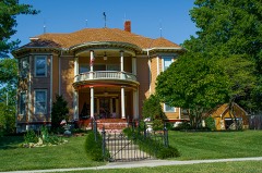
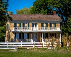
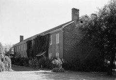
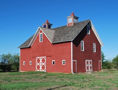
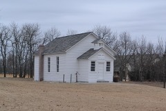
34 National Register listings published here, 1 of them a National Historic Landmark.
Sources: the National Register database, National Park Service
161 topographic sheets cover 41 settlements here, and 34 properties are on the National Register of Historic Places.
34 National Register listings published here, 1 of them a National Historic Landmark.
Sources: the National Register database, National Park Service
Every property in this county listed on the National Register of Historic Places, with the year it was listed and the federal nomination document.
Every wildfire the federal occurrence database records inside this county: 931 of them, burning about 1,092 acres. 11 started naturally and 68 were recorded as arson. Each settlement page carries the fires within five miles of it.
| Reported cause | Fires |
|---|---|
| Missing data/not specified/undetermined | 457 |
| Debris and open burning | 202 |
| Arson/incendiarism | 68 |
| Equipment and vehicle use | 65 |
| Smoking | 60 |
| Recreation and ceremony | 17 |
| Power generation/transmission/distribution | 17 |
| Fireworks | 16 |
| Misuse of fire by a minor | 15 |
| Natural | 11 |
| Other causes | 3 |
The five largest, by the area the report gives. One of them was set deliberately.
| Date | Cause | Size | Reported by | Name on the report |
|---|---|---|---|---|
| 7 March 2007 | Arson/incendiarism | 100 acres | Johnson County | not named |
| 18 August 2003 | Equipment and vehicle use | 100 acres | Johnson County | not named |
| 22 March 2015 | Debris and open burning | 80 acres | Kansas Forest Service | 810073 |
| 14 March 2015 | Missing data/not specified/undetermined | 60 acres | Kansas Forest Service | 730079 |
| 18 February 2016 | Missing data/not specified/undetermined | 45 acres | Kansas Forest Service | 490187 |
| 18 March 2017 | Debris and open burning | 30 acres | Johnson County | 770047 |
| 22 March 2018 | Missing data/not specified/undetermined | 30 acres | Kansas Forest Service | 810180 |
| 15 January 2006 | Recreation and ceremony | 25 acres | Johnson County | not named |
Every settlement page carries the fires within five miles of it - see the settlement index below.
The NOAA Storm Events Database holds 1,380 reports for this county, causing 4 deaths, 30 injuries and about $21,806,730 in recorded property damage. Each settlement page carries the reports that name it.
| Kind of event | Reports |
|---|---|
| Hail | 657 |
| Thunderstorm Wind | 567 |
| Flash Flood | 84 |
| Tornado | 45 |
| Flood | 15 |
| Heavy Rain | 6 |
| Lightning | 5 |
| Funnel Cloud | 1 |
The most serious of them, by death, then injury, then recorded damage. The accounts are quoted exactly as the forecast office filed them.
| When | Event | Place named | Harm | What the report says |
|---|---|---|---|---|
| October 1998 | Flash Flood | Overland Park | 2 killed, $8,000,000 | no account filed |
| August 2003 | Flash Flood | Overland Park | 1 killed | Flooding on various creeks and roadways due to torrential rains. An 18 year old Johnson county male died swimming in a rain swollen Indian Creek. Indian Creek crested at 12.6 feet or 0.6 feet above flood stage. |
| May 1991 | Thunderstorm Wind | not stated | 1 killed | no account filed |
| September 1993 | Hail | Shawnee | 12 hurt, $50,000 | Twelve members of a football team were injured after being caught in a storm that produced golfball hail driven by 75-knot winds. The hail dented numerous vehicles while the high winds uprooted trees and broke large limbs. |
| April 1966 | Tornado (F3) | not stated | 4 hurt, $2,500,000 | no account filed |
| June 1995 | Thunderstorm Wind | Spring Hill | 4 hurt | Severe thunderstorms moved across Johnson County. A 70 mph wind gust was observed at the intersection of U.S. Route 169 and 199th Street, and a 65 mph wind gust occurred near Stanley. Gusts up to 60 mph were recorded at the New Century Airport in Olathe, at the intersection of Interstate 435 and Johnson Drive. Thunderstorm winds knocked down numerous trees and limbs in Gardner and Shawnee. In Overland Park, a tree fell on a house and car, and a 60-foot tree was knocked down at 92nd and Switzer. Several streets were completely blocked by downed trees and limbs. A two-foot diameter tree also fell onto a house in Merriam, and trees, limbs, and power lines were downed in Spring Hill. |
| July 1969 | Tornado (F2) | not stated | 2 hurt, $250,000 | no account filed |
| June 1957 | Tornado (F1) | not stated | 2 hurt, $250,000 | no account filed |
| May 1995 | Tornado (F1) | Edgerton to | 2 hurt, $10,000 | A small tornado was associated with strong thunderstorms which produced downburst winds. It crossed into the far southwest portion of the county, west of Interstate 35, from Douglas county. In this area, 20 to 25 utility poles were snapped off and there was some minor structural damage to outbuildings. Several trees were also broken off and downed. The damage path ended after being into Johnson county about 1 mile. |
| May 1980 | Tornado (F2) | not stated | 1 hurt, $250,000 | no account filed |
| May 1952 | Tornado (F4) | not stated | 1 hurt, $250,000 | no account filed |
| June 1995 | Thunderstorm Wind | Gardner | 1 hurt | Severe thunderstorms moved across Johnson County. A 70 mph wind gust was observed at the intersection of U.S. Route 169 and 199th Street, and a 65 mph wind gust occurred near Stanley. Gusts up to 60 mph were recorded at the New Century Airport in Olathe, at the intersection of Interstate 435 and Johnson Drive. Thunderstorm winds knocked down numerous trees and limbs in Gardner and Shawnee. In Overland Park, a tree fell on a house and car, and a 60-foot tree was knocked down at 92nd and Switzer. Several streets were completely blocked by downed trees and limbs. A two-foot diameter tree also fell onto a house in Merriam, and trees, limbs, and power lines were downed in Spring Hill. |
| September 1986 | Thunderstorm Wind | not stated | 1 hurt | no account filed |
| May 1977 | Tornado (F3) | not stated | $2,500,000 | no account filed |
| March 2017 | Thunderstorm Wind | (Ojc)Johnson Co Exec | $500,000 | On the evening of March 6, a squall line with damaging winds moved through the Johnson County Executive Airport, and produced significant damage to hangars and aircraft enclosed in the hangars. Several planes were flipped after the building shredded apart by the strong straight line winds. NWS survey inspected the site and due to damage being spread in a unidirectional fashion the cause of the damage was deemed to be straight line winds ranging between 80 and 90 mph. |
| August 2004 | Flash Flood | Mission | $500,000 | 4 to 6 inches of rain in a short period of time caused the northbound ramp to Southwest Trafficway to close. Water rescues were conducted and several homes and businesses suffered flooding. |
| June 1999 | Flash Flood | Countywide | $500,000 | Several homes were flooded in Olathe and Mission Hills, and fire and rescue units responded to 74 emergency calls during the morning of June 28. Unofficial reports were received of 4 inches of rain in an hour, and a storm total of 7.8 inches was received at 131st and Kenneth Road. Near Stanley, flood waters from the Blue River were over the 151st Street bridge. Sections of Interstate 35 were closed due to high water. |
| July 1994 | Thunderstorm Wind | not stated | $500,000 | Thunderstorm winds downed trees and power lines. An estimated 15,000 county residents lost power during the event. |
| March 1993 | Tornado (F1) | DeSoto to 0.25 | $500,000 | A small tornado began in De Soto and ended north of Lenape in Leavenworth County. |
| September 1993 | Hail | Edgerton | $500,000 | Severe thunderstorms produced hail up to the size of baseballs and 60 knot winds throughout parts of western and southern Johnson County. Hail broke numerous windows and heavily damaged roofs and automobiles. Damage was also reported in Clare. |
| September 2000 | Lightning | Lenexa | $325,000 | Lightning sparked a house fire which caused $325,000 in damage to the house and its contents. |
| March 2006 | Hail | Shawnee | $250,000 | Numerous roofs and cars damaged by the hail. |
| June 2002 | Thunderstorm Wind | Olathe | $250,000 | Thunderstorm winds ripped off portions of a roof on a VFW building and a Toys "R" Us building. Numerous trees were uprooted. Tractor trailer rigs were overturned. Power lines were also downed and power poles were snapped in two. The downtown jail reported damage. |
| May 1977 | Tornado (F2) | not stated | $250,000 | no account filed |
| April 1972 | Tornado (F2) | not stated | $250,000 | no account filed |
| July 1965 | Tornado (F1) | not stated | $250,000 | no account filed |
| April 2006 | Hail | Stilwell | $200,000 | Roof and car damage from the large hail. |
| June 2003 | Hail | Overland Park | $200,000 | no account filed |
| August 1999 | Thunderstorm Wind | Olathe | $200,000 | no account filed |
| August 2006 | Lightning | Overland Park | $150,000 | Lightning hit a home and caused major damage from a fire that broke out. |
| May 1999 | Thunderstorm Wind | Olathe | $150,000 | Thunderstorm winds ripped a 2500 square foot section of roof off a business in Olathe and damaged a billboard along Interstate 35. |
| June 2003 | Hail | Olathe | $150,000 | no account filed |
| August 2025 | Lightning | Leawood | $100,000 | Large house fire caused by lightning strike just before 6 AM CDT on August 19th at 119th and Cherokee in Leawood. |
| March 2021 | Tornado (EF0) | Aubry | $100,000 | The storm moved through a neighborhood and caused some damage to the residences. Several outbuildings were also heavily damaged or destroyed, but the tornado was deemed an EF-0. The most dramatic damage noted was a roof blown off the top of a garage where wind compromised the large entry doors and removed the roof from inside the building. The tornado crossed HWY 69 and dissipated near the Kansas and Missouri state line. |
| August 2000 | Thunderstorm Wind | Olathe Johnson Co Ar | $100,000 | An isolated thunderstorm developed in very hot and humid air, and then collapsed, producing a 77 mph wind gust at Johnson County Executive Airport. The winds flipped two aircraft and moved several others at the airport. |
| June 1998 | Thunderstorm Wind | Overland Park | $100,000 | Severe thunderstorm winds gusted to 75 MPH in Overland Park. Structural damage was reported at several homes and business along 119th street between Antioch Rd and Metcalf Rd. Large trees were blown onto the roofs of several houses and fallen trees temporarily blocked traffic along 119th St . The damaging winds also blew roof top air conditioners from their moorings at several businesses and threw them approximately 20 feet. A construction trailer was damaged by the winds and several street lights were and power lines were blown down in the 119th Street and Metcalf area. |
| March 2006 | Hail | De Soto | $100,000 | no account filed |
| April 2011 | Hail | Lackmans | $80,000 | Roof damage was reported. |
| July 2011 | Thunderstorm Wind | Stilwell | $75,000 | A four block area in Stilwell, had around one dozen large trees knocked down, with a few of them landing on homes. Multiple power poles were snapped off, with resultant power outages across town. One front porch was knocked a little off the foundation of a home. The downburst had thunderstorm winds estimated up to 80 mph. |
| June 1995 | Thunderstorm Wind | Overland Park | $55,000 | Severe thunderstorms moved across Johnson County. A 70 mph wind gust was observed at the intersection of U.S. Route 169 and 199th Street, and a 65 mph wind gust occurred near Stanley. Gusts up to 60 mph were recorded at the New Century Airport in Olathe, at the intersection of Interstate 435 and Johnson Drive. Thunderstorm winds knocked down numerous trees and limbs in Gardner and Shawnee. In Overland Park, a tree fell on a house and car, and a 60-foot tree was knocked down at 92nd and Switzer. Several streets were completely blocked by downed trees and limbs. A two-foot diameter tree also fell onto a house in Merriam, and trees, limbs, and power lines were downed in Spring Hill. |
| April 2011 | Hail | Leawood | $50,000 | Roof damage was reported. |
| May 2000 | Hail | Overland Park | $50,000 | The same thunderstorm that produced large hail in Kansas City, KS continued south-southeast into Johnson County, tracking from Merriam across Overland Park, and into Leawood. Numerous reports of hail were received, with hail size ranging from pea size to ping-pong ball size. Large hail damaged numerous vehicles at a car dealership in Overland Park. Farther southeast, pea size hail fell continuously for several minutes, covering the ground and bringing Sunday afternoon traffic to a standstill on Interstate 435. |
| September 2000 | Thunderstorm Wind | Aubry | $50,000 | A camper was blown over, and a home under construction sustained significant damage. |
| July 2000 | Lightning | Leawood | $50,000 | A lightning strike sparked a house fire, which resulted in an estimated $50,000 in damage. |
| August 2000 | Thunderstorm Wind | Merriam | $50,000 | A fabric dome covering tennis courts was torn by thunderstorm winds. The dome was rated to withstand 85 mph winds. |
| August 2000 | Thunderstorm Wind | Lenexa | $50,000 | Emergency managers estimated winds at 70 mph. Several cars were blown off the road at Interstate 435 and 87th Street. Billboard signs were blown down and a parked semi trailer was overturned near 119th Street and Renner Road. |
| June 1994 | Thunderstorm Wind | Olathe | $50,000 | High winds from a thunderstorm downed a tree into a home. |
| June 1994 | Thunderstorm Wind | Gardner | $50,000 | Thunderstorm winds damaged barns, flipped a pickup truck and tore a roof off of a house. Lightning strikes also knocked out power to 18,000 homes in southern Johnson County. |
| April 1994 | Thunderstorm Wind | Overland Park | $50,000 | Thunderstorm winds blew the roof partially off an elementary school and downed several trees. |
| June 1994 | Thunderstorm Wind | Spring Hill | $50,000 | Trees and limbs were blown down from Olathe to the northern portion of Spring Hill. |
| May 1993 | Thunderstorm Wind | Olathe | $50,000 | A barn and power lines were blown down at 175th Street and Ridgeview. |
| September 1993 | Thunderstorm Wind | Olathe | $50,000 | The severe storms broke a number of power poles on the west side Olathe. |
| March 2006 | Hail | Overland Park | $50,000 | no account filed |
| March 2006 | Hail | Leawood | $50,000 | no account filed |
| May 2003 | Hail | Gardner | $50,000 | no account filed |
| June 2003 | Hail | Lenexa | $50,000 | no account filed |
| June 1999 | Flood | Countywide | $50,000 | no account filed |
| September 1993 | Hail | Spring Hill | $50,000 | no account filed |
| August 2004 | Thunderstorm Wind | Spring Hill | $45,000 | Fire truck blown off road. Three semi trailers overturned. One of which crushed an automobile. Radio tower snapped and power lines were down. |
| March 2006 | Hail | Shawnee | $40,000 | no account filed |
The Survey's mineral resources record lists 3 workings inside this county. All of them still produce. Each settlement page carries the workings within five miles of it.
| Commodity | Workings |
|---|---|
| Sand and Gravel, Construction | 2 |
| Stone, Crushed/Broken | 1 |
The least common of them first, because a county's hundredth gravel pit says nothing its first ten did not.
| Where | Site | Commodity | Status | Recorded |
|---|---|---|---|---|
| Monahan Mine | Stone, Crushed/Broken | Producer | ||
| Bonner Springs-Plant #2 | Sand and Gravel, Construction | Producer | ||
| Builders #2 Dredge & Pit | Sand and Gravel, Construction | Producer |
Named settlements recorded in the Geographic Names Information System, each with the topographic sheets covering it. Villages, hamlets and abandoned places alike. Each is shown with the nearest named watercourse or landform and the survey quadrangle it falls on.
Lake Quivira city · 66217 · Near Nelson Island · Edwardsville quadrangle
38 sheets, 1890 to 1991
McCamish township · 66025 · Edgerton quadrangle
18 sheets, 1885 to 1983
No longer a settlement
The vanished settlements of Johnson County: the places named above that are no longer on the map.