Block
From the record
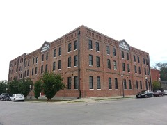
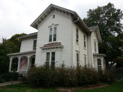
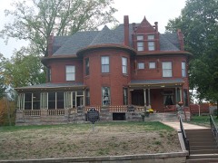
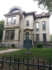
40 National Register listings published here, 2 of them National Historic Landmarks.
Sources: the National Register database, National Park Service
147 topographic sheets cover 33 settlements here, and 40 properties are on the National Register of Historic Places.
40 National Register listings published here, 2 of them National Historic Landmarks.
Sources: the National Register database, National Park Service
Every property in this county listed on the National Register of Historic Places, with the year it was listed and the federal nomination document.
Every wildfire the federal occurrence database records inside this county: 492 of them, burning about 9,334 acres. 1 started naturally and 28 were recorded as arson. Each settlement page carries the fires within five miles of it.
| Reported cause | Fires |
|---|---|
| Missing data/not specified/undetermined | 199 |
| Debris and open burning | 192 |
| Smoking | 39 |
| Arson/incendiarism | 28 |
| Equipment and vehicle use | 23 |
| Power generation/transmission/distribution | 3 |
| Misuse of fire by a minor | 3 |
| Recreation and ceremony | 2 |
| Fireworks | 2 |
| Natural | 1 |
The five largest, by the area the report gives. None of them was recorded as arson.
| Date | Cause | Size | Reported by | Name on the report |
|---|---|---|---|---|
| 21 March 2009 | Missing data/not specified/undetermined | 900 acres | Kansas Counties | LANGLEY |
| 7 February 2009 | Missing data/not specified/undetermined | 800 acres | Kansas Counties | SNAKE FARM |
| 8 November 2007 | Missing data/not specified/undetermined | 800 acres | Kansas Counties | PORTER FIRE |
| 22 August 2012 | Missing data/not specified/undetermined | 800 acres | Kansas Counties | SPRINGDALE |
| 22 March 2018 | Missing data/not specified/undetermined | 750 acres | Leavenworth County | IDA RD |
| 22 March 2015 | Missing data/not specified/undetermined | 450 acres | Kansas Forest Service | 150030 |
| 13 April 2015 | Debris and open burning | 400 acres | Kansas Forest Service | 150044 |
| 27 February 2016 | Missing data/not specified/undetermined | 350 acres | Kansas Forest Service | 44 |
Every settlement page carries the fires within five miles of it - see the settlement index below.
The NOAA Storm Events Database holds 763 reports for this county, causing 2 deaths, 28 injuries and about $48,360,150 in recorded property damage. Each settlement page carries the reports that name it.
| Kind of event | Reports |
|---|---|
| Hail | 323 |
| Thunderstorm Wind | 316 |
| Flash Flood | 71 |
| Tornado | 32 |
| Flood | 18 |
| Lightning | 2 |
| Funnel Cloud | 1 |
The most serious of them, by death, then injury, then recorded damage. The accounts are quoted exactly as the forecast office filed them.
| When | Event | Place named | Harm | What the report says |
|---|---|---|---|---|
| April 1964 | Tornado (F3) | not stated | 1 killed, 22 hurt, $2,500,000 | no account filed |
| June 1966 | Tornado (F4) | not stated | 1 killed, 2 hurt, $250,000 | no account filed |
| May 2003 | Tornado (F2) | Linwood | 2 hurt, $4,000,000 | Tornado on the ground 2 miles northwest of Linwood at County Road 25 and Interstate 70. Reported by emergency management and ham radio operator. Video shows the tornado crossed the Kansas Turnpike east of the Eastern Toll Booth, and then proceeded northeast to where it lifted 2 miles south of Basehor. Total track length was 6 miles, with a width approaching 250 yards at times. Maxium intensity rating was F2, with most damage noted to homes near and just northeast of the intersection of 166th and Kansas Road. |
| October 1984 | Tornado (F1) | not stated | 1 hurt, $250,000 | no account filed |
| June 2008 | Lightning | Basehor | 1 hurt | A 36 year old female was standing in the doorway of her home, when lightning struck nearby. She was transported to the hospital complaining of deafness. |
| May 2019 | Tornado (EF4) | Linwood | $26,000,000 | This tornado is a continuation of the tornado that formed in Douglas County and crossed the Kansas River into Leavenworth County. As the tornado crossed the Kansas River it became very strong and wide. It produced EF-3 damage to residences along the Kansas River. When the tornado impacted Linwood, Kansas it produced isolated EF-3 and EF-4 damage. Preliminary estimates for damage exceeded 26 million dollars, per the Leavenworth Times ( https://www.leavenworthtimes.com/news/20190531/tornado-damage-exceeds-26-million ). Despite the EF-4 rating and widespread devastation to rural areas near Lawrence and Linwood no serious injuries occurred. This was the strongest tornado to impact the Kansas City metro area since 2003. |
| May 2000 | Tornado (F1) | Tonganoxie | $2,600,000 | The tornado, which had formed in Jefferson County, entered southwestern Leavenworth County at around 9:40 pm CDT, 6 miles west-southwest of Tonganoxie. The tornado moved east-northeast and lifted 2 miles north of Basehor at 10:12 pm. The 16 mile long path was as wide as 1/4 mile at times, though the average was around 100 yards wide. In Leavenworth County, 200 homes were affected and six were destroyed. One apartment building suffered roof damage. Thirteen businesses were damaged, and two were destroyed. The Leavenworth County Fairgrounds in Tonganoxie suffered extensive damage, approaching a half-million dollars. Total damage was estimated by County Emergency Management officials at $2.6 million. |
| May 1961 | Tornado (F4) | not stated | $2,500,000 | no account filed |
| October 1998 | Flash Flood | Tonganoxie | $2,000,000 | no account filed |
| October 2005 | Flash Flood | Easton | $1,200,000 | 8.5 inches of rain fell in the Easton area with flash flooding reported on city streets and roads entering and leaving town. 100 homes or businesses suffered damage with 35 having major damage. One home was destroyed. A nursing home with 40 residents had to be evacuated. |
| May 2019 | Thunderstorm Wind | Linwood | $1,000,000 | A power pole was snapped in half at this location. |
| October 2005 | Flash Flood | Leavenworth | $1,000,000 | Flash flooding reported in Leavenworth with 130 buildings having suffered minor damage. 20 buildings reported major damage. |
| May 2007 | Flood | Lowemont | $750,000 | The Stranger Creek at Easton had its highest crest ever on May 7,2007. It crested at 27.80 feet, or 10.80 feet above flood stage. Several homes and businesses suffered damage. |
| March 1993 | Tornado (F1) | DeSoto | $500,000 | A small tornado touched down near 8th and Lexington in DeSoto in Johnson County and moved northeast lifting one mile north of Lenape in Leavenworth County. The tornado was witnessed by a citizen in De Soto who described the circulation as about 50 feet in diameter. Property damage was estimated at between $100,000 and $125,000. Hail the size of baseballs and severe straight-line winds accompanied the parent thunderstorm. |
| September 1993 | Hail | Reno | $500,000 | Severe storms repeatedly moved to the southwest of Reno producing up to baseball-size hail and 60 knot winds. Damage from the hail was estimated at $200,000 to homes and cars. Windows were also broken in Linwood where tennis ball-size hail was reported. |
| July 1994 | Thunderstorm Wind | Tonganoxie | $500,000 | no account filed |
| April 2009 | Tornado (EF1) | Reno | $400,000 | An Ef1 tornado touched down at 1735 CST near the intersection of 238th Street and Loring Street. The tornado crossed Interstate 70, and then remained nearly parallel to the Interstate, before lifting at 1750 CST, near the intersection of Metro Avenue and 190th Street. Two homes sustained major damage and several barns were destroyed. Numerous trees were uprooted and several outbuildings were damaged. |
| April 1995 | Thunderstorm Wind | Linwood | $300,000 | Severe thunderstorms produced winds of 60 mph or greater west and north of Linwood. Numerous trees were uprooted across the area, and a barn and a mobile home were destroyed four and one-half miles north of Linwood. |
| March 2006 | Hail | Basehor | $250,000 | Numerous roofs damaged. |
| June 1999 | Flash Flood | Countywide | $250,000 | no account filed |
| June 1996 | Tornado (F1) | Tonganoxie | $250,000 | no account filed |
| May 1952 | Tornado (F4) | not stated | $250,000 | no account filed |
| March 2006 | Hail | Basehor | $200,000 | Numerous roofs damaged. |
| April 1995 | Thunderstorm Wind | Linwood | $100,000 | Severe thunderstorms produced winds of 60 mph or greater west and north of Linwood. Numerous trees were uprooted across the area, and a barn and a mobile home were destroyed four and one-half miles north of Linwood. |
| May 1999 | Thunderstorm Wind | Basehor | $100,000 | no account filed |
| April 2006 | Hail | Easton | $50,000 | no account filed |
| June 1999 | Flood | Countywide | $50,000 | no account filed |
| July 1994 | Thunderstorm Wind | Easton | $50,000 | no account filed |
| August 2006 | Thunderstorm Wind | Basehor | $40,000 | Two barns destroyed along with a metal garage...trees also downed. |
| August 2005 | Lightning | Ft Leavenworth | $30,000 | Lightning struck a residence. |
| June 1998 | Thunderstorm Wind | Linwood | $30,000 | Severe thunderstorm winds gusted to 70 MPH throughout Leavenworth County. County Emergency Management reported 15 to 20 inch diameter trees down in Basehor. Also in Basehor, a 60 foot tree fell on two homes and a car. Numerous power lines were reported down as were numerous power outages. |
| June 2011 | Thunderstorm Wind | Fairmount | $25,000 | Large trees were snapped off at ground level. A barn was destroyed at 155th Street and Fairmont Road. |
| April 2000 | Hail | Easton | $25,000 | Hail up to golfball-size fell nearly continuously for 15 minutes. Numerous vehicles suffered hail damage, and exterior lighting fixtures were damaged. |
| August 2000 | Thunderstorm Wind | Basehor | $25,000 | A 20 inch diameter tree fell on a house. |
| June 1999 | Flood | Countywide | $25,000 | Heavy rainfall during the late evening hours resulted in urban flooding that required road closings and water rescues around midnight, local time. |
| April 2006 | Hail | Lansing | $25,000 | no account filed |
| April 2006 | Hail | Lansing | $25,000 | no account filed |
| May 1971 | Tornado (F2) | not stated | $25,000 | no account filed |
| June 1966 | Tornado (F2) | not stated | $25,000 | no account filed |
| April 1965 | Tornado (F3) | not stated | $25,000 | no account filed |
| June 1952 | Tornado (F2) | not stated | $25,000 | no account filed |
| June 1998 | Thunderstorm Wind | Leavenworth | $20,000 | Severe thunderstorm winds blew trees down onto a transformer causing a fire at Leavenworth. Thunderstorm winds in Jarbalo took the roof off a barn and blew down a grain bin. |
| April 2010 | Thunderstorm Wind | Loring | $15,000 | A 120 by 40 Foot barn roof and the front side of a barn, was destroyed at 158th and K-32. A travel trailer was blown over at 166th and Stilwell Road. |
| September 2001 | Thunderstorm Wind | Leavenworth | $13,000 | A 20 by 30 foot section of house roof blown off. Garage doors blown in and patio windows blown out. |
| May 2002 | Tornado (F1) | Lansing | $12,000 | Brief tornado touchdown with damage at a mobile home park and to nearby commercial buildings. |
| August 2011 | Hail | Easton | $10,000 | Hail up to the size of softballs were reported around Easton. Windows were broken out of homes, along with roof damage. |
| March 2006 | Tornado (F0) | Linwood | $10,000 | Brief tornado touchdown. Some structural damage noted to several residences. |
| June 2000 | Thunderstorm Wind | Leavenworth | $10,000 | A tree fell on top of a house. |
| May 1999 | Thunderstorm Wind | Tonganoxie | $10,000 | no account filed |
| September 2001 | Thunderstorm Wind | Easton | $7,000 | Siding blown off house. Gazebo attached to house torn off. Above ground pool with water blown over. Many tree limbs 12 to 18 inches in diameter snapped off. |
| June 1996 | Thunderstorm Wind | Basehor | $7,000 | no account filed |
| June 1996 | Thunderstorm Wind | Tonganoxie | $7,000 | no account filed |
| June 2019 | Thunderstorm Wind | Lansing | $5,000 | A tree went down on some power lines causing a power outage in portions of Lansing. |
| May 2019 | Thunderstorm Wind | Lenape | $5,000 | Dispatchers reported that power poles were blown down near Sherman Township. |
| August 2011 | Thunderstorm Wind | Leavenworth | $5,000 | Extensive tree damage was reported across western portions of Leavenworth. Several large trees were blown onto houses. Thunderstorm wind gusts were estimated up to 60 mph. |
| August 2011 | Thunderstorm Wind | Leavenworth | $5,000 | Power out in much of Leavenworth, due to downed power lines. A roof was blown onto Highway 73. Trees also reported blocking Highways 73 and 92. Thunderstorm wind gusts were estimated up to 60 mph. |
| April 2010 | Thunderstorm Wind | Loring | $5,000 | A roof was blown off a house at 142nd and Krieger Road. |
| August 2006 | Thunderstorm Wind | Leavenworth | $5,000 | Trees and power lines down. |
| May 1993 | Tornado (F0) | Jarbalo | $5,000 | A tornado touched down briefly at Jarbalo with reports of damage to trees and roof damage to barns. |
| July 1996 | Thunderstorm Wind | Leavenworth | $5,000 | no account filed |
The Survey's mineral resources record lists 1 working inside this county. It still produces. Each settlement page carries the workings within five miles of it.
| Commodity | Workings |
|---|---|
| Stone, Crushed/Broken | 1 |
The least common of them first, because a county's hundredth gravel pit says nothing its first ten did not.
| Where | Site | Commodity | Status | Recorded |
|---|---|---|---|---|
| Lansing Quarry | Stone, Crushed/Broken | Producer |
Named settlements recorded in the Geographic Names Information System, each with the topographic sheets covering it. Villages, hamlets and abandoned places alike. Each is shown with the nearest named watercourse or landform and the survey quadrangle it falls on.
Leavenworth city · 66048 · On Fivemile Creek · Leavenworth quadrangle
49 sheets, 1890 to 1984
Delaware township · 66043 · On Ninemile Creek · Leavenworth quadrangle
49 sheets, 1890 to 1984
Delaware township · 66048 · On Sevenmile Creek · Wolcott quadrangle
37 sheets, 1890 to 1983
High Prairie township · 66048 · On Murray Creek · Jarbalo quadrangle
22 sheets, 1886 to 1984
Delaware township · 66109 · On Little Snell Creek · Wolcott quadrangle
37 sheets, 1890 to 1983
Leavenworth city · 66048 · On Threemile Creek · Leavenworth quadrangle
49 sheets, 1890 to 1984
Sherman township · 66052 · On Ninemile Creek · Tonganoxie quadrangle
23 sheets, 1886 to 1960
Delaware township · 66109 · On Little Snell Creek · Wolcott quadrangle
37 sheets, 1890 to 1983
Lansing city · 66043 · On Ninemile Creek · Leavenworth quadrangle
49 sheets, 1890 to 1984