Block
From the record
21 National Register listings published here, 1 of them a National Historic Landmark.
Sources: the National Register database, National Park Service
63 topographic sheets cover 15 settlements here, and 21 properties are on the National Register of Historic Places.
21 National Register listings published here, 1 of them a National Historic Landmark.
Sources: the National Register database, National Park Service
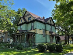
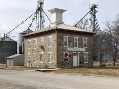
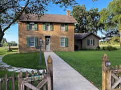
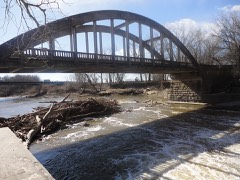
Every property in this county listed on the National Register of Historic Places, with the year it was listed and the federal nomination document.
Every wildfire the federal occurrence database records inside this county: 347 of them, burning about 24,740 acres. 4 started naturally and 23 were recorded as arson. Each settlement page carries the fires within five miles of it.
| Reported cause | Fires |
|---|---|
| Missing data/not specified/undetermined | 144 |
| Debris and open burning | 118 |
| Equipment and vehicle use | 24 |
| Arson/incendiarism | 23 |
| Smoking | 10 |
| Power generation/transmission/distribution | 9 |
| Recreation and ceremony | 7 |
| Fireworks | 4 |
| Natural | 4 |
| Misuse of fire by a minor | 2 |
| Other causes | 2 |
The five largest, by the area the report gives. Two of them were set deliberately.
| Date | Cause | Size | Reported by | Name on the report |
|---|---|---|---|---|
| 17 March 2016 | Missing data/not specified/undetermined | 5,000 acres | Kansas Forest Service | 016-028 |
| 20 March 2014 | Missing data/not specified/undetermined | 4,500 acres | Lyon County | ROAD Y |
| 22 March 2015 | Arson/incendiarism | 3,500 acres | Kansas Forest Service | 015-029 |
| 16 January 2014 | Missing data/not specified/undetermined | 1,800 acres | Lyon County | 310 AND J ROAD |
| 27 February 2016 | Missing data/not specified/undetermined | 1,000 acres | Kansas Forest Service | 501 |
| 10 February 2009 | Missing data/not specified/undetermined | 640 acres | Kansas Counties | ROAD M |
| 28 April 2019 | Missing data/not specified/undetermined | 550 acres | Lyon County | RD. 130/RD. V |
| 29 April 2011 | Arson/incendiarism | 534 acres | Flint Hills National Wildlife Refuge | NELSON BOTTOM |
Every settlement page carries the fires within five miles of it - see the settlement index below.
The NOAA Storm Events Database holds 861 reports for this county, causing 9 deaths, 205 injuries and about $58,359,850 in recorded property damage. Each settlement page carries the reports that name it.
| Kind of event | Reports |
|---|---|
| Hail | 378 |
| Thunderstorm Wind | 343 |
| Flash Flood | 61 |
| Tornado | 49 |
| Flood | 12 |
| Lightning | 7 |
| Funnel Cloud | 6 |
| Heavy Rain | 5 |
The most serious of them, by death, then injury, then recorded damage. The accounts are quoted exactly as the forecast office filed them.
| When | Event | Place named | Harm | What the report says |
|---|---|---|---|---|
| June 1974 | Tornado (F4) | not stated | 6 killed, 177 hurt, $25,000,000 | no account filed |
| May 2011 | Tornado (EF3) | Reading | 1 killed, 5 hurt, $2,280,000 | Another tornado developed 3 miles southwest of Reading. This tornado proceeded to hit the town of Reading producing EF3 damage in the city. The tornado continued on a path that took it into Osage County Kansas where it produced additional damage before lifting approximately 4 miles south of Osage City. A single story home in Reading was swept off its foundation. There were several two story homes with significant damage to the second story or completely removed. A well anchored mobile home was lofted and thrown 50 yards into a tree. Vehicles were rolled and large chemical tank was thrown 100 yards. Winds estimated at 140 mph. |
| August 1985 | Thunderstorm Wind | not stated | 1 killed, 5 hurt | no account filed |
| July 2015 | Flash Flood | Plymouth | 1 killed | Flooding over the Kansas turnpike at mile marker 118. This shut down the northbound lanes. A 21 year old male driver hydroplaned and lost control of his vehicle. The vehicle left the road and was then swept downstream by the flood waters. He was not able to survive. |
| June 1990 | Tornado (F2) | not stated | 17 hurt, $25,000,000 | no account filed |
| August 1985 | Thunderstorm Wind | not stated | 1 hurt | no account filed |
| November 1998 | Flash Flood | Emporia | $2,500,000 | no account filed |
| July 2004 | Flash Flood | Admire | $935,000 | Thunderstorms produced heavy rains totaling 3 to 6 inches the morning of the 24th with flash flooding the result. Numerous rural roads and bridges were washed out or badly damaged. Damage totals were over 900 thousand dollars. |
| May 1989 | Tornado (F1) | not stated | $250,000 | no account filed |
| May 1987 | Tornado (F1) | not stated | $250,000 | no account filed |
| May 1962 | Tornado (F2) | not stated | $250,000 | no account filed |
| May 2007 | Flash Flood | Emporia | $200,000 | Report of water flowing over K-99 north of town. This portion of the road has been barricaded by law enforcement. Unofficial reports of 5 to 6 inches of rain received. The police department reported water damage and several evacuations took place. |
| June 2005 | Flash Flood | Admire | $200,000 | A local bridge was closed and at least 6 inches of fast flowing water reported across junction of k-99 and US 56 junction. |
| June 2005 | Flash Flood | Bushong | $150,000 | Fast flowing water washed out bridge and closed U.S. Highway 56. |
| July 2007 | Flood | Neosho Rapids | $100,000 | Flooding continues into early July. Some roads are closed especially along the lower reaches of the Neosho River near Neosho Rapids. |
| May 2007 | Flood | Emporia | $100,000 | Moderate or greater flooding...including flooding of rural roads...in the immediate reach of the gages on the Cottonwood near Emporia, the Neosho river near Emporia, the Neosho River near Neosho Rapids and near Reading on the Marais Des Cygnes. |
| May 2006 | Flash Flood | Emporia | $100,000 | Thunderstorms dumped heavy rainfall on the city of Emporia, causing widespread street flooding. 2 to 3 inches of rain were estimated to have fallen in the mid to late afternoon hours. Many roads were closed due to the rapidly rising water, and underpasses were filled with water as well. Water levels rose past the bumpers of many cars, and several water rescues had to be performed from people stranded on the roofs of their cars. Homes and businesses were also flooded as a result of the heavy rains. The heaviest street flooding and some water rescues were reported at the State Street underpass, the intersections of 6th and Congress, and the intersections of 12th and Burlingame Rd. There were no deaths or injuries reported. |
| June 2005 | Flash Flood | Olpe | $100,000 | K99 highway closed by fast flowing water after nearly 5 inches of rain. |
| June 2005 | Flash Flood | Allen | $100,000 | The northbound lane of junction of highways K99 and US56 under two feet of water with large trees and limbs floating. |
| June 1995 | Tornado (F1) | Emporia | $100,000 | A small tornado hit in the 3100 block of Road N, damaging trees, power poles, fencing, farm buildings, and hog sheds. |
| June 1996 | Flash Flood | Emporia | $100,000 | no account filed |
| June 2007 | Flood | Neosho Rapids | $80,000 | The Marais des Cygnes River reaches moderate flooding stage due to persistent heavy rains. Flooding continues into July. |
| August 2009 | Thunderstorm Wind | Bushong | $50,000 | The wind event continued through Lyon county and did damage to some out buildings near the city of Allen. The city of Allen and Admire also reported many large trees and tree limbs snapped as a result of the wind. The swath of damage was around 20 miles wide, with the mid line drawn through the center of the damage path. |
| August 2005 | Flash Flood | Americus | $50,000 | Fast flowing water over county roads. One indirect injury due to hydroplaning on water covered road. |
| June 1994 | Thunderstorm Wind | Emporia | $50,000 | Gusty winds damaged a barn and knocked shingles off roofs of other buildings. Lightning also caused many power outages. |
| July 1994 | Thunderstorm Wind | Emporia | $50,000 | Winds clocked to 73 mph at the Emporia Airport caused widespread and severe damage to trees, power lines and some buildings around much of the county. |
| May 1995 | Hail | Bushong | $50,000 | no account filed |
| October 1998 | Flash Flood | Emporia | $35,000 | no account filed |
| June 2007 | Flash Flood | Olpe | $30,000 | Spotters reported Rock Creek was out of its banks with several inches of fast flowing water over the road. |
| July 2007 | Flash Flood | Americus | $30,000 | Reports of 4 to 5 inches of water covering County Rd. F in Americus. Pester Creek is flooding with water over Orange St. in Americus. Barricades placed at 7th and Orange St. |
| June 2005 | Flash Flood | Admire | $25,000 | Around 6 inches of fast flowing water across K99 highway with several rural roads closed. |
| May 1995 | Thunderstorm Wind | Miller | $25,000 | High winds damaged a house and outbuildings. |
| March 1973 | Tornado (F2) | not stated | $25,000 | no account filed |
| June 2025 | Flash Flood | Emporia | $20,000 | Numerous roads closed across the Lyon County, including roads that rarely flood. |
| November 2005 | Tornado (F0) | Hartford | $20,000 | The tornado touched down 3 miles SW of Hartford and moved nroth to 1.5 miles west of Hartford. The tornado produced F0 damage to buildings on three farmsteads and several other outbuildings along its path. The parent thunderstorm was a mini-supercell within a bow echo. |
| May 2006 | Lightning | Americus | $15,000 | A lightning strike destroyed a garage and a pickup truck inside the garage. A room converted from a garage was also damaged. The residents of the home were not injured as they fled their smoke filled house. |
| July 2012 | Thunderstorm Wind | Emporia | $10,000 | Tree limbs were down, blocking roadways in Emporia. Also a grain bin was destroyed and blown over 3 miles northeast of Emporia. |
| July 1996 | Thunderstorm Wind | Emporia | $10,000 | no account filed |
| June 2006 | Lightning | Emporia | $7,000 | Lightning struck and severely damaged the cross atop St. Andrew's Episcopal Church as well as caused damage to the stained glass window and narthex. |
| August 2010 | Thunderstorm Wind | Olpe | $5,000 | A law enforcement officer reported power poles down between Olpe and Madison. Also, near Hartford, a truck was blown off the road and into a ditch. |
| June 1999 | Thunderstorm Wind | Emporia | $4,000 | Strong winds blew the roof off a house. |
| August 2001 | Thunderstorm Wind | Olpe | $3,000 | Strong winds blew a shed onto a road. |
| June 1999 | Thunderstorm Wind | Emporia | $3,000 | Strong winds blew the roof off a trailer home. |
| May 1998 | Thunderstorm Wind | Emporia | $3,000 | no account filed |
| July 1996 | Thunderstorm Wind | Emporia | $3,000 | no account filed |
| April 1973 | Tornado (F2) | not stated | $2,500 | no account filed |
| April 1964 | Tornado | not stated | $2,500 | no account filed |
| May 1962 | Tornado (F0) | not stated | $2,500 | no account filed |
| May 1962 | Tornado (F1) | not stated | $2,500 | no account filed |
| May 1962 | Tornado (F2) | not stated | $2,500 | no account filed |
| April 1954 | Tornado (F2) | not stated | $2,500 | no account filed |
| July 2002 | Thunderstorm Wind | Emporia | $2,000 | Strong winds downed power poles south of Emporia. |
| June 2002 | Lightning | Emporia | $2,000 | Lightning struck a power line knocking out power for a time. |
| August 2000 | Thunderstorm Wind | Emporia | $2,000 | Strong winds knocked down power poles in Emporia. |
| June 1999 | Thunderstorm Wind | Miller | $2,000 | Winds to 81 mph did some structural damage to buildings in Miller. |
| June 1998 | Lightning | Emporia | $2,000 | no account filed |
| June 1998 | Thunderstorm Wind | Emporia | $2,000 | no account filed |
| July 1996 | Thunderstorm Wind | Bushong | $2,000 | no account filed |
| July 1996 | Thunderstorm Wind | Emporia | $2,000 | no account filed |
| June 2011 | Thunderstorm Wind | Lang | $1,500 | A tree was blown onto the deck of a house near Reading. |
Named settlements recorded in the Geographic Names Information System, each with the topographic sheets covering it. Villages, hamlets and abandoned places alike. Each is shown with the nearest named watercourse or landform and the survey quadrangle it falls on.