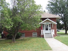
Block
From the record
26 National Register listings published here.
Sources: the National Register database, National Park Service
62 topographic sheets cover 18 settlements here, and 26 properties are on the National Register of Historic Places.
26 National Register listings published here.
Sources: the National Register database, National Park Service
Every property in this county listed on the National Register of Historic Places, with the year it was listed and the federal nomination document.
Every wildfire the federal occurrence database records inside this county: 353 of them, burning about 9,996 acres. 9 started naturally and 37 were recorded as arson. Each settlement page carries the fires within five miles of it.
| Reported cause | Fires |
|---|---|
| Missing data/not specified/undetermined | 109 |
| Debris and open burning | 103 |
| Smoking | 37 |
| Arson/incendiarism | 37 |
| Equipment and vehicle use | 35 |
| Recreation and ceremony | 16 |
| Natural | 9 |
| Power generation/transmission/distribution | 3 |
| Fireworks | 3 |
| Misuse of fire by a minor | 1 |
The five largest, by the area the report gives. None of them was recorded as arson.
| Date | Cause | Size | Reported by | Name on the report |
|---|---|---|---|---|
| 8 January 2017 | Missing data/not specified/undetermined | 3,000 acres | Ellsworth County | 33 |
| 15 April 2008 | Missing data/not specified/undetermined | 2,000 acres | Kansas Counties | MAXWELL PASTURE |
| 11 March 2015 | Missing data/not specified/undetermined | 2,000 acres | McPherson County | 2ND AND SIOUX |
| 7 April 2020 | Missing data/not specified/undetermined | 500 acres | Kansas Forest Service | not named |
| 2 August 2012 | Missing data/not specified/undetermined | 400 acres | Kansas Counties | 2ND AND SIOUX |
| 18 March 2016 | Missing data/not specified/undetermined | 400 acres | Kansas Forest Service | 13 |
| 10 March 2016 | Debris and open burning | 225 acres | Kansas Forest Service | 16-0020 |
| 18 October 2005 | Debris and open burning | 160 acres | McPherson County | not named |
Every settlement page carries the fires within five miles of it - see the settlement index below.
The NOAA Storm Events Database holds 994 reports for this county, causing 1 death, 20 injuries and about $90,615,650 in recorded property damage. Each settlement page carries the reports that name it.
| Kind of event | Reports |
|---|---|
| Hail | 434 |
| Thunderstorm Wind | 396 |
| Tornado | 53 |
| Flood | 44 |
| Heavy Rain | 39 |
| Flash Flood | 23 |
| Funnel Cloud | 4 |
| Lightning | 1 |
The most serious of them, by death, then injury, then recorded damage. The accounts are quoted exactly as the forecast office filed them.
| When | Event | Place named | Harm | What the report says |
|---|---|---|---|---|
| June 1950 | Tornado (F4) | not stated | 1 killed, 5 hurt, $250,000 | no account filed |
| June 1992 | Tornado (F4) | not stated | 10 hurt, $25,000,000 | no account filed |
| May 2007 | Thunderstorm Wind | Moundridge | 3 hurt, $1,500,000 | Rather extensive damage occurred across the town of Moundridge due to extreme straight line winds estimated at 90 to 100 mph. Three businesses and one residence received major damage. Numerous trees were uprooted across the town. The damage path was relatively narrow, indicating an intense channel microburst. Three individuals received minor injuries. |
| June 1971 | Tornado (F2) | not stated | 1 hurt, $25,000 | no account filed |
| February 2012 | Thunderstorm Wind | Moundridge | 1 hurt, $15,000 | Winds estimated around 75 mph blew over a semi tractor-trailer on Interstate 135, just east of Moundridge. The driver, a 40-year-old woman, was injured (direct). Information courtesy of the McPherson Sentinel. |
| March 1990 | Tornado (F5) | not stated | $25,000,000 | no account filed |
| March 1990 | Tornado (F5) | not stated | $25,000,000 | no account filed |
| May 1990 | Tornado (F3) | not stated | $2,500,000 | no account filed |
| March 1990 | Tornado (F3) | not stated | $2,500,000 | no account filed |
| May 1974 | Tornado (F2) | not stated | $2,500,000 | no account filed |
| May 2014 | Thunderstorm Wind | Galva | $1,000,000 | Extensive damage from wind driven hail occurred in and around the town of Galva, Kansas. The winds were estimated to be between 65 and 75 mph causing damage to numerous houses and downing tress across town. Tree limbs eight inches in diameter were knocked down. An RV storage unit had it's roof taken off from the damaging winds. Homes received damage to siding from wind driven half dollar sized hail. The roof of the school had damage as well. |
| May 2014 | Thunderstorm Wind | Galva | $500,000 | Damaging wind gusts estimated at 75 mph derailed a train, with 33 rail cars knocked off the tracks. Two drivers were aboard the train, but were unharmed. The rail cars contained grain products, and other household goods. Cleanup took over a week to complete. |
| June 2013 | Hail | Marquette | $500,000 | The public also estimated 60-70 mph winds that uprooted trees all over town. |
| June 2010 | Thunderstorm Wind | Lindsborg | $400,000 | Sixty five to seventy mph winds tore part of the roof off the Smoky Valley High School gymnasium. With the roof open, a heavy deluge of rainfall damaged the gym floor beyond repair. A basketball practice was ongoing when the ceiling was torn off but no one was hurt. Numerous trees were also knocked down across town with some minor structural damage reported to some homes. |
| May 2014 | Thunderstorm Wind | Canton | $250,000 | Trees and power lines were reported knocked down in and around Canton. A section of rook was taken off of a home west of Canton on Highway 56. The school in Canton reported wind damage to its roof. |
| June 2002 | Thunderstorm Wind | Marquette | $250,000 | Two 80-85 foot silos collapsed, destroying the office building and milling operation. A 45-by-50 foot metal pole barn was destroyed, being picked up and hurled into a field southeast of where it had been located. Numerous businesses and residences sustained roof damage and had windows blown out. Obviously, tree damage was widespread and numerous power lines and power poles were downed. Area newspapers contributed greatly to this report. |
| June 2000 | Thunderstorm Wind | Mc Pherson | $250,000 | Microburst winds swept across a 10-12 block area of North McPherson. Roofs were damaged or removed, insulation was ripped out, merchandise overturned at the garden department of a supermarket, boats and gas tanks were tossed into nearby lots and one side of a greenhouse was ripped off. |
| September 1973 | Tornado (F2) | not stated | $250,000 | no account filed |
| June 2009 | Tornado (EF0) | Mc Pherson Arpt | $200,000 | Three barns were completely destroyed, a silo was blown into a cornfield, a center-pivot irrigation system was destroyed, and 26 power poles were downed. Additionally, an SUV was thrown into a wheat field. The McPherson Sentinel contributed to this report. |
| June 2014 | Hail | Mc Pherson | $150,000 | A trained spotter reported 3.25 inch hail at the 1700 block of Limestone. |
| July 2009 | Thunderstorm Wind | Elyria | $150,000 | A line of twenty power poles were blown down along Old Highway 81. This knocked out power to all of Moundridge for the next 24 hours. |
| August 2005 | Thunderstorm Wind | Marquette | $150,000 | The porches of two homes were destroyed; the first by a large tree that was uprooted and fell onto it, while the second, a small porch, was ripped from the home and tossed onto the roof. Prior to losing it's front porch, the second home was struck by a trampoline. The second home also sustained extensive water damage. Roof damage was extensive throughout the community. The damage estimate assigned is tentative, pending examination by an insurance adjustors. In addition, windows and screens were blown out of many homes. Downed power lines and power poles resulted in loss of power to the entire community. Tree damage was likewise extensive and included many that were uprooted. No doubt the tree damage, be it trees that were uprooted or downed limbs falling onto power lines, contributed to the outages. (Narrative courtesy McPherson Sentinal.) |
| August 2001 | Thunderstorm Wind | Lindsborg | $150,000 | Fifteen power poles, of which nine were snapped, and their associated power lines downed. The resulting power outages affected most of Lindsborg including Lindsborg Community Hospital, a retirement home, the middle school, and Smoky Valley High School. Both schools were closed the next day. Most of Lindsborg was without power for nearly two days. Just south of Lindsborg, a machine storage shed was leveled. Area newspapers contributed greatly to this report. |
| June 2002 | Thunderstorm Wind | Lindsborg | $125,000 | Widespread damage to roofs, trees, power lines and power poles. (Cooperative observer). |
| June 2002 | Thunderstorm Wind | Mc Pherson | $125,000 | Widespread damage to roofs, trees, power lines and power poles. |
| August 2005 | Hail | Marquette | $100,000 | Vinyl siding damaged to an unspecified number of homes. (Narrative courtesy of McPherson Sentinal.) |
| June 2002 | Thunderstorm Wind | Marquette | $100,000 | Widespread roof damage as well as downed power lines and power poles. |
| June 2002 | Thunderstorm Wind | Marquette | $100,000 | Widespread roof damage as well as downed power lines and power poles. |
| September 1998 | Thunderstorm Wind | Windom | $100,000 | Grain bins blown over, power lines and power poles blown down, houses sustained damage to roofs, siding and windows, and vehicles had windows blown out. |
| June 1998 | Thunderstorm Wind | Mc Pherson | $85,000 | Awning of service station blown down, a restaurant sign was blown down, a barn just southwest Mcpherson severely damaged, and numerous tree limbs blew onto power lines severing power to numerous residences. |
| August 2011 | Thunderstorm Wind | Inman | $75,000 | A powerful supercell thunderstorm produced extreme straight-line wind damage in the Inman area. Winds estimated up to 90 mph tore a portion of a roof from a residence, and also blew out several windows at that same residence. Thereafter, heavy rainfall rushed through the broken windows and section of missing roof, damaging some of the interior. At a neighbors house, a shed in the backyard was destroyed. Additionally, a few windows in the house were broken and the garage wall was moved about one foot. Damage amounts are rough estimates. The Hutchinson News was the sole contributor to this report. |
| June 2009 | Tornado (EF1) | Windom | $75,000 | Tornado moved across a farmstead and destroyed a barn, toppled a tractor trailer, and threw two grain bins out into the wheat field. |
| May 2007 | Flash Flood | Mc Pherson | $61,000 | Numerous, slow-moving thunderstorms produced 4 to 6 inches of rain across primarily the southern two-thirds of McPherson County from the late afternoon hours on May 23rd, to the early morning hours on May 24th. This caused widespread countywide flash flooding. Numerous rural and city roads were closed, and in fact all county roads across the southern half of the county were closed during the overnight hours due to high water. A vehicle was swept off Chisholm Road near 22nd Avenue, just north of Moundridge, but no injuries were reported. The highest measured total was 6.15 inches 7 miles west-northwest of McPherson. Estimated road and bridge damage across the county is $61,000. Other public and private damages are unknown. |
| May 2014 | Hail | Roxbury | $50,000 | Sixty mph winds were also reported. The wind driven hail produced damage to vinyl siding of houses. |
| June 2011 | Hail | Canton | $50,000 | Hail up to baseball size affected the Canton area. The large hail likely inflicted damage to various roofs and vehicles, although the exact amount is unknown. Consequently, property damage amounts are rough estimates. |
| April 2009 | Thunderstorm Wind | Moundridge | $50,000 | Straight-line winds blew over a grain bin east of Moundridge, and also damaged some farm equipment. The Moundridge Ledger contributed to this report. |
| May 1999 | Tornado (F1) | Mc Pherson | $50,000 | Initial damage occurred 3.5 miles SW of Inman where an old barn collapsed and trees were uprooted. The greatest damage occurred 3-4 miles east of Inman where one house sustained minor roof damage, a circle irrigation system was destroyed, a tin cattleshed was destroyed, and an irrigation pipe was wrapped around trees. As the tornado continued a northeast track along and just east Highway 61, it inflicted more tree damage as well as damaging part of the wheat crop as it passed 2 miles southeast of Groveland before lifting 3 miles southwest of McPherson. Though possessing an overall track of 10 miles from point of entry into McPherson County to dissipation, the tornado skipped, never maintaining ground contact for more than 2 miles at a time with the segments totalling about 5 miles. |
| July 1994 | Thunderstorm Wind | McPherson | $50,000 | A huge tree was uprooted and landed on a house in Inman. Winds of 60 miles an hour were reported six miles west of McPherson. |
| May 1997 | Thunderstorm Wind | Marquette | $50,000 | no account filed |
| June 2009 | Thunderstorm Wind | Canton | $45,000 | Damaging straight line winds estimated at 80 mph took the roof off a storage shed and severely damaged another shed on a homestead. |
| May 2014 | Thunderstorm Wind | Roxbury | $30,000 | Roof damage occurred and a shed was destroyed at a farm. Trees were also uprooted and power lines were blown down. |
| June 2009 | Thunderstorm Wind | Elyria | $30,000 | Two semi-trucks were blown over southeast of McPherson. Information courtesy of the McPherson Sentinel. |
| July 2009 | Thunderstorm Wind | Inman | $30,000 | A tin roof was blown off a roof of a business. The damaging winds also sheered a portion of the roof off. A 40 foot high bell tower was also destroyed. |
| May 2012 | Thunderstorm Wind | Moundridge | $25,000 | Major tree damage throughout city with downed power poles and power lines. Power out across town. |
| February 2012 | Thunderstorm Wind | Moundridge | $25,000 | Around two-dozen utility poles were downed along Old Highway 81 a few miles northwest of Moundridge. Information courtesy of the Wichita Eagle. |
| August 2001 | Thunderstorm Wind | Galva | $25,000 | Storage shed, 8 by 12 feet, dislodged from foundation. |
| May 2019 | Hail | Mc Pherson | $25,000 | no account filed |
| June 1996 | Thunderstorm Wind | Mc Pherson | $25,000 | no account filed |
| June 1992 | Tornado (F2) | not stated | $25,000 | no account filed |
| June 1992 | Tornado (F1) | not stated | $25,000 | no account filed |
| March 1991 | Tornado (F1) | not stated | $25,000 | no account filed |
| November 1973 | Tornado (F0) | not stated | $25,000 | no account filed |
| April 1955 | Tornado (F2) | not stated | $25,000 | no account filed |
| April 1955 | Tornado (F1) | not stated | $25,000 | no account filed |
| August 1951 | Tornado | not stated | $25,000 | no account filed |
| August 1951 | Tornado | not stated | $25,000 | no account filed |
| June 2010 | Thunderstorm Wind | Lindsborg | $20,000 | A trained spotter reported some minor damage to outbuildings. |
| June 2008 | Thunderstorm Wind | Mc Pherson Arpt | $20,000 | The wind was measured by AWOS equipment at the McPherson Airport. Power poles and 16,000-volt power lines were downed along I-135 between exits 57 and 58 southeast of McPherson, and 3-inch diameter tree limbs were downed in McPherson. Additionally, various fireworks tents were blown down across the county. |
| June 2006 | Thunderstorm Wind | Mc Pherson | $20,000 | Several utility poles were blown down around the Canton area. Courtesy The Salina Journal. |
| May 2019 | Hail | Mc Pherson | $20,000 | no account filed |
Named settlements recorded in the Geographic Names Information System, each with the topographic sheets covering it. Villages, hamlets and abandoned places alike. Each is shown with the nearest named watercourse or landform and the survey quadrangle it falls on.
King City township · 67460 · On Running Turkey Creek · McPherson South quadrangle
16 sheets, 1891 to 1985
McPherson city · 67460 · On Bull Creek · McPherson South quadrangle
16 sheets, 1891 to 1985
Gypsum Creek township · 67476 · On South Gypsum Creek · Roxbury quadrangle
17 sheets, 1889 to 1990