 Block
From the record
3 National Register listings published here.
Sources: the National Register database, National Park Service
18 topographic sheets cover 6 settlements here, and 3 properties are on the National Register of Historic Places.
3 National Register listings published here.
Sources: the National Register database, National Park Service
Every property in this county listed on the National Register of Historic Places, with the year it was listed and the federal nomination document.
| Photograph | Property | Type | Listed | Reference |
|---|---|---|---|---|
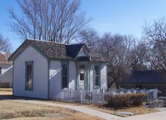 | Dalton Gang Hideout and Museum | district | 2015 | 14001121 |
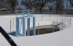 | Fowler Swimming Pool and Bathhouse | building | 2009 | 09000030 |
| Hotel Bunyan | building | 2025 | 100012120 |
Every wildfire the federal occurrence database records inside this county: 66 of them, burning about 71,881 acres. 6 started naturally and none was recorded as arson. Each settlement page carries the fires within five miles of it.
| Reported cause | Fires |
|---|---|
| Missing data/not specified/undetermined | 35 |
| Equipment and vehicle use | 12 |
| Debris and open burning | 7 |
| Natural | 6 |
| Fireworks | 3 |
| Power generation/transmission/distribution | 2 |
| Misuse of fire by a minor | 1 |
The five largest, by the area the report gives. None of them was recorded as arson.
| Date | Cause | Size | Reported by | Name on the report |
|---|---|---|---|---|
| 21 February 1996 | Missing data/not specified/undetermined | 55,000 acres | Meade County | not named |
| 12 March 2006 | Missing data/not specified/undetermined | 9,700 acres | Kansas Counties | MEADE |
| 29 December 1999 | Missing data/not specified/undetermined | 2,000 acres | Meade County | not named |
| 18 August 2003 | Missing data/not specified/undetermined | 1,000 acres | Clark County | not named |
| 4 July 2012 | Missing data/not specified/undetermined | 850 acres | Kansas Counties | HAGER RANCH |
| 2 March 2017 | Equipment and vehicle use | 700 acres | Meade County | 17013 |
| 6 April 2010 | Missing data/not specified/undetermined | 640 acres | Kansas Counties | BOREKAR SAND PIT FIRE |
| 19 July 2010 | Missing data/not specified/undetermined | 600 acres | Kansas Counties | 9162 FIRE |
Every settlement page carries the fires within five miles of it - see the settlement index below.
The NOAA Storm Events Database holds 749 reports for this county, causing no deaths, no injuries and about $9,612,030 in recorded property damage. Each settlement page carries the reports that name it.
| Kind of event | Reports |
|---|---|
| Hail | 482 |
| Thunderstorm Wind | 170 |
| Tornado | 57 |
| Heavy Rain | 22 |
| Flash Flood | 14 |
| Funnel Cloud | 3 |
| Flood | 1 |
The most serious of them, by death, then injury, then recorded damage. The accounts are quoted exactly as the forecast office filed them.
| When | Event | Place named | Harm | What the report says |
|---|---|---|---|---|
| April 1994 | Tornado (F2) | Plains | $5,000,000 | The tornado entered Meade County from Seward County at 1545 CST 4 SW of Plains and moved ENE at 35 miles an hour striking the southern part of the town of Meade at around 1600 CST. It ended one mile SE of Meade after doing extensive damage to Meade High School, power lines, and several agri-based businesses in southern Meade Township. Damage estimates were around $1.3 million. |
| May 1998 | Thunderstorm Wind | Missler | $1,650,000 | Eleven irrigation sprinklers damaged along with ten power poles. At least 80 mph wind occurred with the Rear Flank Downdraft. Wheat and corn were destroyed in the area. |
| May 2019 | Flash Flood | Fowler | $1,000,000 | Rainfall of nearly 10 inches caused very severe flash flooding. Water came across highway 23 and washed an old concrete truck full of concrete across the highway and into an adjacent draw about 400 yards away. The drum of concrete had been there for decades. Also, water washed out a bridge and a resident of nearly 90 years had never seen so much water. The majority of the rain fell in a 3 hour period. |
| May 2015 | Tornado (EF1) | Plains | $750,000 | This tornado moved in from Seward County. It appeared to be much stronger and wider, visually. But the cloud bases were extremely low. The tornado turned north and then northwest as is dissipated, based on the survey. Many persons did not see the tornado due to nearby stratus and fog. |
| May 2003 | Tornado (F1) | Plains | $300,000 | This tornado took out numerous trees, pivot sprinklers and blew out windows in one structure. |
| April 1976 | Tornado (F1) | not stated | $250,000 | no account filed |
| August 2002 | Thunderstorm Wind | Meade | $100,000 | Numerous trees and power lines were blown down and there was structural damage to several buildings. |
| June 2008 | Tornado (EF1) | Collano | $85,000 | This tornado destroyed a pivot irrigation sprinkler and threw oil drums around as it moved southeast. |
| March 2007 | Tornado (EF1) | Fowler | $75,000 | This tornado damaged a shed and some trees west of Fowler and a pivot irrigation sprinkler northwest of Fowler. The tornado moved into Gray county at 752 PM CDT. |
| February 2007 | Tornado (EF1) | Fowler | $50,000 | The second tornado to form started 6.3 miles northwest of Fowler at 1011 PM and traveled a total of 17 miles dissipating at 1040 PM 7 miles southwest of the Dodge City Post Office. It did EF1 damage to five pivot irrigation sprinklers, trees and some outbuildings...in addition to moving a 3000 gallon tank about 1/2 of a mile. In Meade county it tipped over a pivot sprinkler before moving into Ford county at 1014 PM. |
| May 2003 | Tornado (F1) | Meade | $50,000 | Three hog barns were destroyed. |
| July 2000 | Thunderstorm Wind | Meade | $50,000 | Metal roof panels blown off a building. Pivot irrigation sprinkler was overturned and trees were blown down in the area. |
| April 1994 | Hail | Kismet | $50,000 | Hail broke windows out of house and car. Damage also done to car body by hail. |
| September 1993 | Hail | Plains | $50,000 | no account filed |
| September 1994 | Thunderstorm Wind | Plains | $25,000 | The public reported numerous power poles blown down. |
| September 1973 | Tornado (F3) | not stated | $25,000 | no account filed |
| June 1963 | Tornado (F0) | not stated | $25,000 | no account filed |
| June 1958 | Tornado (F2) | not stated | $25,000 | no account filed |
| September 1994 | Thunderstorm Wind | not stated | $10,000 | High winds knocked down numerous tree limbs with some roof damage. |
| May 2010 | Hail | Meade State Park | $8,000 | The siding was damaged and windows were broken. |
| May 1994 | Thunderstorm Wind | Meade | $5,000 | Agtap observer estimated wind at 60 mph. Power lines were downed along his county road. |
| July 1994 | Hail | Plains | $5,000 | no account filed |
| July 1994 | Hail | Meade State Lake | $5,000 | no account filed |
| September 2007 | Thunderstorm Wind | Meade | $4,500 | Five telephone poles were blown down and a 10 foot by 12 foot shed was damagedand moved 30 feet. |
| July 2000 | Thunderstorm Wind | Meade | $2,500 | Five power poles were blown down. |
| November 1973 | Tornado (F1) | not stated | $2,500 | no account filed |
| June 1955 | Tornado (F0) | not stated | $2,500 | no account filed |
| June 1955 | Tornado (F0) | not stated | $2,500 | no account filed |
| June 1955 | Tornado (F0) | not stated | $2,500 | no account filed |
| March 2000 | Thunderstorm Wind | Meade | $1,000 | Tree down and power lines damaged. |
| June 1997 | Thunderstorm Wind | Meade | $1,000 | Three inch tree limbs blown down. |
| May 1982 | Tornado (F0) | not stated | $30 | no account filed |
| June 2025 | Thunderstorm Wind | Meade State Park | - | Pictures were received through social media of multiple trees blown down by severe thunderstorms wind gusts. |
| April 2025 | Hail | Meade | - | A public report of 1 inch hail. |
| August 2025 | Thunderstorm Wind | Plains | - | The Emergency Manager reported several utility poles down near county road G and county road 4. Delayed report. |
| August 2025 | Thunderstorm Wind | Meade | - | The mesonet station UP367 4.9 NE Meade (UPR) reported a 66mph wind gust. |
| August 2025 | Thunderstorm Wind | Hobart | - | Mesonet site UP332 recorded a 67 mph wind gust. |
| June 2025 | Thunderstorm Wind | Meade State Park | - | There was a social media report of a snapped tree. |
| July 2025 | Thunderstorm Wind | Meade | - | The gusts measured by station UP367 at 4.9 NE Meade. |
| July 2025 | Thunderstorm Wind | Meade | - | Union Pacific Railroad near Meade recorded a 60 mph wind gust. |
| July 2025 | Hail | Fowler Arpt | - | A photo of 1 inch diameter hail was received through social media. |
| August 2025 | Thunderstorm Wind | Plains | - | A public weather station recorded a wind gust of 64 mph. |
| June 2024 | Thunderstorm Wind | Plains | - | Publick report of overturned irrigation pivot. |
| June 2024 | Heavy Rain | Meade State Park | - | Rainfall report of 1.65 inches. |
| June 2024 | Heavy Rain | Meade Muni Arpt | - | Rainfall report of 1.44 inches. |
| July 2024 | Thunderstorm Wind | Missler | - | Strong Thunderstorm wind gusts estimated by the Public. |
| August 2024 | Thunderstorm Wind | Meade | - | At the Meade High School, a section of the roof peeled along with other damage on the flat roof from loose objects. The football field scoreboard was blown about 300 yards east or northeast into an adjacent tree row. |
| February 2023 | Thunderstorm Wind | Meade State Park | - | Social media report of flipped irrigation pivots with also a photo of a possible funnel cloud time estimate based off radar. |
| June 2023 | Thunderstorm Wind | Missler | - | Wind gust from trained spotter. |
| June 2023 | Thunderstorm Wind | Fowler Arpt | - | Multiple tree limbs down 3 inches and bigger. |
| May 2022 | Thunderstorm Wind | Meade | - | Recorded at mile marker 49. |
| June 2022 | Thunderstorm Wind | Missler | - | Winds were estimated to be 65 MPH. |
| September 2022 | Thunderstorm Wind | Meade State Park | - | Observed from the mesonet site in Meade. |
| June 2021 | Thunderstorm Wind | Meade State Park | - | Winds were estimated to be gusting to 60 MPH. |
| August 2021 | Hail | Fowler Arpt | - | There was severe roof and siding damage. |
| August 2021 | Thunderstorm Wind | Fowler Arpt | - | There were broken tree limbs from this estimated 70 MPH wind. |
| May 2020 | Hail | Fowler | - | The hail was penny to quarter sized. |
| July 2020 | Thunderstorm Wind | Fowler Arpt | - | Winds were estimated to be 60 MPH. |
| May 2019 | Tornado (EF0) | Fowler | - | This was brief and intermittent tornado. |
| May 2019 | Tornado (EF1) | Missler | - | This was one of three tornadoes in the area. This one moved slowly southwest. It was NOT a landspout tornado. |
Named settlements recorded in the Geographic Names Information System, each with the topographic sheets covering it. Villages, hamlets and abandoned places alike. Each is shown with the nearest named watercourse or landform and the survey quadrangle it falls on.
Meade Center township · 67864 · Near Artesian Valley · Meade quadrangle
14 sheets, 1892 to 1985