Block
From the record
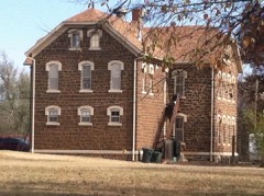
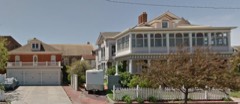
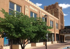
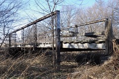
21 National Register listings published here, 1 of them a National Historic Landmark.
Sources: the National Register database, National Park Service
47 topographic sheets cover 19 settlements here, and 21 properties are on the National Register of Historic Places.
21 National Register listings published here, 1 of them a National Historic Landmark.
Sources: the National Register database, National Park Service
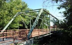
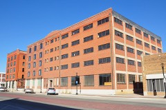
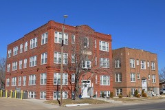
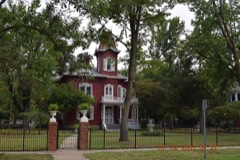
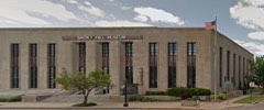
Every property in this county listed on the National Register of Historic Places, with the year it was listed and the federal nomination document.
Every wildfire the federal occurrence database records inside this county: 210 of them, burning about 1,130 acres. 1 started naturally and 16 were recorded as arson. Each settlement page carries the fires within five miles of it.
| Reported cause | Fires |
|---|---|
| Missing data/not specified/undetermined | 70 |
| Debris and open burning | 54 |
| Equipment and vehicle use | 23 |
| Smoking | 22 |
| Arson/incendiarism | 16 |
| Fireworks | 9 |
| Power generation/transmission/distribution | 8 |
| Misuse of fire by a minor | 5 |
| Other causes | 2 |
| Natural | 1 |
The five largest, by the area the report gives. Two of them were set deliberately.
| Date | Cause | Size | Reported by | Name on the report |
|---|---|---|---|---|
| 14 March 2017 | Debris and open burning | 180 acres | Saline County | 28 |
| 27 February 2016 | Missing data/not specified/undetermined | 150 acres | Kansas Forest Service | 16 |
| 10 April 2015 | Arson/incendiarism | 120 acres | Kansas Forest Service | 38 |
| 22 March 2015 | Debris and open burning | 120 acres | Kansas Forest Service | 29 |
| 8 March 2015 | Missing data/not specified/undetermined | 80 acres | Kansas Forest Service | 19 |
| 8 March 2015 | Equipment and vehicle use | 60 acres | Kansas Forest Service | 13 |
| 27 March 2015 | Arson/incendiarism | 60 acres | Kansas Forest Service | 662 |
| 18 March 2017 | Debris and open burning | 60 acres | Saline County | 31 |
Every settlement page carries the fires within five miles of it - see the settlement index below.
The NOAA Storm Events Database holds 812 reports for this county, causing no deaths, 75 injuries and about $72,852,100 in recorded property damage. Each settlement page carries the reports that name it.
| Kind of event | Reports |
|---|---|
| Hail | 388 |
| Thunderstorm Wind | 281 |
| Tornado | 50 |
| Flood | 30 |
| Heavy Rain | 30 |
| Flash Flood | 25 |
| Lightning | 6 |
| Funnel Cloud | 2 |
The most serious of them, by death, then injury, then recorded damage. The accounts are quoted exactly as the forecast office filed them.
| When | Event | Place named | Harm | What the report says |
|---|---|---|---|---|
| June 1969 | Tornado (F3) | not stated | 60 hurt, $25,000,000 | no account filed |
| July 1987 | Thunderstorm Wind | not stated | 7 hurt | no account filed |
| September 1973 | Tornado (F3) | not stated | 6 hurt, $25,000,000 | no account filed |
| July 2000 | Thunderstorm Wind | Salina | 1 hurt, $50,000 | Microburst winds tore a roof off a barn. One man injured, sustaining fractured right elbow and head injury that required ten stitches. Large branches stripped from a maple tree fell onto the porch of a duplex collapsing part of it's roof. Horse shelter didn't exactly live up it's billing when it was lifted off the ground and blown over the tops of about 15 parked cars at a neighboring towing company. Downed power lines cuased spotty power outages although tree damage was fairly widespread. Newspapers contributed to this report. |
| July 2000 | Thunderstorm Wind | Salina | 1 hurt, $5,000 | Severe thunderstorm winds blew truck off I-70. Driver injured. |
| May 2007 | Flood | Salina | $6,500,000 | Numerous, slow-moving thunderstorms produced widespread 4 to 7 inch rainfall amounts across primarily the northwestern two-thirds of Saline County from the evening hours on May 23rd, to the early morning hours on May 24th. Excessive runoff from this heavy rain caused widespread countywide flooding for days. Numerous rural and city roads were closed due to high water. The Mulberry Creek reached record flood stage during the late afternoon hours of the 24th, resulting in road closures and evacuations across portions of Salina. Mandatory evacuations were needed in the communities of Hedville and Bavaria, due to the rapidly rising Mulberry and Spring Creeks. The rising Smoky Hill River effectively closed all roads leading in and out of New Cambria. Some water rescues were needed across the county, but there were no reported injuries. Numerous homes and businesses received extensive flood damage, as well as various roads and one bridge across the county. Additionally, the Salina Municipal Aiport terminal building received fairly extensive flood damage. Roughly $3.5 million in public damages was suffered across the county, with likely around $3 million in private damages. |
| July 1994 | Thunderstorm Wind | Salina | $5,000,000 | Damaging winds of 75 miles an hour hit the Salina area and ripped tree limbs and power lines down and yanked roofs off buildings. |
| May 2007 | Flood | Salina | $4,840,000 | Heavy rains over several days from intense thunderstorms caused significant river flooding throughout the county. The hardest hit area was Salina where the Smoky Hill River and the Mulberry Creek combined to cause nearly 5 million dollars in damage. According the Salina Journal, 239 structures had minor flood damage, ranging from a few inches of water in basements to as much as 6 feet of water in basements. 18 structures sustained some structural damage and 9 structures were destroyed. There was also about 1.75 million dollars in damage to public roads bridges and structures. The Mulberry Creek crested at 27.22 feet late in the evening on May 7th. The Smoky Hill River crested at 20.99 feet at Mentor on the evening of May 8th. At New Cambria on the Smoky Hill River, the crested during the afternoon hours of May 7th. |
| June 2008 | Tornado (EF3) | Phillips Vlg | $2,630,000 | Widespread damage was noted to several homes, businesses, and trees along the tornadoes path. One cabinet making business had a 10000 square foot section of roof removed, with a total of 20000 square feet of damage to the structure as a sprinkler main broke pouring water onto the factory floor. Several homes sustained damage due to garage doors collapsing in the wind and ultimately lifting the roofs off of the homes. One home sustained slightly more damage than the rest, as two exterior walls were also blown out. |
| June 2008 | Hail | (Sln)Salina Muni Arp | $600,000 | Tennis ball to baseball sized hail fell across the Salina Municipal Airport and continued across the Kansas State Campus at Salina. There were hail smashed car windshields in the parking lot and pummeled the tar composite roof hangers, some dating back to World War 2. |
| June 2008 | Hail | Salina | $500,000 | The largest hail stone fell at Magnolia and Marketplace in Downtown Salina. |
| August 2009 | Thunderstorm Wind | (Sln)Salina Muni Arp | $397,500 | Winds estimated at 75 mph moved across the city, damaging 2500 businesses and homes and knocking out power to 1400 people. Three private hangers were totaled at the Salina Municipal Airport. A steeple was blown off the top of a church, piercing the roof of the church like a lawn dart. The funnel formed by the stuck steeple poured water into the sanctuary. The metal canopy of a gas station was partially destroyed. The storm knocked down almost 70 power poles across town. Numerous large trees and limbs were knocked down all over the city. |
| June 1998 | Hail | Assaria | $300,000 | Extensive damage to 15 vehicles and houses sustained major roof damage and broken windows in a 3-mile wide area from near Smolan southeast to Assaria. |
| September 2001 | Tornado (F1) | Assaria | $250,000 | The following were destroyed: One earthen home, one house on south side of town, numerous outbuildings, and the town's only water pump station. In addition, one barn, one garage, and one earthern home were damaged. Area newspapers contributed to this report. |
| July 1982 | Tornado (F1) | not stated | $250,000 | no account filed |
| August 2019 | Flash Flood | Salina | $200,000 | Numerous roads and intersections were flooded in Salina. There were several stalled vehicles dues to high water. |
| June 1998 | Thunderstorm Wind | Assaria | $200,000 | Numerous power lines and power poles blown down, a shed blown over, and widespread roof damage. |
| September 2022 | Thunderstorm Wind | Hedville | $100,000 | Major damage occurred to this farmstead as a wet microburst pounded the area. The very large barn was completely decimated and damage to the home was also noted. Parts of the home allowed for the wind to enter the home and built-up pressure inside which actually blew an interior door off of its hinge and also pushed a window out. There were also about 100 round bales of hay that rolled 200-400 yards from the original location. |
| August 2021 | Thunderstorm Wind | Salina | $100,000 | Widespread wind damage occurred across Salina. Numerous powerlines were blown down, including some power poles snapped. Numerous trees and tree limbs were reported down. |
| May 2018 | Tornado (EF1) | Glendale | $100,000 | A supercell thunderstorm produced a tornado, across northern portions of Saline county, Kansas, 7 miles northwest of Salina, Kansas. When the tornado touched down, it produced damage to a metal barn. Part of the roof had been blown off and some of the side walls had been blown out. The tornado continued to track to the northwest and moved into Ottawa county, Kansas, just to the east of the town of Tescott. The tornado was on the ground for 1.6 miles, in Saline county, and had a path width of 200 yards. A National Weather Service survey team, rated the tornado an EF1, across Saline county. Note: the tornado would go on to produce EF3 damage across Ottawa county. |
| April 2006 | Tornado (F1) | New Cambria | $70,000 | On the afternoon of April 6th, 2006 an F1 tornado touched down 5 miles northeast of New Cambria in Saline county. The tornado struck a homestead where it caused 70 thousand dollars in damage. The tornado was 75 yards wide and tracked for 200 yards. |
| June 2015 | Flash Flood | (Sln)Salina Muni Arp | $50,000 | Law enforcement reported water over several roads across town. Rainfall amounts ranged from 2 to 4 inches. |
| June 2015 | Flash Flood | (Sln)Salina Muni Arp | $50,000 | Two to three feet of water was flowing over Scanlan Road near the airport. Rainfall amounts were reported ranged from 2.13 inches to 4.15 inches. |
| June 2003 | Flash Flood | Salina | $50,000 | Unspecifieid number of vehicles abandoned. |
| May 1999 | Thunderstorm Wind | Salina | $50,000 | About 10 power poles blown down. |
| August 1993 | Thunderstorm Wind | Hedville | $50,000 | Strong thunderstorm winds blew over five telephone poles and several large tree limbs were blown off. |
| April 2011 | Tornado (EF0) | Glendale | $45,000 | Home took a glancing blow by a weak tornado. The tornado blew out the soffits and some shingles from both sides of the home. A shed on the back side of the property was blown about 25 feet to the northeast. Wrap around shingles and soffit material was found on the northwest and west quadrants of circulation and could not have been due to straight line winds. Home owner also saw small finger like funnel exiting property to the north. |
| June 2010 | Lightning | Assaria | $40,000 | A fire was caused to a building by lightning. The fire collapsed the roof and one wall, causing seed sacks inside the building to be a total loss. |
| July 2019 | Flash Flood | Gypsum | $30,000 | Emergency management conducted water rescues across the northeast portion of Gypsum, due to flash flooding along the Gypsum Creek. |
| June 2009 | Thunderstorm Wind | Salina | $30,000 | Numerous large trees and power lines were downed across Salina. Additionally, a pole barn in rural Salina was damaged. |
| July 2010 | Thunderstorm Wind | Hedville | $25,000 | Winds estimated at 60 mph blew over a camper near mile marker 248 on Interstate 70. |
| August 1951 | Tornado | not stated | $25,000 | no account filed |
| August 2006 | Thunderstorm Wind | Salina | $24,000 | A short lived microburst moved a shed about one quarter of a mile. And produced damage to several homes roofs. |
| August 2011 | Lightning | Salina | $20,000 | Lightning struck an automobile and a radio station in Salina. The strike burned the vehicle antenna, damaged the drivers side door and windshield, and shattered the back window. At the radio station, damage occurred to the transmitter, satellites and other equipment. No one was injured. Property damage amounts are rough estimates. The Salina Journal was the sole contributor to this report. |
| August 2009 | Flood | Salina | $20,000 | Very heavy rainfall rates on the order of nearly 2.50 inches per hour during the late evening hours on the 25th caused sporadic street flooding across Salina. The Autozone warehouse on the south side of town was reportedly flooded, but the extent or severity of the flooding is a rough estimate at best. |
| May 2007 | Thunderstorm Wind | Salina | $20,000 | Large trees and street lights were downed. Additionally, the wind pulled the roof off the west side of a residence. |
| April 2006 | Thunderstorm Wind | Brookville | $20,000 | Roof was ripped off of a large three-sided pole barn, causing the barn to collapse. |
| August 2003 | Lightning | Salemsburg | $20,000 | Gun barrel tank struck. (A gun barrel tank is one in which water separates from the oil after the latter has been pumped from the ground.) The force of the resultant explosion was sufficient to launch the tank across the adjacent Halstead Road, knocking down power lines in the process. The explosion also set fire to four neighboring tanks, one truck used for hauling saltwater, (destroying each), and around 140 barrels of oil. The downed power lines severed power to approximately 900 customers for nearly 3 hours. (All details from this incident courtesy of the Salina Journal.) |
| September 2022 | Thunderstorm Wind | (Sln)Salina Muni Arp | $15,000 | A few power poles were snapped along Schilling road near Ohio street. |
| June 2011 | Thunderstorm Wind | Salina | $15,000 | Several signs were blown over at the National Guard Armory. An air conditioning unit was blown off at the Kansas State facility located on airport grounds. |
| May 1998 | Thunderstorm Wind | Salina | $15,000 | Severe thunderstorm winds blew a tree onto a car. |
| June 2014 | Thunderstorm Wind | (Sln)Salina Muni Arp | $12,000 | The emergency manager reported power lines down. |
| July 2019 | Flash Flood | Gypsum | $10,000 | Emergency management reported either to twelve water rescues in Gypsum and Kipp due to rising water. |
| June 2013 | Thunderstorm Wind | Brookville | $10,000 | Power poles were downed. This was a delayed report based on radar. |
| June 2013 | Thunderstorm Wind | Falun | $10,000 | A tree with a 12-15 inch diameter trunk was uprooted. Several power poles were downed in Falun. This was a delayed report with the time of event based on radar. |
| June 2011 | Thunderstorm Wind | Assaria | $10,000 | An 18 to 20 inch tree was snapped off and blown through a roof. |
| June 2006 | Thunderstorm Wind | Salina | $10,000 | A semi trailer traveling eastbound on Interstate 70 was blown onto its side. The driver was not injured. |
| April 2004 | Lightning | Salina | $10,000 | Tree top on south side of house struck. Side discharge punctured a hole in attic wall, traveled through the attic then down into a wall of a first-floor bedroom. A small section of wallpaper was peeled from the corner of the bedroom near ceiling, causing part of the wallboard to fall to the floor. (Narrative courtesy of the Salina Journal.) |
| June 2002 | Lightning | Salina | $10,000 | Power line knocked down just south of Iron Ave./Columbia Ave. intersection, tripping a circuit breaker that severed power to 656 people including the Penn Campus of Salina Regional Health Center and the Salina Journal. |
| May 2011 | Thunderstorm Wind | Salina | $7,000 | Reports from Fire Department personnel, emergency management and a KAKE TV storm chaser reported areas of thunderstorm wind damage in Salina. Windows were blown out of a business near the intersection of Cloud and South 9th street, power lines were downed on Santa Fe Avenue, and some trees were uprooted across the city. |
| September 2022 | Hail | New Cambria | $5,000 | The hail was reported by a driver on Interstate 70. Damage was noted to the vehicle. |
| July 2010 | Thunderstorm Wind | Salina | $5,000 | Some power lines and trees were downed by the damaging winds. |
| July 2006 | Thunderstorm Wind | Salina | $5,000 | 7 to 10 inch diameter tree limbs downed with several on to cars. Report via KSAL radio |
| June 1996 | Thunderstorm Wind | Salina | $5,000 | no account filed |
| March 1993 | Hail | Mentor | $5,000 | no account filed |
| August 2010 | Thunderstorm Wind | Assaria | $4,000 | The public reported 30 to 40 inch diameter trees blown down. Some power outages were reported as well. Some Interstate 135 signs were snapped off. |
| July 2007 | Thunderstorm Wind | Gypsum | $3,000 | A power pole was downed at the intersection of 3rd and King, and 4-inch tree limbs were downed in and around Gypsum. Courtesy of The Salina Journal. |
| April 2016 | Thunderstorm Wind | Hedville | $2,500 | A car port was lifted from its foundation and a trampoline was lifted and tossed into the tree tops. This was a delayed storm report. |
| May 1996 | Thunderstorm Wind | Salina | $2,500 | no account filed |
| August 1985 | Tornado (F1) | not stated | $2,500 | no account filed |
The Survey's mineral resources record lists 3 workings inside this county. All of them still produce. Each settlement page carries the workings within five miles of it.
| Commodity | Workings |
|---|---|
| Sand and Gravel, Construction | 3 |
The least common of them first, because a county's hundredth gravel pit says nothing its first ten did not.
| Where | Site | Commodity | Status | Recorded |
|---|---|---|---|---|
| C-K Pit | Sand and Gravel, Construction | Producer | ||
| Jenney Pit & Plant | Sand and Gravel, Construction | Producer | ||
| Knox Pit & Plant | Sand and Gravel, Construction | Producer |
Named settlements recorded in the Geographic Names Information System, each with the topographic sheets covering it. Villages, hamlets and abandoned places alike. Each is shown with the nearest named watercourse or landform and the survey quadrangle it falls on.
Smoky View township · 67416 · On Kentucky Creek · Assaria quadrangle
16 sheets, 1892 to 1990
Solomon township · 67401 · On West Branch Gypsum Creek · Kipp quadrangle
16 sheets, 1889 to 1990
Cambria township · 67470 · On Saline River · New Cambria quadrangle
16 sheets, 1892 to 1990
Salina city · 67401 · Salina SW quadrangle
17 sheets, 1892 to 1990
No longer a settlement
The vanished settlements of Saline County: the places named above that are no longer on the map.