 Block
From the record
8 National Register listings published here.
Sources: the National Register database, National Park Service
40 topographic sheets cover 9 settlements here, and 8 properties are on the National Register of Historic Places.
8 National Register listings published here.
Sources: the National Register database, National Park Service
Every property in this county listed on the National Register of Historic Places, with the year it was listed and the federal nomination document.
| Photograph | Property | Type | Listed | Reference |
|---|---|---|---|---|
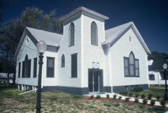 | Convenanter Church | building | 2005 | 05000544 |
 | Farmers National Bank | building | 2006 | 06000392 |
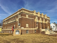 | First Methodist Episcopal Church | building | 2002 | 02001264 |
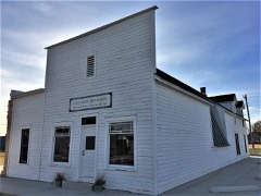 | William R. Gray Photography Studio and Residence | building | 2013 | 12001121 |
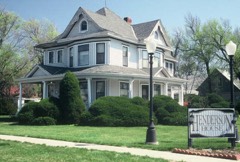 | Sarah L. Henderson House | building | 1996 | 96000763 |
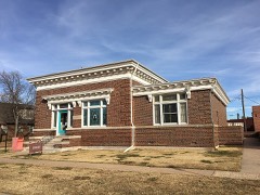 | Nora E. Larabee Memorial Library | building | 2006 | 06000391 |
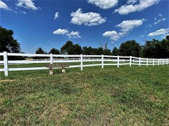 | Martin Cemetery | site | 2015 | 15000692 |
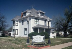 | Joseph L. Spickard House | building | 2005 | 05000546 |
Every wildfire the federal occurrence database records inside this county: 209 of them, burning about 18,880 acres. 47 started naturally and 6 were recorded as arson. Each settlement page carries the fires within five miles of it.
| Reported cause | Fires |
|---|---|
| Missing data/not specified/undetermined | 81 |
| Natural | 47 |
| Debris and open burning | 37 |
| Equipment and vehicle use | 19 |
| Power generation/transmission/distribution | 10 |
| Arson/incendiarism | 6 |
| Fireworks | 3 |
| Smoking | 2 |
| Recreation and ceremony | 2 |
| Other causes | 1 |
| Railroad operations and maintenance | 1 |
The five largest, by the area the report gives. None of them was recorded as arson.
| Date | Cause | Size | Reported by | Name on the report |
|---|---|---|---|---|
| 3 April 2010 | Missing data/not specified/undetermined | 3,664 acres | Quivira National Wildlife Refuge | BIG SALT MARSH |
| 31 March 2015 | Debris and open burning | 3,000 acres | Kansas Forest Service | 29 |
| 25 September 1998 | Natural | 2,620 acres | Quivira National Wildlife Refuge | GATTON |
| 3 May 2011 | Debris and open burning | 1,897 acres | Quivira National Wildlife Refuge | SALT CREEK |
| 22 March 2018 | Natural | 1,508 acres | Quivira National Wildlife Refuge | COTTONWOOD |
| 18 February 2016 | Missing data/not specified/undetermined | 1,000 acres | Montgomery County | HEMPLE |
| 1 July 1994 | Debris and open burning | 800 acres | Quivira National Wildlife Refuge | HORNBAKER |
| 3 November 2010 | Missing data/not specified/undetermined | 700 acres | Kansas Counties | STAFFORD/PRATT COUNTY LINE |
Every settlement page carries the fires within five miles of it - see the settlement index below.
The NOAA Storm Events Database holds 703 reports for this county, causing 3 deaths, 8 injuries and about $2,511,550 in recorded property damage. Each settlement page carries the reports that name it.
| Kind of event | Reports |
|---|---|
| Hail | 437 |
| Thunderstorm Wind | 159 |
| Tornado | 72 |
| Heavy Rain | 22 |
| Flash Flood | 6 |
| Flood | 6 |
| Funnel Cloud | 1 |
The most serious of them, by death, then injury, then recorded damage. The accounts are quoted exactly as the forecast office filed them.
| When | Event | Place named | Harm | What the report says |
|---|---|---|---|---|
| May 2011 | Tornado (EF2) | Hudson | 2 killed, 1 hurt | This tornado moved north/northwest and unfortunately claimed two lives. The tornado hit a house (among trees, outbuildings, fences) and the persons involved were parked under a tree in the drive way of the home. Tragically, the very large tree was uprooted and landed on the vehicle. A female (age 21) that was in the back seat was severely injured. A female (age 56) and her son (age 17) in the front seat were crushed and apparently killed instantly. The tornado moved on into Barton county at 606 PM. The house received EF2 damage and the occupant of the home was in the basement, but arrived there less than 30 seconds before the tornado hit. |
| May 2007 | Tornado (EF3) | Macksville | 1 killed | This killer tornado formed just east of another large but dissipating tornado that was approaching Macksville. Unfortunately a law officer watching the dissipating tornado was unaware that this one was rapidly forming and could not get out of harms way. His car was thrown at least 1/4 of a mile and was found in a field. He died several days later from catastrophic injuries received in the crushed vehicle. EF3 damage was done to over a dozen farms, trees, machinery, vehicles, pivot irrigation sprinklers and power poles. |
| August 1985 | Hail | not stated | 2 hurt | no account filed |
| April 1964 | Tornado (F3) | not stated | 2 hurt | no account filed |
| June 1999 | Thunderstorm Wind | St John | 1 hurt, $300,000 | One trailer home was completely destroyed and the occupant received minor cuts and bruises, but lucky to be alive according to the Emergency Manager. Trees were down all over the place and several roofs received quite a bit of damage. Several pivot sprinklers overturned or damaged and a patrol car window pushed out. The same patrol car was blown into a ditch, after sitting idle with the driver pressing on the brake, powerless to the high wind. |
| May 1965 | Tornado (F3) | not stated | 1 hurt, $250,000 | no account filed |
| May 2007 | Tornado (EF3) | Macksville | 1 hurt | This tornado moved out of northwest Pratt county and dissipated just south of Macksville. It did strong EF3 damage to farms, trees, machinery and vehicles. A Blazer was carried over 3/4 of a mile and was barely recognizable as a vehicle. Several dozen head of cattle were killed along with wildlife in the area. One well built home was completely swept off it's foundation. |
| May 1993 | Tornado (F2) | Byers | $500,000 | The tornado moved into Stafford County from Pratt County. The tornado was 1/4 of a mile wide as it moved into Stafford County. The tornado destroyed or damaged six buildings at a farmstead 13 miles southwest of St. John. Buildings at an abandoned farmstead 9.5 miles southwest of St. KANSAS Cont'd John were also destroyed or damaged. Large cottonwood trees were snapped or uprooted along the path of the tornado. Two center pivot irrigation systems were also destroyed. Telephone poles were knocked down on the east side of St. John. |
| April 1991 | Tornado (F1) | not stated | $250,000 | no account filed |
| July 1979 | Tornado (F0) | not stated | $250,000 | no account filed |
| November 1973 | Tornado (F1) | not stated | $250,000 | no account filed |
| July 1999 | Thunderstorm Wind | Hudson | $100,000 | A microburst that lasted three minutes caused tremendous damage in the small community. Every building in the town had damage. 15 Homes had major structural damage. An ammonia tank was damaged causing a 2 to 3 block area to be evacuated. |
| June 2008 | Thunderstorm Wind | St John | $75,000 | The winds blew a pivot irrigation sprinkler into a ditch. |
| May 2008 | Tornado (EF1) | Macksville | $65,000 | EF1 damage was done to trees and a pivot irrigation sprinkler. |
| May 2011 | Thunderstorm Wind | Leesburg | $60,000 | Trees up to 2 feet in diameter were blown down and several irrigation sprinklers were rolled over. Also, hail up to 3/4 of an inch in diameter covered the ground. |
| June 2002 | Thunderstorm Wind | Stafford | $53,000 | A pivot sprinkler was blown down along with 6 to 7 power poles. |
| May 2004 | Thunderstorm Wind | Macksville | $50,000 | A pivot irrigation center was blown over |
| March 2002 | Thunderstorm Wind | Hudson | $50,000 | Pivot sprinkler was completely destroyed by the wind. |
| August 2007 | Thunderstorm Wind | Bedford Station | $45,000 | Nine power poles were blown down. |
| July 1979 | Tornado (F0) | not stated | $25,000 | no account filed |
| June 1977 | Tornado (F1) | not stated | $25,000 | no account filed |
| November 1973 | Tornado (F1) | not stated | $25,000 | no account filed |
| May 1964 | Tornado (F3) | not stated | $25,000 | no account filed |
| June 1955 | Tornado (F1) | not stated | $25,000 | no account filed |
| June 1955 | Tornado (F3) | not stated | $25,000 | no account filed |
| May 2008 | Flood | St John | $15,000 | One house in town was flooded and two more had water up their porches. |
| May 1996 | Thunderstorm Wind | Stafford | $10,000 | no account filed |
| May 1995 | Tornado (F1) | St. John | $10,000 | no account filed |
| June 2002 | Thunderstorm Wind | Stafford | $8,000 | The wind damaged the roof of a local restaurant and broken numerous three to five inch diameter tree limbs. |
| August 2009 | Thunderstorm Wind | Hudson | $7,000 | Multiple power poles were blown down by the high wind. |
| August 2009 | Thunderstorm Wind | Stafford | $5,000 | Multiple power poles were blown down. |
| August 2007 | Thunderstorm Wind | Bedford Station | $4,000 | Eight power poles were blown down. |
| August 2007 | Thunderstorm Wind | Stafford | $3,000 | Six power poles were snapped off near the ground. |
| June 2008 | Thunderstorm Wind | Seward | $1,500 | Two power poles were blown down and there were numerous tree branches broken. |
| July 1994 | Thunderstorm Wind | Gorham | $50 | no account filed |
| April 2026 | Hail | Dillwyn | - | A public report of 1 inch hail. |
| April 2026 | Thunderstorm Wind | Macksville Smith Arp | - | Personal Ambient Weather Station Nutrients_ag reported maximum wind gust of 65 mph. |
| April 2025 | Hail | Seward | - | Received a mPING report of 1 inch hail. |
| April 2025 | Thunderstorm Wind | Macksville | - | A public report of a 62 mph wind gust. |
| June 2025 | Thunderstorm Wind | Macksville | - | A report of an estimated 67 mph winds came from the Public. |
| July 2025 | Thunderstorm Wind | Neola | - | Measured wind gusts. |
| September 2025 | Hail | Quivira Refuge | - | A public report of 1.25 inch hail. |
| September 2025 | Hail | Neola | - | A 1 inch hail report from the public. |
| September 2025 | Hail | Hudson | - | A public report of 1.75 inch hail. |
| September 2025 | Hail | Hudson | - | A public report of 1.75 inch hail. |
| August 2024 | Hail | Radium | - | Hail was estimated the sized of quarters by the public. |
| August 2024 | Hail | St John | - | Hail the size of quarters was reported by the Public. |
| May 2024 | Heavy Rain | Stafford | - | A 24 hour rainfall report of 1.18 inches. |
| June 2024 | Flash Flood | St John | - | Road closed with water over road. |
| May 2024 | Heavy Rain | Leesburg | - | A 24 hour rainfall report of 1.00 inches. |
| May 2024 | Heavy Rain | Macksville | - | Rainfall report of 1.87 inches. |
| August 2024 | Thunderstorm Wind | Quivira Refuge | - | Thunderstorm wind damage cause resulted in a downed power pole at the intersection of NW 80th Avenue and 90th Street. |
| March 2023 | Thunderstorm Wind | St John | - | Report form Mping. |
| July 2023 | Thunderstorm Wind | Radium | - | Law enforcement reported multiple power poles blown down. |
| June 2022 | Thunderstorm Wind | Stafford | - | A shed was flipped over by the high wind gusts. |
| September 2021 | Thunderstorm Wind | Dillwyn | - | There was damage to a door and roof to a hay shed and 3 to 4 inch diameter tree branches were broken by the high wind. |
| July 2020 | Heavy Rain | Macksville | - | Rainfall of 2.95 inches was observed with the majority of the rain falling in a 3 hour period. |
| June 2020 | Thunderstorm Wind | Macksville | - | A grain cart was overturned by the high wind. |
| May 2019 | Tornado (EF0) | Leesburg | - | This QLCS tornado moved in from Pratt County at 2310. Due to very muddy roads and conditions, the end point was estimated but could have very well been farther into the county. |
| May 2019 | Thunderstorm Wind | St John | - | Sections of a roof were blown off a 50 x 150 foot pole barn and deposited 1 to 2 blocks north of the building. |
The Survey's mineral resources record lists 1 working inside this county. It still produces. Each settlement page carries the workings within five miles of it.
| Commodity | Workings |
|---|---|
| Sand and Gravel, Construction | 1 |
The least common of them first, because a county's hundredth gravel pit says nothing its first ten did not.
| Where | Site | Commodity | Status | Recorded |
|---|---|---|---|---|
| Partin Sand and Gravel Pit | Sand and Gravel, Construction | Producer |
Named settlements recorded in the Geographic Names Information System, each with the topographic sheets covering it. Villages, hamlets and abandoned places alike. Each is shown with the nearest named watercourse or landform and the survey quadrangle it falls on.