 Block
Clayton, Kansas
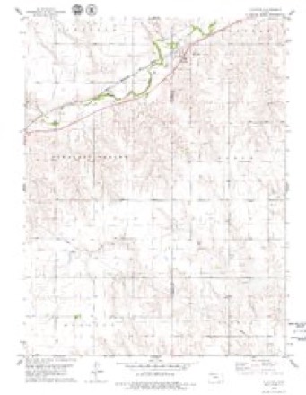
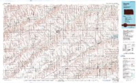
7 topographic sheets cover this place, the earliest surveyed in 1954 and the latest in 1985. It stands in Highland-District 2 Township. It lies in ZIP code area 67629. It stands on Plum Creek. The Survey maps it on the Clayton quadrangle.
Topographic sheets covering this place
5 surveys from 7 printed sheetsMatched by testing this settlement's coordinate against the published boundary of every sheet in the United States Geological Survey's historical collection. Each opens the scanned sheet at the Survey.
- 1954 USGS Goodland quadrangle1:250000
- 1956 USGS Goodland quadrangle1:250000
- 1957 USGS Goodland quadrangle1:250000, 2 printings
- 1978 USGS Clayton quadrangle1:24000
- 1985 USGS Oberlin quadrangle1:100000, 2 printings



Storms near this place
28 since 1993Regional context, not property-specific evidence. The National Weather Service names Clayton in 28 storm reports between 1993 and 2024: 19 hail, 7 thunderstorm wind, 1 flood, 1 flash flood. No death or injury is recorded in these reports. Each account below is quoted exactly as the forecast office filed it, from the NOAA Storm Events Database, and each date opens the federal record of that event.
| When | Event | Place named | Harm | What the report says |
|---|---|---|---|---|
| May 2008 | Flood | Clayton | $25,000 | The river gauge 4 miles east of Clayton remained at or above flood stage for 21 hours due to heavy rainfall during the late afternoon and evening of May 22nd. Low land flooding occurred along Prairie Dog Creek leading to Sebelius Reservoir. An unattended camper floated away when the waters rose. |
| August 1993 | Thunderstorm Wind | Clayton | $50 | Three-inch-diameter branches were downed by high winds. |
| October 2023 | Thunderstorm Wind | Clayton | - | Trained spotter estimated thunderstorm winds 40-60 mph. |
| August 2023 | Hail | Clayton | - | The hail ranged from pea to dime in size. |
| July 2023 | Hail | Clayton | - | Spotter report of 1.75 inch hail. |
| June 2022 | Hail | Clayton | - | Dime to quarter sized hail fell for a duration of fifteen minutes over the location. |
| June 2022 | Hail | Clayton | - | Dime to quarter sized hail observed in the town of Clayton. |
| July 2021 | Hail | Clayton | - | Report received of hail from pea sized up to penny sized at location. Time is radar estimated. |
| June 2010 | Flash Flood | Clayton | - | Extremely heavy rainfall occurred just west of Clayton in Norton county during the evening with radar estimated rainfall of 6 to 10 inches. Law enforcement later that night reported that Prairie Dog Creek had gone out of its banks 4 miles east of Clayton sometime during the night, with locations of debris indicating a rapid water rise out of the banks. Time of event is estimated from radar, rain gauge reports and law enforcement observations. |
| July 2004 | Thunderstorm Wind | Clayton | - | Numerous tree limbs down. |
| July 1994 | Thunderstorm Wind | Clayton | - | Estimated winds up to 70 mph with two inch diameter branches broken off trees. |
| March 2024 | Hail | Clayton | - | no account filed |
| July 2006 | Hail | Clayton | - | no account filed |
| May 2004 | Thunderstorm Wind | Clayton | - | no account filed |
| June 2004 | Thunderstorm Wind | Clayton | - | no account filed |
| July 2003 | Hail | Clayton | - | no account filed |
| April 2002 | Thunderstorm Wind | Clayton | - | no account filed |
| May 2001 | Hail | Clayton | - | no account filed |
| June 2000 | Hail | Clayton | - | no account filed |
| May 1999 | Hail | Clayton | - | no account filed |
| May 1999 | Hail | Clayton | - | no account filed |
| May 1998 | Hail | Clayton | - | no account filed |
| June 1997 | Hail | Clayton | - | no account filed |
| May 1996 | Hail | Clayton | - | no account filed |
| July 1996 | Hail | Clayton | - | no account filed |
| May 1994 | Hail | Clayton | - | no account filed |
| May 1994 | Hail | Clayton | - | no account filed |
| July 1994 | Hail | Clayton | - | no account filed |
Nearest settlements
The eight closest, with where each one stands in the county. Distances are straight-line, computed from the Geographic Names Information System coordinates.
Provenance
This settlement is recorded in the Geographic Names Information System as feature 471080. The sheet list is computed by point-in-boundary test against the United States Geological Survey's historical topographic inventory. Both are works of the United States government and carry no copyright under 17 U.S.C. 105.
Storms. NOAA National Centers for Environmental Information, Storm Events Database https://www.ncei.noaa.gov/stormevents/ A work of the United States government, no copyright under 17 U.S.C. 105. Narratives are quoted verbatim from the National Weather Service report and are not edited or summarised.