 Block
El Dorado, Kansas
14 topographic sheets cover this place, the earliest surveyed in 1888 and the latest in 1990. It stands in El Dorado City. It lies in ZIP code area 67042. It stands on West Branch Walnut River. The Survey maps it on the El Dorado quadrangle. 12,870 people lived here at the 2020 count. It stands 1,342 feet above sea level.
On record in El Dorado
Buildings and businesses the archive holds for this place. Each opens its own page, with the source record it came from.
On the National Register 7 records
 Butler County Courthouselisted 2002
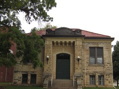 El Dorado Carnegie Librarylisted 1987
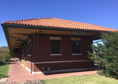 El Dorado Missouri Pacific Depotlisted 1994
 James T. Oldham Houselisted 2006
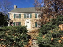 Ray L. Smith Houselisted 2015
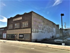 Yingling Brothers Auto Companylisted 2011
- El Dorado Historic Districtlisted 2013
Population over time
2 figuresEl Dorado fell from 13,021 to 12,870 between 2010 and 2020. These are the recorded population figures Wikidata holds for this place, reached through the Geographic Names Information System number this page is keyed on rather than by name, so they belong to this place and not to another of the same name. Most are census counts, but not all are: an early figure may be a founding or settlement estimate, and an estimate published within five years of a census is left out. The change column is computed, and is left blank where more than 20 years separate a figure from the one before it, because a gap that long is not a change between two counts.
| Year | People | Change |
|---|---|---|
| 2010 | 13,021 | |
| 2020 | 12,870 | -151 (-1%) |
Topographic sheets covering this place
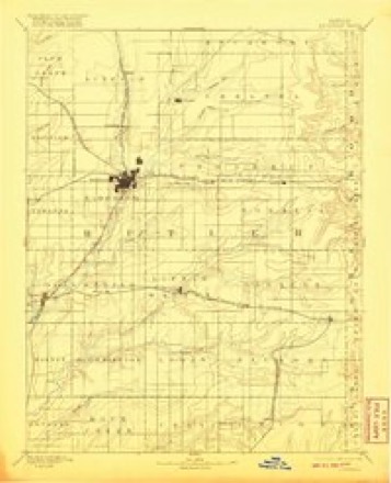
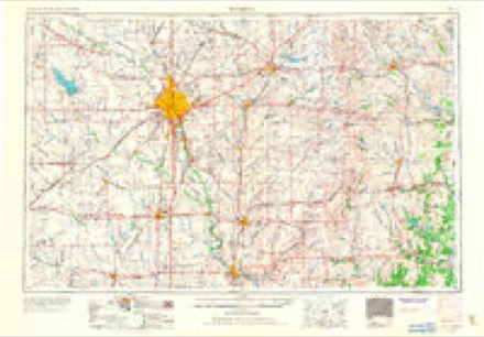
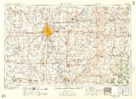
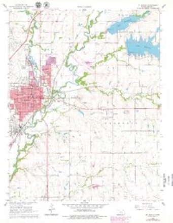
6 surveys from 14 printed sheetsMatched by testing this settlement's coordinate against the published boundary of every sheet in the United States Geological Survey's historical collection. Each opens the scanned sheet at the Survey.
- 1888 USGS Eldorado quadrangle1:125000, 6 printings
- 1955 USGS Wichita quadrangle1:250000, 3 printings
- 1958 USGS Wichita quadrangle1:250000
- 1961 USGS El Dorado quadrangle1:24000, 2 printings
- 1985 USGS El Dorado quadrangle1:100000
- 1990 USGS El Dorado quadrangle1:100000
Fires near this place
140 since 2006Regional context, not property-specific evidence. The federal wildfire occurrence database lists 140 fires within 5 miles of El Dorado between 2006 and 2020, burning about 16,087 acres in total. None started naturally. 4 were recorded as arson. Distance is straight-line from the map coordinates, so a fire counted here may appear on a neighbouring settlement's page as well.
| Reported cause | Fires |
|---|---|
| Missing data/not specified/undetermined | 76 |
| Debris and open burning | 35 |
| Equipment and vehicle use | 13 |
| Arson/incendiarism | 4 |
| Smoking | 3 |
| Power generation/transmission/distribution | 3 |
| Misuse of fire by a minor | 2 |
| Fireworks | 2 |
| Recreation and ceremony | 2 |
The most recent of them, most recent first, with the day each was reported and the service that recorded it.
| Date | Cause | Size | Reported by | Name on the report |
|---|---|---|---|---|
| 5 September 2020 | Missing data/not specified/undetermined | 1.0 acres | Kansas Forest Service | not named |
| 25 September 2017 | Missing data/not specified/undetermined | 1.0 acres | Butler County | 986 |
| 11 September 2017 | Missing data/not specified/undetermined | under an acre | Butler County | 918 |
| 3 August 2018 | Missing data/not specified/undetermined | under an acre | Kansas Forest Service | 1035 |
| 2 August 2018 | Missing data/not specified/undetermined | under an acre | Kansas Forest Service | 1031 |
| 2 August 2017 | Missing data/not specified/undetermined | 1.0 acres | Butler County | 779 |
| 13 August 2018 | Equipment and vehicle use | 1.0 acres | Kansas Forest Service | 1846 |
| 5 July 2015 | Missing data/not specified/undetermined | under an acre | Kansas Forest Service | 674 |
Settlements close enough to share some of these fires:
Storms near this place
60 of 274 shownRegional context, not property-specific evidence. The National Weather Service names El Dorado in 274 storm reports between 1993 and 2026: 121 thunderstorm wind, 113 hail, 13 flood, 12 flash flood. The reports record 1 death. Each account below is quoted exactly as the forecast office filed it, from the NOAA Storm Events Database, and each date opens the federal record of that event.
| When | Event | Place named | Harm | What the report says |
|---|---|---|---|---|
| March 2009 | Flood | El Dorado | 1 killed, $10,000 | Heavy rainfall caused ponding of water on North Main Street in El Dorado. This ponding of water caused a car to slide off the road into a rain swollen culvert. The heavy runoff carried the car 65 feet into a six by six culvert, where the driver became trapped and eventually drowned as water filled the car. |
| May 1993 | Thunderstorm Wind | El Dorado | $5,000,000 | El Dorado was also hit hard with thunderstorm winds greater than 80 miles an hour. Twenty homes on the west side of tow sustained superficial damage. The marina at El Dorado Lake was damaged. Total damage was estimated at $500,000. |
| May 2015 | Hail | El Dorado | $2,500,000 | We received a delayed report of baseball-sized hail that caused damage to an unspecified number of local businesses. |
| May 2015 | Hail | El Dorado | $1,000,000 | KWCH Channel 12 relayed the report. |
| May 2015 | Hail | El Dorado | $500,000 | The hail ranged in size from golf balls to hen eggs. |
| July 2003 | Thunderstorm Wind | El Dorado | $350,000 | Microburst-induced winds downed power lines and power poles. A large Oak Tree in front of Butler County courthouse was uprooted and landed on a pick-up truck. The roof at Pizza Hut was damaged while a brick wall at K&M car wash in West El Dorado was blown down. A light pole (that also contained the power control system) at El Dorado High School's football field was toppled while a second was twisted. Roof damage was extensive, mainly due to shingles being first peeled, then dislodged. A sandblasting shop at a construction site was destroyed. Two trailers were overturned.Tree damage was widespread, including one large branch that fell onto a house, severely damaging it's roof. El Dorado Times contributed greatly to this report. |
| May 2010 | Thunderstorm Wind | El Dorado | $250,000 | Three semi tractor trailer trucks were overturned along the Kansas Turnpike directly underneath the K-254 overpass, when high tension powerlines fell onto the road. The semi's became tangled in the wires and overturned or were pushed off the road. 2 injuries occurred as one of the semi's broke open when it hit the bridge pillar, spilling the moving vans contents into the rain. |
| June 1998 | Thunderstorm Wind | El Dorado | $150,000 | In South El Dorado, 4 aircraft and 1 older hangar damaged. |
| July 2007 | Flood | El Dorado | $108,000 | Heavy rainfall from the end of June into early July caused flooding throughout Butler County. This resulted in roughly 108 thousand dollars in damage. |
| September 2000 | Lightning | El Dorado | $100,000 | A tank battery was destroyed, an office building had it's alarm system disabled, and numerous power lines were struck resulting in widespread arcing. |
| June 2008 | Thunderstorm Wind | El Dorado | $75,000 | Twenty electric power poles were broken off at the ground. |
| August 2003 | Thunderstorm Wind | El Dorado | $50,000 | Barn and grain silo destroyed. Debris from the destroyed barn "helped" to knock over a nearby power pole. (El Dorado Times). |
| July 2003 | Thunderstorm Wind | El Dorado | $50,000 | Trailer overturned. |
| March 2002 | Thunderstorm Wind | El Dorado | $50,000 | On Kansas Turnpike, one semi-trailer overturned. Three miles away, a second semi-trailer was involved in a two-vehicle accident. No injuries or fatalities reported with either mishap. Downed power lines severed power to approximately 155-160 residences. |
| April 1994 | Thunderstorm Wind | El Dorado | $50,000 | Strong thunderstorm winds uprooted trees, overturned dumpsters, caused extensive building damage, blew the roofs off a tire shed and the County shop building, and blew down a street light. Three-quarter-inch hail accompanied the storm. |
| July 2016 | Thunderstorm Wind | El Dorado | $35,000 | An outbuilding was destroyed along with a camper and residential propane tank rolled. Numerous 6 to 8 inch tree limbs were also down. . |
| April 2016 | Thunderstorm Wind | El Dorado | $30,000 | A tractor trailer was overturned on the north side of town. |
| July 2016 | Thunderstorm Wind | El Dorado | $30,000 | A fireworks tent was destroyed by thunderstorm winds. |
| April 2015 | Thunderstorm Wind | El Dorado | $30,000 | A mobile home was destroyed with two people injured. |
| May 2009 | Thunderstorm Wind | El Dorado | $30,000 | At the El Dorado airport a small plane was flipped and a metal hanger collapsed. |
| May 2012 | Thunderstorm Wind | El Dorado | $25,000 | Four inch tree limbs were knocked down across town. |
| July 2003 | Thunderstorm Wind | El Dorado | $25,000 | See 1909CST entry for damage summary. |
| July 2007 | Flash Flood | El Dorado | $20,000 | Law enforcement reported that a water rescue was performed at the intersection of Vine and 1st streets in El Dorado. Several businesses also reported flooding at 1st and Main. Highway 77 was also closed just south of the Turnpike. |
| May 1998 | Thunderstorm Wind | El Dorado | $20,000 | Widespread damage to trees, power lines and mobile homes. |
| June 2011 | Thunderstorm Wind | El Dorado | $15,000 | Winds were estimated around 75 mph. Numerous trees and power lines were downed in the El Dorado area. |
| September 2001 | Thunderstorm Wind | El Dorado | $15,000 | Barn heavily damaged as were numerous trees. Area newspapers contributed to this report. |
| July 2015 | Thunderstorm Wind | El Dorado | $12,000 | A trailer was overturned near Butler County Community College. a few power poles were also knocked down. |
| April 2011 | Thunderstorm Wind | El Dorado | $10,000 | Multiple power poles were knocked down along Highway 196, just north of Highway 254. The knocked down lines sparked a grass fire along the road. |
| July 2007 | Thunderstorm Wind | El Dorado | $5,000 | Law enforcement personnel from Butler County reported damage to several trees. |
| July 2003 | Thunderstorm Wind | El Dorado | $5,000 | Large trees uprooted at court house. |
| May 1993 | Thunderstorm Wind | El Dorado | $5,000 | A line of thunderstorms produced winds estimated at 55 to 65 miles an hour. Little damage resulted. |
| May 1993 | Hail | El Dorado | $5,000 | no account filed |
| May 2023 | Thunderstorm Wind | El Dorado | $3,000 | Large tree branches were reported down on a truck and two houses. Both houses reported minor damage. |
| March 2017 | Thunderstorm Wind | El Dorado | $3,000 | Roof damage was reported to a house. |
| June 2008 | Thunderstorm Wind | El Dorado | $2,500 | Two foot diameter tree blown down and is blocking westbound traffic on Highway 54. |
| August 2013 | Thunderstorm Wind | El Dorado | $2,000 | A ten inch diameter tree was knocked down. |
| June 2008 | Thunderstorm Wind | El Dorado | $1,500 | Six car windshields were broken from debris kicked up by high winds. |
| March 2017 | Thunderstorm Wind | El Dorado | $1,000 | Damage was reported to a residence, where a screened in porch was torn off. |
| May 2008 | Thunderstorm Wind | El Dorado | $1,000 | High winds knocked down several 6 to 8 inch tree limbs. |
| May 2008 | Thunderstorm Wind | El Dorado | $1,000 | High winds downed several 6 to 8 inch tree limbs. |
| June 2008 | Thunderstorm Wind | El Dorado | $750 | A telephone pole has fallen on a house and caused damage. |
| October 1993 | Hail | El Dorado | $500 | no account filed |
| June 2008 | Flood | El Dorado | $200 | Some streets were reported flooded in town. |
| May 2022 | Flood | El Dorado | $100 | Heavy rainfall led to some water covered roads in El Dorado, Kansas. |
| May 2020 | Flash Flood | El Dorado | $100 | Significant street flooding occurred in the city of Augusta closing one road on the west side of town. Street flooding in El Dorado was also reported with a couple of vehicles stranded in the high water. One water rescue was reported. |
| August 2019 | Flash Flood | El Dorado | $100 | A couple of roads were flooded in El Dorado due to high water. |
| September 2016 | Flash Flood | El Dorado | $100 | Several streets were flooded across the county, including in the communities of El Dorado, Andover and Augusta. |
| August 2013 | Flood | El Dorado | $100 | Very localized flooding occurred on the east side of El Dorado, between downtown and the Walnut River, due to heavy rainfall. |
| July 2009 | Flood | El Dorado | $100 | Local law enforcement reported flooding of low lying areas. |
| June 2008 | Flood | El Dorado | $50 | The north and west side of the intersection of Turkey Creek and Southeast 50th Road was flooded. Rainfall amounts of 3.5 inches were reported. |
| March 2026 | Thunderstorm Wind | El Dorado | - | A report of a large eastern red cedar tree was snapped at six feet above the ground. The time is estimated from radar data. |
| May 2025 | Hail | El Dorado | - | Pictures of tennis-ball sized hail sent in by the emergency manager. |
| July 2025 | Thunderstorm Wind | El Dorado | - | Measured at the El Dorado airport. |
| July 2025 | Thunderstorm Wind | El Dorado | - | The trained spotter estimated winds between 60 and 65 mph. |
| July 2025 | Thunderstorm Wind | El Dorado | - | Tree limbs between 6 to 8 inch in diameter were down. |
| July 2025 | Thunderstorm Wind | El Dorado | - | Numerous limbs reported down in the southeast part of El Dorado. |
| July 2025 | Thunderstorm Wind | El Dorado | - | Measured at the El Dorado airport. |
| May 2024 | Thunderstorm Wind | El Dorado | - | Wind gusts were estimated to be around 60 mph. |
| May 2024 | Thunderstorm Wind | El Dorado | - | Measured wind gust at El Dorado Captain Jack Thomas Airport. |
| July 2024 | Hail | El Dorado | - | Time of report was estimated via radar. |
Nearest settlements
The eight closest, with where each one stands in the county. Distances are straight-line, computed from the Geographic Names Information System coordinates.
Elsewhere
Matched on this settlement's Geographic Names Information System number rather than its name, so it cannot be a different place of the same name in another state.
| Wikipedia article on El Dorado | An encyclopaedic summary. Its text is share-alike, so it is linked here rather than copied. |
| Wikidata item Q630677 | The structured record the population and elevation above come from. Public domain (CC0). |
Provenance
This settlement is recorded in the Geographic Names Information System as feature 485449. The sheet list is computed by point-in-boundary test against the United States Geological Survey's historical topographic inventory. Both are works of the United States government and carry no copyright under 17 U.S.C. 105.
Wildfire. Short, Karen C. 2022. Spatial wildfire occurrence data for the United States, 1992-2020 [FPA_FOD_20221014]. 6th Edition. Fort Collins, CO: Forest Service Research Data Archive. https://doi.org/10.2737/RDS-2013-0009.6 Collected with United States Government funding and usable without additional permissions or fees.
Storms. NOAA National Centers for Environmental Information, Storm Events Database https://www.ncei.noaa.gov/stormevents/ A work of the United States government, no copyright under 17 U.S.C. 105. Narratives are quoted verbatim from the National Weather Service report and are not edited or summarised.