Block
From the record
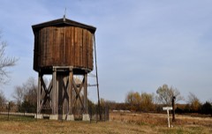
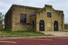
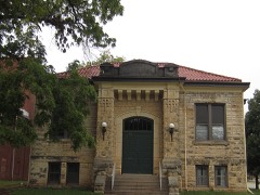
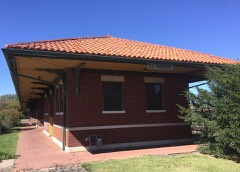
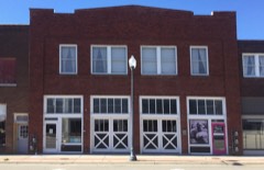
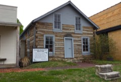
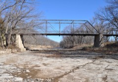
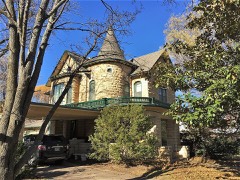
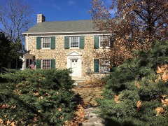
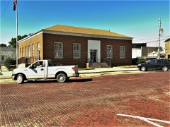
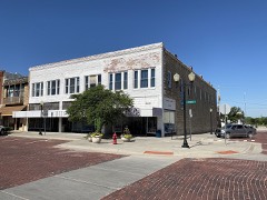
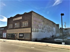
26 National Register listings published here.
Sources: the National Register database, National Park Service
107 topographic sheets cover 43 settlements here, and 26 properties are on the National Register of Historic Places.
26 National Register listings published here.
Sources: the National Register database, National Park Service
Every property in this county listed on the National Register of Historic Places, with the year it was listed and the federal nomination document.
Every wildfire the federal occurrence database records inside this county: 815 of them, burning about 49,428 acres. 9 started naturally and 24 were recorded as arson. Each settlement page carries the fires within five miles of it.
| Reported cause | Fires |
|---|---|
| Missing data/not specified/undetermined | 352 |
| Debris and open burning | 272 |
| Equipment and vehicle use | 84 |
| Arson/incendiarism | 24 |
| Recreation and ceremony | 24 |
| Power generation/transmission/distribution | 18 |
| Smoking | 15 |
| Fireworks | 11 |
| Natural | 9 |
| Misuse of fire by a minor | 4 |
| Other causes | 2 |
The five largest, by the area the report gives. None of them was recorded as arson.
| Date | Cause | Size | Reported by | Name on the report |
|---|---|---|---|---|
| 8 March 2006 | Missing data/not specified/undetermined | 10,700 acres | Kansas Counties | 254 FIRE |
| 1 April 2002 | Missing data/not specified/undetermined | 6,000 acres | Butler County | not named |
| 1 April 2002 | Missing data/not specified/undetermined | 5,500 acres | Butler County | not named |
| 28 January 1996 | Missing data/not specified/undetermined | 4,000 acres | Butler County | not named |
| 25 July 2012 | Natural | 3,800 acres | Kansas Counties | HWY 77 AND NW 150TH |
| 29 January 2016 | Equipment and vehicle use | 3,500 acres | Kansas Forest Service | 3 |
| 12 April 2014 | Missing data/not specified/undetermined | 2,500 acres | Butler County | KS_BUX_0019 |
| 27 February 2016 | Missing data/not specified/undetermined | 2,190 acres | Butler County | WIEEMAN |
Every settlement page carries the fires within five miles of it - see the settlement index below.
The NOAA Storm Events Database holds 1,848 reports for this county, causing 30 deaths, 217 injuries and about $357,272,240 in recorded property damage. Each settlement page carries the reports that name it.
| Kind of event | Reports |
|---|---|
| Hail | 892 |
| Thunderstorm Wind | 662 |
| Tornado | 90 |
| Flash Flood | 86 |
| Heavy Rain | 66 |
| Flood | 48 |
| Lightning | 3 |
| Funnel Cloud | 1 |
The most serious of them, by death, then injury, then recorded damage. The accounts are quoted exactly as the forecast office filed them.
| When | Event | Place named | Harm | What the report says |
|---|---|---|---|---|
| June 1958 | Tornado (F4) | not stated | 15 killed, 5 hurt, $2,500,000 | no account filed |
| April 1991 | Tornado (F5) | not stated | 13 killed, 150 hurt, $250,000,000 | no account filed |
| March 2009 | Flood | El Dorado | 1 killed, $10,000 | Heavy rainfall caused ponding of water on North Main Street in El Dorado. This ponding of water caused a car to slide off the road into a rain swollen culvert. The heavy runoff carried the car 65 feet into a six by six culvert, where the driver became trapped and eventually drowned as water filled the car. |
| August 2016 | Flash Flood | Rose Hill | 1 killed | Water was flowing across many area roads. Several swift water rescues were performed. In a couple of cases, the vehicles were swept of off the roadway. Four individuals were in those vehicles and two were found and rescued. One other individual had been swept downstream and appeared to rescuers as he walked out of a soybean field. Unfortunately, one person was not found until later and had perished. |
| July 1987 | Thunderstorm Wind | not stated | 25 hurt | no account filed |
| April 1991 | Tornado (F2) | not stated | 4 hurt, $250,000 | no account filed |
| July 2009 | Thunderstorm Wind | El Dorado Res | 4 hurt, $50,000 | Severe straight-line winds from a squall line ravaged the Shady Creek Campground on the east side of El Dorado Lake. Numerous large trees were uprooted, campsites were damaged, and two camper trailers were overturned. Minor injuries were sustained. |
| June 1990 | Thunderstorm Wind | not stated | 4 hurt | no account filed |
| June 1958 | Tornado (F2) | not stated | 4 hurt | no account filed |
| July 2024 | Thunderstorm Wind | Andover | 3 hurt | Broadcast media reported a fireworks tent blown over with three injuries. The injury information was confirmed with emergency management. |
| April 1956 | Tornado (F1) | not stated | 2 hurt, $250,000 | no account filed |
| August 2003 | Thunderstorm Wind | El Dorado Res | 2 hurt, $150,000 | One camper overturned resulting in two injuries, both minor. At El Dorado State Park, Shady Creek Marina sustained extensive damage to dock coverings, a gasoline dock, the 'A' dock boat slip, with several docks torn loose. Power outages resulted obviously from power lines and power poles downed nearby. Tree damage was widespread with many trees uprooted. One limb fell onto a mobile home. The El Dorado Times contributed greatly to this report. |
| June 2008 | Lightning | Rose Hill | 2 hurt | Two people were struck by lightning and transported to the hospital. |
| May 1963 | Tornado (F2) | not stated | 2 hurt | no account filed |
| April 2022 | Tornado (EF3) | Andover | 1 hurt, $37,000,000 | A highly visible tornado tracked across portions of Andover, Kansas, during the early evening hours of April 29th, 2022. The tornado went through a highly populated portion of town, including 2 different subdivisions. Also a health club took a direct hit, but no injuries occurred due to actions taken by the health club. Only 1 direct injury occurred from the tornado, with 3 indirect injuries occurred during search and rescue operations. Total damaged house or destroyed structures in Andover and rural Butler County were 205. Of the damaged properties, approximately 180 were residences and the rest were businesses or city buildings. Damage estimates were around $37 million. |
| July 1994 | Thunderstorm Wind | Cassoday | 1 hurt, $5,000,000 | Damaging winds over 60 miles an hour began in Cassoday where 24 utility poles were either broke or blown over. The hardest hit was the Augusta area where four homes were totally destroyed and seven sustained major damage. Two mobile homes were destroyed. A woman was hospitalized when her mobile home was blown over and rolled three times. Sixty mobile homes in the Cedar Land Mobile Home Court had damage. The winds collapsed a storage shed at a car lot, while blowing debris damaged many vehicles on the lot. Damage in the Andover area was mostly from and to trees. Firework tents were knocked down or destroyed and traffic lights were knocked down. Damage estimates range from $10 thousand to $50 thousand. In El Dorado, 70 mph winds damaged the hospital and trees were blown down on the Courthouse lawn. Over 80 mph winds lasted ten minutes in Peabody. Eighty mph winds were reported in Douglass where there was extensive tree damage; the roof of an auto body shop was blown off and a church lost part of its roof. Total damage for the county was nearly $3 million. Utility power lines sustained $614,000 in damages. |
| April 2008 | Thunderstorm Wind | Potwin | 1 hurt, $600,000 | An intense bow echo moved across northern Butler county producing widespread wind damage from the Potwin area through Cassoday. Seventy four very large high voltage H-poles were downed along with 130 power poles and a 300 ft cell phone tower also collapsed. Additionally, 3 semi trucks were blown off of the Kansas Turnpike which resulted in one injury. Several calves were also killed by flying debris near Cassoday. |
| October 1960 | Tornado (F2) | not stated | 1 hurt, $25,000 | no account filed |
| July 1994 | Thunderstorm Wind | Whitewater | 1 hurt, $5,000 | Damaging thunderstorms winds hit eastern Butler County with speeds around 63 miles an hour. Three miles west of Towanda a tractor-semitrailer was overturned. A twenty-three year old woman was hit in the head with a 2 by 4 as she stood on her porch. She was taken to the hospital in critical condition. |
| April 1960 | Tornado (F2) | not stated | 1 hurt, $2,500 | no account filed |
| April 1960 | Tornado (F2) | not stated | 1 hurt, $30 | no account filed |
| July 2011 | Thunderstorm Wind | Rose Hill | 1 hurt | A car was blown off of the road due to the strong winds and caused a minor injury. |
| October 2003 | Flash Flood | West Central Portion | 1 hurt | Flash flooding was major! The following roads were barricaded: Andover Road, Santa Fe Lake Road 2 miles south of Douglass, Haverhill Road 2 miles south of Highway 54 near Haverhill, Butler Road north of Highway 254 between NW 30th and NW 40th Streets, 2nd Street Bridge just west of Augusta on Southwest Thunder Road, SW 120th Street and Tawakoni Road, 21st Street just west of Santa Fe Lake Road, and the Santa Fe Lake Road/NW 30th Street intersection. Stalled vehicles dotted the entire area.The reported injury resulted from a one vehicle accident on North Ohio Avenue in Augusta. Water flowed across the Little Walnut River bridge. Flooding of many basements resulted from rainfalls ranging from 3 to 5.7 inches. A one-vehicle accident occurred near El Dorado at the intersection of Edgemoor & Towanda Roads when the driver missed the edge of the road and went into a ditch. The driver was unhurt. A rescue squad was summoned to evacuate one couple and their pet from their home located on Four-Mile Creek near Augusta. The home was flooded to depths around one foot. Members of the rescue squad were endangered as the 12-foot boat used required operation at full throttle to work it's way upstream. A rescue squad was also summoned to the scene of one vehicle stalled in high water at SW 70th Street and Ohio.In the Aspen Creek development about 2 miles south of Andover, two homes sustained major basement flooding to depths of 5-6 feet. In the Wagon Wheel subdivision, six homes were flooded, although depths did not exceed one foot.Not surprisingly, the torrential rains induced rises from both the Walnut and Whitewater Rivers in Augusta. The Walnut River crested to around 22.0 feet (four feet above flood stage) the night of the 10th. The Whitewater River crested at 24.5 feet (3.5 feet above flood stage) at the Whitewater Bridge on U.S. Highway 54 the afternoon of the 9th. (The Augusta Daily News, the El Dorado Times and the Wichita Eagle all contributed greatly to this narrative.) |
| June 1990 | Thunderstorm Wind | not stated | 1 hurt | no account filed |
| May 2009 | Thunderstorm Wind | Benton | $30,000,000 | A large swatch of damaging winds moved across the area from Benton to Rosalia including the city of El Dorado with winds measured at 80 mph at the Jefferson elementary school in El Dorado. Numerous large trees were knocked down in Benton, with a mobile home trailer rolled over east of town. The Damaging winds destroyed the historic stone silo bearing the name of the town of Towanda. The damaging winds estimated at 70 to 80 mph moved into El Dorado damaging roofs to numerous businesses in downtown and knocking down numerous large trees. Two or three schools in El Dorado had their roofs partially peeled off. The refinery in El Dorado had some large storage tanks dented. The damaging winds continued to move east downing almost every one of the large transmission lines along US 54 highway from El Dorado to Rosalia. |
| May 1993 | Thunderstorm Wind | El Dorado | $5,000,000 | El Dorado was also hit hard with thunderstorm winds greater than 80 miles an hour. Twenty homes on the west side of tow sustained superficial damage. The marina at El Dorado Lake was damaged. Total damage was estimated at $500,000. |
| March 1993 | Hail | Augusta | $5,000,000 | no account filed |
| April 2011 | Hail | Rose Hill | $4,370,000 | Baseball to softball size hail pounded the city of Rose Hill. This hail damaged roofs, siding, cars and homes. The Rose Hill high school roof was a total loss at $700,000. Damage to city vehicles and buildings were estimated at $313,000. Nine out of 10 of the city police cars have been damaged and one car was totalled. Nearly every home in town had 50 to 100 percent roof damage. |
| May 2015 | Hail | El Dorado | $2,500,000 | We received a delayed report of baseball-sized hail that caused damage to an unspecified number of local businesses. |
| July 2009 | Hail | Andover | $2,500,000 | The same hail storm that devastated Downtown Wichita, Kansas continued to track east and produced large hail ranging from golf ball to baseball size, across western sections of Butler county including the cities of Andover and Augusta along US Highway 54. Witnesses report that the hail lasted for almost a half an hour, causing damage to hundreds of vehicles with numerous roofs and windows damaged. |
| June 2025 | Flash Flood | Leon | $2,000,000 | Numerous reports of significant flash flooding were reported across portions of Butler County. These reports included, but not limited to, the following road closures: Kansas Highway 77 at McCollum, Highway 254 in El Dorado and Prairie Creek Road near Benton. Many other side streets and roads across Butler County were also impassible especially in El Dorado. In addition to the road closures, numerous reports of stalled vehicles due to high water were reported across many areas of the county. Homes were evacuated on the north and southwest side of El Dorado due to rapidly rising flood waters. Flooding on area roadways and into homes impacted the Wagon Wheel neighborhood near Santa Fe Lake. A total of 240 homes and businesses were impacted in the county with damage to county roadways as well resulting in $4 million infrastructure damages. |
| May 2015 | Hail | El Dorado | $1,000,000 | KWCH Channel 12 relayed the report. |
| April 2009 | Flash Flood | Latham | $1,000,000 | Heavy rainfall from numerous thunderstorms during the afternoon, evening and overnight hours on the 26th produced widespread urban and rural flooding across the county. Many locations received 3 to 5 inches of rainfall, with areas around Benton and Andover receiving over 6 inches of rainfall. Several rural and city roads were closed countywide due to high water. Nearly two dozen evacuations took place along Dry Creek near Santa Fe Lake about 3 miles northwest of Augusta, and also across portions of El Dorado. Several of those homes sustained flood damage, some of which was major, and several businesses in downtown El Dorado sustained water damage. The Wichita Eagle and Andover Journal-Advocate contributed to this report. |
| October 2007 | Thunderstorm Wind | Andover | $1,000,000 | Straight line winds caused extensive damage to a business. The business was a large span, morton type building with metal siding and roofs. Four large garage doors were blown in and the roof was partially removed. Cold storage lockers in the parking lot were thrown 20 to 40 feet. Some power lines were also knocked down. No injuries occurred, due to the plant employees being sent home earlier in the day due to a power ouutage. |
| May 2015 | Hail | El Dorado | $500,000 | The hail ranged in size from golf balls to hen eggs. |
| May 2002 | Flash Flood | Augusta | $500,000 | Part of Highway 54 closed. Numerous basements flooded. |
| May 1999 | Flash Flood | Towanda | $500,000 | Major flash flooding occurred in Northwest Butler County along Four Mile Creek, a tributary of the Whitewater River. Several houses were reported in high water. In Towanda, the torrential rains caused widespread street flooding. |
| March 1993 | Hail | Beaumont | $500,000 | no account filed |
| July 2003 | Thunderstorm Wind | El Dorado | $350,000 | Microburst-induced winds downed power lines and power poles. A large Oak Tree in front of Butler County courthouse was uprooted and landed on a pick-up truck. The roof at Pizza Hut was damaged while a brick wall at K&M car wash in West El Dorado was blown down. A light pole (that also contained the power control system) at El Dorado High School's football field was toppled while a second was twisted. Roof damage was extensive, mainly due to shingles being first peeled, then dislodged. A sandblasting shop at a construction site was destroyed. Two trailers were overturned.Tree damage was widespread, including one large branch that fell onto a house, severely damaging it's roof. El Dorado Times contributed greatly to this report. |
| May 2010 | Thunderstorm Wind | El Dorado | $250,000 | Three semi tractor trailer trucks were overturned along the Kansas Turnpike directly underneath the K-254 overpass, when high tension powerlines fell onto the road. The semi's became tangled in the wires and overturned or were pushed off the road. 2 injuries occurred as one of the semi's broke open when it hit the bridge pillar, spilling the moving vans contents into the rain. |
| July 1987 | Tornado (F2) | not stated | $250,000 | no account filed |
| July 1987 | Tornado (F1) | not stated | $250,000 | no account filed |
| June 1978 | Tornado (F1) | not stated | $250,000 | no account filed |
| September 1978 | Tornado (F0) | not stated | $250,000 | no account filed |
| June 1998 | Thunderstorm Wind | El Dorado | $150,000 | In South El Dorado, 4 aircraft and 1 older hangar damaged. |
| May 2014 | Hail | Augusta | $125,000 | The large hail ranged in size from half dollar to golf ball size. The hail was driven by 70 mph winds, causing damage to cars and house siding. |
| July 2007 | Flood | El Dorado | $108,000 | Heavy rainfall from the end of June into early July caused flooding throughout Butler County. This resulted in roughly 108 thousand dollars in damage. |
| June 2017 | Thunderstorm Wind | Augusta | $100,000 | The Emergency Manager reported that campers were overturned at Santa Fe Lake but there were no injuries. Multiple trees were downed in this area. The damage was spread across about a 1 mile diameter. The time of the event was estimated from radar. |
| September 2000 | Lightning | El Dorado | $100,000 | A tank battery was destroyed, an office building had it's alarm system disabled, and numerous power lines were struck resulting in widespread arcing. |
| April 2015 | Thunderstorm Wind | Douglass | $75,000 | The emergency manager reported two mobile homes just northeast of town were destroyed. |
| March 2008 | Thunderstorm Wind | Leon | $75,000 | Thunderstorm winds, estimated to be between 60 and 70 mph knocked power lines and power poles down for three quarters of a mile along southwest 170th and Cole Creek Road. |
| June 2008 | Thunderstorm Wind | El Dorado | $75,000 | Twenty electric power poles were broken off at the ground. |
| February 2012 | Thunderstorm Wind | Leon | $60,000 | Winds estimated around 90 mph produced extensive damage to a farmstead 7 miles east of Leon. A barn was destroyed, half of the home's roof was blown off, and extensive tree damage occurred. Additionally, several power poles were downed. Property damage amounts are rough estimates. |
| May 2009 | Thunderstorm Wind | El Dorado Res | $60,000 | Three campers were overturned at the El Dorado Lake state park. Two unoccupied trailers were overturned. A third occupied trailer at the Walnut River area of the lake was also rolled over. Of the two people in the trailer, suffered a minor (direct) head injury. |
| May 2003 | Tornado (F1) | Beaumont | $60,000 | Farmstead damaged. Details courtesy of Jim Schmidt, Butler County Emergency Manager, and Andover Journal-Advocate. |
| April 1999 | Hail | Cassoday | $60,000 | Tennis ball-sized hail damaged 5 vehicles and inflicted roof damage to several houses. |
| September 2008 | Flash Flood | Douglass | $55,000 | Local broadcast media reported that a mobile home park was being evacuated due to high water in the town of Douglass. |
| July 2023 | Lightning | Andover | $50,000 | Fire and rescue reported a lightning strike caused a house fire. |
| April 2015 | Thunderstorm Wind | Douglass | $50,000 | A large barn was destroyed by the damaging winds. |
| August 2013 | Thunderstorm Wind | El Dorado Res | $50,000 | The Shady Creek Marina was hit hard by 80 mph damaging winds as the strong winds ripped away a dock from the marina store. Several boats were damaged, including a 40 foot houseboat that was swamped or partially sank. The submerging of the houseboat led to minor fuel spill, with 75 to 100 gallons of fuel spilling into the water. The fuel spill was quickly contained to the marina cove. |
The Survey's mineral resources record lists 1 working inside this county. It still produces. Each settlement page carries the workings within five miles of it.
| Commodity | Workings |
|---|---|
| Stone, Crushed/Broken | 1 |
The least common of them first, because a county's hundredth gravel pit says nothing its first ten did not.
| Where | Site | Commodity | Status | Recorded |
|---|---|---|---|---|
| Number 21 Quarry | Stone, Crushed/Broken | Producer |
Named settlements recorded in the Geographic Names Information System, each with the topographic sheets covering it. Villages, hamlets and abandoned places alike. Each is shown with the nearest named watercourse or landform and the survey quadrangle it falls on.
Bloomington township · 67039 · On Hickory Creek · Gordon quadrangle
15 sheets, 1888 to 1990
Clay township · 67008 · On North Branch Rock Creek · Augusta SE quadrangle
14 sheets, 1888 to 1990
El Dorado city · 67042 · On West Branch Walnut River · El Dorado quadrangle
14 sheets, 1888 to 1990
El Dorado city · 67042 · On West Branch Walnut River · El Dorado quadrangle
14 sheets, 1888 to 1990
Towanda township · 67144 · On Spring Branch · El Dorado SW quadrangle
14 sheets, 1888 to 1990
El Dorado township · 67042 · On Sutton Creek · El Dorado SW quadrangle
14 sheets, 1888 to 1990