 Block
Fredonia, Kansas
24 topographic sheets cover this place, the earliest surveyed in 1886 and the latest in 1990. It stands in Center Township. It lies in ZIP code area 66736. It lies near South Mound. The Survey maps it on the Fredonia quadrangle. 2,151 people lived here at the 2020 count. It stands 896 feet above sea level.
Research this city
On record in Fredonia
Buildings and businesses the archive holds for this place. Each opens its own page, with the source record it came from.
On the National Register 3 records
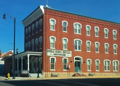 Gold Dust Hotellisted 1991
- Dr. A. C. Flack Houselisted 1989
- US Post Office-Fredonialisted 1989
Population over time
2 figuresFredonia fell from 2,482 to 2,151 between 2010 and 2020. These are the recorded population figures Wikidata holds for this place, reached through the Geographic Names Information System number this page is keyed on rather than by name, so they belong to this place and not to another of the same name. Most are census counts, but not all are: an early figure may be a founding or settlement estimate, and an estimate published within five years of a census is left out. The change column is computed, and is left blank where more than 20 years separate a figure from the one before it, because a gap that long is not a change between two counts.
| Year | People | Change |
|---|---|---|
| 2010 | 2,482 | |
| 2020 | 2,151 | -331 (-13%) |
Topographic sheets covering this place
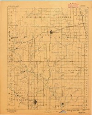
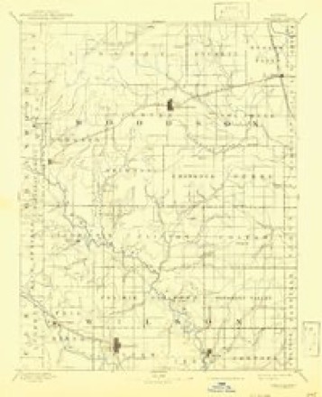
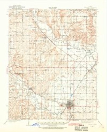
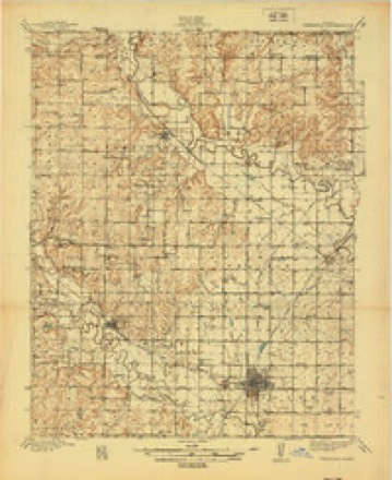
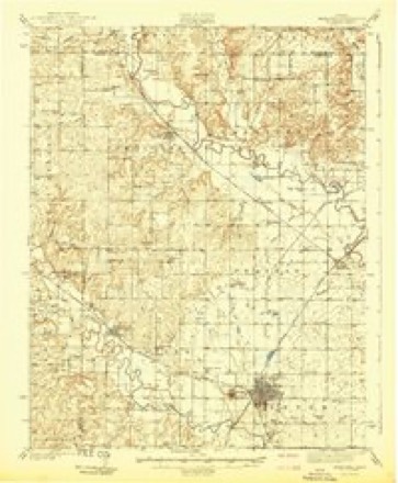
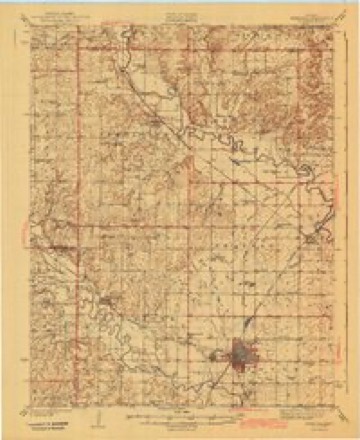
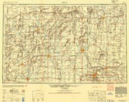
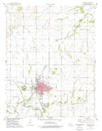
14 surveys from 24 printed sheetsMatched by testing this settlement's coordinate against the published boundary of every sheet in the United States Geological Survey's historical collection. Each opens the scanned sheet at the Survey.
- 1886 USGS Fredonia quadrangle1:125000
- 1894 USGS Fredonia quadrangle1:125000, 6 printings
- 1938 USGS Fredonia quadrangle1:62500, 2 printings
- 1939 USGS Fredonia quadrangle1:48000, 2 printings
- 1942 USGS Fredonia quadrangle1:62500
- 1943 USGS Fredonia quadrangle1:62500, 2 printings
- 1947 USGS Joplin quadrangle1:250000
- 1949 USGS Joplin quadrangle1:250000
- 1954 USGS Joplin quadrangle1:250000, 3 printings
- 1958 USGS Joplin quadrangle1:250000
- 1959 USGS Joplin quadrangle1:250000
- 1975 USGS Fredonia quadrangle1:24000
- 1985 USGS Chanute quadrangle1:100000
- 1990 USGS Chanute quadrangle1:100000
Fires near this place
8 since 2012Regional context, not property-specific evidence. The federal wildfire occurrence database lists 8 fires within 5 miles of Fredonia between 2012 and 2018, burning about 2,084 acres in total. None started naturally. None was recorded as arson. Distance is straight-line from the map coordinates, so a fire counted here may appear on a neighbouring settlement's page as well.
| Reported cause | Fires |
|---|---|
| Debris and open burning | 4 |
| Missing data/not specified/undetermined | 4 |
The most recent of them, most recent first, with the day each was reported and the service that recorded it.
| Date | Cause | Size | Reported by | Name on the report |
|---|---|---|---|---|
| 23 August 2012 | Missing data/not specified/undetermined | 1,307 acres | Kansas Counties | 400 AND LANE |
| 7 April 2018 | Debris and open burning | 750 acres | Kansas Forest Service | 2018010 |
| 5 March 2015 | Debris and open burning | 3.0 acres | Kansas Forest Service | 2015023 |
| 16 March 2015 | Debris and open burning | 20 acres | Kansas Forest Service | 2015029 |
| 7 February 2016 | Debris and open burning | under an acre | Kansas Forest Service | 3 |
| 27 February 2015 | Missing data/not specified/undetermined | under an acre | Kansas Forest Service | 2015021 |
| 14 February 2016 | Missing data/not specified/undetermined | under an acre | Kansas Forest Service | 4 |
| 16 January 2015 | Missing data/not specified/undetermined | 4.0 acres | Kansas Forest Service | 2015007 |
Settlements close enough to share some of these fires:
Mines and quarries near this place
2 within 5 milesRegional context, not property-specific evidence. The federal mineral resources record lists 2 workings within 5 miles of Fredonia: 2 producers. All of them still produce. What was taken out: Clay, Stone, Crushed/Broken. Distance is straight-line from the map coordinates, so a quarry counted here may appear on a neighbouring settlement's page as well.
| Where | Site | Commodity | Status | Recorded |
|---|---|---|---|---|
| Fredonia Clay Pit | Clay | Producer | ||
| Fredonia Quarry & Mill | Stone, Crushed/Broken | Producer |
Storms near this place
60 of 102 shownRegional context, not property-specific evidence. The National Weather Service names Fredonia in 102 storm reports between 1993 and 2026: 41 hail, 26 thunderstorm wind, 14 flash flood, 6 flood. No death or injury is recorded in these reports. Each account below is quoted exactly as the forecast office filed it, from the NOAA Storm Events Database, and each date opens the federal record of that event.
| When | Event | Place named | Harm | What the report says |
|---|---|---|---|---|
| July 2007 | Flash Flood | Fredonia | $21,600,000 | Extremely heavy rainfall from the end of June into early July caused flash flooding throughout Wilson County. The flash flooding and the ensuing river flooding led to approximately 500 homes sustaining major damage which resulted in an estimated 15 million dollars in damage. Additionally, 6.6 million dollars of damage was done to public infrastructure. The Fall River at Fredonia had a record crest of 41.12 feet on the morning of June 30th. This is 24.12 feet above flood stage. The river fell below flood stage early in the morning of July 2nd. |
| August 2005 | Lightning | Fredonia | $150,000 | Front office, restaurant, and scale area of the Fredonia Sales Barn destroyed. (Narrative courtesy of the Wilson County Citizen.) |
| May 2009 | Thunderstorm Wind | Fredonia | $120,000 | Winds speeds of 80 to 90 mph produced widespread wind damage across Fredonia and Altoona. Numerous businesses in Fredonia had some serious roof damage. Sheds and outbuildings in rural areas were destroyed and 42 power poles were downed. |
| May 2009 | Flash Flood | Fredonia | $70,000 | Numerous county roads were under water from 2 to 4 inches of rainfall in a short period of time. The worse flooding occurred from Buffalo to Altoona. |
| August 2013 | Flash Flood | Fredonia | $50,000 | Extreme street flooding and standing water from very heavy rainfall, led to some evacuations in Fredonia from rising water. |
| September 2009 | Flash Flood | Fredonia | $30,000 | Nearly eight inches of rainfall caused creeks to overflow their banks in both Fredonia and Neodesha. The Salt creek on the west side of Fredonia left its banks for a period of time. The flooding caused numerous street closings in and around the towns. The severity of the flooding washed out the SKO railroad tracks in Neodesha, this stopped train traffic through town until repairs could be made. Three water rescues also occurred from people driving into flooded roadways, but no injuries were reported. |
| September 2001 | Thunderstorm Wind | Fredonia | $25,000 | Barn destroyed. Downed power lines became entangled near a shop, severing power to most of town for about two hours. In addition, an earlier power outage occurred when lightning struck an oil switch at the town's substation. |
| May 2010 | Thunderstorm Wind | Fredonia | $15,000 | Several trees were knocked down across town. A few powerlines were also knocked down. |
| April 2017 | Thunderstorm Wind | Fredonia | $10,000 | Highway signs were blown down by the gusts. |
| May 2010 | Thunderstorm Wind | Fredonia | $10,000 | Several trees were reported knocked down across town, along with several powerlines. |
| September 2010 | Thunderstorm Wind | Fredonia | $10,000 | Wind damage was reported from Fredonia to Neodesha. The hardest hit city was Neodesha where a portion of the roof was blown off a motel, and numerous businesses had broken windows. Tree branches were reported down all across the city. |
| June 2007 | Lightning | Fredonia | $10,000 | Lightning struck a residence in Fredonia and caused damage to wiring, electric equipment and plumbing. Neighboring homes also sustained minor damage to electronics. The Wilson County Citizen contributed to this report. |
| June 2006 | Thunderstorm Wind | Fredonia | $10,000 | Strong winds caused roof damage and blew out windows at a residence in Lafontaine, and also caused some tree damage. |
| June 2008 | Flash Flood | Fredonia | $5,000 | Widespread street flooding reported throughout the town. |
| August 2003 | Thunderstorm Wind | Fredonia | $5,000 | Damage to one telephone line at the Fredonia swimming pool. Tree damage was widespread. The Wilson County Citizen contributed to this report. |
| March 1993 | Hail | Fredonia | $5,000 | A series of thunderstorms developed around Hutchinson and Wichita, and intermittently dropped hail between 0.75 inch and 2.00 inches as they drifted east and weakened. Widespread golfball-size hail resulted in damage estimated by the Insurance Information Institute at near $35 million primarily in Wichita. |
| July 2011 | Lightning | Fredonia | $2,000 | Lightning caught a small shed on fire. The shed was a total loss. |
| September 2018 | Flood | Fredonia | $100 | Emergency manager reported flooding of low lying areas across the county. Minor flooding also occurred in Fredonia and Neodesha. |
| September 2018 | Flash Flood | Fredonia | $100 | Several roads were barricaded in Fredonia and across the county. |
| August 2013 | Flash Flood | Fredonia | $100 | Street flooding was reported all across Fredonia. |
| July 2010 | Flash Flood | Fredonia | $100 | Significant street flooding occurred in Fredonia. |
| April 2024 | Tornado (EF0) | Fredonia | - | Parts of metal roofs to outdoor buildings at the fairgrounds sustained damage. |
| May 2024 | Heavy Rain | Fredonia | - | Twenty four hour rainfall from COOP observer of 2.02 inches. |
| April 2024 | Tornado (EFU) | Fredonia | - | There was a very brief tornado in an open field. No damage occurred. |
| April 2024 | Thunderstorm Wind | Fredonia | - | Part of a roof was blow off of one of the log buildings at the Old Iron Club and was laying across the road. The damage was concluded to be straight line winds as all of it went in one direction. |
| May 2023 | Flood | Fredonia | - | Multiple flooded streets were reported in Fredonia. |
| October 2023 | Heavy Rain | Fredonia | - | A 24 hour rainfall total of 3.02 inches. |
| May 2022 | Thunderstorm Wind | Fredonia | - | A ten in diameter tree trunk was snapped. |
| May 2022 | Heavy Rain | Fredonia | - | A Coop observer in Fredonia, Kansas, reported a 24 hour rainfall total of 3.32 inches. |
| June 2022 | Heavy Rain | Fredonia | - | A Coop observer near Fredonia reported 4.73 inches of rainfall in 24 hours. |
| June 2022 | Heavy Rain | Fredonia | - | A Cocorahs observer in Fredonia reported 4.73 inches of rainfall in 24 hours. |
| July 2021 | Flood | Fredonia | - | Heavy rains prompted flood warnings and problems on area roads, especially in the southwestern sections. |
| July 2021 | Heavy Rain | Fredonia | - | This was a 24 hour rain total of 6.53 inches. |
| August 2019 | Thunderstorm Wind | Fredonia | - | No damage was reported. |
| June 2018 | Thunderstorm Wind | Fredonia | - | A tree was downed in Fredonia. Since the size of the tree was unknown, the speed is definitely an estimate. |
| June 2018 | Hail | Fredonia | - | This was a delayed report. Most of the hail was nickel to quarter-sized, but a few golf ball-sized specimens were mixed in. |
| August 2017 | Flash Flood | Fredonia | - | Rapid flowing water crossing the road along Rainbow creek. Several other low lying roads were reported as being under water due to the localized 5 plus inch rainfall. |
| September 2017 | Thunderstorm Wind | Fredonia | - | Several trees were blown down in town. |
| July 2016 | Thunderstorm Wind | Fredonia | - | A deputy estimated 60 mph wind gusts and torrential rainfall. |
| July 2013 | Flood | Fredonia | - | Some roads were flooded and closed in the flood-prone areas. It was still raining heavily with around 3 inches measured at this time. |
| May 2010 | Hail | Fredonia | - | Trees were also knocked down from estimted 60 mph winds. |
| September 2010 | Hail | Fredonia | - | Wind gusts to 70 mph were also reported. |
| May 2008 | Flood | Fredonia | - | Street flooding occurred in town with several creeks in the vicinity running at bank full as well. |
| May 2008 | Tornado (EF0) | Fredonia | - | The tornado touched down briefly in an open field. |
| June 2007 | Flash Flood | Fredonia | - | Widespread 15 to 20 inch rainfall amounts occurred across Wilson County from June 27th through July 1st, producing widespread, significant flooding. Please refer to this event in the July 2007 StormData publication for complete details. |
| March 2006 | Tornado (F0) | Fredonia | - | Sporadic touchdowns along a 2 to 3 mile path over open country. Did not produce any known damage. |
| May 2004 | Thunderstorm Wind | Fredonia | - | Downed tree limbs. |
| April 2003 | Tornado (F0) | Fredonia | - | Brief touchdown in open country. |
| May 2002 | Flash Flood | Fredonia | - | Water covered 1000 Road east of 15th Street. |
| May 2002 | Flash Flood | Fredonia | - | Numerous roads across the town had been covered by water and washed out. |
| May 2002 | Flash Flood | Fredonia | - | A low water crossing was flooded and an automobile rescue had to be performed. |
| June 2000 | Flash Flood | Fredonia | - | With grounds already saturated from recent thunderstorms, a slow-moving thunderstorm producing 4 to 5 inches of rain resulted in the flooding of a park, the fairgrounds and most roads leading into Fredonia. The flooding was so extensive that nearly all access into Fredonia was closed off. New Albany, located 5 miles norhwest of Fredonia, was completely cutoff when the county road leading to it was barricaded. |
| June 1999 | Thunderstorm Wind | Fredonia | - | Large trees blown down. |
| March 2026 | Hail | Fredonia | - | no account filed |
| August 2019 | Hail | Fredonia | - | no account filed |
| April 2015 | Hail | Fredonia | - | no account filed |
| June 2011 | Hail | Fredonia | - | no account filed |
| June 2011 | Hail | Fredonia | - | no account filed |
| June 2011 | Hail | Fredonia | - | no account filed |
| June 2011 | Hail | Fredonia | - | no account filed |
Nearest settlements
The eight closest, with where each one stands in the county. Distances are straight-line, computed from the Geographic Names Information System coordinates.
| Map | Place | Distance | Sheets |
|---|---|---|---|
| Benedict Junction | 6.0 miles | 24 | |
| New Albany | 6.4 miles | 24 | |
| Guilford | 7.2 miles | 23 | |
| Benedict | 7.5 miles | 24 | |
| Buxton | 7.7 miles | 16 | |
| Altoona | 8.8 miles | 23 | |
| Lafontaine | 9.3 miles | 16 | |
| Buffville | 9.5 miles | 17 |
Elsewhere
Matched on this settlement's Geographic Names Information System number rather than its name, so it cannot be a different place of the same name in another state.
| Wikipedia article on Fredonia | An encyclopaedic summary. Its text is share-alike, so it is linked here rather than copied. |
| Wikidata item Q1925165 | The structured record the population and elevation above come from. Public domain (CC0). |
Provenance
This settlement is recorded in the Geographic Names Information System as feature 475082. The sheet list is computed by point-in-boundary test against the United States Geological Survey's historical topographic inventory. Both are works of the United States government and carry no copyright under 17 U.S.C. 105.
Wildfire. Short, Karen C. 2022. Spatial wildfire occurrence data for the United States, 1992-2020 [FPA_FOD_20221014]. 6th Edition. Fort Collins, CO: Forest Service Research Data Archive. https://doi.org/10.2737/RDS-2013-0009.6 Collected with United States Government funding and usable without additional permissions or fees.
Mines and quarries. USGS Mineral Resources Data System (MRDS) https://mrdata.usgs.gov/mrds/ A work of the United States government, no copyright under 17 U.S.C. 105.
Storms. NOAA National Centers for Environmental Information, Storm Events Database https://www.ncei.noaa.gov/stormevents/ A work of the United States government, no copyright under 17 U.S.C. 105. Narratives are quoted verbatim from the National Weather Service report and are not edited or summarised.