 Block
From the record
10 National Register listings published here, 1 of them a National Historic Landmark.
Sources: the National Register database, National Park Service
51 topographic sheets cover 19 settlements here, and 10 properties are on the National Register of Historic Places.
10 National Register listings published here, 1 of them a National Historic Landmark.
Sources: the National Register database, National Park Service
Every property in this county listed on the National Register of Historic Places, with the year it was listed and the federal nomination document.
| Photograph | Property | Type | Listed | Reference |
|---|---|---|---|---|
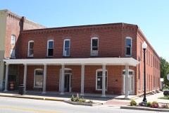 | Brown Hotel | building | 1995 | 95000863 |
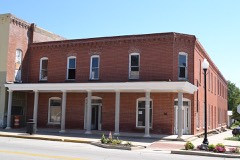 | Brown Hotel (Boundary Increase) | building | 2008 | 08000690 |
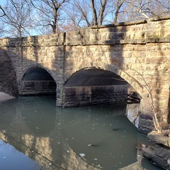 | Brush Creek Bridge | structure | 1985 | 85001419 |
| Dorothy DeLay House | building | 2023 | 100008863 | |
| Dr. A. C. Flack House | building | 1989 | 89001463 | |
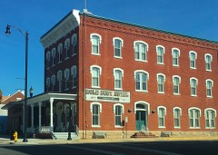 | Gold Dust Hotel | building | 1991 | 91001542 |
| Neodesha City Hall Building | building | 2018 | 100002248 | |
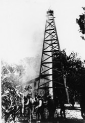 | Norman No. 1 Oil Well Site | site | 1974 | 74000846 |
| US Post Office-Fredonia | building | 1989 | 89001638 | |
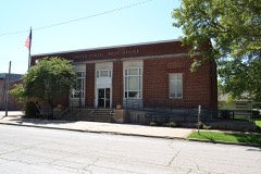 | US Post Office-Neodesha | building | 1989 | 89001647 |
Every wildfire the federal occurrence database records inside this county: 79 of them, burning about 4,727 acres. None started naturally and 1 was recorded as arson. Each settlement page carries the fires within five miles of it.
| Reported cause | Fires |
|---|---|
| Debris and open burning | 33 |
| Missing data/not specified/undetermined | 32 |
| Smoking | 4 |
| Equipment and vehicle use | 3 |
| Misuse of fire by a minor | 2 |
| Fireworks | 2 |
| Other causes | 1 |
| Recreation and ceremony | 1 |
| Arson/incendiarism | 1 |
The five largest, by the area the report gives. None of them was recorded as arson.
| Date | Cause | Size | Reported by | Name on the report |
|---|---|---|---|---|
| 23 August 2012 | Missing data/not specified/undetermined | 1,307 acres | Kansas Counties | 400 AND LANE |
| 7 April 2018 | Debris and open burning | 750 acres | Kansas Forest Service | 2018010 |
| 5 April 2018 | Debris and open burning | 640 acres | Kansas Forest Service | 2018008 |
| 5 April 2018 | Debris and open burning | 375 acres | Kansas Forest Service | 2018009 |
| 8 April 2009 | Missing data/not specified/undetermined | 275 acres | Kansas Counties | MARION ROAD |
| 19 March 2009 | Missing data/not specified/undetermined | 250 acres | Kansas Counties | WILSON |
| 5 March 2016 | Missing data/not specified/undetermined | 200 acres | Kansas Forest Service | 1600035 |
| 13 April 2006 | Debris and open burning | 200 acres | Woodson County | not named |
Every settlement page carries the fires within five miles of it - see the settlement index below.
The NOAA Storm Events Database holds 434 reports for this county, causing 1 death, 1 injury and about $23,742,630 in recorded property damage. Each settlement page carries the reports that name it.
| Kind of event | Reports |
|---|---|
| Hail | 206 |
| Thunderstorm Wind | 124 |
| Flash Flood | 33 |
| Heavy Rain | 25 |
| Tornado | 23 |
| Flood | 19 |
| Lightning | 3 |
| Funnel Cloud | 1 |
The most serious of them, by death, then injury, then recorded damage. The accounts are quoted exactly as the forecast office filed them.
| When | Event | Place named | Harm | What the report says |
|---|---|---|---|---|
| May 2009 | Thunderstorm Wind | New Albany | 1 killed, $510,000 | A mobile home was blown 40 feet and ended up wrapped around a large tree and was totally demolished. A 54 year old woman of the home was found in the wreckage and died. A church in town was totally destroyed and also the town post office was a total loss after it collapsed. Numerous trees were also down across town. |
| February 2012 | Thunderstorm Wind | Neodesha | 1 hurt, $50,000 | Winds estimated around 90 mph destroyed a home a few miles northeast of Neodesha. One injury (direct) was reported. The Independence Daily Reporter contributed to this report. |
| July 2007 | Flash Flood | Fredonia | $21,600,000 | Extremely heavy rainfall from the end of June into early July caused flash flooding throughout Wilson County. The flash flooding and the ensuing river flooding led to approximately 500 homes sustaining major damage which resulted in an estimated 15 million dollars in damage. Additionally, 6.6 million dollars of damage was done to public infrastructure. The Fall River at Fredonia had a record crest of 41.12 feet on the morning of June 30th. This is 24.12 feet above flood stage. The river fell below flood stage early in the morning of July 2nd. |
| May 1982 | Tornado (F1) | not stated | $250,000 | no account filed |
| September 1973 | Tornado (F1) | not stated | $250,000 | no account filed |
| August 2005 | Lightning | Fredonia | $150,000 | Front office, restaurant, and scale area of the Fredonia Sales Barn destroyed. (Narrative courtesy of the Wilson County Citizen.) |
| May 2009 | Thunderstorm Wind | Fredonia | $120,000 | Winds speeds of 80 to 90 mph produced widespread wind damage across Fredonia and Altoona. Numerous businesses in Fredonia had some serious roof damage. Sheds and outbuildings in rural areas were destroyed and 42 power poles were downed. |
| August 2009 | Thunderstorm Wind | Neodesha | $100,000 | An early morning severe thunderstorm produced winds estimated at 70 mph across Wilson county. The storm downed numerous trees and caused scattered property damage in Neodesha, including the partial collapse of a storage building in downtown. Other Neodesha damage included a destroyed restaurant sign, and downed or leaning light poles at the ball field. The Chanute Tribune contributed to this report. |
| May 2008 | Flash Flood | Neodesha | $100,000 | A water rescue occurred where Highway 400 crossed over the Verdigris River. The person clung to a tree in the river until help arrived. The flood waters also washed out some railroad tracks. |
| August 2005 | Flash Flood | Countywide | $98,000 | Rainfalls of 8.63-12 inches in 12-hour period resulted in major flash flooding! All roads leading into Coyville (located in Northwest Wilson County), were barricaded, thus preventing all access into or out of town. The remainder of Wilson County received around 6 inches of rain during this same 12-hour period. In extreme Northeast Wilson County, flash flooding of Highway 39 resulted in it's closure, preventing travel into or out of the small town of Two Lakes. New Albany, located in extreme West-Central Wilson County, was surrounded by flash flooding. In Neodesha, located in South-Central Wilson County, 6 people were rescued from a truck after being stranded. An estimated 16,000 acres of farmland were affected by the flash flooding. The following is a breakdown of the affected crops, their respecitve acreage, and percentage of yield losses: Corn: 4,320, 8%; Soybeans: 8800, 60%; Grain sorghum: 2,880, 60%. The flash flooding damaged a total of 14 farm structures. (Agricultural portion of narrative courtesy of USDA Flash Situation Report. Neodesha Derrick contributed to part of this narrative.) |
| April 2016 | Thunderstorm Wind | Neodesha | $75,000 | A semi pulling double trailers was overturned on Highway 400 very close to the Montgomery/Wilson County line. |
| May 2009 | Flash Flood | Fredonia | $70,000 | Numerous county roads were under water from 2 to 4 inches of rainfall in a short period of time. The worse flooding occurred from Buffalo to Altoona. |
| August 2013 | Flash Flood | Fredonia | $50,000 | Extreme street flooding and standing water from very heavy rainfall, led to some evacuations in Fredonia from rising water. |
| September 2009 | Flash Flood | Fredonia | $30,000 | Nearly eight inches of rainfall caused creeks to overflow their banks in both Fredonia and Neodesha. The Salt creek on the west side of Fredonia left its banks for a period of time. The flooding caused numerous street closings in and around the towns. The severity of the flooding washed out the SKO railroad tracks in Neodesha, this stopped train traffic through town until repairs could be made. Three water rescues also occurred from people driving into flooded roadways, but no injuries were reported. |
| June 2008 | Thunderstorm Wind | Coyville | $25,000 | A tractor trailer was overturned by high winds. |
| September 2001 | Thunderstorm Wind | Fredonia | $25,000 | Barn destroyed. Downed power lines became entangled near a shop, severing power to most of town for about two hours. In addition, an earlier power outage occurred when lightning struck an oil switch at the town's substation. |
| March 1954 | Tornado (F2) | not stated | $25,000 | no account filed |
| June 2008 | Flash Flood | New Albany | $20,000 | Heavy rainfall trained across the county. Rainfall amounts ranged from 3.17 inches in Neodesha to 5.00 inches in Fredonia. Quite a few roads were washed out causing a railroad boxcar to spill over in Neodesha. A water rescue also occurred near New Albany when a car was washed off the road. The woman was rescued unharmed. |
| March 2006 | Tornado (F1) | Coyville | $20,000 | Damaged a barn, carport, and some trees. |
| April 2010 | Thunderstorm Wind | Neodesha | $18,000 | A few power poles were knocked down along 4th Street knocking out power to Neodesha. This power outage left 3500 people without power for most of the day. |
| June 2019 | Thunderstorm Wind | Neodesha | $15,000 | A microburst caused major damage along Tank Ave. between 4th and 8th streets. Trees were uprooted and power poles were snapped off. |
| May 2010 | Thunderstorm Wind | Fredonia | $15,000 | Several trees were knocked down across town. A few powerlines were also knocked down. |
| February 2000 | Thunderstorm Wind | Altoona | $15,000 | A pole barn and some of it's contents were destroyed. |
| April 2017 | Thunderstorm Wind | Fredonia | $10,000 | Highway signs were blown down by the gusts. |
| May 2010 | Thunderstorm Wind | Coyville | $10,000 | Several outbuildings were damaged by strong downburst winds. |
| May 2010 | Thunderstorm Wind | Fredonia | $10,000 | Several trees were reported knocked down across town, along with several powerlines. |
| September 2010 | Thunderstorm Wind | Fredonia | $10,000 | Wind damage was reported from Fredonia to Neodesha. The hardest hit city was Neodesha where a portion of the roof was blown off a motel, and numerous businesses had broken windows. Tree branches were reported down all across the city. |
| June 2007 | Lightning | Fredonia | $10,000 | Lightning struck a residence in Fredonia and caused damage to wiring, electric equipment and plumbing. Neighboring homes also sustained minor damage to electronics. The Wilson County Citizen contributed to this report. |
| June 2006 | Thunderstorm Wind | Fredonia | $10,000 | Strong winds caused roof damage and blew out windows at a residence in Lafontaine, and also caused some tree damage. |
| April 2015 | Thunderstorm Wind | Coyville | $7,500 | Half of a barn roof was blown off. Also eight inch diameter tree limbs were blown down. |
| June 2008 | Flash Flood | Fredonia | $5,000 | Widespread street flooding reported throughout the town. |
| August 2003 | Thunderstorm Wind | Fredonia | $5,000 | Damage to one telephone line at the Fredonia swimming pool. Tree damage was widespread. The Wilson County Citizen contributed to this report. |
| March 1993 | Hail | Fredonia | $5,000 | A series of thunderstorms developed around Hutchinson and Wichita, and intermittently dropped hail between 0.75 inch and 2.00 inches as they drifted east and weakened. Widespread golfball-size hail resulted in damage estimated by the Insurance Information Institute at near $35 million primarily in Wichita. |
| May 1993 | Thunderstorm Wind | Buffalo | $5,000 | A line of thunderstorms packing winds in excess of 70 miles an hour crossed south-central Kansas. The winds caused widespread damage to trees and power lines and scattered structural damage to outbuildings and homes. The winds hit that section of south-central Kansas east of Wellington to Wichita to El Dorado. They finally settled down by the time the storms had moved east to an Iola to Chanute to Coffeyville line. Other significant damage included outbuildings destroyed at two locations southeast of Wellington and west of Moline. |
| March 1993 | Hail | Near New Albany | $5,000 | no account filed |
| June 2005 | Thunderstorm Wind | Altoona | $4,000 | Damage to two unspecified farm structures. (Narrative courtesy USDA Flash Situation Report.) |
| April 2006 | Thunderstorm Wind | Buffalo | $2,500 | The porch to a house was damaged by severe straight line winds. |
| April 1996 | Thunderstorm Wind | Altoona | $2,500 | no account filed |
| July 2011 | Lightning | Fredonia | $2,000 | Lightning caught a small shed on fire. The shed was a total loss. |
| October 2008 | Thunderstorm Wind | Neodesha | $2,000 | Wind damage was reported to several buildings. |
| October 2008 | Thunderstorm Wind | Altoona | $2,000 | Trees were damaged between 1700 and 1800 Road near Anderson Road. |
| October 2008 | Thunderstorm Wind | Neodesha | $1,000 | A metal shed was knocked over on 700 road. |
| October 2007 | Thunderstorm Wind | Neodesha | $500 | Thunderstorm winds knocked down six to ten inch tree limbs. |
| July 1994 | Thunderstorm Wind | Lafontaine | $500 | There was some scattered tree damage. |
| August 1963 | Tornado (F1) | not stated | $250 | no account filed |
| June 1961 | Tornado (F1) | not stated | $250 | no account filed |
| July 2022 | Flash Flood | Benedict | $100 | A few low water crossings were flooded in the Benedict area. |
| May 2019 | Flash Flood | Buffalo | $100 | Water was reported flowing over Highway 39 from Udall Road to Wichita Road. Rainfall amounts were reported to be 3.5 to 4 inches. |
| May 2019 | Flood | Altoona | $100 | Received a total of 2.75 inches of rain. Flooding of low lying areas was reported. |
| August 2019 | Flash Flood | Neodesha | $100 | Some roads were covered with water around Neodesha. |
| August 2019 | Flash Flood | Coyville | $100 | Sections of Kansas highway 39 were flooded. |
| September 2018 | Flood | Fredonia | $100 | Emergency manager reported flooding of low lying areas across the county. Minor flooding also occurred in Fredonia and Neodesha. |
| September 2018 | Flash Flood | Fredonia | $100 | Several roads were barricaded in Fredonia and across the county. |
| September 2018 | Flood | New Albany | $100 | Several roads were closed across the county. |
| August 2013 | Flash Flood | Fredonia | $100 | Street flooding was reported all across Fredonia. |
| August 2013 | Flash Flood | Neodesha | $100 | Numerous rural roads were reported under water and impassible due to extremely heavy rainfall. |
| August 2013 | Flood | Neodesha | $100 | A few low water crossings were underwater. |
| July 2010 | Flash Flood | Neodesha | $100 | Significant street flooding occurred in Fredonia. A water rescue took place just southeast of Neodesha. Numerous county roads were closed across the county. |
| July 2010 | Flash Flood | Fredonia | $100 | Significant street flooding occurred in Fredonia. |
| June 2009 | Flash Flood | Neodesha | $100 | Heavy rainfall up to 2.5 inches caused some county roads to be barricaded. |
The Survey's mineral resources record lists 2 workings inside this county. All of them still produce. Each settlement page carries the workings within five miles of it.
| Commodity | Workings |
|---|---|
| Clay | 1 |
| Stone, Crushed/Broken | 1 |
The least common of them first, because a county's hundredth gravel pit says nothing its first ten did not.
| Where | Site | Commodity | Status | Recorded |
|---|---|---|---|---|
| Fredonia Clay Pit | Clay | Producer | ||
| Fredonia Quarry & Mill | Stone, Crushed/Broken | Producer |
Named settlements recorded in the Geographic Names Information System, each with the topographic sheets covering it. Villages, hamlets and abandoned places alike. Each is shown with the nearest named watercourse or landform and the survey quadrangle it falls on.
Guilford township · 66714 · On Buffalo Creek · Middletown quadrangle
24 sheets, 1886 to 1990
Guilford township · 66736 · On Sutton Branch · Fredonia quadrangle
24 sheets, 1886 to 1990
Webster township · 66736 · On Walnut Creek · Middletown quadrangle
24 sheets, 1886 to 1990
Fall River township · 66736 · On Indian Creek · New Albany quadrangle
24 sheets, 1886 to 1990
Colfax township · 66720 · Vilas quadrangle
21 sheets, 1886 to 1990
No longer a settlement
The vanished settlements of Wilson County: the places named above that are no longer on the map.