 Block
Goddard, Kansas
14 topographic sheets cover this place, the earliest surveyed in 1889 and the latest in 1990. It stands in Attica Township. It lies in ZIP code area 67052. The Survey maps it on the Goddard quadrangle. 5,084 people lived here at the 2020 count. It stands 1,463 feet above sea level.
Population over time
2 figuresGoddard grew from 4,344 to 5,084 between 2010 and 2020. These are the recorded population figures Wikidata holds for this place, reached through the Geographic Names Information System number this page is keyed on rather than by name, so they belong to this place and not to another of the same name. Most are census counts, but not all are: an early figure may be a founding or settlement estimate, and an estimate published within five years of a census is left out. The change column is computed, and is left blank where more than 20 years separate a figure from the one before it, because a gap that long is not a change between two counts.
| Year | People | Change |
|---|---|---|
| 2010 | 4,344 | |
| 2020 | 5,084 | +740 (+17%) |
Topographic sheets covering this place
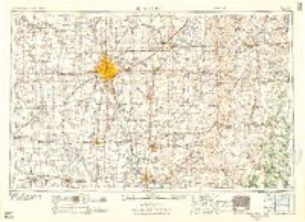
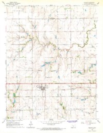
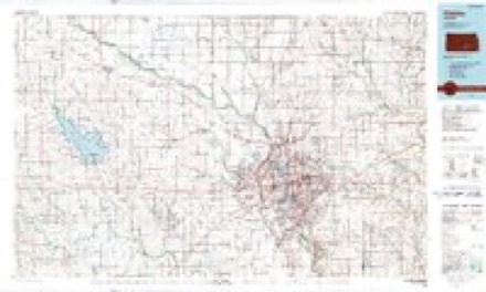
8 surveys from 14 printed sheetsMatched by testing this settlement's coordinate against the published boundary of every sheet in the United States Geological Survey's historical collection. Each opens the scanned sheet at the Survey.
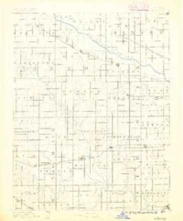
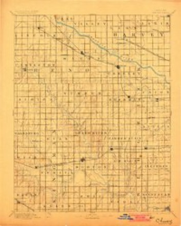
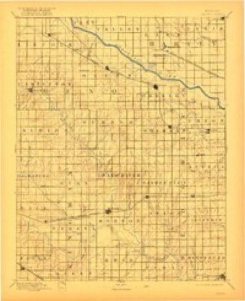
- 1889 USGS Cheney quadrangle1:125000, 2 printings
- 1891 USGS Cheney quadrangle1:125000, 2 printings
- 1901 USGS Cheney quadrangle1:125000, 2 printings
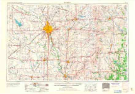
- 1955 USGS Wichita quadrangle1:250000, 3 printings
- 1958 USGS Wichita quadrangle1:250000
- 1965 USGS Goddard quadrangle1:24000, 2 printings
- 1985 USGS Wichita quadrangle1:100000
- 1990 USGS Wichita quadrangle1:100000
Fires near this place
66 since 2015Regional context, not property-specific evidence. The federal wildfire occurrence database lists 66 fires within 5 miles of Goddard between 2015 and 2019, burning about 148 acres in total. None started naturally. None was recorded as arson. Distance is straight-line from the map coordinates, so a fire counted here may appear on a neighbouring settlement's page as well.
| Reported cause | Fires |
|---|---|
| Missing data/not specified/undetermined | 30 |
| Debris and open burning | 25 |
| Power generation/transmission/distribution | 6 |
| Equipment and vehicle use | 4 |
| Fireworks | 1 |
The most recent of them, most recent first, with the day each was reported and the service that recorded it.
| Date | Cause | Size | Reported by | Name on the report |
|---|---|---|---|---|
| 4 September 2017 | Missing data/not specified/undetermined | under an acre | Sedgwick County | 6336 |
| 29 September 2015 | Missing data/not specified/undetermined | under an acre | Kansas Forest Service | 7384 |
| 24 September 2019 | Missing data/not specified/undetermined | under an acre | Kansas Forest Service | 018-035 |
| 23 September 2017 | Missing data/not specified/undetermined | under an acre | Sedgwick County | 6845 |
| 21 September 2015 | Missing data/not specified/undetermined | under an acre | Kansas Forest Service | 7153 |
| 19 September 2015 | Power generation/transmission/distribution | under an acre | Kansas Forest Service | 7115 |
| 4 August 2017 | Missing data/not specified/undetermined | under an acre | Sedgwick County | 44691 |
| 17 August 2017 | Debris and open burning | under an acre | Sedgwick County | 5836 |
Settlements close enough to share some of these fires:
Storms near this place
60 of 122 shownRegional context, not property-specific evidence. The National Weather Service names Goddard in 122 storm reports between 1996 and 2025: 59 thunderstorm wind, 51 hail, 3 flash flood, 3 flood. The reports record 3 injuries. Each account below is quoted exactly as the forecast office filed it, from the NOAA Storm Events Database, and each date opens the federal record of that event.
| When | Event | Place named | Harm | What the report says |
|---|---|---|---|---|
| July 2011 | Thunderstorm Wind | Goddard | 2 hurt, $2,000 | A fireworks tent was blown over causing two minor injuries. |
| August 2003 | Lightning | Goddard | 1 hurt | A 37-year old man was struck while watching a thunderstorm from his back yard. Though not seriously injured, the man did sustain minor burns. Narrative courtesy of Times Sentinel, Cheney, KS. Time of the incident approximate based on timing of severe thunderstorm winds 10 miles southwest of Wichita. |
| September 2010 | Hail | Goddard | $150,000,000 | Two supercell thunderstorms left a destructive swath of very large hail across portions of the county. The swath of hail was approximately 5 miles wide and 15 miles long, stretching from northwest of Goddard, Kansas through the western and southern half of Wichita, Kansas to near Rose Hill, Kansas. Hail as large as softball and grapefruit size pounded roofs and cars along its path with over 35,000 claims turned into insurance agencies. The hail made roofs look like a war zone, with holes big enough for people to stick their heads through. Cars and golf courses were pot marked with large dents. Some of the hail came through roofs, including the terminal at the Mid Continent Airport in Wichita. Three commercial airliners were damaged and had to be towed to hangers for repairs. The National Weather Service in Wichita suffered damage to its vehicles, including one hail dent that was almost 10 inches across. One such hailstone 2 miles west of the National Weather Service office broke the state record for diameter, measuring 7.75 inches across (see separate entry). |
| April 2006 | Hail | Goddard | $70,000,000 | An early morning severe thunderstorm pounded western and central portions of Sedgwick County with destructive hail as large as 3 inches in diameter between roughly 6:10 and 6:30 AM CST. Several instances of 1.75 to 3 inch hail occurred from Goddard into western and central portions of Wichita, generally between 13th and Kellogg, and into the downtown area. Another area of large hail around 1.75 inches in diameter affected northern and northeast portions of Wichita, generally east of I-135 along K96. Surrounding the very large hail area were numerous reports of 0.75 to 1.25 inch hail, affecting portions of South, North, and East Wichita. The large hail inflicted widespread property damage across the Wichita area, some of which was rather severe, to automobiles, homes, and businesses. A handful of golf courses had to close for the day due to large divots on the putting greens, and Botanica Gardens just west of downtown sustained damage. Additionally, 17 police cars at the Patrol West Bureau near Central and I-235 had windows and/or flashing emergency lights shattered. |
| July 1998 | Thunderstorm Wind | Goddard | $500,000 | Severe thunderstorm winds, ranging from 51-70 KT, ripped across Goddard, inflicting widespread damage to trees, roofs, pwoer lines and power poles. |
| September 2008 | Flash Flood | Goddard | $310,000 | Rainfall amounts of 6.40 inches lead to widespread reports of water over county roads southwest of Wichita. |
| May 2015 | Lightning | Goddard | $150,000 | A house caught fire. Since the extent of damage is unknown, and since Storm Data requires a damage estimate, a $150,000 value was entered. |
| June 2008 | Thunderstorm Wind | Goddard | $20,000 | The strong winds rolled a semi-truck on US-54 one mile west of Goddard. The report was relayed by KWCH Television and KFDI Radio. |
| July 2000 | Thunderstorm Wind | Goddard | $10,000 | Power poles blown over. |
| July 2000 | Thunderstorm Wind | Goddard | $5,000 | Large tree with 6 inch diameter limbs blown onto house. |
| June 2008 | Thunderstorm Wind | Goddard | $2,000 | Six-inch diameter tree limbs were downed. |
| October 2018 | Flood | Goddard | $100 | High water closed 151st Street between 49th and Kansas highway 42. |
| October 2018 | Flood | Goddard | $100 | Water was reported over the road along Maple Street between 167th and 135th Streets. |
| September 2016 | Flash Flood | Goddard | $100 | The fire department reported a water rescue from water over the road at west 21st street and North 199th street. |
| May 2010 | Flood | Goddard | $100 | Minor street flooding occurred around the lake. |
| July 2025 | Thunderstorm Wind | Goddard | - | Picture received via social media of 1-foot diameter cottonwood tree blown over. |
| March 2024 | Hail | Goddard | - | Nickel sized hail was reported near Goddard. |
| May 2024 | Thunderstorm Wind | Goddard | - | Off duty NWS employee's home weather station measured a wind gust to 78 mph. The ASOS at Wichita Eisenhower National Airport measured an estimated gust to 72 mph. Near the airport there was an eight inch diameter tree snapped onto vehicles and powerlines were reported down as well. |
| June 2023 | Hail | Goddard | - | Quarter sized hail was reported covering the ground at 21st and 199th streets. |
| June 2023 | Thunderstorm Wind | Goddard | - | The winds were estimated to be around 62 mph. |
| July 2023 | Heavy Rain | Goddard | - | An off duty NWS employee measured 2.72 inches over the past 12 hours. |
| June 2022 | Heavy Rain | Goddard | - | The Cocorahs observer in Goddard reported 2.85 inches of rainfall in 24 hours. |
| June 2022 | Heavy Rain | Goddard | - | A public report in Goddard of 1.02 inches of rainfall in 24 hours. |
| June 2022 | Thunderstorm Wind | Goddard | - | Measured on a home weather station. |
| October 2021 | Thunderstorm Wind | Goddard | - | The report came in via Facebook. |
| July 2020 | Thunderstorm Wind | Goddard | - | Report is from a home weather station. |
| June 2019 | Hail | Goddard | - | Social media picture of quarter size hail in Goddard. Relayed via KWCH TV. |
| June 2019 | Thunderstorm Wind | Goddard | - | Measured by a home weather station. |
| May 2019 | Thunderstorm Wind | Goddard | - | No damage was reported. |
| May 2019 | Thunderstorm Wind | Goddard | - | There were scattered reports of minor damage around Goddard. |
| August 2019 | Thunderstorm Wind | Goddard | - | No damage was reported. |
| August 2019 | Thunderstorm Wind | Goddard | - | No damage was reported. |
| August 2019 | Thunderstorm Wind | Goddard | - | No damage was reported. |
| June 2019 | Hail | Goddard | - | The quarter-sized hail was reported along MacArthur Road. |
| June 2019 | Thunderstorm Wind | Goddard | - | An 8-foot section of fence was blown down. |
| June 2019 | Thunderstorm Wind | Goddard | - | The winds were estimated from 70 to 80 mph in Goddard. No damage was reported but with winds this strong, one would have to think there was. |
| June 2019 | Thunderstorm Wind | Goddard | - | The media storm chaser reported 65 to 70 mph winds at the Dillon's warehouse. |
| June 2018 | Thunderstorm Wind | Goddard | - | The 56-knot/65-mph winds were reported by campers at Lake Afton. Ping pong ball sized hail also occurred. |
| June 2018 | Hail | Goddard | - | The ping pong ball-sized hail was reported near Lake Afton. The time of the event was estimated from radar. |
| July 2017 | Thunderstorm Wind | Goddard | - | There were no reports of damage. |
| May 2016 | Hail | Goddard | - | Near 135th and Central Avenue. |
| July 2016 | Thunderstorm Wind | Goddard | - | A tent was blown into power lines. |
| October 2016 | Hail | Goddard | - | Seventy mph winds were also reported. |
| October 2016 | Thunderstorm Wind | Goddard | - | Golf ball sized hail was also reported with the gusts. |
| April 2015 | Thunderstorm Wind | Goddard | - | A trained spotter measured the gust. |
| June 2015 | Flash Flood | Goddard | - | The intersection at 13th street was completely under water and dangerous. Barricades are in place. |
| April 2014 | Hail | Goddard | - | This event occurred near the intersection of 167th and Maple. |
| May 2012 | Hail | Goddard | - | Occurred just southwest of West 135th/Central intersection. |
| July 2011 | Thunderstorm Wind | Goddard | - | A KWCH storm chaser estimated winds around 60 mph at the intersection of 135th and Central. |
| June 2011 | Thunderstorm Wind | Goddard | - | The wind occurred with golfball size hail. |
| August 2010 | Thunderstorm Wind | Goddard | - | Law enforcement reported 60 to 70 mph winds. |
| August 2010 | Thunderstorm Wind | Goddard | - | Law enforcement in Goddard reported the winds. |
| August 2010 | Thunderstorm Wind | Goddard | - | The fire chief estimated the 70 mph winds. |
| May 2010 | Thunderstorm Wind | Goddard | - | Amatuer radio estimated a wind gust to 60 mph. |
| September 2010 | Hail | Goddard | - | A KAKE-TV storm spotter reported the large hail. |
| May 2009 | Tornado (EF0) | Goddard | - | A funnel cloud briefly touched the ground. |
| June 2008 | Hail | Goddard | - | The ground was covered with half inch to ping pong ball size hail that covered the ground. Some of the hail stones were golf ball sized as well. |
| June 2006 | Thunderstorm Wind | Goddard | - | 78 mph gust measured with a home weather station. Sustained winds were measured at 51 mph. |
| March 2005 | Hail | Goddard | - | KFDI spotter. |
| April 2001 | Thunderstorm Wind | Goddard | - | Occurred at Lake Afton. |
Nearest settlements
The eight closest, with where each one stands in the county. Distances are straight-line, computed from the Geographic Names Information System coordinates.
| Map | Place | Distance | Sheets |
|---|---|---|---|
| Saint Marys | 4.7 miles | 14 | |
| Saint Marks | 5.3 miles | 14 | |
| Garden Plain | 5.7 miles | 14 | |
| Schulte | 6.1 miles | 20 | |
| The Dell | 6.1 miles | 20 | |
| Clonmel | 6.8 miles | 14 | |
| Tyler | 7.0 miles | 20 | |
| Westlink Village | 7.0 miles | 20 |
Elsewhere
Matched on this settlement's Geographic Names Information System number rather than its name, so it cannot be a different place of the same name in another state.
| Wikipedia article on Goddard | An encyclopaedic summary. Its text is share-alike, so it is linked here rather than copied. |
| Wikidata item Q2535140 | The structured record the population and elevation above come from. Public domain (CC0). |
Provenance
This settlement is recorded in the Geographic Names Information System as feature 474001. The sheet list is computed by point-in-boundary test against the United States Geological Survey's historical topographic inventory. Both are works of the United States government and carry no copyright under 17 U.S.C. 105.
Wildfire. Short, Karen C. 2022. Spatial wildfire occurrence data for the United States, 1992-2020 [FPA_FOD_20221014]. 6th Edition. Fort Collins, CO: Forest Service Research Data Archive. https://doi.org/10.2737/RDS-2013-0009.6 Collected with United States Government funding and usable without additional permissions or fees.
Storms. NOAA National Centers for Environmental Information, Storm Events Database https://www.ncei.noaa.gov/stormevents/ A work of the United States government, no copyright under 17 U.S.C. 105. Narratives are quoted verbatim from the National Weather Service report and are not edited or summarised.