 Block
Laird, Kansas
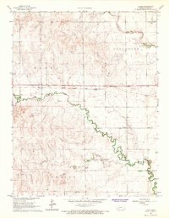
8 topographic sheets cover this place, the earliest surveyed in 1955 and the latest in 1985. It stands in Forrester Township. It lies in ZIP code area 67560. The Survey maps it on the Laird quadrangle.
Topographic sheets covering this place
4 surveys from 8 printed sheetsMatched by testing this settlement's coordinate against the published boundary of every sheet in the United States Geological Survey's historical collection. Each opens the scanned sheet at the Survey.
- 1955 USGS Scott City quadrangle1:250000, 4 printings
- 1958 USGS Scott City quadrangle1:250000
- 1966 USGS Laird quadrangle1:24000
- 1985 USGS Scott City quadrangle1:100000, 2 printings

Storms near this place
48 since 2007Regional context, not property-specific evidence. The National Weather Service names Laird in 48 storm reports between 2007 and 2025: 25 hail, 13 thunderstorm wind, 7 tornado, 2 heavy rain. No death or injury is recorded in these reports. Each account below is quoted exactly as the forecast office filed it, from the NOAA Storm Events Database, and each date opens the federal record of that event.
| When | Event | Place named | Harm | What the report says |
|---|---|---|---|---|
| March 2007 | Tornado (EF3) | Laird | $325,000 | This tornado originated in Hodgeman county and entered Ness county at 925 PM. This large tornado destroyed or heavily damaged 5 homes in Ness county. Hundreds of power poles were broken along with 7 pivot irrigation sprinklers and lots of damage to trees. There were also at least 20 head of cattle dead from this tornado in Ness county. |
| June 2011 | Tornado (EF1) | Laird | $22,000 | There was minor damage to a home and moderate damage to a large metal outbuilding. |
| July 2025 | Thunderstorm Wind | Laird | - | Personal Weather Station. |
| October 2025 | Thunderstorm Wind | Laird | - | A public report of a 65 mph wind gust. |
| October 2025 | Thunderstorm Wind | Laird | - | A mesonet site recorded a 81 mph wind gust. |
| May 2016 | Tornado (EF1) | Laird | - | This tornado turned back to the northwest. It did damage to trees. |
| May 2016 | Tornado (EF2) | Laird | - | This tornado moved in from Hodgeman County. It heavily damaged trees, outbuildings, fences and trees. |
| April 2015 | Hail | Laird | - | The ground was covered by the hail. |
| July 2015 | Heavy Rain | Laird | - | Rainfall of 3.80 inches was observed. |
| November 2015 | Tornado (EF1) | Laird | - | This tornado snapped tree trunks and small barns and farm outbuildings were destroyed. |
| September 2014 | Thunderstorm Wind | Laird | - | Winds were estimated to be 65 MPH. |
| September 2014 | Thunderstorm Wind | Laird | - | Winds were estimated to be 60 to 70 MPH. |
| June 2014 | Hail | Laird | - | Rainfall of 1.25 was also reported. |
| September 2012 | Hail | Laird | - | Most of the hail was smaller hail. |
| August 2011 | Thunderstorm Wind | Laird | - | Winds were estimated at 70 MPH. |
| June 2010 | Thunderstorm Wind | Laird | - | A tree was blown over onto a house. |
| June 2008 | Hail | Laird | - | The hail lasted 15 minutes. |
| May 2008 | Tornado (EF2) | Laird | - | This was a large tornado that produced EF2 damage. It turned northwest towards the end of its life cycle but dissipated before reaching Arnold. Damage was done to trees, large power poles, a large tank, a barn and hay bales. |
| May 2008 | Tornado (EF0) | Laird | - | This tornado was video taped and moved over sparsely populated land. |
| May 2008 | Hail | Laird | - | Dime to nickel sized hail covered the ground. |
| August 2007 | Heavy Rain | Laird | - | The rain fell in just over 1 hour time frame. It was reported that a tributary of the south fork of the Walnut Creek near the observers house was running full and strong. |
| June 2020 | Hail | Laird | - | no account filed |
| June 2020 | Hail | Laird | - | no account filed |
| June 2020 | Hail | Laird | - | no account filed |
| July 2018 | Hail | Laird | - | no account filed |
| May 2018 | Hail | Laird | - | no account filed |
| May 2018 | Hail | Laird | - | no account filed |
| June 2017 | Hail | Laird | - | no account filed |
| June 2017 | Hail | Laird | - | no account filed |
| April 2015 | Hail | Laird | - | no account filed |
| April 2015 | Funnel Cloud | Laird | - | no account filed |
| July 2015 | Thunderstorm Wind | Laird | - | no account filed |
| May 2015 | Thunderstorm Wind | Laird | - | no account filed |
| June 2014 | Thunderstorm Wind | Laird | - | no account filed |
| May 2013 | Thunderstorm Wind | Laird | - | no account filed |
| May 2012 | Hail | Laird | - | no account filed |
| April 2012 | Hail | Laird | - | no account filed |
| May 2012 | Hail | Laird | - | no account filed |
| September 2012 | Hail | Laird | - | no account filed |
| May 2011 | Hail | Laird | - | no account filed |
| September 2009 | Hail | Laird | - | no account filed |
| June 2008 | Hail | Laird | - | no account filed |
| May 2008 | Hail | Laird | - | no account filed |
| August 2008 | Hail | Laird | - | no account filed |
| August 2007 | Thunderstorm Wind | Laird | - | no account filed |
| August 2007 | Hail | Laird | - | no account filed |
| August 2007 | Hail | Laird | - | no account filed |
| May 2007 | Thunderstorm Wind | Laird | - | no account filed |
Nearest settlements
The eight closest, with where each one stands in the county. Distances are straight-line, computed from the Geographic Names Information System coordinates.
Provenance
This settlement is recorded in the Geographic Names Information System as feature 484563. The sheet list is computed by point-in-boundary test against the United States Geological Survey's historical topographic inventory. Both are works of the United States government and carry no copyright under 17 U.S.C. 105.
Storms. NOAA National Centers for Environmental Information, Storm Events Database https://www.ncei.noaa.gov/stormevents/ A work of the United States government, no copyright under 17 U.S.C. 105. Narratives are quoted verbatim from the National Weather Service report and are not edited or summarised.