 Block
From the record
7 National Register listings published here.
Sources: the National Register database, National Park Service
40 topographic sheets cover 11 settlements here, and 7 properties are on the National Register of Historic Places.
7 National Register listings published here.
Sources: the National Register database, National Park Service
Every property in this county listed on the National Register of Historic Places, with the year it was listed and the federal nomination document.
| Photograph | Property | Type | Listed | Reference |
|---|---|---|---|---|
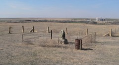 | George Washington Carver Homestead Site | site | 1977 | 77000593 |
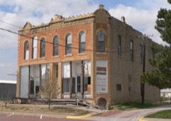 | Lion Block | building | 2008 | 08000986 |
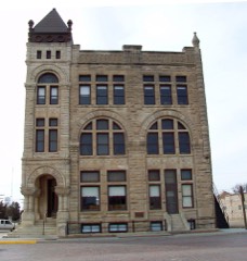 | Ness County Bank | building | 1972 | 72000519 |
| Ness County Bridge FS-450 | structure | 2017 | 100000803 | |
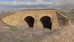 | Pawnee River Tributary Bridge | structure | 1985 | 85001446 |
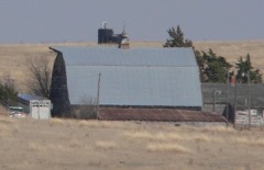 | Thornburg Barn | building | 2009 | 09000192 |
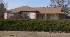 | Henry Tilley House | building | 2006 | 06001053 |
Every wildfire the federal occurrence database records inside this county: 13 of them, burning about 357 acres. 3 started naturally and 1 was recorded as arson. Each settlement page carries the fires within five miles of it.
| Reported cause | Fires |
|---|---|
| Equipment and vehicle use | 5 |
| Natural | 3 |
| Missing data/not specified/undetermined | 3 |
| Debris and open burning | 1 |
| Arson/incendiarism | 1 |
The five largest, by the area the report gives. One of them was set deliberately.
| Date | Cause | Size | Reported by | Name on the report |
|---|---|---|---|---|
| 14 July 2003 | Natural | 100 acres | Lane County | not named |
| 9 August 2003 | Natural | 100 acres | Lane County | not named |
| 5 May 2017 | Arson/incendiarism | 80 acres | Ness County | 17U5051 |
| 5 May 2017 | Debris and open burning | 40 acres | Ness County | 17U5052 |
| 11 October 2016 | Natural | 25 acres | Kansas Forest Service | 16U1011 |
| 19 September 2015 | Equipment and vehicle use | 10 acres | Kansas Forest Service | 15U0919 |
| 9 March 2017 | Equipment and vehicle use | 2.0 acres | Ness County | 17U0392 |
| 22 February 2017 | Equipment and vehicle use | under an acre | Ness County | 4 |
Every settlement page carries the fires within five miles of it - see the settlement index below.
The NOAA Storm Events Database holds 712 reports for this county, causing no deaths, 4 injuries and about $7,053,530 in recorded property damage. Each settlement page carries the reports that name it.
| Kind of event | Reports |
|---|---|
| Hail | 436 |
| Thunderstorm Wind | 179 |
| Tornado | 46 |
| Heavy Rain | 36 |
| Flash Flood | 10 |
| Flood | 3 |
| Lightning | 1 |
| Funnel Cloud | 1 |
The most serious of them, by death, then injury, then recorded damage. The accounts are quoted exactly as the forecast office filed them.
| When | Event | Place named | Harm | What the report says |
|---|---|---|---|---|
| June 1962 | Tornado (F3) | not stated | 3 hurt, $250,000 | no account filed |
| June 1971 | Tornado (F2) | not stated | 1 hurt, $250,000 | no account filed |
| April 1990 | Tornado (F3) | not stated | $2,500,000 | no account filed |
| June 1996 | Thunderstorm Wind | Ness City | $1,400,000 | no account filed |
| May 1996 | Hail | Ness City | $1,200,000 | no account filed |
| March 2007 | Tornado (EF3) | Laird | $325,000 | This tornado originated in Hodgeman county and entered Ness county at 925 PM. This large tornado destroyed or heavily damaged 5 homes in Ness county. Hundreds of power poles were broken along with 7 pivot irrigation sprinklers and lots of damage to trees. There were also at least 20 head of cattle dead from this tornado in Ness county. |
| April 1972 | Tornado (F3) | not stated | $250,000 | no account filed |
| April 1972 | Tornado (F4) | not stated | $250,000 | no account filed |
| May 1999 | Thunderstorm Wind | Brownell | $200,000 | Two separate swaths of hail moved through the county. The first was in a 7 to 12 mile wide swath from 2 miles south of Utica...to Arnold...Ransom...Brownell...and McCracken. The second swath was from 2 miles south of Beeler...to 4 miles south of Ness City...to 3 miles south of Bazine. A dollar amount was not made available...but crops were nearly completely wiped out in the hail swaths and numerous windows were broken out in automobiles and homes. |
| July 1994 | Thunderstorm Wind | Utica | $50,000 | Ness County Sheriff's Office reported barn blown down and power poles down from thunderstorm winds. |
| April 1993 | Tornado (F1) | to 4 NE | $50,000 | Two grain bins were destroyed north of Ness City. Five telephone poles were also knocked down. |
| May 1996 | Tornado (F1) | Ness City | $50,000 | no account filed |
| August 1996 | Thunderstorm Wind | Ransom | $40,000 | no account filed |
| August 2000 | Thunderstorm Wind | Beeler | $35,000 | Two 12X14 foot metal doors were ripped from a machine shed and blown 150 ft. |
| May 1998 | Hail | Ransom | $32,500 | Windshield broken. Hail fell in a swath across the county. The swath was about 30 miles wide. |
| June 1995 | Hail | Bazine | $25,000 | no account filed |
| May 1959 | Tornado (F2) | not stated | $25,000 | no account filed |
| June 2011 | Tornado (EF1) | Laird | $22,000 | There was minor damage to a home and moderate damage to a large metal outbuilding. |
| April 2006 | Thunderstorm Wind | Ness City | $15,000 | Damage was done to an irrigation sprinkler. A horse barn was lifted and blown over 25 foot high power line. |
| September 2006 | Hail | Bazine | $15,000 | There was significant damage done to the house siding. Dents were made in the steel siding. |
| June 2002 | Thunderstorm Wind | Ransom | $10,000 | A combine header was blown off a parked trailer. |
| July 1996 | Hail | Ness City | $10,000 | no account filed |
| June 1995 | Hail | Bazine | $10,000 | no account filed |
| July 1996 | Thunderstorm Wind | Ness City | $7,000 | no account filed |
| May 1995 | Hail | 7 W Ness City | $5,000 | no account filed |
| April 1993 | Hail | Bazine | $5,000 | no account filed |
| May 1996 | Thunderstorm Wind | Ness City | $4,000 | no account filed |
| August 1996 | Thunderstorm Wind | Ransom | $3,000 | no account filed |
| April 1990 | Tornado (F0) | not stated | $2,500 | no account filed |
| April 1972 | Tornado (F3) | not stated | $2,500 | no account filed |
| June 1970 | Tornado (F0) | not stated | $2,500 | no account filed |
| May 1960 | Tornado | not stated | $2,500 | no account filed |
| June 2000 | Thunderstorm Wind | Bazine | $2,000 | Power poles and lines knocked down. |
| September 2012 | Thunderstorm Wind | Ransom | $1,000 | Two power poles were blown down. |
| July 1997 | Thunderstorm Wind | Arnold | $1,000 | Three inch tree limbs blown down. |
| May 1996 | Lightning | Ness City | $1,000 | no account filed |
| May 1960 | Tornado (F2) | not stated | $30 | no account filed |
| May 2025 | Thunderstorm Wind | Bazine | - | A public report estimated wind gusts at 60 mph. A mesonet site recorded a 56 mph gust shortly before the public report at the KKSNESSC2 observing station. |
| May 2025 | Hail | Ransom | - | A trained spotter reported 1 inch hail. |
| July 2025 | Thunderstorm Wind | Laird | - | Personal Weather Station. |
| September 2025 | Hail | Utica | - | A public report of 1 inch hail. |
| October 2025 | Thunderstorm Wind | Laird | - | A public report of a 65 mph wind gust. |
| October 2025 | Thunderstorm Wind | Ness City | - | A public report of a 60 mph wind gust. |
| October 2025 | Thunderstorm Wind | Laird | - | A mesonet site recorded a 81 mph wind gust. |
| May 2024 | Thunderstorm Wind | Brownell | - | A wind gust of 60 mph was reported. |
| February 2023 | Thunderstorm Wind | Ransom | - | Roof over a deck blown off and shed damage. |
| June 2023 | Thunderstorm Wind | Bazine | - | Public reported 60 mph wind estimate. |
| May 2022 | Hail | Osgood | - | The hail was mostly nickel sized. |
| May 2021 | Thunderstorm Wind | Bazine | - | A large tree was blown down by the high wind. |
| September 2021 | Heavy Rain | Ness City Arpt | - | Rainfall of 3.16 inches was observed. |
| September 2021 | Heavy Rain | Ness City | - | Rainfall of 2.90 inches was observed. |
| July 2021 | Thunderstorm Wind | Beeler | - | Several outbuildings were heavily damaged by high wind. |
| August 2021 | Thunderstorm Wind | Ness City Arpt | - | A tree was blown over. |
| July 2020 | Flash Flood | Ness City | - | Water was flowing across Road R. |
| August 2020 | Hail | Brownell | - | Windows were broke out several vehicles. |
| June 2020 | Thunderstorm Wind | Ness City | - | Several limbs were broken by the high wind estimated to be 60 MPH. |
| April 2019 | Thunderstorm Wind | Ness City | - | Winds were estimated to be 75 MPH. |
| July 2019 | Thunderstorm Wind | Ness City | - | Winds were estimated to be near 65 MPH. |
| July 2018 | Heavy Rain | Utica | - | Rainfall of 4.50 inches was observed. Most of the rain fell during the late evening hours. |
| July 2018 | Thunderstorm Wind | Ness City Arpt | - | Winds were estimated to be around 70 MPH. |
Named settlements recorded in the Geographic Names Information System, each with the topographic sheets covering it. Villages, hamlets and abandoned places alike. Each is shown with the nearest named watercourse or landform and the survey quadrangle it falls on.
Franklin township · 67560 · Near Guzzlers Gulch · Ness City SW quadrangle
15 sheets, 1892 to 1985