 Block
Lawrence, Kansas
19 topographic sheets cover this place, the earliest surveyed in 1885 and the latest in 1983. It stands in Lawrence City. It lies in ZIP code area 66044. The Survey maps it on the Lawrence East quadrangle. 94,934 people lived here at the 2020 count. It stands 866 feet above sea level.
Research this city
On record in Lawrence
Buildings and businesses the archive holds for this place. Each opens its own page, with the source record it came from.
On the National Register 12 of 78 shown
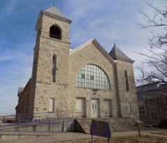 Haskell InstituteNational Historic Landmark · listed 1966
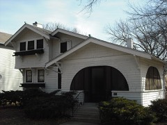 Ralph and Cloyd Achning Houselisted 1987
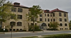 Bailey Halllisted 2001
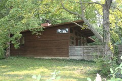 George Malcom Beal Houselisted 2015
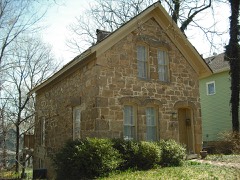 George and Annie Bell Houselisted 1983
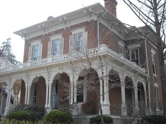 Col. James Blood Houselisted 1972
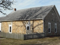 Clinton School District 25listed 1998
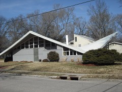 Double Hyperbolic Paraboloid Houselisted 2007
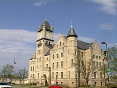 Douglas County Courthouselisted 1975
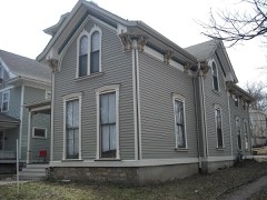 Charles Duncan Houselisted 1986
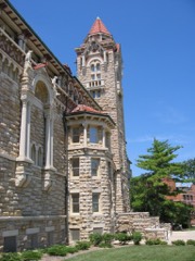 Dyche Hall, University of Kansaslisted 1974
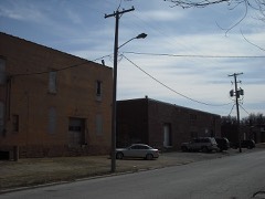 East Lawrence Industrial Historic Districtlisted 2022
Population over time
2 figuresLawrence grew from 87,643 to 94,934 between 2010 and 2020. These are the recorded population figures Wikidata holds for this place, reached through the Geographic Names Information System number this page is keyed on rather than by name, so they belong to this place and not to another of the same name. Most are census counts, but not all are: an early figure may be a founding or settlement estimate, and an estimate published within five years of a census is left out. The change column is computed, and is left blank where more than 20 years separate a figure from the one before it, because a gap that long is not a change between two counts.
| Year | People | Change |
|---|---|---|
| 2010 | 87,643 | |
| 2020 | 94,934 | +7,291 (+8%) |
Topographic sheets covering this place
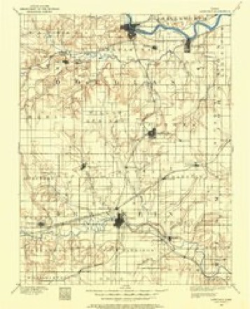
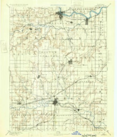
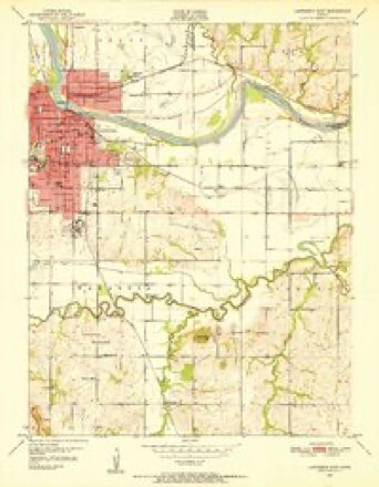
8 surveys from 19 printed sheetsMatched by testing this settlement's coordinate against the published boundary of every sheet in the United States Geological Survey's historical collection. Each opens the scanned sheet at the Survey.
- 1885 USGS Lawrence quadrangle1:125000
- 1889 USGS Lawrence quadrangle1:125000, 6 printings
- 1947 USGS Lawrence quadrangle1:250000
- 1950 USGS Lawrence quadrangle1:250000
- 1950 USGS Lawrence East quadrangle1:24000, 4 printings
- 1956 USGS Lawrence quadrangle1:250000, 4 printings
- 1961 USGS Lawrence quadrangle1:250000
- 1983 USGS Lawrence quadrangle1:100000
Fires near this place
159 since 2015Regional context, not property-specific evidence. The federal wildfire occurrence database lists 159 fires within 5 miles of Lawrence between 2015 and 2020, burning about 900 acres in total. None started naturally. 27 were recorded as arson. Distance is straight-line from the map coordinates, so a fire counted here may appear on a neighbouring settlement's page as well.
| Reported cause | Fires |
|---|---|
| Missing data/not specified/undetermined | 66 |
| Debris and open burning | 36 |
| Arson/incendiarism | 27 |
| Equipment and vehicle use | 13 |
| Smoking | 9 |
| Misuse of fire by a minor | 3 |
| Power generation/transmission/distribution | 3 |
| Recreation and ceremony | 1 |
| Fireworks | 1 |
The most recent of them, most recent first, with the day each was reported and the service that recorded it.
| Date | Cause | Size | Reported by | Name on the report |
|---|---|---|---|---|
| 7 September 2017 | Arson/incendiarism | under an acre | Douglas County | 8594 |
| 22 September 2017 | Arson/incendiarism | under an acre | Douglas County | 9130 |
| 8 August 2018 | Equipment and vehicle use | under an acre | Kansas Forest Service | 7969 |
| 6 August 2018 | Debris and open burning | under an acre | Kansas Forest Service | 7898 |
| 5 August 2017 | Missing data/not specified/undetermined | under an acre | Douglas County | 7332 |
| 3 August 2018 | Debris and open burning | under an acre | Kansas Forest Service | 7782 |
| 29 August 2017 | Arson/incendiarism | under an acre | Douglas County | 8263 |
| 26 August 2015 | Missing data/not specified/undetermined | under an acre | Kansas Forest Service | 7560 |
Settlements close enough to share some of these fires:
Mines and quarries near this place
1 within 5 milesRegional context, not property-specific evidence. The federal mineral resources record lists 1 working within 5 miles of Lawrence: 1 producer. All of them still produce. What was taken out: Stone, Crushed/Broken. Distance is straight-line from the map coordinates, so a quarry counted here may appear on a neighbouring settlement's page as well.
| Where | Site | Commodity | Status | Recorded |
|---|---|---|---|---|
| Lawrence Quarry & Mill No.16 | Stone, Crushed/Broken | Producer |
Storms near this place
60 of 292 shownRegional context, not property-specific evidence. The National Weather Service names Lawrence in 292 storm reports between 1993 and 2026: 115 hail, 110 thunderstorm wind, 31 flash flood, 22 lightning. The reports record 21 injuries. Each account below is quoted exactly as the forecast office filed it, from the NOAA Storm Events Database, and each date opens the federal record of that event.
| When | Event | Place named | Harm | What the report says |
|---|---|---|---|---|
| May 2003 | Tornado (F2) | Lawrence | 6 hurt, $6,400,000 | A tornado touched down in the southwest part of Lawrence and did considerable damage to the area. An apartment complex suffered major damage as did several other homes and residences in the area. Six people were injured and treated at a Lawrence hospital. |
| October 1998 | Flash Flood | Lawrence | 5 hurt, $1,100,000 | no account filed |
| March 2006 | Thunderstorm Wind | Lawrence | 3 hurt, $8,000,000 | A large portion of the city sustained damage. The governor issued a State of Disaster Emergency for Douglas County. At least three direct storm related injuries were reported. Windows were blown out of numerous cars and businesses. A trailer park also sustained damage. Numerous telephone poles and trees were blown down. Many trees and cars on the Kansas University campus were damaged. More than 70 of Kansas University's 116 buildings received some damage. Many homes in the city also sustained damage. Video of the event indicated a microburst with winds of 70 to 90 mph. Several notable events reflected the severity of the wind damage. A heating/cooling unit was blown from the roof of a campus residence hall and landed on a car. Several semi-trucks were blown onto their sides. Two brick spires were toppled from one of the city's oldest churches dating back to 1870. Two 60 foot tall silos at a country market near Lawrence were destroyed. Three 500 pound ventilators atop a junior high building were blown off the roof...one landing nearly 100 yards away. Each ventilator was 6 feet tall and 5 feet wide. The emergency manager of Douglas county estimated total damage at 8 million dollars of which 6 million dollars occurred on the Kansas University campus alone. |
| June 1996 | Flash Flood | Lawrence | 3 hurt, $2,000,000 | no account filed |
| May 1997 | Thunderstorm Wind | Lawrence | 2 hurt, $10,000 | no account filed |
| July 2023 | Thunderstorm Wind | Lawrence | 1 hurt | Numerous trees and powerlines down. A car was blown off of US highway 59 into a creek with one injury reported. |
| August 2002 | Lightning | Lawrence | 1 hurt | Lightning struck a tree, then passed through the air and struck the umbrella of a nearby female passerby producing minor injuries to the 21 year old female. |
| April 2006 | Hail | Lawrence | $4,000,000 | Between 8:50 pm cst and 9:03 pm cst, many reports of hail ranging from 0.75" to 2.50" in diameter were received from the city of Lawrence as a supercell thunderstorm moved through. The largest reported hail fell on the campus of Kansas University. State Farm Insurance reported an expected $1.8 million in auto claims for damaged vehicles; American Family Insurance was expecting up to 600 auto claims and 300 home claims to be filed. |
| November 1998 | Flash Flood | Lawrence | $2,500,000 | no account filed |
| March 1997 | Hail | Lawrence | $1,000,000 | no account filed |
| July 1994 | Thunderstorm Wind | Lawrence | $500,000 | Winds estimated to near 80 mph caused widespread tree, power line and structural damage in and around the city of Lawrence. Most of the city was without power for several hours. |
| May 2007 | Flood | Lawrence | $255,000 | Report that several county roads are closed due to water covering the roads. Also several road closures within Lawrence city limits. Report of a non-emergency water rescue for a resident who had water all around their house. Lowland flooding along immediate reach of the Kansas River due to moderate or greater flooding. |
| June 2005 | Flash Flood | Lawrence | $100,000 | At least six inches of fast flowing water over highway 59. |
| July 2004 | Flash Flood | Lawrence | $75,000 | Heavy rains produced flash flooding in northern Douglas county. In Lawrence motorists were stranded due to fast rising water and rescue efforts were required. Northwest of Lawrence at Lake View water was reported one and one half feet over a roadway. At the east edge of Eudora water was reported running over a county road. Occupants of a building near Lawrence were stranded due to high water and had to be rescued. |
| October 1998 | Tornado (F1) | Lawrence | $75,000 | An F1 tornado traveled intermittantly for 6 miles. One home was destroyed and 8 to 10 other buildings were damaged in various degrees. |
| September 1998 | Lightning | Lawrence | $60,000 | Lightning struck a business and started a fire which did about 60 thousand dollars damage. |
| May 2007 | Flash Flood | Lawrence | $50,000 | Water reported flowing over 23rd and Ousdahl roads in town. Officials reportedly putting up barricades around this intersection. |
| August 2005 | Flash Flood | Lawrence | $50,000 | Four feet of water under railroad tracks north end of Lawrence with many intersections flooded by fast flowing water resulting from nearly four inches of rain. |
| June 1994 | Thunderstorm Wind | Lawrence | $50,000 | Winds estimated at 70 mph caused widespread damage to trees, tree limbs, power lines, and buildings in and around the Lawrence area during the midday hour. Hail up to one inch was also reported. |
| October 1996 | Lightning | Lawrence | $50,000 | no account filed |
| June 1998 | Thunderstorm Wind | Lawrence | $30,000 | no account filed |
| September 2001 | Thunderstorm Wind | Lawrence | $27,000 | Strong winds flipped a construction trailer onto a nearby street. A metal sign was also blown down on some cars at a dealership doing considerable damage. |
| April 2026 | Flash Flood | Lawrence | $20,000 | Water rescue of a stranded motorist in deep water near Iowa street. |
| March 1997 | Lightning | Lawrence | $13,000 | no account filed |
| May 1999 | Lightning | Lawrence | $12,000 | Lightning struck twice, once to a hotel doing an estimated 10 thousand dollars damage and once to a residence doing an estimated 2 thousand dollars damage. |
| August 2005 | Heavy Rain | Lawrence | $10,000 | One indirect injury during very heavy rain due to hydroplaning of vehicle. |
| August 2004 | Lightning | Lawrence | $10,000 | Lightning struck a house and started a fire that did considerable damage. |
| June 1997 | Thunderstorm Wind | Lawrence | $10,000 | no account filed |
| April 2001 | Lightning | Lawrence | $7,500 | Lightning struck a house doing significant damage. |
| June 2004 | Thunderstorm Wind | Lawrence | $7,000 | Strong winds blew down street light poles. |
| April 2001 | Thunderstorm Wind | Lawrence | $7,000 | Strong thunderstorm winds damaged 6 mobile homes and blew a shed into a street. |
| April 2000 | Hail | Lawrence | $7,000 | Large hail did about 7 thousand dollars damage to plants at a Wal-Mart garden center in the south part of Lawrence. |
| August 2004 | Lightning | Lawrence | $6,000 | Lightning struck a wastewater treatment plant and damaged a number of controls. |
| March 1997 | Lightning | Lawrence | $6,000 | no account filed |
| July 2012 | Thunderstorm Wind | Lawrence | $5,000 | Emergency Manager reported some powerlines down and tree damage near the intersection of Cedarwood and Kent Road. |
| April 1993 | Hail | Lawrence | $5,000 | Hail accumulated to a depth of several inches and drifted in open areas. Heavy rainfall that accompanied the hail caused temporary flooding of streets and poor drainage areas. The hail was quite soft which limited overall damage. Two separate storms containing extensive hail struck the city and surrounding areas. Flooding from heavy rainfall caused widespread travel problems. |
| September 1993 | Tornado (F0) | Lawrence | $5,000 | A short lived tornado hit about 0.5 mile south of the Lawrence Airport causing only minor damage to some outbuildings. |
| August 2004 | Thunderstorm Wind | Lawrence | $4,000 | Strong winds blew down power lines in Lawrence. |
| April 2002 | Thunderstorm Wind | Lawrence | $4,000 | Power lines and trees were downed in Lawrence. |
| June 2002 | Lightning | Lawrence | $4,000 | Lightning struck a radio station and started a fire that destroyed some equipment. |
| August 2004 | Lightning | Lawrence | $3,000 | Lightning struck and damaged 2 tornado sirens in Lawrence. |
| August 1997 | Thunderstorm Wind | Lawrence | $3,000 | no account filed |
| August 2010 | Thunderstorm Wind | Lawrence | $2,000 | At 1550 Delaware and 1100 block of E 1500 Road, power lines were down. Scattered power outages were reported across Lawrence. A power pole was down over N1100 Road. |
| September 2001 | Thunderstorm Wind | Lawrence | $2,000 | Strong winds blew some windows out of a building. |
| September 2000 | Lightning | Lawrence | $2,000 | Lightning struck a house and started a fire which did minor damage. |
| June 1998 | Thunderstorm Wind | Lawrence | $2,000 | no account filed |
| June 2011 | Thunderstorm Wind | Lawrence | $1,000 | A law enforcement officer reported trees down at 11th and Mississippi Street in Lawrence. |
| May 2005 | Flash Flood | Lawrence | $1,000 | Fast flowing water over 23rd St. and 2nd St. |
| May 2000 | Lightning | Lawrence | $1,000 | Lightning struck a bank and knocked some bricks off a chimney doing minor damage. |
| June 2000 | Lightning | Lawrence | $1,000 | Lightning struck a transformer and knocked out power to 1800 KPL customers for about 25 minutes. |
| May 1997 | Thunderstorm Wind | Lawrence | $1,000 | no account filed |
| July 1996 | Lightning | Lawrence | $1,000 | no account filed |
| May 2000 | Lightning | Lawrence | $500 | Lightning struck and knocked two co-located radio stations off the air for a time doing minor damage. |
| July 1996 | Lightning | Lawrence | $500 | no account filed |
| April 2026 | Thunderstorm Wind | Lawrence | - | A few 6-8 inch tree branches downed. |
| April 2026 | Thunderstorm Wind | Lawrence | - | Six inch tree limb is downed and blocking Tennessee street. |
| July 2024 | Thunderstorm Wind | Lawrence | - | Tree uprooted and laying on house. |
| July 2024 | Thunderstorm Wind | Lawrence | - | Off-duty NWS meteorologist estimated 70 mph winds. |
| June 2024 | Thunderstorm Wind | Lawrence | - | Large branches snapped in the Indian Hills area. |
| June 2024 | Thunderstorm Wind | Lawrence | - | Tree limb 5 inches in diameter blown down. |
Nearest settlements
The eight closest, with where each one stands in the county. Distances are straight-line, computed from the Geographic Names Information System coordinates.
| Map | Place | Distance | Sheets |
|---|---|---|---|
| Bismark Grove | 1.6 miles | 19 | |
| Broken Arrow Park | 2.8 miles | 19 | |
| Noria | 3.4 miles | 19 | |
| Midland | 3.9 miles | 23 | |
| Sibleyville | 6.4 miles | 19 | |
| Kanwaka | 7.3 miles | 21 | |
| Eudora | 7.5 miles | 21 | |
| Pleasant Grove | 8.2 miles | 18 |
Elsewhere
Matched on this settlement's Geographic Names Information System number rather than its name, so it cannot be a different place of the same name in another state.
| Wikipedia article on Lawrence | An encyclopaedic summary. Its text is share-alike, so it is linked here rather than copied. |
| Wikidata item Q493840 | The structured record the population and elevation above come from. Public domain (CC0). |
Provenance
This settlement is recorded in the Geographic Names Information System as feature 479145. The sheet list is computed by point-in-boundary test against the United States Geological Survey's historical topographic inventory. Both are works of the United States government and carry no copyright under 17 U.S.C. 105.
Wildfire. Short, Karen C. 2022. Spatial wildfire occurrence data for the United States, 1992-2020 [FPA_FOD_20221014]. 6th Edition. Fort Collins, CO: Forest Service Research Data Archive. https://doi.org/10.2737/RDS-2013-0009.6 Collected with United States Government funding and usable without additional permissions or fees.
Mines and quarries. USGS Mineral Resources Data System (MRDS) https://mrdata.usgs.gov/mrds/ A work of the United States government, no copyright under 17 U.S.C. 105.
Storms. NOAA National Centers for Environmental Information, Storm Events Database https://www.ncei.noaa.gov/stormevents/ A work of the United States government, no copyright under 17 U.S.C. 105. Narratives are quoted verbatim from the National Weather Service report and are not edited or summarised.