 Block
Lincoln, Kansas
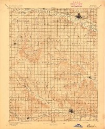
12 topographic sheets cover this place, the earliest surveyed in 1894 and the latest in 1985. It stands in Elkhorn Township. It lies in ZIP code area 67455. It stands on Lost Creek. The Survey maps it on the Lincoln quadrangle.
Research this city
On record in Lincoln
Buildings and businesses the archive holds for this place. Each opens its own page, with the source record it came from.
On the National Register 8 records
 Cummins Block Buildinglisted 2000
 Lincoln Carnegie Librarylisted 1987
 Lincoln County Courthouselisted 1976
 Marshall-Yohe Houselisted 2001
 Spring Creek Tributary Bridgelisted 1985
- Lincoln City Parklisted 2020
- Lincoln Downtown Historic Districtlisted 2020
- Lincoln High Schoollisted 2020
Topographic sheets covering this place
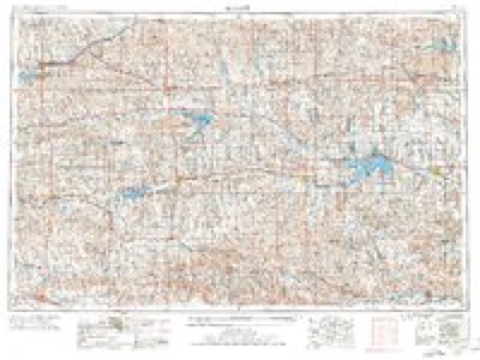
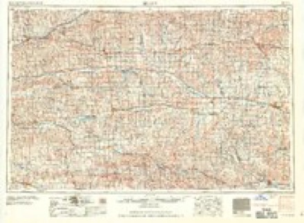
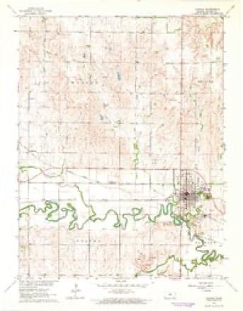
5 surveys from 12 printed sheetsMatched by testing this settlement's coordinate against the published boundary of every sheet in the United States Geological Survey's historical collection. Each opens the scanned sheet at the Survey.
- 1894 USGS Beloit quadrangle1:125000, 3 printings
- 1955 USGS Beloit quadrangle1:250000, 3 printings
- 1959 USGS Beloit quadrangle1:250000, 3 printings
- 1962 USGS Lincoln quadrangle1:24000
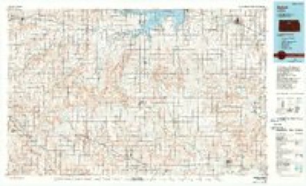
- 1985 USGS Beloit quadrangle1:100000, 2 printings
Fires near this place
3 since 2015Regional context, not property-specific evidence. The federal wildfire occurrence database lists 3 fires within 5 miles of Lincoln in 2015, burning about 15 acres in total. 1 started naturally. None was recorded as arson. Distance is straight-line from the map coordinates, so a fire counted here may appear on a neighbouring settlement's page as well.
| Reported cause | Fires |
|---|---|
| Natural | 1 |
| Equipment and vehicle use | 1 |
| Debris and open burning | 1 |
The most recent of them, most recent first, with the day each was reported and the service that recorded it.
| Date | Cause | Size | Reported by | Name on the report |
|---|---|---|---|---|
| 16 September 2015 | Natural | 10 acres | Kansas Forest Service | 10 |
| 5 March 2015 | Debris and open burning | 3.0 acres | Kansas Forest Service | 62015 |
| 1 November 2015 | Equipment and vehicle use | 2.0 acres | Kansas Forest Service | 12 |
Settlements close enough to share some of these fires:
Mines and quarries near this place
2 within 5 milesRegional context, not property-specific evidence. The federal mineral resources record lists 2 workings within 5 miles of Lincoln: 2 producers. All of them still produce. What was taken out: Stone, Crushed/Broken. Distance is straight-line from the map coordinates, so a quarry counted here may appear on a neighbouring settlement's page as well.
| Where | Site | Commodity | Status | Recorded |
|---|---|---|---|---|
| Lewick-Molloy Quarry & Mill | Stone, Crushed/Broken | Producer | ||
| Wilson Ryan Quarry & Mill | Stone, Crushed/Broken | Producer |
Storms near this place
60 of 155 shownRegional context, not property-specific evidence. The National Weather Service names Lincoln in 155 storm reports between 1993 and 2025: 85 hail, 51 thunderstorm wind, 8 flash flood, 6 tornado. No death or injury is recorded in these reports. Each account below is quoted exactly as the forecast office filed it, from the NOAA Storm Events Database, and each date opens the federal record of that event.
| When | Event | Place named | Harm | What the report says |
|---|---|---|---|---|
| August 2006 | Thunderstorm Wind | Lincoln | $125,000 | City is without power. Roof damage was reported and some windows were blown out. |
| August 2002 | Hail | Lincoln | $100,000 | Widespread damage to homes and vehicles. |
| June 2011 | Thunderstorm Wind | Lincoln | $60,000 | Emergency management reported quite a bit of tree damage in and around Lincoln. Additionally, newspaper reports indicated a large 140,000 bushel grain bin was destroyed along with other grain storage damaged in Lincoln. Furthermore, some power poles were snapped just west of Lincoln. Information courtesy of the Lincoln Sentinel-Republican. |
| April 2001 | Tornado (F0) | Lincoln | $50,000 | Minor damage to one home as well as a few trees. |
| May 1998 | Thunderstorm Wind | Lincoln | $50,000 | Widespread tree damage, including a large tree falling onto a truck. Roofs were damaged to several businesses including one restaurant. |
| August 2009 | Thunderstorm Wind | Lincoln | $45,000 | Measured wind gusts to 58 mph...produced wind damage to several structures across town. A building supply company received damage to its tin roof. A door was pulled from its frame and the glass broken at another business. A 100 year old building formerly a livery stable was nearly blown over and was later demolished, after the framework and foundation were rendered unstable. Numerous other small to large trees were also downed. |
| May 2015 | Tornado (EF0) | Lincoln | $25,000 | Multiple vortex tornado moved to the northeast across open country. Minor damage was noted at one farmstead when a sheet metal roof was blown across the road (DI1 DOD2). Otherwise, minor tree damage occurred sporadically along the path. Several cedar trees were snapped in the cemetery on the east side of Lincoln. The tornado was 100 yards wide. |
| April 2003 | Thunderstorm Wind | Lincoln | $10,000 | Unspecified barn and tree damage. |
| April 2001 | Thunderstorm Wind | Lincoln | $10,000 | Power lines blown down. (Reported by KRSL Radio.) |
| June 2013 | Thunderstorm Wind | Lincoln | $5,000 | Power lines and power poles were downed across the city of Lincoln extending east to near the Shady Bend area. |
| August 1999 | Thunderstorm Wind | Lincoln | $5,000 | Power lines blown down. |
| July 1994 | Thunderstorm Wind | Lincoln | $5,000 | Winds of 50 to 75 miles an hour lasted nearly an hour and broke a plate glass window and knocked down some power lines. |
| July 1994 | Thunderstorm Wind | Lincoln | $5,000 | Utility poles were blown down in town. |
| October 2007 | Flash Flood | Lincoln | $3,000 | Flash flooding stalled cars in Lincoln. Water rose up to 2 feet above bridges with 2 city streets barricaded. Flooding came within 100 feet of the Lincoln Junior/Senior High School. Sand bagging also occurred around 2 homes. One of the homes was evacuated. While 3.80 inches of rainfall fell across the area in less than 2 hours. |
| October 2007 | Lightning | Lincoln | $3,000 | Lightning struck the Lincoln County Courthouse, loosening shingles from the historic building spire and damaging computers inside. |
| June 2022 | Flash Flood | Lincoln | $500 | Law enforcement reported several rural road closures due to high water. |
| August 2010 | Thunderstorm Wind | Lincoln | $500 | A trained spotter reported several small tree limbs down. Also a 12 to 14 inch diameter tree was blown down. |
| June 2022 | Flash Flood | Lincoln | $100 | Water was reported running over Kansas Highway 14. |
| August 2025 | Thunderstorm Wind | Lincoln | - | A trained spotter estimated this wind gust along the thunderstorm outflow. |
| June 2025 | Thunderstorm Wind | Lincoln | - | Power was knocked out in Lincoln. |
| May 2024 | Thunderstorm Wind | Lincoln | - | A trained spotter estimated wind speeds of 50-60 mph and had penny sized hail as well. |
| July 2024 | Thunderstorm Wind | Lincoln | - | Wind gusts were estimated to be around 70 mph. |
| July 2024 | Thunderstorm Wind | Lincoln | - | Wind gusts were estimated to be around 80 mph. |
| July 2024 | Thunderstorm Wind | Lincoln | - | A trained spotter estimated 60 mph winds. There was another report from a trained spotter of a 12 foot tree broken half way up. The tree was approximately six inches in diameter at the point of where the tree was snapped. |
| August 2023 | Heavy Rain | Lincoln | - | Rain fall total 24 hours of 2.05 inches. |
| July 2023 | Thunderstorm Wind | Lincoln | - | This was a measured wind gust. |
| May 2022 | Hail | Lincoln | - | Other reports of 1 inch in diameter were noted across the community also. |
| July 2022 | Thunderstorm Wind | Lincoln | - | The public reported the gust. |
| May 2021 | Flash Flood | Lincoln | - | Numerous streets are flooded and impassable in Lincoln. The fire department also had to barricade roads to keep people from driving into the flooded areas. A resident also reported flooding to their basement. |
| May 2021 | Heavy Rain | Lincoln | - | This is a 24 hour rainfall total of 5.24 inches. |
| August 2021 | Thunderstorm Wind | Lincoln | - | A UPS truck was blown over near highway 14 east of Lincoln. The driver was extracted and reported to be injured. They were transported via ambulance. |
| August 2021 | Thunderstorm Wind | Lincoln | - | A power pole was snapped. |
| December 2021 | Thunderstorm Wind | Lincoln | - | A power line and transformer were blown down in Lincoln at 5th and Lost St. A railroad crossing arm was snapped along with scattered reports of tree limbs down. |
| December 2021 | Thunderstorm Wind | Lincoln | - | Very poor visibility was also reported. |
| May 2020 | Hail | Lincoln | - | Heavy rain was also reported. |
| June 2020 | Hail | Lincoln | - | Lots of ping pong ball sized hail at Iron Drive South of Lincoln. |
| May 2019 | Hail | Lincoln | - | The golf ball-sized hail occurred along Highway K14. |
| May 2019 | Thunderstorm Wind | Lincoln | - | No damage was reported. |
| May 2018 | Hail | Lincoln | - | Winds of 50 mph were also reported. |
| April 2017 | Flash Flood | Lincoln | - | Water was reported over Highway 14 near Elk Drive making travel extremely hazardous. |
| April 2017 | Hail | Lincoln | - | This was reported on Highway 14. |
| April 2017 | Hail | Lincoln | - | One mile west of Lincoln on K-18. |
| June 2017 | Thunderstorm Wind | Lincoln | - | Three to four in diameter tree limbs were blown out of trees. |
| August 2016 | Flood | Lincoln | - | Numerous county roads were flooded south of Lincoln. |
| August 2016 | Flood | Lincoln | - | Street flooding was reported in the city of Lincoln. This was a delayed report. |
| July 2015 | Thunderstorm Wind | Lincoln | - | No damage was reported. |
| August 2015 | Hail | Lincoln | - | The hail was mostly nickel size with a couple of quarter size stones. |
| September 2014 | Hail | Lincoln | - | Golf ball to tennis ball-sized hail pelted a residence at 2270 North 120th Road, but no damage was reported. |
| May 2014 | Hail | Lincoln | - | The picture of the falling hail was sent to KSN-TV media. |
| May 2013 | Thunderstorm Wind | Lincoln | - | No damage was reported. |
| June 2013 | Thunderstorm Wind | Lincoln | - | Winds ranging from 70-80 mph tore through the town of Lincoln along with heavy rains. Significant tree damage occurred. |
| June 2013 | Hail | Lincoln | - | The golf ball-sized hail was driven by winds up to 80 mph. |
| June 2013 | Thunderstorm Wind | Lincoln | - | Emergency management reported significant tree damage. Golf ball-sized hail also occurred. |
| July 2013 | Hail | Lincoln | - | The ping-pong ball-sized hail was reported near 200th Road and Grain Drive. |
| July 2013 | Hail | Lincoln | - | The quarter-sized hail was reported on Highway K-14. |
| May 2011 | Thunderstorm Wind | Lincoln | - | Winds were estimated around 60 mph. |
| August 2010 | Thunderstorm Wind | Lincoln | - | The emergency manager reported wind gusts of 50 to 60 mph. |
| April 2010 | Hail | Lincoln | - | Winds of 60 mph occurred with the hail. |
| April 2010 | Thunderstorm Wind | Lincoln | - | Occurred with dime size hail. |
| June 2006 | Thunderstorm Wind | Lincoln | - | One inch diameter tree limbs downed across the city of Lincoln. |
Nearest settlements
The eight closest, with where each one stands in the county. Distances are straight-line, computed from the Geographic Names Information System coordinates.
Provenance
This settlement is recorded in the Geographic Names Information System as feature 472553. The sheet list is computed by point-in-boundary test against the United States Geological Survey's historical topographic inventory. Both are works of the United States government and carry no copyright under 17 U.S.C. 105.
Wildfire. Short, Karen C. 2022. Spatial wildfire occurrence data for the United States, 1992-2020 [FPA_FOD_20221014]. 6th Edition. Fort Collins, CO: Forest Service Research Data Archive. https://doi.org/10.2737/RDS-2013-0009.6 Collected with United States Government funding and usable without additional permissions or fees.
Mines and quarries. USGS Mineral Resources Data System (MRDS) https://mrdata.usgs.gov/mrds/ A work of the United States government, no copyright under 17 U.S.C. 105.
Storms. NOAA National Centers for Environmental Information, Storm Events Database https://www.ncei.noaa.gov/stormevents/ A work of the United States government, no copyright under 17 U.S.C. 105. Narratives are quoted verbatim from the National Weather Service report and are not edited or summarised.