 Block
Menoken, Kansas
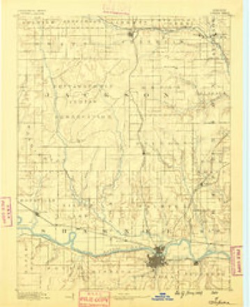
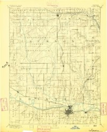
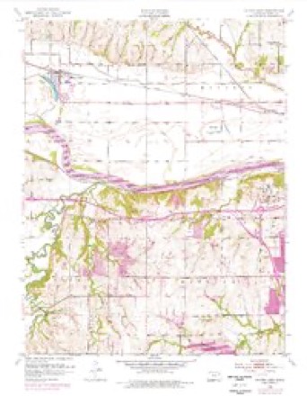
20 topographic sheets cover this place, the earliest surveyed in 1889 and the latest in 1983. It stands in Menoken Township. It lies in ZIP code area 66618. The Survey maps it on the Silver Lake quadrangle.
Topographic sheets covering this place
8 surveys from 20 printed sheetsMatched by testing this settlement's coordinate against the published boundary of every sheet in the United States Geological Survey's historical collection. Each opens the scanned sheet at the Survey.
- 1889 USGS Topeka quadrangle1:125000
- 1894 USGS Topeka quadrangle1:125000, 5 printings
- 1950 USGS Kansas City quadrangle1:250000
- 1952 USGS Silver Lake quadrangle1:24000, 4 printings
- 1954 USGS Kansas City quadrangle1:250000
- 1956 USGS Kansas City quadrangle1:250000, 4 printings
- 1960 USGS Kansas City quadrangle1:250000, 3 printings
- 1983 USGS Silver Lake quadrangle1:24000
Fires near this place
267 since 2006Regional context, not property-specific evidence. The federal wildfire occurrence database lists 267 fires within 5 miles of Menoken between 2006 and 2020, burning about 327 acres in total. 1 started naturally. 76 were recorded as arson. Distance is straight-line from the map coordinates, so a fire counted here may appear on a neighbouring settlement's page as well.
| Reported cause | Fires |
|---|---|
| Missing data/not specified/undetermined | 110 |
| Arson/incendiarism | 76 |
| Debris and open burning | 52 |
| Smoking | 10 |
| Equipment and vehicle use | 7 |
| Power generation/transmission/distribution | 4 |
| Other causes | 3 |
| Misuse of fire by a minor | 2 |
| Fireworks | 2 |
| Natural | 1 |
The most recent of them, most recent first, with the day each was reported and the service that recorded it.
| Date | Cause | Size | Reported by | Name on the report |
|---|---|---|---|---|
| 29 September 2015 | Arson/incendiarism | under an acre | Kansas Forest Service | 15109 |
| 26 September 2015 | Missing data/not specified/undetermined | under an acre | Kansas Forest Service | 14941 |
| 22 September 2015 | Arson/incendiarism | under an acre | Kansas Forest Service | 14677 |
| 19 September 2018 | Missing data/not specified/undetermined | under an acre | Kansas Forest Service | 844 |
| 15 September 2017 | Arson/incendiarism | under an acre | Shawnee County | 15708 |
| 14 September 2018 | Debris and open burning | under an acre | Kansas Forest Service | 16891 |
| 14 September 2018 | Debris and open burning | under an acre | Kansas Forest Service | 16893 |
| 13 September 2017 | Debris and open burning | under an acre | Shawnee County | 15570 |
Settlements close enough to share some of these fires:
Mines and quarries near this place
1 within 5 milesRegional context, not property-specific evidence. The federal mineral resources record lists 1 working within 5 miles of Menoken: 1 producer. All of them still produce. What was taken out: Sand and Gravel, Construction. Distance is straight-line from the map coordinates, so a quarry counted here may appear on a neighbouring settlement's page as well.
| Where | Site | Commodity | Status | Recorded |
|---|---|---|---|---|
| Kansas Sand and Concrete Dredge | Sand and Gravel, Construction | Producer |
Storms near this place
60 of 107 shownRegional context, not property-specific evidence. The National Weather Service names Menoken in 107 storm reports between 2008 and 2026: 50 thunderstorm wind, 38 hail, 17 flash flood, 1 lightning. No death or injury is recorded in these reports. Each account below is quoted exactly as the forecast office filed it, from the NOAA Storm Events Database, and each date opens the federal record of that event.
| When | Event | Place named | Harm | What the report says |
|---|---|---|---|---|
| May 2011 | Thunderstorm Wind | Menoken | $5,000 | Large tree limbs were seen broken on 21st Avenue and Wanamaker Boulevard in Topeka. At Croco Road and 29th Avenue damage at the baseball fields were observed and a fifth wheel trailer was overturned. |
| June 2010 | Thunderstorm Wind | Menoken | $5,000 | The ASOS at Philip Billard Airport reported a 62 mph wind gust. Damage to large trees also occurred in the city of Topeka and near the airport. A large tree also fell on a power line creating a brief power outage. |
| June 2008 | Lightning | Menoken | $1,000 | A lightning strike at the Indian Hills substation caused a power loss to approximately one thousand customers for just over two hours. Businesses along the Wanamaker corridor in Topeka were most adversely affected. |
| April 2026 | Thunderstorm Wind | Menoken | - | Dime size hail also reported. |
| April 2026 | Hail | Menoken | - | Time of report estimated by radar. |
| September 2024 | Thunderstorm Wind | Menoken | - | Delayed report via social media of tree downed across Brookfield Road. |
| September 2024 | Thunderstorm Wind | Menoken | - | NWS employee estimated 60 mph wind gusts. |
| September 2024 | Thunderstorm Wind | Menoken | - | NWS employee observed a five inch diameter tree branch downed half a mile east of his home. |
| July 2024 | Thunderstorm Wind | Menoken | - | Estimated 60 to 70 mph winds and near zero visibility in heavy rain. |
| June 2024 | Thunderstorm Wind | Menoken | - | Reported by off duty NWS Employee. |
| June 2024 | Thunderstorm Wind | Menoken | - | Power is out. |
| June 2024 | Thunderstorm Wind | Menoken | - | Corrects previous storm wind damage report from 7 W Topeka. 1 inch tree limbs broken and shingles blown off. |
| June 2024 | Thunderstorm Wind | Menoken | - | Thirteen inch diameter tree branch down, fence is blown over. |
| June 2024 | Thunderstorm Wind | Menoken | - | Power line reported down just east of Wanamaker Road and 29th Street. Time estimated by radar. |
| June 2024 | Thunderstorm Wind | Menoken | - | Trees uprooted or snapped. Roof blown off. |
| June 2024 | Thunderstorm Wind | Menoken | - | Personal weather station. |
| July 2024 | Flood | Menoken | - | Mping report of river/creek overflowing or cropland, yard, or basement flooding. |
| July 2024 | Thunderstorm Wind | Menoken | - | Estimated 70 mph winds. |
| August 2024 | Thunderstorm Wind | Menoken | - | Estimated from off-duty employee. |
| August 2024 | Thunderstorm Wind | Menoken | - | Off duty NWS employee. |
| April 2023 | Hail | Menoken | - | Quarter sized hail reported from mping. |
| May 2023 | Thunderstorm Wind | Menoken | - | Report of 3 to 4 inch tree limbs broken. |
| June 2023 | Thunderstorm Wind | Menoken | - | Tree limbs 4 to 5 inches in diameter blown down. |
| April 2023 | Hail | Menoken | - | Quarter sized hail reported. |
| July 2023 | Thunderstorm Wind | Menoken | - | Estimated gusts to 60 mph. |
| July 2023 | Thunderstorm Wind | Menoken | - | Mping report of small limbs down. |
| June 2022 | Thunderstorm Wind | Menoken | - | Wind gust of 65 mph. |
| May 2022 | Thunderstorm Wind | Menoken | - | Tree limbs 3 inches in diameter blown down. |
| May 2022 | Flash Flood | Menoken | - | Vehicle immersed in flood waters and immobilized at 11th and Fairlawn Road. |
| May 2022 | Thunderstorm Wind | Menoken | - | Power out, estimated 60 to 65 mph wind gusts. |
| May 2022 | Thunderstorm Wind | Menoken | - | Wind gust of 60 mph. |
| July 2021 | Thunderstorm Wind | Menoken | - | Tree limb 8 inches in diameter blown down. |
| August 2021 | Thunderstorm Wind | Menoken | - | Report of tree blown down. |
| December 2021 | Thunderstorm Wind | Menoken | - | Tree limbs 1 inch in diameter broken, shingles blown off roof. |
| December 2021 | Thunderstorm Wind | Menoken | - | Tree limb 8 inches in diameter blown down. |
| May 2020 | Thunderstorm Wind | Menoken | - | Tree fell on a house at 17th and Urish. |
| April 2020 | Hail | Menoken | - | Ping pong sized hail reported. |
| April 2020 | Hail | Menoken | - | Ping pong sized hail reported. |
| April 2020 | Hail | Menoken | - | Most hail was half dollar size with a few golf ball sized as well. |
| April 2020 | Hail | Menoken | - | Quarter sized hail reported at WIBW-TV. |
| April 2020 | Hail | Menoken | - | Reported at 33rd and Wanamaker. |
| April 2020 | Hail | Menoken | - | Ping pong sized hail reported. |
| April 2020 | Hail | Menoken | - | Quarter sized hail reported. |
| July 2020 | Flash Flood | Menoken | - | Twitter report showed street flooding. |
| July 2020 | Flash Flood | Menoken | - | Photos show what appears to be two feet of water covering a roadway with a stalled vehicle. Water was approaching homes as well. |
| July 2020 | Flash Flood | Menoken | - | Report of water rushing along street level along Ward Creek. |
| July 2020 | Flash Flood | Menoken | - | Reports of several water rescues across the city. |
| July 2020 | Flash Flood | Menoken | - | Roads closed due to a creek out of its banks with water covering roadways. |
| July 2020 | Flash Flood | Menoken | - | Flood water from Shunganunga Creek has caused road closures. |
| July 2020 | Flash Flood | Menoken | - | Flooding reported via Twitter at the corner near Bishop Elementary school. |
| July 2020 | Thunderstorm Wind | Menoken | - | Tree 12 inches in diameter split in half at 29th and Romar. Time estimated from radar. |
| July 2020 | Thunderstorm Wind | Menoken | - | Large tree limbs reported down in and around Gage Park. Time estimated from radar. |
| June 2019 | Thunderstorm Wind | Menoken | - | A 5 to 6 inch diameter tree was down near the intersection of Urish and 29th street. |
| August 2019 | Thunderstorm Wind | Menoken | - | Large tree trunk snapped. |
| July 2018 | Thunderstorm Wind | Menoken | - | Estimated wind gust report. |
| July 2018 | Thunderstorm Wind | Menoken | - | Social media pictures of multiple business signs and power poles down on 29th street between Fairlawn and Wanamaker. |
| June 2018 | Thunderstorm Wind | Menoken | - | Estimated wind gust. |
| June 2017 | Thunderstorm Wind | Menoken | - | Seven inch diameter tree limb snapped, blocking 2800 block of SW Bingham Road. |
| June 2017 | Thunderstorm Wind | Menoken | - | Ten inch diameter limbs down in the 7400 block of SW Cannock Chase Road. |
| June 2017 | Thunderstorm Wind | Menoken | - | Large 4 to 5 inch diameter limbs snapped off of a tree. |
Nearest settlements
The eight closest, with where each one stands in the county. Distances are straight-line, computed from the Geographic Names Information System coordinates.
| Map | Place | Distance | Sheets |
|---|---|---|---|
| Kiro | 2.3 miles | 20 | |
| North Topeka | 4.9 miles | 21 | |
| Topeka | 5.1 miles | 21 | |
| Silver Lake | 5.5 miles | 20 | |
| Elmont | 5.8 miles | 20 | |
| Valencia | 6.4 miles | 19 | |
| Oakland | 6.5 miles | 21 | |
| Highland Park | 6.7 miles | 21 |
Provenance
This settlement is recorded in the Geographic Names Information System as feature 484865. The sheet list is computed by point-in-boundary test against the United States Geological Survey's historical topographic inventory. Both are works of the United States government and carry no copyright under 17 U.S.C. 105.
Wildfire. Short, Karen C. 2022. Spatial wildfire occurrence data for the United States, 1992-2020 [FPA_FOD_20221014]. 6th Edition. Fort Collins, CO: Forest Service Research Data Archive. https://doi.org/10.2737/RDS-2013-0009.6 Collected with United States Government funding and usable without additional permissions or fees.
Mines and quarries. USGS Mineral Resources Data System (MRDS) https://mrdata.usgs.gov/mrds/ A work of the United States government, no copyright under 17 U.S.C. 105.
Storms. NOAA National Centers for Environmental Information, Storm Events Database https://www.ncei.noaa.gov/stormevents/ A work of the United States government, no copyright under 17 U.S.C. 105. Narratives are quoted verbatim from the National Weather Service report and are not edited or summarised.