 Block
Nickerson, Kansas
14 topographic sheets cover this place, the earliest surveyed in 1894 and the latest in 1985. It stands in Grant Township. It lies in ZIP code area 67561. The Survey maps it on the Nickerson quadrangle. 1,058 people lived here at the 2020 count. It stands 1,594 feet above sea level.
Population over time
2 figuresNickerson fell from 1,070 to 1,058 between 2010 and 2020. These are the recorded population figures Wikidata holds for this place, reached through the Geographic Names Information System number this page is keyed on rather than by name, so they belong to this place and not to another of the same name. Most are census counts, but not all are: an early figure may be a founding or settlement estimate, and an estimate published within five years of a census is left out. The change column is computed, and is left blank where more than 20 years separate a figure from the one before it, because a gap that long is not a change between two counts.
| Year | People | Change |
|---|---|---|
| 2010 | 1,070 | |
| 2020 | 1,058 | -12 (-1%) |
Topographic sheets covering this place
6 surveys from 14 printed sheetsMatched by testing this settlement's coordinate against the published boundary of every sheet in the United States Geological Survey's historical collection. Each opens the scanned sheet at the Survey.
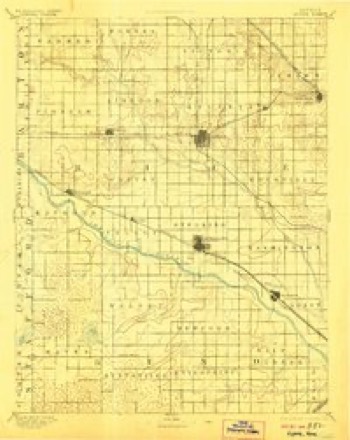
- 1894 USGS Lyons quadrangle1:125000, 5 printings
- 1955 USGS Great Bend quadrangle1:250000, 3 printings
- 1957 USGS Great Bend quadrangle1:250000
- 1958 USGS Great Bend quadrangle1:250000, 2 printings
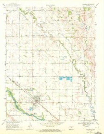
- 1970 USGS Nickerson quadrangle1:24000
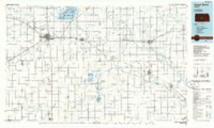
- 1985 USGS Great Bend quadrangle1:100000, 2 printings
Fires near this place
17 since 2016Regional context, not property-specific evidence. The federal wildfire occurrence database lists 17 fires within 5 miles of Nickerson between 2016 and 2020, burning about 34 acres in total. 1 started naturally. None was recorded as arson. Distance is straight-line from the map coordinates, so a fire counted here may appear on a neighbouring settlement's page as well.
| Reported cause | Fires |
|---|---|
| Missing data/not specified/undetermined | 11 |
| Equipment and vehicle use | 2 |
| Debris and open burning | 2 |
| Natural | 1 |
| Fireworks | 1 |
The most recent of them, most recent first, with the day each was reported and the service that recorded it.
| Date | Cause | Size | Reported by | Name on the report |
|---|---|---|---|---|
| 11 August 2020 | Missing data/not specified/undetermined | 15 acres | Kansas Forest Service | not named |
| 9 July 2017 | Missing data/not specified/undetermined | 3.0 acres | Reno County | 1700063 |
| 4 July 2018 | Fireworks | under an acre | Kansas Forest Service | 1800058 |
| 7 June 2017 | Equipment and vehicle use | 2.0 acres | Reno County | 1700045 |
| 20 June 2017 | Equipment and vehicle use | 10 acres | Reno County | 1700051 |
| 15 June 2017 | Natural | under an acre | Reno County | 1700047 |
| 13 June 2020 | Missing data/not specified/undetermined | 1.0 acres | Kansas Forest Service | not named |
| 2 May 2017 | Missing data/not specified/undetermined | under an acre | Reno County | 1519 |
Settlements close enough to share some of these fires:
Storms near this place
60 of 94 shownRegional context, not property-specific evidence. The National Weather Service names Nickerson in 94 storm reports between 1994 and 2024: 39 thunderstorm wind, 34 hail, 11 tornado, 4 flash flood. The reports record 1 injury. Each account below is quoted exactly as the forecast office filed it, from the NOAA Storm Events Database, and each date opens the federal record of that event.
| When | Event | Place named | Harm | What the report says |
|---|---|---|---|---|
| June 1998 | Lightning | Nickerson | 1 hurt, $1,000 | One wall of a storage shed set ablaze. One person sustained minor injuires. |
| August 2002 | Thunderstorm Wind | Nickerson | $1,000,000 | Speeds ranged from 70-87kts, inflicting widespread tree and power line damage. The following were destroyed: One single-family home, three mobile homes, and a shed that was scattered amongst a grove of trees. The following sustained major damage: Two single-family homes and three mobile homes. Approximately 50 other structures sustained minor damage. A 40-foot tree, splintered at the base, fell onto the bumper of one vehicle. A state of disaster emergency was declared by Governor Graves. Area newspapers contributed greatly to this report. |
| August 2002 | Flash Flood | Nickerson | $500,000 | Nickerson completely flooded and inaccessible, with water levels reaching the windows of many vehicles. In South Hutchinson, a 17-year old drove his sport utility vehicle into the city's storm overflow drainage pond where it later submerged. The S.U.V., a 1994 Mazda Navajo worth $6,000, was a total loss. In addition, flooding, though of a lesser magnitude, was reported throughout the county. No dollar estimate available regarding crop losses, however total acreage affected was 250,000. In Hutchinson, the Cow Creek overflowed, resulting in the closures of the following roads and streets: Pennington Road from 5th Avenue north to 82nd Avenue, 43rd Avenue from Pennington Road east 1 block to Hendricks Road, 50th Avenue from Wilson Road east 1 block to Pennington Road, 56th Avenue from Wilson Road east half a block toward Pennington Road, 69th Avenue from Wilson Road east 2 blocks to Hendricks Road, and Wilson Road from 69th Avenue north to 82nd Avenue. USDA Flash Situation Report and area newspapers contributed greatly to this narrative. |
| July 2015 | Tornado (EF3) | Nickerson | $250,000 | A strong tornado moved southwest towards the town of Nickerson. One home was completely destroyed as it was blown off of its foundation. There were no anchor bolts present in the foundation (DI2 DOD9). The second more significant damage sight was where many trees were completely uprooted. Those that were not uprooted only had the main trunk left and it was completely debarked. The home took a glancing blow and only had minor damage. The family took shelter in an above ground shelter in their garage. The damage path for this portion of the tornado that moved out of Rice County was 350 yards wide. |
| May 2019 | Tornado (EF1) | Nickerson | $100,000 | This tornado had a peculiar movement from the northeast to the southwest. It initially touched down, and destroyed a 100 foot long pole barn, lofting some of the 1000 pound girders into a nearby field to the west. The tornado then curled back to the southeast hitting another farmstead further south, collapsing a pole barn and knocking down trees all around a farmhouse. Occupants of the house were home, but were uninjured. |
| August 2011 | Thunderstorm Wind | Nickerson | $75,000 | Winds estimated around 70 mph blew a large camping trailer into an adjacent lake just south of Nickerson. Additionally, some trees and tree limbs were downed in the Nickerson area. Property damage amounts are rough estimates. The Sterling Bulletin was the sole contributor to this report. |
| August 2002 | Thunderstorm Wind | Nickerson | $50,000 | Widespread tree and power line damage. Power outages town-wide. See 2028 CST entry for summary of the most significant damage. |
| June 2019 | Thunderstorm Wind | Nickerson | $25,000 | A large tree fell onto a house, causing the roof to collapse. |
| August 2002 | Thunderstorm Wind | Nickerson | $25,000 | Trees and power lines downed. |
| April 2015 | Thunderstorm Wind | Nickerson | $15,000 | Several power poles were snapped. |
| June 2005 | Thunderstorm Wind | Nickerson | $10,000 | Home partially unroofed. |
| May 2011 | Thunderstorm Wind | Nickerson | $5,000 | Power lines were downed near the intersection of 82nd and Riverton. The number of power lines or poles downed is unknown. |
| June 2008 | Thunderstorm Wind | Nickerson | $1,800 | Several tree limbs were down across town. |
| August 2013 | Thunderstorm Wind | Nickerson | $1,200 | A tree fell on the road at Highway 14 and Centennial. |
| June 1994 | Hail | Nickerson | $500 | no account filed |
| May 2019 | Flood | Nickerson | $100 | Street flooding, up to curb level occurred in town. |
| August 2013 | Flash Flood | Nickerson | $100 | Water was reported over Highway 96 in and around Nickerson. It was reported that between 6 to 8 inches of water was flowing over the road. 1.15 inches of rainfall fell in a very short time. |
| March 2024 | Hail | Nickerson | - | An accumulating hail report of penny sized hail up to one-half inch deep on the deck occurred in Nickerson. |
| June 2024 | Thunderstorm Wind | Nickerson | - | Large tree branch downed on a house. Time of occurrence estimated by radar. |
| August 2023 | Thunderstorm Wind | Nickerson | - | Trained spotter also reported trees coming down. |
| May 2022 | Thunderstorm Wind | Nickerson | - | This was an estimated wind gust. |
| April 2022 | Hail | Nickerson | - | A picture was sent to the office via Facebook. The time is estimated from radar. |
| November 2022 | Heavy Rain | Nickerson | - | A Cocorahs observer reported 1.25 inches of rainfall. |
| June 2019 | Thunderstorm Wind | Nickerson | - | A large tree was uprooted and fell onto a house. |
| June 2019 | Thunderstorm Wind | Nickerson | - | Strong winds downed a large tree. They also experienced dime to nickel sized hail. |
| May 2019 | Thunderstorm Wind | Nickerson | - | In Nickerson, 4 to 5 inch diameter limbs were downed and the town lost power. |
| May 2019 | Flood | Nickerson | - | Highway 14 was barricaded from Nickerson to Sterling. Flooding from the Arkansas River was a likely contributor. |
| May 2019 | Thunderstorm Wind | Nickerson | - | Among the tree damage was a 10-inch diameter limb that was downed across a road. |
| May 2019 | Tornado (EF1) | Nickerson | - | A tornado touched down over open country and then moved across a farmstead causing damage to several of the out buildings. |
| July 2018 | Thunderstorm Wind | Nickerson | - | The emergency manager didn't report any damage. |
| May 2016 | Thunderstorm Wind | Nickerson | - | Two to six inch tree limbs were blown out of trees. |
| April 2015 | Hail | Nickerson | - | The trained spotter reported quarter to golf ball sized hail and 40 to 50 mph winds. |
| April 2015 | Thunderstorm Wind | Nickerson | - | Law enforcement reported the gust. |
| July 2015 | Thunderstorm Wind | Nickerson | - | Trees were blown across the road about two miles east of Nickerson. |
| June 2015 | Flood | Nickerson | - | Minor street flooding was reported via social media. |
| April 2015 | Thunderstorm Wind | Nickerson | - | A trained spotter measured the gust. |
| June 2014 | Thunderstorm Wind | Nickerson | - | Five to six inch diameter limbs were blown down. |
| June 2014 | Thunderstorm Wind | Nickerson | - | Estimated gust reported by trained spotter. |
| May 2013 | Thunderstorm Wind | Nickerson | - | An 8 inch tree branch was blown down. |
| May 2013 | Thunderstorm Wind | Nickerson | - | The wind gust was measured. |
| May 2012 | Thunderstorm Wind | Nickerson | - | Speeds ranged from 50 to 60 mph. |
| May 2011 | Thunderstorm Wind | Nickerson | - | Nickerson was without power for a time. |
| September 2009 | Hail | Nickerson | - | Reported by spotters associated with the emergnecy manager. |
| September 2009 | Hail | Nickerson | - | Reported by spotters associated with the emergency manager. |
| October 2008 | Flood | Nickerson | - | Several roads were closed due to flooding along Cow Creek. |
| April 2007 | Tornado (EF0) | Nickerson | - | Brief touchdown in open country. Reported by KWCH-TV. |
| April 2007 | Tornado (EF0) | Nickerson | - | Brief touchdown in open country. Reported by KWCH-TV. |
| April 2007 | Tornado (EF0) | Nickerson | - | Off duty NWS employee reported a few brief touchdowns in open country. |
| April 2007 | Tornado (EF0) | Nickerson | - | Brief touchdown in open country. Reported by KWCH-TV. |
| April 2007 | Tornado (EF0) | Nickerson | - | Brief touchdown in open country. |
| April 2007 | Tornado (EF0) | Nickerson | - | Multiple very brief touchdowns in open country. |
| April 2006 | Thunderstorm Wind | Nickerson | - | Estimated at the intersection of 82nd Ave and Yaggy Rd. |
| June 2005 | Thunderstorm Wind | Nickerson | - | Downed trees and power lines across town. |
| June 2002 | Flash Flood | Nickerson | - | K96 flooded as well many county roads. |
| July 2000 | Thunderstorm Wind | Nickerson | - | Several large trees blown down and blocked a highway. |
| April 1998 | Flash Flood | Nickerson | - | Cow Creek flooded, causing the closure of numerous roads across northeast Reno County. The flooding was mainly due to snow melt and previous rainfall. |
| May 1995 | Thunderstorm Wind | Nickerson | - | Eighty mph straight line winds caused considerable damage to a farm three miles north of Nickerson. Most of the damage was tin roofs and buildings being blown down. Irrigation system was tipped over and a large horse trailer was rolled over several times. |
| May 2024 | Hail | Nickerson | - | no account filed |
| April 2020 | Hail | Nickerson | - | no account filed |
| May 2019 | Hail | Nickerson | - | no account filed |
Nearest settlements
The eight closest, with where each one stands in the county. Distances are straight-line, computed from the Geographic Names Information System coordinates.
| Map | Place | Distance | Sheets |
|---|---|---|---|
| Yaggy | 5.3 miles | 16 | |
| Willowbrook | 5.8 miles | 15 | |
| Adams Corner | 6.2 miles | 16 | |
| Charters Corner | 8.0 miles | 14 | |
| McVays Corner | 9.0 miles | 14 | |
| Hutchinson | 10.1 miles | 15 | |
| Whiteside | 10.3 miles | 16 | |
| South Hutchinson | 11.2 miles | 15 |
Elsewhere
Matched on this settlement's Geographic Names Information System number rather than its name, so it cannot be a different place of the same name in another state.
| Wikipedia article on Nickerson | An encyclopaedic summary. Its text is share-alike, so it is linked here rather than copied. |
| Wikidata item Q2013102 | The structured record the population and elevation above come from. Public domain (CC0). |
Provenance
This settlement is recorded in the Geographic Names Information System as feature 475913. The sheet list is computed by point-in-boundary test against the United States Geological Survey's historical topographic inventory. Both are works of the United States government and carry no copyright under 17 U.S.C. 105.
Wildfire. Short, Karen C. 2022. Spatial wildfire occurrence data for the United States, 1992-2020 [FPA_FOD_20221014]. 6th Edition. Fort Collins, CO: Forest Service Research Data Archive. https://doi.org/10.2737/RDS-2013-0009.6 Collected with United States Government funding and usable without additional permissions or fees.
Storms. NOAA National Centers for Environmental Information, Storm Events Database https://www.ncei.noaa.gov/stormevents/ A work of the United States government, no copyright under 17 U.S.C. 105. Narratives are quoted verbatim from the National Weather Service report and are not edited or summarised.