 Block
Wellington, Kansas
13 topographic sheets cover this place, the earliest surveyed in 1890 and the latest in 1985. It stands in Wellington City. It lies in ZIP code area 67152. The Survey maps it on the Dalton quadrangle. 7,715 people lived here at the 2020 count. It stands 1,230 feet above sea level.
On record in Wellington
Buildings and businesses the archive holds for this place. Each opens its own page, with the source record it came from.
On the National Register 4 records
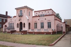 Edwin Smith Houselisted 2004
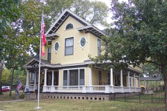 H.F. Smith Houselisted 2007
 Wellington Carnegie Librarylisted 1987
- Grocery/Drugs/Dry Goods/Millinerylisted 2007
Population over time
2 figuresWellington fell from 8,172 to 7,715 between 2010 and 2020. These are the recorded population figures Wikidata holds for this place, reached through the Geographic Names Information System number this page is keyed on rather than by name, so they belong to this place and not to another of the same name. Most are census counts, but not all are: an early figure may be a founding or settlement estimate, and an estimate published within five years of a census is left out. The change column is computed, and is left blank where more than 20 years separate a figure from the one before it, because a gap that long is not a change between two counts.
| Year | People | Change |
|---|---|---|
| 2010 | 8,172 | |
| 2020 | 7,715 | -457 (-6%) |
Topographic sheets covering this place
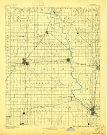
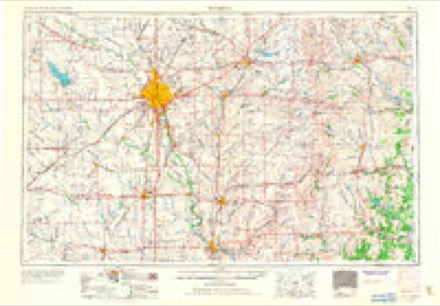
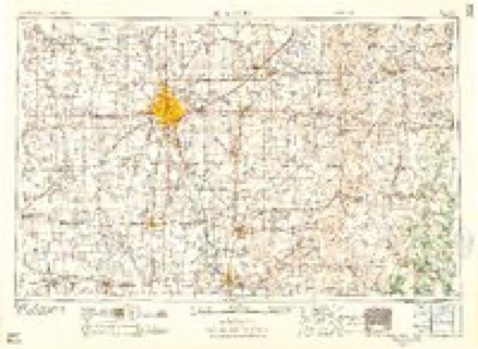
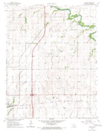
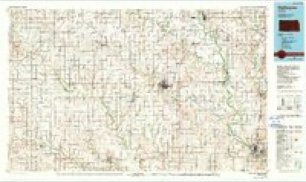
5 surveys from 13 printed sheetsMatched by testing this settlement's coordinate against the published boundary of every sheet in the United States Geological Survey's historical collection. Each opens the scanned sheet at the Survey.
- 1890 USGS Wellington quadrangle1:125000, 6 printings
- 1955 USGS Wichita quadrangle1:250000, 3 printings
- 1958 USGS Wichita quadrangle1:250000
- 1964 USGS Dalton quadrangle1:24000
- 1985 USGS Wellington quadrangle1:100000, 2 printings
Fires near this place
65 since 2015Regional context, not property-specific evidence. The federal wildfire occurrence database lists 65 fires within 5 miles of Wellington between 2015 and 2020, burning about 1,352 acres in total. None started naturally. None was recorded as arson. Distance is straight-line from the map coordinates, so a fire counted here may appear on a neighbouring settlement's page as well.
| Reported cause | Fires |
|---|---|
| Debris and open burning | 28 |
| Missing data/not specified/undetermined | 21 |
| Equipment and vehicle use | 7 |
| Recreation and ceremony | 4 |
| Smoking | 2 |
| Misuse of fire by a minor | 2 |
| Power generation/transmission/distribution | 1 |
The most recent of them, most recent first, with the day each was reported and the service that recorded it.
| Date | Cause | Size | Reported by | Name on the report |
|---|---|---|---|---|
| 6 September 2015 | Debris and open burning | 80 acres | Kansas Forest Service | 798 |
| 6 September 2015 | Debris and open burning | 40 acres | Kansas Forest Service | 799 |
| 3 September 2018 | Debris and open burning | under an acre | Kansas Forest Service | 915 |
| 1 September 2018 | Equipment and vehicle use | 2.0 acres | Kansas Forest Service | 909 |
| 6 July 2020 | Missing data/not specified/undetermined | 10 acres | Kansas Forest Service | not named |
| 5 July 2018 | Missing data/not specified/undetermined | under an acre | Kansas Forest Service | 692 |
| 4 July 2020 | Missing data/not specified/undetermined | 1.0 acres | Kansas Forest Service | not named |
| 30 July 2017 | Equipment and vehicle use | 12 acres | Sumner County | 749 |
Settlements close enough to share some of these fires:
Storms near this place
60 of 149 shownRegional context, not property-specific evidence. The National Weather Service names Wellington in 149 storm reports between 1993 and 2026: 75 hail, 46 thunderstorm wind, 14 flash flood, 8 flood. The reports record 4 injuries. Each account below is quoted exactly as the forecast office filed it, from the NOAA Storm Events Database, and each date opens the federal record of that event.
| When | Event | Place named | Harm | What the report says |
|---|---|---|---|---|
| May 1999 | Tornado (F1) | Wellington | 4 hurt, $750,000 | Initial touchdown occurred 4 miles north of Wellington in Central Sumner County where several power poles were knocked down. Moving north-northeast near 30 kts, the tornado inflicted damage to about 15 structures including complete destruction of two mobile homes, a pole barn, two wood sheds and one metal shed. Also damaged were a ranch style home and a metal shed, both of which lost most of their roofing. This tornado was responsible for all 4 injuries in Sumner County. Of the injuries, 3 occurred (1 serious) in the two destroyed mobile homes. While in Sumner County, this tornado possessed a path 10 miles long and 1/4 to 1/2 mile wide. It would exit Sumner County at 1930, continuing a north-northeast track into Sedgwick County. |
| April 1996 | Thunderstorm Wind | Wellington | $7,000,000 | no account filed |
| May 2019 | Flash Flood | Wellington | $2,000,000 | Interstate 35 or the Kansas Turnpike was closed due the Slate Creek reaching record levels and overflowing the highway at mile marker 21. The interstate was closed for hours, as crews waited for the water to recede and repair work to occur. Traffic was diverted at the Wellington exit and had to use an alternate until it reached the Kansas Oklahoma line. The Kansas Turnpike Authority said that closing that long of a stretch of the Turnpike had not occurred in 30 years. |
| June 1998 | Hail | Wellington | $2,000,000 | Wind-driven golfball-sized hail smashed windows, dented siding and caused widespread roof damage. |
| June 1998 | Hail | Wellington | $1,000,000 | Hail smashed windows to numerous cars and buildings. |
| August 2004 | Tornado (F2) | Wellington | $250,000 | At intersection of E. 40th St. S and Highway 81, 2 miles south of Wellington, two homes were damaged around 1830 CST. The first, a 2-story brick structure, was unroofed and had one wall collapsed. (F2 rating assigned to this property.) Tree damage also occurred on & around the property. The 2nd, neighboring home, of wood frame construction, was located 30 feet distant, and sustained minor roof damag. (F0 rating assigned to this property.) In addition, four power poles were snapped to near the ground as were, of course, their associated power lines. |
| July 2003 | Thunderstorm Wind | Wellington | $50,000 | Construction trailer overturned near Wellington Airport, and one shed blown down. Tree damage. The Wellington Daily contributed to this narrative. |
| May 1993 | Thunderstorm Wind | Wellington | $50,000 | Trees, power lines and fences were knocked down. |
| May 1993 | Thunderstorm Wind | Wellington | $50,000 | no account filed |
| September 2008 | Flash Flood | Wellington | $25,000 | Interstate 35 (The Kansas Turnpike) was closed due to high water at mile marker 16. This 2 mile stretch of road closure caused interstate traffic to be diverted at the Wellington, Kansas exit (mile marker 19) through Wellington, which then returned to the interstate at the South Haven, Kansas (mile marker 4) interchange. |
| May 1996 | Thunderstorm Wind | Wellington | $25,000 | no account filed |
| July 2016 | Thunderstorm Wind | Wellington | $20,000 | A large tree was uprooted in town. Downed power lines and power poles caused power outages to 2 residences between Belle Plaine and Mulvane. Westar Energy contributed to this narrative. |
| August 2010 | Flood | Wellington | $15,000 | Rainfall amounts of 2 to 3 inches flooded several streets in Wellington and Belle Plaine and adjacent rural areas during the morning hours on the 17th. Several streets were closed by local law enforcement in Wellington. Additionally, during the early morning hours on the 18th two separate one-vehicle accidents occurred, likely due to hydroplaning from standing water on area roads. Both vehicles entered the ditch and slammed into utility poles. Three minor injuries (indirect) were incurred. The Wellington Daily News and Belle Plaine News contributed to this report. |
| April 1996 | Thunderstorm Wind | Wellington | $15,000 | no account filed |
| June 1995 | Thunderstorm Wind | Wellington | $8,000 | no account filed |
| April 2004 | Thunderstorm Wind | Wellington | $5,000 | Washington Elementary sustained minor roof damage when a single tile fell into the school's multi-purpose room. |
| May 1998 | Thunderstorm Wind | Wellington | $5,000 | Large tree blown over, downing power lines and landing onto the roof of a neighbor's garage and pulling the electric meter from the house. |
| April 1994 | Hail | Wellington | $5,000 | Winds were estimated at 65 mph with this storm. |
| May 1993 | Hail | Wellington | $5,000 | Hail an inch in diameter fell, but it resulted in only minor damage. |
| May 1993 | Hail | Wellington | $5,000 | no account filed |
| May 1993 | Thunderstorm Wind | Wellington | $5,000 | no account filed |
| May 2019 | Flash Flood | Wellington | $100 | Water was reported coming into homes in Wellington. |
| May 2019 | Flash Flood | Wellington | $100 | Numerous roads were reported impassible due to high water. |
| May 2019 | Flash Flood | Wellington | $100 | Home evacuations occurred on the west side of Wellington along the 900 block of N-H street. |
| May 2019 | Flash Flood | Wellington | $100 | Numerous roads were reported closed due to high water. |
| May 2019 | Flood | Wellington | $100 | Multiple street had water over them in town. |
| October 2018 | Flood | Wellington | $100 | A handful of rural roads were flooded across the county, mainly across southern portions of the county. |
| August 2013 | Flood | Wellington | $100 | Water was over the road at Senaca and 40th road. Water was 6 to 10 inches deep. |
| August 2013 | Flood | Wellington | $100 | Street flooding was reported across the south part of Wellington. |
| April 2024 | Thunderstorm Wind | Wellington | - | A social media report of a large tree down in town. |
| August 2023 | Thunderstorm Wind | Wellington | - | Measured wind gust from home weather station. |
| May 2022 | Hail | Wellington | - | The report came from Kwch Tv. |
| March 2022 | Hail | Wellington | - | Nickel sized hail was reported by law enforcement. |
| June 2022 | Thunderstorm Wind | Wellington | - | A storm chaser estimated the winds to be 70 to 75 mph. |
| July 2021 | Tornado (EF0) | Wellington | - | Landspout. A very brief touchdown of a landspout over open country. No damage occurred. |
| May 2019 | Flash Flood | Wellington | - | A delayed report was received of some street flooding occurring in Wellington. Fair Street was closed. |
| May 2019 | Flash Flood | Wellington | - | The flooding occurred in prone areas across Wellington. |
| May 2019 | Tornado (EF0) | Wellington | - | Brief touch down over open country. A loafer shed was hit and some damage was reported. |
| July 2019 | Hail | Wellington | - | Nickel to quarter size hail was reported in town. |
| July 2018 | Thunderstorm Wind | Wellington | - | A delayed report was received via Twitter. The video that was submitted showed a tree being uprooted by severe thunderstorm winds. The time of the event was estimated by radar. |
| July 2018 | Thunderstorm Wind | Wellington | - | A 62 mph measured gust was reported on the north side of town. As the wind moved across town and to the southeast, a significant amount of tree damage was reported across the community. |
| June 2016 | Hail | Wellington | - | The public reported, via Twitter, that quarter-sized hail occurred in town. The report was relayed by KAKE Channel 10. |
| June 2016 | Thunderstorm Wind | Wellington | - | Estimated 43 to 52 kt winds downed 4-inch diameter limbs near the courthouse. |
| June 2016 | Thunderstorm Wind | Wellington | - | Five to six inch diameter limbs were reported down all over town. This was a delayed report. |
| July 2016 | Hail | Wellington | - | The hail was nickel to quarter-sized. |
| May 2015 | Flood | Wellington | - | The flooding occurred along the Slate Creek. |
| May 2011 | Hail | Wellington | - | The hail occurred near the intersection of Interstate 35 and Highway 160. |
| May 2011 | Thunderstorm Wind | Wellington | - | Winds were estimated around 60 mph. |
| April 2011 | Hail | Wellington | - | The hail was reported by a KFDI radio listener. |
| June 2010 | Hail | Wellington | - | Winds estimated to 60 mph were also reported. |
| June 2010 | Thunderstorm Wind | Wellington | - | Quarter sized hail was also reported. |
| June 2009 | Thunderstorm Wind | Wellington | - | Wind was estimated by a trained spotter. |
| May 2008 | Flood | Wellington | - | Street flooding was reported in the city. |
| March 2008 | Thunderstorm Wind | Wellington | - | Half inch sized hail was also reported. |
| March 2007 | Flood | Wellington | - | Numerous thunderstorms dropped 2 to 4 inches of rain across mainly central and southeast portions of Sumner County during the morning and afternoon hours of March 20th. Consequently, several rural roads and some town roads were closed due to high water across central and southeast portions of the county. |
| June 2007 | Flash Flood | Wellington | - | Widespread 6 to 9 inch rainfall amounts occurred across mainly the eastern half of Sumner County from June 28th through the 30th, producing widespread flooding. Please refer to this event in the July 2007 StormData publication for complete details. |
| May 2006 | Thunderstorm Wind | Wellington | - | The Wellington KSN Weather Lab site reported a 58 mph wind gust. |
| May 2006 | Thunderstorm Wind | Wellington | - | The Wellington KSN Weather Lab reported a 61 mph wind gust. |
| July 2005 | Thunderstorm Wind | Wellington | - | KSN Weatherlab. |
| August 2005 | Thunderstorm Wind | Wellington | - | Downed large limbs. |
Nearest settlements
The eight closest, with where each one stands in the county. Distances are straight-line, computed from the Geographic Names Information System coordinates.
Elsewhere
Matched on this settlement's Geographic Names Information System number rather than its name, so it cannot be a different place of the same name in another state.
| Wikipedia article on Wellington | An encyclopaedic summary. Its text is share-alike, so it is linked here rather than copied. |
| Wikidata item Q1961905 | The structured record the population and elevation above come from. Public domain (CC0). |
Provenance
This settlement is recorded in the Geographic Names Information System as feature 470147. The sheet list is computed by point-in-boundary test against the United States Geological Survey's historical topographic inventory. Both are works of the United States government and carry no copyright under 17 U.S.C. 105.
Wildfire. Short, Karen C. 2022. Spatial wildfire occurrence data for the United States, 1992-2020 [FPA_FOD_20221014]. 6th Edition. Fort Collins, CO: Forest Service Research Data Archive. https://doi.org/10.2737/RDS-2013-0009.6 Collected with United States Government funding and usable without additional permissions or fees.
Storms. NOAA National Centers for Environmental Information, Storm Events Database https://www.ncei.noaa.gov/stormevents/ A work of the United States government, no copyright under 17 U.S.C. 105. Narratives are quoted verbatim from the National Weather Service report and are not edited or summarised.