 Block
From the record
One of 5 National Register listings published here for Smith County · listed in 2001 · category: Building · built in 1949.
Sources: the National Register database, National Park Service
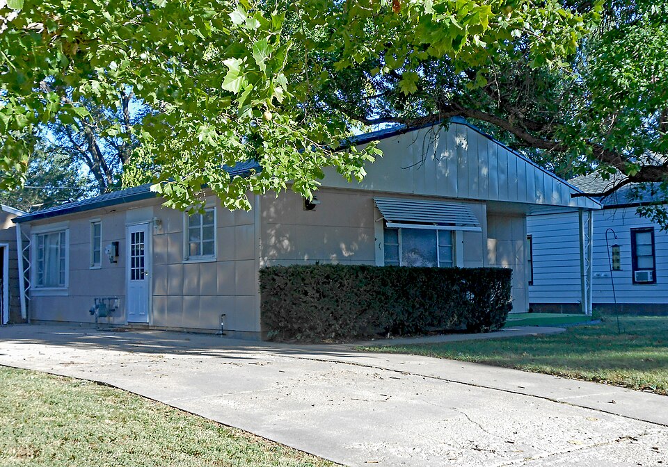
Built in 1949. Listed on the National Register of Historic Places in 2001.
One of 5 National Register listings published here for Smith County · listed in 2001 · category: Building · built in 1949.
Sources: the National Register database, National Park Service
Regional context, not property-specific evidence. The federal wildfire occurrence database lists 12 fires within 5 miles of Grimes House between 1999 and 2018, burning about 2,602 acres in total. None started naturally. None was recorded as arson. Distance is straight-line from the map coordinates, so a fire counted here may appear on a neighbouring settlement's page as well.
| Reported cause | Fires |
|---|---|
| Debris and open burning | 6 |
| Equipment and vehicle use | 3 |
| Missing data/not specified/undetermined | 3 |
The most recent of them, most recent first, with the day each was reported and the service that recorded it.
| Date | Cause | Size | Reported by | Name on the report |
|---|---|---|---|---|
| 12 September 2017 | Equipment and vehicle use | under an acre | Smith County | 2017063 |
| 22 July 2017 | Debris and open burning | under an acre | Smith County | 2017044 |
| 2 July 2018 | Equipment and vehicle use | under an acre | Kansas Forest Service | 2018037 |
| 19 June 2017 | Debris and open burning | under an acre | Smith County | 2017036 |
| 15 April 2017 | Debris and open burning | under an acre | Smith County | 2017028 |
| 10 April 2015 | Missing data/not specified/undetermined | under an acre | Kansas Forest Service | 2015028 |
| 7 March 2017 | Missing data/not specified/undetermined | under an acre | Smith County | 2017021 |
| 6 March 2017 | Missing data/not specified/undetermined | 1,100 acres | Smith County | 2017020 |
Regional context, not property-specific evidence. The National Weather Service names Smith Center, the town this property stands in, in 92 storm reports between 1993 and 2024: 53 hail, 26 thunderstorm wind, 5 tornado, 4 heavy rain. No death or injury is recorded in these reports. Each account below is quoted exactly as the forecast office filed it, from the NOAA Storm Events Database, and each date opens the federal record of that event.
| When | Event | Place named | Harm | What the report says |
|---|---|---|---|---|
| May 2024 | Hail | Smith Center | $500,000 | no account filed |
| May 2021 | Hail | Smith Center | $250,000 | Hail ranging anywhere from pea size to 2 inches in diameter was reported in Smith Center from a number of sources. |
| July 2004 | Hail | Smith Center | $100,000 | Hail ranging in size from pennies to golf balls pounded Smith Center for about 20 minutes. |
| September 2003 | Thunderstorm Wind | Smith Center | $100,000 | no account filed |
| September 1997 | Thunderstorm Wind | Smith Center | $80,000 | no account filed |
| August 2002 | Thunderstorm Wind | Smith Center | $75,000 | no account filed |
| June 1999 | Thunderstorm Wind | Smith Center | $65,000 | no account filed |
| May 2008 | Hail | Smith Center | $60,000 | Hail up to an inch and a half in diameter fell between 836 and 841 PM in the town of Smith Center. Damage from the hail was mainly to roofs, trees and a few windows. |
| May 2007 | Hail | Smith Center | $50,000 | no account filed |
| May 2007 | Thunderstorm Wind | Smith Center | $50,000 | no account filed |
| May 2002 | Thunderstorm Wind | Smith Center | $50,000 | no account filed |
| June 1999 | Thunderstorm Wind | Smith Center | $50,000 | no account filed |
| August 1998 | Hail | Smith Center | $50,000 | no account filed |
| June 1996 | Hail | Smith Center | $50,000 | no account filed |
| September 1993 | Hail | Smith Center | $50,000 | no account filed |
| May 1998 | Thunderstorm Wind | Smith Center | $45,000 | no account filed |
| September 1997 | Hail | Smith Center | $40,000 | no account filed |
| May 2002 | Hail | Smith Center | $30,000 | no account filed |
| July 2024 | Thunderstorm Wind | Smith Center | $25,000 | A wind gust of 62 MPH was measured by the Smith Center Airport AWOS. Social media reports noted tree damage across town, and that about 20 percent of the town lost power. |
| June 2016 | Thunderstorm Wind | Smith Center | $25,000 | Wind gusts estimated to be near 60 MPH accompanied quarter size hail. Tree limbs roughly 4 to 5 inches in diameter were downed. |
| May 2013 | Thunderstorm Wind | Smith Center | $25,000 | Wind gusts were estimated to be near 60 MPH. |
| May 2015 | Hail | Smith Center | $25,000 | no account filed |
| May 2007 | Thunderstorm Wind | Smith Center | $25,000 | no account filed |
| July 2004 | Thunderstorm Wind | Smith Center | $25,000 | no account filed |
| August 2003 | Thunderstorm Wind | Smith Center | $25,000 | no account filed |
| July 2001 | Thunderstorm Wind | Smith Center | $25,000 | no account filed |
| April 2015 | Tornado (EF0) | Smith Center | $20,000 | An EF-0 rated tornado occurred north-northeast of Smith Center, KS. Damage was mainly limited to minor roof damage on an outbuilding, and the path was most likely intermittent. Maximum wind speed was estimated at 75 mph. A combination of radar data, storm survey, photos, and personal accounts were used to determine the approximate location and time of the tornado. |
| May 2007 | Hail | Smith Center | $20,000 | no account filed |
| May 2006 | Flood | Smith Center | $20,000 | no account filed |
| June 2000 | Thunderstorm Wind | Smith Center | $15,000 | no account filed |
| June 2008 | Hail | Smith Center | $10,000 | Nickel to quarter size hail was reported. |
| May 2007 | Hail | Smith Center | $10,000 | no account filed |
| May 2007 | Hail | Smith Center | $10,000 | no account filed |
| May 2007 | Hail | Smith Center | $10,000 | no account filed |
| May 2006 | Hail | Smith Center | $10,000 | no account filed |
| May 2006 | Hail | Smith Center | $10,000 | no account filed |
| May 2006 | Thunderstorm Wind | Smith Center | $10,000 | no account filed |
| May 1998 | Thunderstorm Wind | Smith Center | $10,000 | no account filed |
| June 1998 | Hail | Smith Center | $10,000 | no account filed |
| July 1998 | Lightning | Smith Center | $10,000 | no account filed |
| May 1993 | Tornado (F0) | Smith Center | $5,000 | This tornado touched down over open county and remained over open country until it dissipated. |
| April 2008 | Hail | Smith Center | $5,000 | no account filed |
| May 2007 | Hail | Smith Center | $5,000 | no account filed |
| August 2007 | Flash Flood | Smith Center | $5,000 | no account filed |
| July 2001 | Hail | Smith Center | $5,000 | no account filed |
| July 1996 | Hail | Smith Center | $5,000 | no account filed |
| July 1994 | Thunderstorm Wind | Smith Center | $5,000 | no account filed |
| July 1994 | Thunderstorm Wind | Smith Center | $5,000 | no account filed |
| July 1994 | Thunderstorm Wind | Smith Center | $5,000 | no account filed |
| May 1994 | Hail | Smith Center | $5,000 | no account filed |
| August 1993 | Hail | Smith Center | $5,000 | no account filed |
| June 2023 | Thunderstorm Wind | Smith Center | $1,000 | Wind gusts estimated to be near 60 MPH caused minor tree damage in Smith Center. |
| May 1993 | Tornado (F0) | Smith Center | $500 | This tornado remained over open country until it dissipated. |
| June 1994 | Thunderstorm Wind | Smith Center | $500 | no account filed |
| April 1994 | Hail | Smith Center | $500 | no account filed |
| May 1994 | Hail | Smith Center | $500 | no account filed |
| May 1993 | Hail | Smith Center | $500 | no account filed |
| May 1994 | Hail | Smith Center | $50 | no account filed |
| June 2018 | Heavy Rain | Smith Center | - | Storm total rainfall amounts of 3 to 5 inches was common across the area. The highest totals included 4.30 inches at Smith Center, 4.20 inches six miles north-northeast of Bellaire, and 3.35 inches in Lebanon. |
| May 2017 | Heavy Rain | Smith Center | - | A 24 hour rainfall total of 3.63 inches was reported. |
No historic map-sheet match is published for this property yet. That does not mean no map exists. This record needs a coordinate-quality review before it can be joined to a sheet boundary. Browse the county's mapped places while that work is pending.
Other National Register properties close enough to walk or drive between, ordered by distance from this one. Both positions come from the same geocoding pass that matched these properties to their map sheets.
| Photograph | Property | Distance | Listed |
|---|---|---|---|
 | Martyn House | under 500 feet | 2001 |
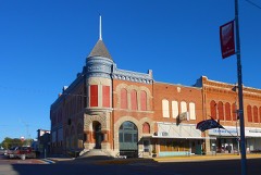 | First National Bank Building | 0.4 miles | 2006 |
| Athol Community Hall | 7.6 miles | 2025 |
| National Archives record | The nomination case file for reference 01000192 in Record Group 79. |
| Smith County | All 5 listed properties in this county. |