 Block
From the record
One of 13 National Register listings published here for Ford County · listed in 2004 · category: Building.
Sources: the National Register database, National Park Service
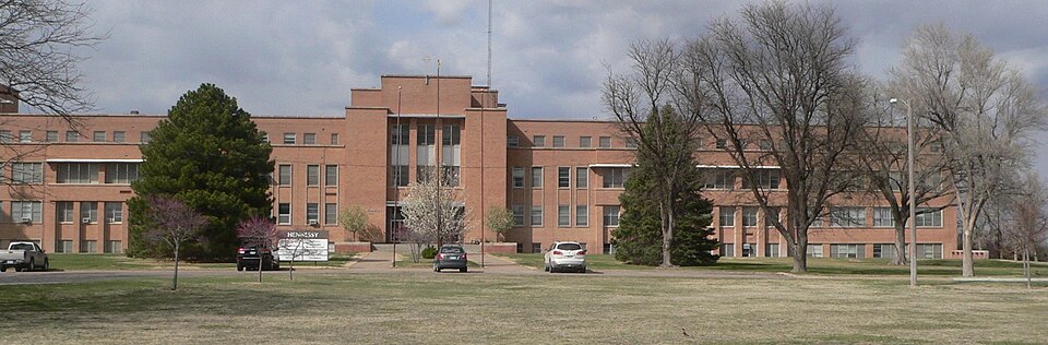
Listed on the National Register of Historic Places in 2004.
One of 13 National Register listings published here for Ford County · listed in 2004 · category: Building.
Sources: the National Register database, National Park Service
Regional context, not property-specific evidence. The federal wildfire occurrence database lists 140 fires within 5 miles of Hennessy Hall, Saint Mary of the Plains Campus between 2015 and 2020, burning about 2,761 acres in total. 4 started naturally. 5 were recorded as arson. Distance is straight-line from the map coordinates, so a fire counted here may appear on a neighbouring settlement's page as well.
| Reported cause | Fires |
|---|---|
| Missing data/not specified/undetermined | 68 |
| Debris and open burning | 31 |
| Equipment and vehicle use | 17 |
| Fireworks | 6 |
| Arson/incendiarism | 5 |
| Misuse of fire by a minor | 5 |
| Natural | 4 |
| Smoking | 2 |
| Power generation/transmission/distribution | 1 |
| Other causes | 1 |
The most recent of them, most recent first, with the day each was reported and the service that recorded it.
| Date | Cause | Size | Reported by | Name on the report |
|---|---|---|---|---|
| 6 September 2017 | Debris and open burning | 1.0 acres | Ford County | 1170287 |
| 6 September 2017 | Equipment and vehicle use | under an acre | Ford County | 1170285 |
| 24 September 2015 | Missing data/not specified/undetermined | under an acre | Kansas Forest Service | 1150161 |
| 20 September 2017 | Missing data/not specified/undetermined | under an acre | Ford County | 1423 |
| 4 August 2017 | Debris and open burning | under an acre | Ford County | 1170257 |
| 3 August 2017 | Equipment and vehicle use | 1.0 acres | Ford County | 1170256 |
| 28 August 2015 | Natural | 20 acres | Kansas Forest Service | 1150142 |
| 28 August 2015 | Equipment and vehicle use | under an acre | Kansas Forest Service | 1150146 |
Regional context, not property-specific evidence. The National Weather Service names Dodge City, the town this property stands in, in 589 storm reports between 1993 and 2025: 363 hail, 152 thunderstorm wind, 23 flash flood, 23 tornado. The reports record 8 injuries. Each account below is quoted exactly as the forecast office filed it, from the NOAA Storm Events Database, and each date opens the federal record of that event.
| When | Event | Place named | Harm | What the report says |
|---|---|---|---|---|
| August 2011 | Thunderstorm Wind | Dodge City | 6 hurt | A strong thunderstorm wind gusts blew down several large tents at the Dodge City Days Rodeo. Six persons were injured from flying debris or falling tents. |
| May 2016 | Tornado (EF2) | Dodge City | 1 hurt | During the initial stages of development, there was DOW data on this tornado. It intensified from 40 meters/second to 90 meters/second in a span of 21 seconds that lasted less than a minute at those velocities. This would have been enough to produce EF5 damage briefly, based on those velocities. As the tornado moved north into a housing addition just west of Dodge City, it showed multiple vortex characteristics and did EF2 Damage. One person was seriously hurt in a home that was heavily damaged. The tornado eventually went north-northwest and crossed into Hodgeman County at 18:12 CST as it turned northeast. As it crossed into Hodgeman County, it tossed a partially filled stock tank to the west, about a mile and an half from the original location in far northern Ford County. |
| May 1997 | Flood | Dodge City | 1 hurt | Thirteen year old youth was swept down a drainage ditch and carried 1.5 miles before being rescued. |
| May 1998 | Hail | Dodge City | $6,000,000 | Golfball to tennis ball size hail affected much of the Dodge City area. |
| July 2025 | Thunderstorm Wind | Dodge City | $5,000,000 | Two telephone poles blown down on Highway 283 near the Expo Center south of Dodge City. |
| April 1993 | Hail | Dodge City | $5,000,000 | A severe thunderstorm developed on the west side of Dodge City and slowly moved to the northeast. Golfball- to baseball-size hail occurred in the west and northwest areas of Dodge City from 1842 CST CST to 1855 CST. |
| September 1997 | Flash Flood | Dodge City | $2,000,000 | 7 to 10 inches of rain fell in about a four hour period causing extensive flash flooding across the southern portion of Dodge City. 200 homes and businesses were flooded. 1000 people were evacuated from their homes. |
| July 1994 | Hail | Dodge City | $500,000 | Several incidents of large hail were reported in and around Dodge City for a fifteen minute period starting at 1710CST. There was considerable damage to roofs and automobiles. |
| June 2009 | Thunderstorm Wind | Dodge City | $210,000 | A second downburst was recorded by radar and verified by ground survey south of Dodge City and south of another damage area. In this area, three pivot irrigation sprinklers were overturned, several power poles were broken and a 1/4 mile stretch of cedar trees were uprooted. The damage area was about 3/4 mile wide and 2 1/2 miles long. |
| May 1995 | Hail | Dodge City | $150,000 | no account filed |
| June 2009 | Thunderstorm Wind | Dodge City | $110,000 | A downburst was evident on radar and by ground survey south of Dodge City. One pivot irrigation sprinkler was rolled over and a grain bin was destroyed and carried about 3/4 of a mile. A 1/2 mile stretch of power poles were blown down also. |
| July 1995 | Thunderstorm Wind | Dodge City | $105,000 | Thunderstorm wind of near 100 mph caused extensive damage to fences. Once filling station canopy was downed and it landed on two occupied vehicles but there were no injuries. One roof was taken off a house with debris scattered several hundred yards. A large storage shed was heavily damaged with two motor homes inside receiving extensive damage. Debris was carried one-quarter of a mile. |
| August 2007 | Flash Flood | Dodge City | $100,000 | Vehicles floated down third street in Dodge City...one with occupants in it, however they were able to escape. Over three inches of rain were reported in town in about 1 1/2 hours. |
| May 1997 | Hail | Dodge City | $100,000 | no account filed |
| July 1996 | Thunderstorm Wind | Dodge City | $100,000 | no account filed |
| May 1994 | Thunderstorm Wind | Dodge City | $50,000 | Ford County dispatch reported power lines downed in west Dodge City. Wyandotte County Kansas City,24,1745CST,,,0,0,0,0,Hail (0.88) Hail up to the size of nickels was reported near the University of Kansas Medical Center in southeast Kansas City, Kansas. |
| July 1994 | Thunderstorm Wind | Dodge City | $50,000 | A weakening thunderstorm produced damage in north east Dodge City. Skylights were blown off houses, basketball goals and fences were downed from wind estimates to 75 knots (86 mph). |
| May 1997 | Thunderstorm Wind | Dodge City | $15,200 | Swath of 5 miles wide flattened crops, broke branches and destroyed fences. |
| May 1997 | Thunderstorm Wind | Dodge City | $15,000 | Sprinkler irrigation system damaged...tree limbs down...fence tore down. |
| May 1998 | Hail | Dodge City | $15,000 | no account filed |
| June 2002 | Thunderstorm Wind | Dodge City | $10,000 | A 50 x 50 foot roof was blown off an outbuilding. |
| July 2000 | Thunderstorm Wind | Dodge City | $10,000 | Roof partially blown off a house. Trees and two HAM towers blown down. |
| May 1997 | Hail | Dodge City | $10,000 | no account filed |
| July 2002 | Thunderstorm Wind | Dodge City | $7,500 | Seven power poles blown down in this microburst. In addition, 25 pieces of sheet metal were blown off a shed. |
| May 1997 | Thunderstorm Wind | Dodge City | $5,000 | Irrigation system overturned. |
| July 1994 | Hail | Dodge City | $5,000 | Another thunderstorm produced hail damage to roofs on the outskirts of Dodge City. |
| September 2024 | Thunderstorm Wind | Dodge City | $4,000 | A public report of 3-inch limbs and power poles broken. |
| April 2001 | Thunderstorm Wind | Dodge City | $4,000 | Large marquis sign blown down and a temporary greenhouse overturned onto a car in west Dodge. |
| April 2008 | Thunderstorm Wind | Dodge City | $3,000 | A shed roof was blown off and into two power poles knocking them down. The power lines were draped across the street and an a chain link fence. |
| July 1997 | Thunderstorm Wind | Dodge City | $2,500 | Four inch tree limbs blown down. |
| July 2002 | Thunderstorm Wind | Dodge City | $1,000 | A roof was blown off a shed. |
| July 1997 | Thunderstorm Wind | Dodge City | $1,000 | Four inch tree limbs blown down. |
| June 2009 | Hail | Dodge City | $750 | A window was broken in Dodge City at 1st street and Elm street. |
| May 1994 | Thunderstorm Wind | Dodge City | $500 | Large tree limbs downed and broken windows in house. |
| June 2008 | Hail | Dodge City | $500 | no account filed |
| July 2016 | Thunderstorm Wind | Dodge City | $450 | A window sash was blown out of the frame on the windward side of the house. There were also large tree branches broken. |
| May 2017 | Hail | Dodge City | $200 | Holes were punched through the vinyl guttering from the hail. |
| April 1998 | Thunderstorm Wind | Dodge City | $200 | The strong winds blew down 3 inch tree limbs and took paint off of a mobile home. |
| June 2025 | Hail | Dodge City | - | A photo of approximately quarter sized hail was fielded through social media. |
| June 2025 | Hail | Dodge City | - | A report of nickel sized hail was recieved. |
| August 2025 | Flash Flood | Dodge City | - | The public reported street flooding. |
| August 2025 | Flash Flood | Dodge City | - | The Emergency Manager reports several streets in Dodge City were covered with water. |
| August 2025 | Thunderstorm Wind | Dodge City | - | Report was from a personal weather station KKSDODGE27 weather station. |
| August 2025 | Thunderstorm Wind | Dodge City | - | Report was from AWN weather station 3 WNW Dodge City. |
| August 2025 | Thunderstorm Wind | Dodge City | - | Report was from the personal weather station KKSDODGE59. |
| July 2025 | Thunderstorm Wind | Dodge City | - | A roof was blown off a trailer house located on the 2700 block of East Trail Street. |
| July 2025 | Thunderstorm Wind | Dodge City | - | Tree were blown down across the road. |
| August 2025 | Thunderstorm Wind | Dodge City | - | An Emergency Manager reported shingles were blown off roof of residence. |
| June 2024 | Flash Flood | Dodge City | - | Numerous streets with water over the roads, especially low spot intersections in town. |
| June 2024 | Flash Flood | Dodge City | - | Water rescue at underpass road. |
| June 2024 | Thunderstorm Wind | Dodge City | - | Picture of tree uprooted. |
| June 2024 | Flash Flood | Dodge City | - | Water over the road reported by fire department. |
| June 2024 | Flash Flood | Dodge City | - | Public video of water over roads. |
| September 2023 | Thunderstorm Wind | Dodge City | - | Three inch limbs and power poles broken. |
| June 2023 | Thunderstorm Wind | Dodge City | - | Large tree fell on 3rd ave damaging a couple of vehicles. |
| June 2023 | Thunderstorm Wind | Dodge City | - | Tree limbs down on north side of town. |
| July 2023 | Thunderstorm Wind | Dodge City | - | Strong winds. |
| July 2023 | Heavy Rain | Dodge City | - | Heavy Rain. |
| May 2022 | Thunderstorm Wind | Dodge City | - | Portions of a tin roof on a small cabin was removed by high wind. |
| May 2022 | Thunderstorm Wind | Dodge City | - | Part of the roof of the Dodge House hotel was blown off. Numerous tree limbs were blown down across the city. |
No historic map-sheet match is published for this property yet. That does not mean no map exists. This record needs a coordinate-quality review before it can be joined to a sheet boundary. Browse the county's mapped places while that work is pending.
Other National Register properties close enough to walk or drive between, ordered by distance from this one. Both positions come from the same geocoding pass that matched these properties to their map sheets.
| Photograph | Property | Distance | Listed |
|---|---|---|---|
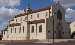 | Sacred Heart Cathedral | 1.4 miles | 1983 |
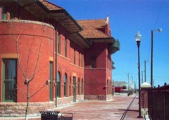 | Atchison, Topeka and Santa Fe Railway Depot | 1.5 miles | 2000 |
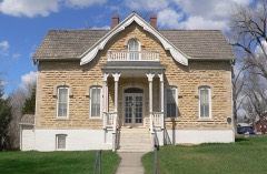 | Mueller-Schmidt House | 1.5 miles | 1972 |
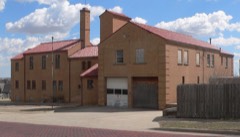 | Dodge City Municipal Building | 1.6 miles | 2013 |
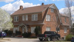 | Burr House | 1.6 miles | 2008 |
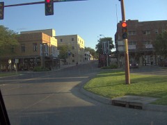 | Dodge City Downtown Historic District | 1.6 miles | 2009 |
| National Archives record | The nomination case file for reference 03001396 in Record Group 79. |
| Ford County | All 13 listed properties in this county. |