 Block
From the record
13 National Register listings published here, 1 of them a National Historic Landmark.
Sources: the National Register database, National Park Service
48 topographic sheets cover 17 settlements here, and 13 properties are on the National Register of Historic Places.
13 National Register listings published here, 1 of them a National Historic Landmark.
Sources: the National Register database, National Park Service
Every property in this county listed on the National Register of Historic Places, with the year it was listed and the federal nomination document.
| Photograph | Property | Type | Listed | Reference |
|---|---|---|---|---|
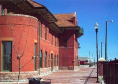 | Atchison, Topeka and Santa Fe Railway Depot | building | 2000 | 00000791 |
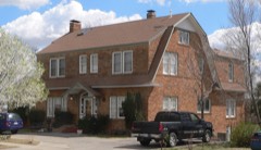 | Burr House | building | 2008 | 07001481 |
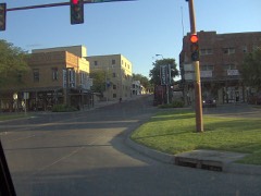 | Dodge City Downtown Historic District | district | 2009 | 09000875 |
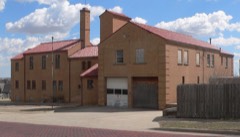 | Dodge City Municipal Building | building | 2013 | 13000217 |
 | Dodge City Public Library | building | 1979 | 79000954 |
| Fort Dodge - Junior Officers' Quarters | building | 2024 | 100010625 | |
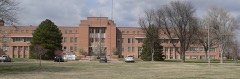 | Hennessy Hall, Saint Mary of the Plains Campus | building | 2004 | 03001396 |
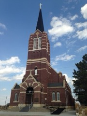 | Immaculate Heart of Mary Catholic Church | building | 1989 | 88003087 |
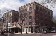 | Lora Locke Hotel | building | 1985 | 85000012 |
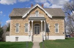 | Mueller-Schmidt House | building | 1972 | 72000499 |
 | Sacred Heart Cathedral | building | 1983 | 83000426 |
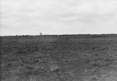 | Santa Fe Trail Ruts | site | 1966 | 66000343 |
| Santa Fe Trail-Ford County Segment 2 | site | 2013 | 13000488 |
Every wildfire the federal occurrence database records inside this county: 205 of them, burning about 4,415 acres. 5 started naturally and 7 were recorded as arson. Each settlement page carries the fires within five miles of it.
| Reported cause | Fires |
|---|---|
| Missing data/not specified/undetermined | 94 |
| Debris and open burning | 46 |
| Equipment and vehicle use | 35 |
| Arson/incendiarism | 7 |
| Fireworks | 6 |
| Natural | 5 |
| Misuse of fire by a minor | 5 |
| Power generation/transmission/distribution | 3 |
| Smoking | 3 |
| Other causes | 1 |
The five largest, by the area the report gives. None of them was recorded as arson.
| Date | Cause | Size | Reported by | Name on the report |
|---|---|---|---|---|
| 6 March 2017 | Missing data/not specified/undetermined | 2,326 acres | Ford County | 1170091 |
| 17 February 2017 | Missing data/not specified/undetermined | 800 acres | Ford County | EAGLE ROAD |
| 14 March 2015 | Debris and open burning | 279 acres | Kansas Forest Service | 1150041 |
| 17 February 2017 | Equipment and vehicle use | 250 acres | Ford County | 1170042 |
| 21 March 2015 | Missing data/not specified/undetermined | 200 acres | Kansas Forest Service | 1150048 |
| 6 March 2017 | Missing data/not specified/undetermined | 100 acres | Ford County | 1170093 |
| 24 February 2017 | Debris and open burning | 80 acres | Ford County | 1170063 |
| 11 April 2017 | Debris and open burning | 65 acres | Ford County | 1170166 |
Every settlement page carries the fires within five miles of it - see the settlement index below.
The NOAA Storm Events Database holds 1,773 reports for this county, causing no deaths, 13 injuries and about $27,202,910 in recorded property damage. Each settlement page carries the reports that name it.
| Kind of event | Reports |
|---|---|
| Hail | 980 |
| Thunderstorm Wind | 530 |
| Tornado | 115 |
| Heavy Rain | 82 |
| Flash Flood | 41 |
| Flood | 17 |
| Funnel Cloud | 6 |
| Strong Wind | 2 |
The most serious of them, by death, then injury, then recorded damage. The accounts are quoted exactly as the forecast office filed them.
| When | Event | Place named | Harm | What the report says |
|---|---|---|---|---|
| August 2011 | Thunderstorm Wind | Dodge City | 6 hurt | A strong thunderstorm wind gusts blew down several large tents at the Dodge City Days Rodeo. Six persons were injured from flying debris or falling tents. |
| July 2006 | Thunderstorm Wind | Spearville | 1 hurt, $120,000 | A house was destroyed by a microburst estimated to be around 120 mph. Also, a grain bin and cattle shed were destroyed in the area. A cemetery across the street of the house received heavy damage to trees and tombstones. The injury was to a male, approximately 45 years of age, and occurred when a door blew off the hinges and into the living area striking the victim. All other occupants were heading towards the basement at the time. The injuries were minor (stitches required). |
| August 2018 | Flood | Howell | 1 hurt, $5,000 | Runoff from heavy rains eventually crossed Saddle Road. A vehicle attempted to drive through but it ultimately stalled and was washed over the shoulder and flipped upside down in the flooded draw. The driver was rescued but suffered minor injuries. |
| May 2016 | Tornado (EF3) | Bloom | 1 hurt | Family took shelter in an underground unit and was able to survive. The modular home was completely destroyed. Two vehicles were thrown about 150 yards. Another truck was carried, rolled, thrown with the bed located 1200 yards from the original location. The two occupants in the home destroyed were in a reinforced concrete bunker but one received minor injuries when a piece of pipe was driven into the wall breaking out concrete. The steal rebar prevented the chunk of pipe from penetrating into the individual. Visually at one point this tornado appeared to be strong enough to cause EF4 damage. |
| May 2016 | Tornado (EF2) | Dodge City | 1 hurt | During the initial stages of development, there was DOW data on this tornado. It intensified from 40 meters/second to 90 meters/second in a span of 21 seconds that lasted less than a minute at those velocities. This would have been enough to produce EF5 damage briefly, based on those velocities. As the tornado moved north into a housing addition just west of Dodge City, it showed multiple vortex characteristics and did EF2 Damage. One person was seriously hurt in a home that was heavily damaged. The tornado eventually went north-northwest and crossed into Hodgeman County at 18:12 CST as it turned northeast. As it crossed into Hodgeman County, it tossed a partially filled stock tank to the west, about a mile and an half from the original location in far northern Ford County. |
| June 2009 | Hail | Wilroads Gardens | 1 hurt | A male on a motorcycle was injured by the large hail and was completely bruised. He said he would have been killed without having a helmet. |
| May 1997 | Flood | Dodge City | 1 hurt | Thirteen year old youth was swept down a drainage ditch and carried 1.5 miles before being rescued. |
| August 1989 | Thunderstorm Wind | not stated | 1 hurt | no account filed |
| May 1998 | Hail | Dodge City | $6,000,000 | Golfball to tennis ball size hail affected much of the Dodge City area. |
| July 2025 | Thunderstorm Wind | Dodge City | $5,000,000 | Two telephone poles blown down on Highway 283 near the Expo Center south of Dodge City. |
| April 1993 | Hail | Dodge City | $5,000,000 | A severe thunderstorm developed on the west side of Dodge City and slowly moved to the northeast. Golfball- to baseball-size hail occurred in the west and northwest areas of Dodge City from 1842 CST CST to 1855 CST. |
| July 2025 | Hail | Howell | $2,500,000 | Most of the hail was golf ball to 2-inch diameter, but largest tennis ball size. Two vehicles suffered windshield damage, a camper received a busted skylight, as well as house windows broken. |
| September 1997 | Flash Flood | Dodge City | $2,000,000 | 7 to 10 inches of rain fell in about a four hour period causing extensive flash flooding across the southern portion of Dodge City. 200 homes and businesses were flooded. 1000 people were evacuated from their homes. |
| August 2022 | Thunderstorm Wind | Bloom | $500,000 | Several large grain bins were destroyed and there was a stretch of power poles broken over by the high wind. |
| May 2019 | Tornado (EF3) | Bloom | $500,000 | The tornado moved out of Clark County at 1952 LST. One farm that received EF3 damage was unoccupied at the time as the residents left their safe spot (basement) and drove 1 1/2 miles east. They left the basement, that did not have any debris in it, on the advice of a storm chaser that was following the tornado. They (Grandparents and three grand children) were very fortunate that they were not injured, if not worse. |
| July 1994 | Hail | Dodge City | $500,000 | Several incidents of large hail were reported in and around Dodge City for a fifteen minute period starting at 1710CST. There was considerable damage to roofs and automobiles. |
| August 1993 | Thunderstorm Wind | Bucklin | $500,000 | An irrigation system and two farm sheds were destroyed. |
| April 2001 | Tornado (F2) | Kingsdown | $425,000 | Eight pivot sprinklers were destroyed along with a barn and silo. |
| May 1978 | Tornado (F2) | not stated | $250,000 | no account filed |
| April 1976 | Tornado (F1) | not stated | $250,000 | no account filed |
| June 1967 | Tornado (F1) | not stated | $250,000 | no account filed |
| June 1955 | Tornado (F4) | not stated | $250,000 | no account filed |
| February 2007 | Tornado (EF1) | Bloom | $225,000 | The second tornado to form started 6.3 miles northwest of Fowler at 1011 PM and traveled a total of 17 miles dissipating at 1040 PM 7 miles southwest of the Dodge City Post Office. It did EF1 damage to five pivot irrigation sprinklers, trees and some outbuildings...in addition to moving a 3000 gallon tank about 1/2 of a mile. |
| June 2009 | Thunderstorm Wind | Dodge City | $210,000 | A second downburst was recorded by radar and verified by ground survey south of Dodge City and south of another damage area. In this area, three pivot irrigation sprinklers were overturned, several power poles were broken and a 1/4 mile stretch of cedar trees were uprooted. The damage area was about 3/4 mile wide and 2 1/2 miles long. |
| April 2001 | Tornado (F2) | Howell | $190,000 | A mobile home was completely demolished. Ironically, the occupants were not at home, only because the school activity bus was late. Another trailer nearby received moderate damage. Two pivot sprinklers were destroyed and there was other scattered minor damage along the path of the tornado. |
| April 2001 | Tornado (F1) | Ford | $165,000 | Three pivot sprinklers were destroyed along with a grain bin. |
| June 2009 | Tornado (EF1) | Wilroads Gardens | $150,000 | This tornado struck two pivot irrigation sprinklers and and also destroyed a shed. |
| May 2002 | Tornado (F2) | Windthorst | $150,000 | This first tornado of the afternoon came close to striking a farm that was plowing his field. His tractor was running low on fuel and just made it back to shelter as irrigation pipe was flying by. Several pivots were destroyed. |
| May 1995 | Hail | Dodge City | $150,000 | no account filed |
| July 1995 | Tornado (F2) | Bucklin | $150,000 | no account filed |
| May 2008 | Tornado (EF1) | Bloom | $145,000 | EF1 damage was done to two pivot irrigation sprinklers and a grain bin. |
| October 2021 | Tornado (EF0) | Spearville | $110,000 | This QLCS tornado moved into Hodgeman County at 21:42 CST. |
| June 2009 | Thunderstorm Wind | Dodge City | $110,000 | A downburst was evident on radar and by ground survey south of Dodge City. One pivot irrigation sprinkler was rolled over and a grain bin was destroyed and carried about 3/4 of a mile. A 1/2 mile stretch of power poles were blown down also. |
| July 1995 | Thunderstorm Wind | Dodge City | $105,000 | Thunderstorm wind of near 100 mph caused extensive damage to fences. Once filling station canopy was downed and it landed on two occupied vehicles but there were no injuries. One roof was taken off a house with debris scattered several hundred yards. A large storage shed was heavily damaged with two motor homes inside receiving extensive damage. Debris was carried one-quarter of a mile. |
| August 2007 | Flash Flood | Dodge City | $100,000 | Vehicles floated down third street in Dodge City...one with occupants in it, however they were able to escape. Over three inches of rain were reported in town in about 1 1/2 hours. |
| August 2003 | Thunderstorm Wind | Bucklin | $100,000 | Two pivot sprinklers were destroyed. They were full of water at the time. |
| August 2003 | Thunderstorm Wind | Ford | $100,000 | Two pivot sprinklers were blown over. They were not operating at the time. |
| May 2001 | Thunderstorm Wind | Ft Dodge | $100,000 | Several trees uprooted and crashed into buildings. Many large tree limbs down. One pivot irrigation sprinkler destroyed 1 e of Fort Dodge. |
| May 1997 | Hail | Dodge City | $100,000 | no account filed |
| July 1996 | Thunderstorm Wind | Dodge City | $100,000 | no account filed |
| June 2009 | Tornado (EF1) | Wilroads Gardens | $65,000 | This tornado overturned a pivot irrigation sprinkler and dissipated as another larger tornado was forming. |
| July 2009 | Thunderstorm Wind | Bloom | $60,000 | A pivot irrigation sprinkler was overturned by the high wind. |
| May 2018 | Thunderstorm Wind | Wilroads | $50,000 | A center pivot irrigation sprinkler was overturned by the high wind. |
| May 1994 | Thunderstorm Wind | Dodge City | $50,000 | Ford County dispatch reported power lines downed in west Dodge City. Wyandotte County Kansas City,24,1745CST,,,0,0,0,0,Hail (0.88) Hail up to the size of nickels was reported near the University of Kansas Medical Center in southeast Kansas City, Kansas. |
| July 1994 | Thunderstorm Wind | Dodge City | $50,000 | A weakening thunderstorm produced damage in north east Dodge City. Skylights were blown off houses, basketball goals and fences were downed from wind estimates to 75 knots (86 mph). |
| June 2009 | Hail | (Ddc)Dodge City Arpt | $35,000 | There were numerous hail stones the size of golf balls with a few 2 stones reported at the airport and National Weather Service office. There was severe damage to vehicles in the parking lot. |
| June 2009 | Hail | (Ddc)Dodge City Arpt | $25,000 | The hail fell at the NWS office. |
| September 2009 | Flood | Bloom | $25,000 | Rainfall of 5 to 8 inches in about 4 hours produced widespread farmland flooding. Some county roads were submerged after water flowed out of the fields. |
| June 2002 | Thunderstorm Wind | Dodge City Arpt | $25,000 | Off duty NWS employee stepped outside the office to witness an airport hanger being ripped off by high wind. The remnants of the hanger landed 150 yards from the employee. |
| September 1973 | Tornado (F3) | not stated | $25,000 | no account filed |
| May 1965 | Tornado | not stated | $25,000 | no account filed |
| May 1955 | Tornado (F0) | not stated | $25,000 | no account filed |
| August 2002 | Thunderstorm Wind | Spearville | $18,000 | A two mile stretch of power poles were blown down (36 of them). |
| May 1997 | Thunderstorm Wind | Dodge City | $15,200 | Swath of 5 miles wide flattened crops, broke branches and destroyed fences. |
| June 2017 | Thunderstorm Wind | Spearville | $15,000 | A downburst produced an approximate 70 MPH gust that damaged the roof of the grade school. Additionally, a nearby small shed was overturned and a trampoline was tossed. Wind direction was southeast to northwest. |
| May 1997 | Thunderstorm Wind | Dodge City | $15,000 | Sprinkler irrigation system damaged...tree limbs down...fence tore down. |
| May 1998 | Hail | Dodge City | $15,000 | no account filed |
| May 2010 | Tornado (EF0) | Wright | $10,000 | This weak tornado traveled quickly east/northeast and damaged a roof, trees, grain bin, feed bunk and flipped an implement. |
| May 2008 | Thunderstorm Wind | Wright | $10,000 | Part of a roof was blown off and several fences were blown down. Shingles were blown off roofs and a pretty good sized tree was uprooted. Four power poles were blown over also. |
| May 2007 | Flood | Bucklin | $10,000 | Water over Outlaw Road. It was barely passable. |
Named settlements recorded in the Geographic Names Information System, each with the topographic sheets covering it. Villages, hamlets and abandoned places alike. Each is shown with the nearest named watercourse or landform and the survey quadrangle it falls on.
Dodge City city · 67801 · Near Boot Hill · South Dodge quadrangle
14 sheets, 1892 to 1985