 Block
From the record
One of 7 National Register listings published here for Ness County · listed in 2009 · category: Building.
Sources: the National Register database, National Park Service
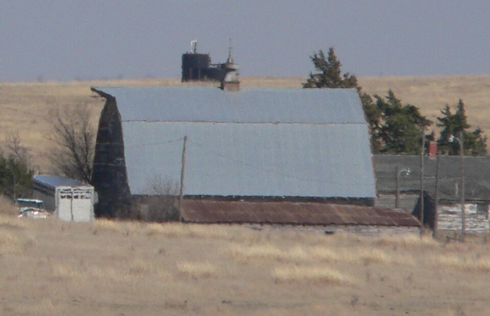
Listed on the National Register of Historic Places in 2009.
One of 7 National Register listings published here for Ness County · listed in 2009 · category: Building.
Sources: the National Register database, National Park Service
Regional context, not property-specific evidence. The federal wildfire occurrence database lists 2 fires within 5 miles of Thornburg Barn in 2015, burning about 10 acres in total. None started naturally. None was recorded as arson. Distance is straight-line from the map coordinates, so a fire counted here may appear on a neighbouring settlement's page as well.
| Reported cause | Fires |
|---|---|
| Equipment and vehicle use | 2 |
The most recent of them, most recent first, with the day each was reported and the service that recorded it.
| Date | Cause | Size | Reported by | Name on the report |
|---|---|---|---|---|
| 19 September 2015 | Equipment and vehicle use | 10 acres | Kansas Forest Service | 15U0919 |
| 14 October 2015 | Equipment and vehicle use | under an acre | Kansas Forest Service | 15U1014 |
Regional context, not property-specific evidence. The National Weather Service names Utica, the town this property stands in, in 82 storm reports between 1993 and 2025: 59 hail, 15 thunderstorm wind, 5 heavy rain, 2 tornado. No death or injury is recorded in these reports. Each account below is quoted exactly as the forecast office filed it, from the NOAA Storm Events Database, and each date opens the federal record of that event.
| When | Event | Place named | Harm | What the report says |
|---|---|---|---|---|
| July 1994 | Thunderstorm Wind | Utica | $50,000 | Ness County Sheriff's Office reported barn blown down and power poles down from thunderstorm winds. |
| September 2025 | Hail | Utica | - | A public report of 1 inch hail. |
| July 2018 | Heavy Rain | Utica | - | Rainfall of 4.50 inches was observed. Most of the rain fell during the late evening hours. |
| May 2018 | Thunderstorm Wind | Utica | - | Winds were estimated to be 60 MPH. |
| June 2017 | Thunderstorm Wind | Utica | - | A large tree limb was broken by the high wind. |
| June 2016 | Thunderstorm Wind | Utica | - | Numerous tree branches of 2 to 4 inches were broken by the high wind. |
| May 2015 | Thunderstorm Wind | Utica | - | Winds were estimated to be at least 60 MPH. |
| June 2014 | Heavy Rain | Utica | - | Rainfall of 3.45 inches was reported at Utica. |
| June 2014 | Thunderstorm Wind | Utica | - | A few small tree limbs were blown down by the 60 MPH wind. |
| May 2013 | Hail | Utica | - | There was also 1.05 of rainfall. |
| August 2013 | Flash Flood | Utica | - | Water was reported over a road. |
| September 2012 | Hail | Utica | - | Most of the hail was between ping pong ball and golf ball size with just a few between hen egg and tennis ball size. |
| July 2011 | Thunderstorm Wind | Utica | - | Winds were estimated to be at least 70 MPH. The roof off a barn was removed by the high wind and most outbuildings were damaged. |
| June 2010 | Hail | Utica | - | Sporadic golf ball sized hail was reported. |
| June 2010 | Hail | Utica | - | Smaller hail fell for about 30 hours from 530 PM until 830 PM. |
| July 2009 | Heavy Rain | Utica | - | Heavy rainfall of 4.00 fell in an hours time. |
| July 2009 | Hail | Utica | - | The hail fell for 20 minutes. |
| July 2009 | Hail | Utica | - | The hail ranged in size from pea to quarter sized. |
| July 2009 | Hail | Utica | - | Quarter sized hail fell for 20 minutes. |
| July 2009 | Tornado (EF0) | Utica | - | This tornado formed as the mesocyclone occluded but did not strike anything to cause damage. |
| May 2008 | Thunderstorm Wind | Utica | - | A cattle shed and lean two were destroyed by the high wind. |
| May 2008 | Tornado (EF1) | Utica | - | The tornado curved back to the northwest before dissipating. It caused EF1 damage at a farm where a 40 by 60 foot shed was destroyed. The tornado also took down fencing. |
| September 2007 | Thunderstorm Wind | Utica | - | One to 1 1/2 inch diameter tree limbs were blown down. |
| June 2007 | Heavy Rain | Utica | - | Rainfall of 3.34 inches was reported during the afternoon. |
| July 2007 | Heavy Rain | Utica | - | Rainfall of 3.30 inches fell overnight. |
| June 2004 | Thunderstorm Wind | Utica | - | Several six inch diameter tree limbs were blown down |
| June 2002 | Thunderstorm Wind | Utica | - | Two to three inch diameter tree branches were broken by the wind. |
| July 2001 | Thunderstorm Wind | Utica | - | Two inch tree branches broken. |
| July 1998 | Thunderstorm Wind | Utica | - | Five inch tree limbs blown down. |
| August 2021 | Hail | Utica | - | no account filed |
| May 2019 | Hail | Utica | - | no account filed |
| May 2017 | Hail | Utica | - | no account filed |
| April 2017 | Hail | Utica | - | no account filed |
| June 2016 | Hail | Utica | - | no account filed |
| June 2014 | Hail | Utica | - | no account filed |
| May 2013 | Hail | Utica | - | no account filed |
| May 2013 | Hail | Utica | - | no account filed |
| May 2013 | Hail | Utica | - | no account filed |
| May 2013 | Hail | Utica | - | no account filed |
| May 2013 | Hail | Utica | - | no account filed |
| May 2013 | Hail | Utica | - | no account filed |
| September 2012 | Hail | Utica | - | no account filed |
| September 2012 | Hail | Utica | - | no account filed |
| May 2011 | Hail | Utica | - | no account filed |
| June 2010 | Hail | Utica | - | no account filed |
| July 2009 | Hail | Utica | - | no account filed |
| July 2009 | Hail | Utica | - | no account filed |
| May 2008 | Hail | Utica | - | no account filed |
| June 2007 | Hail | Utica | - | no account filed |
| August 2007 | Hail | Utica | - | no account filed |
| August 2007 | Hail | Utica | - | no account filed |
| May 2007 | Hail | Utica | - | no account filed |
| June 2005 | Thunderstorm Wind | Utica | - | no account filed |
| June 2005 | Hail | Utica | - | no account filed |
| July 2005 | Hail | Utica | - | no account filed |
| June 2004 | Hail | Utica | - | no account filed |
| August 2004 | Hail | Utica | - | no account filed |
| August 2004 | Hail | Utica | - | no account filed |
| May 2003 | Hail | Utica | - | no account filed |
| May 2003 | Hail | Utica | - | no account filed |
No historic map-sheet match is published for this property yet. That does not mean no map exists. This record needs a coordinate-quality review before it can be joined to a sheet boundary. Browse the county's mapped places while that work is pending.
| National Archives record | The nomination case file for reference 09000192 in Record Group 79. |
| Ness County | All 7 listed properties in this county. |