 Block
From the record
One of 118 National Register listings published here for Douglas County · listed in 2024 · category: Building · built in 1921, Collegiate Gothic.
Sources: the National Register database, National Park Service · the Wikipedia article
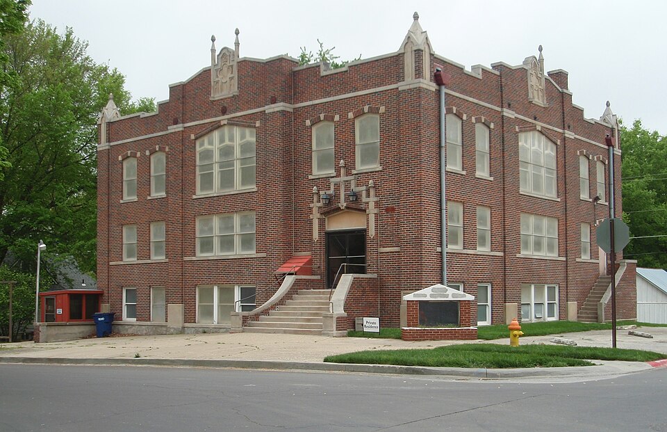
Built in 1921 (Collegiate Gothic). Listed on the National Register of Historic Places in 2024.
One of 118 National Register listings published here for Douglas County · listed in 2024 · category: Building · built in 1921, Collegiate Gothic.
Sources: the National Register database, National Park Service · the Wikipedia article
Regional context, not property-specific evidence. The federal wildfire occurrence database lists 88 fires within 5 miles of First Methodist Church of Eudora between 2015 and 2020, burning about 573 acres in total. None started naturally. 5 were recorded as arson. Distance is straight-line from the map coordinates, so a fire counted here may appear on a neighbouring settlement's page as well.
| Reported cause | Fires |
|---|---|
| Debris and open burning | 49 |
| Missing data/not specified/undetermined | 21 |
| Equipment and vehicle use | 6 |
| Smoking | 6 |
| Arson/incendiarism | 5 |
| Fireworks | 1 |
The most recent of them, most recent first, with the day each was reported and the service that recorded it.
| Date | Cause | Size | Reported by | Name on the report |
|---|---|---|---|---|
| 4 August 2018 | Missing data/not specified/undetermined | under an acre | Kansas Forest Service | 2160006 |
| 4 July 2018 | Fireworks | under an acre | Kansas Forest Service | 337 |
| 4 July 2015 | Smoking | under an acre | Kansas Forest Service | 359 |
| 3 July 2018 | Equipment and vehicle use | under an acre | Kansas Forest Service | 6590 |
| 14 June 2018 | Missing data/not specified/undetermined | 1.0 acres | Kansas Forest Service | 111 |
| 5 May 2018 | Missing data/not specified/undetermined | under an acre | Kansas Forest Service | 1250106 |
| 8 April 2020 | Missing data/not specified/undetermined | 1.0 acres | Kansas Forest Service | not named |
| 5 April 2018 | Debris and open burning | 5.0 acres | Kansas Forest Service | 75 |
Regional context, not property-specific evidence. The National Weather Service names Eudora, the town this property stands in, in 63 storm reports between 1993 and 2026: 31 hail, 25 thunderstorm wind, 3 flash flood, 2 lightning. No death or injury is recorded in these reports. Each account below is quoted exactly as the forecast office filed it, from the NOAA Storm Events Database, and each date opens the federal record of that event.
| When | Event | Place named | Harm | What the report says |
|---|---|---|---|---|
| June 1996 | Lightning | Eudora | $50,000 | no account filed |
| September 2001 | Thunderstorm Wind | Eudora | $8,000 | Strong winds blew the roofs off of two houses. The roof of a nursing home was severely damaged. |
| March 1993 | Thunderstorm Wind | Eudora | $5,000 | Winds estimated at 60 mph moved through the Eudora area producing only minor damage to roofs and trees. |
| May 2000 | Lightning | Eudora | $1,000 | Lightning struck a transformer and knocked out power to a Kwik Shop doing minor damage. |
| March 2026 | Hail | Eudora | - | WFO EAX relayed report of nickel size hail in Eudora from an off-duty AOMC employee. |
| October 2024 | Thunderstorm Wind | Eudora | - | Estimated 60 mph gusts. |
| July 2024 | Thunderstorm Wind | Eudora | - | Social media report of a large, two foot diameter tree uprooted. Winds estimated between 70 and 80 mph. |
| July 2024 | Thunderstorm Wind | Eudora | - | Multiple trees blown down. Time estimated via radar. |
| July 2024 | Thunderstorm Wind | Eudora | - | Eudora AWOS recorded 78 mph gust. |
| June 2021 | Flash Flood | Eudora | - | The northbound lane of E2200 Road partially covered with water and ditches are full on both sides of the road. |
| July 2021 | Thunderstorm Wind | Eudora | - | Delayed report of 60 mph wind gust. |
| December 2021 | Thunderstorm Wind | Eudora | - | Large tree 1 foot in diameter snapped. |
| May 2020 | Thunderstorm Wind | Eudora | - | Siding torn off a building. Time estimated based on radar. |
| May 2019 | Thunderstorm Wind | Eudora | - | Powerlines were reported down. |
| May 2019 | Thunderstorm Wind | Eudora | - | Estimated wind gust. |
| May 2019 | Thunderstorm Wind | Eudora | - | Picture of a 4-8 inch diameter tree limb down. |
| May 2019 | Flash Flood | Eudora | - | Multiple roadways are flooded. |
| May 2019 | Thunderstorm Wind | Eudora | - | Powerlines were reported down. |
| June 2018 | Thunderstorm Wind | Eudora | - | Estimated wind gust. |
| June 2018 | Thunderstorm Wind | Eudora | - | Delayed report received via twitter. Power lines appeared to be bent over and tree branches were snapped. The size of the branches is unknown. |
| June 2018 | Thunderstorm Wind | Eudora | - | Delayed report of a 6 inch diameter limb snapped. |
| July 2016 | Thunderstorm Wind | Eudora | - | Powerlines reported down in Eudora. |
| August 2015 | Thunderstorm Wind | Eudora | - | Tree damage including large limbs in Eudora. |
| July 2015 | Tornado (EF1) | Eudora | - | Damage assessment survey found a path of sporadic tree damage extending approximately 6 miles along a line from Eudora to around 3 miles southwest of De Soto in Johnson County. This tornado did cross from Douglas County Kansas which is NWS Topeka's area into Johnson County Kansas which is NWS Kansas City's service area. EF1 tree damage was noted along the path. Width of damage estimated 250 yards maximum while majority of tornado damage path was more narrow on order of 50 to 100 yards. |
| September 2013 | Thunderstorm Wind | Eudora | - | Wind gust measured on the southwest side of Eudora. No damage reported. |
| July 2012 | Thunderstorm Wind | Eudora | - | Law enforcement reported a 60 mph wind gust in Eudora. |
| June 2011 | Thunderstorm Wind | Eudora | - | A law enforcement officer reported trees down along E 2400 Road. |
| June 2009 | Thunderstorm Wind | Eudora | - | Wind blew 2 to 3 inch tree limbs down. |
| September 2008 | Tornado (EF1) | Eudora | - | The tornado touched down in a field and moved northeast damaging two residences and one farm. The tornado was on the ground for 1 minute and 26 seconds. The tornado produced EF-1 damage at both residences, at the first residence a garage and small barn were both destroyed. A cedar tree was snapped off at its base and a power pole was snapped off mid-way. At the second residence an outbuilding was destroyed. A large barn sustained significant roofing damage. A barn with a cinderblock wall was destroyed. There was damage to the outside of the residence, siding and shingle damage primairly. The tornado lifted over a field a short distance from the second residence. |
| June 2007 | Thunderstorm Wind | Eudora | - | One and half foot diamter tree snapped. Power lines also reported to be down. |
| October 2007 | Flash Flood | Eudora | - | Law enforcement relayed a report that water was flowing over N. 1500 Road near E. 2000 Rd. A spotter in the town of Eudora reported 4.00 of rain so far on the 17th. |
| May 2000 | Thunderstorm Wind | Eudora | - | Strong winds took trees and power lines down in Eudora. |
| May 2012 | Hail | Eudora | - | no account filed |
| May 2012 | Hail | Eudora | - | no account filed |
| May 2012 | Hail | Eudora | - | no account filed |
| July 2012 | Hail | Eudora | - | no account filed |
| July 2012 | Hail | Eudora | - | no account filed |
| August 2012 | Hail | Eudora | - | no account filed |
| August 2012 | Hail | Eudora | - | no account filed |
| April 2011 | Hail | Eudora | - | no account filed |
| April 2011 | Hail | Eudora | - | no account filed |
| March 2011 | Hail | Eudora | - | no account filed |
| April 2010 | Hail | Eudora | - | no account filed |
| June 2010 | Hail | Eudora | - | no account filed |
| June 2009 | Hail | Eudora | - | no account filed |
| June 2009 | Hail | Eudora | - | no account filed |
| June 2009 | Hail | Eudora | - | no account filed |
| June 2009 | Hail | Eudora | - | no account filed |
| May 2009 | Hail | Eudora | - | no account filed |
| May 2009 | Hail | Eudora | - | no account filed |
| March 2006 | Hail | Eudora | - | no account filed |
| March 2006 | Hail | Eudora | - | no account filed |
| April 2006 | Hail | Eudora | - | no account filed |
| March 2003 | Hail | Eudora | - | no account filed |
| March 2002 | Hail | Eudora | - | no account filed |
| May 2002 | Hail | Eudora | - | no account filed |
| April 2001 | Hail | Eudora | - | no account filed |
| September 2000 | Hail | Eudora | - | no account filed |
| September 2000 | Hail | Eudora | - | no account filed |
| June 1998 | Thunderstorm Wind | Eudora | - | no account filed |
No historic map-sheet match is published for this property yet. That does not mean no map exists. This record needs a coordinate-quality review before it can be joined to a sheet boundary. Browse the county's mapped places while that work is pending.
Other National Register properties close enough to walk or drive between, ordered by distance from this one. Both positions come from the same geocoding pass that matched these properties to their map sheets.
| Photograph | Property | Distance | Listed |
|---|---|---|---|
| Cohn/Gardner-Hill & Company Store | 0.1 miles | 2021 | |
 | Charles Pilla House | 0.1 miles | 1974 |
| Holy Family Catholic Church | 0.2 miles | 2020 | |
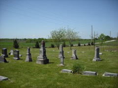 | Beni Israel Cemetery | 1.5 miles | 2013 |
 | Oak Hill Cemetery | 6.3 miles | 2017 |
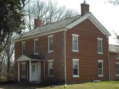 | Robert H. Miller House | 6.7 miles | 1984 |
| National Archives record | The nomination case file for reference 100009704 in Record Group 79. |
| Wikipedia article | Community-written account of this property, licensed CC BY-SA. |
| Douglas County | All 118 listed properties in this county. |