 Block
From the record
One of 148 National Register listings published here for Sedgwick County · listed in 2012 · category: Building · built in 1912.
Sources: the National Register database, National Park Service · the Wikipedia article
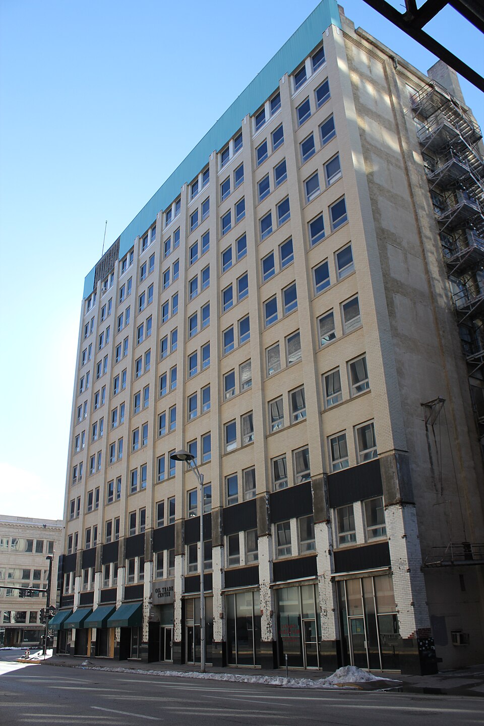
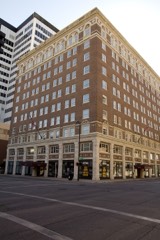
Built in 1912. Listed on the National Register of Historic Places in 2012.
One of 148 National Register listings published here for Sedgwick County · listed in 2012 · category: Building · built in 1912.
Sources: the National Register database, National Park Service · the Wikipedia article
Regional context, not property-specific evidence. The federal wildfire occurrence database lists 567 fires within 5 miles of Bitting Building between 2008 and 2020, burning about 87 acres in total. 3 started naturally. 6 were recorded as arson. Distance is straight-line from the map coordinates, so a fire counted here may appear on a neighbouring settlement's page as well.
| Reported cause | Fires |
|---|---|
| Missing data/not specified/undetermined | 380 |
| Debris and open burning | 67 |
| Equipment and vehicle use | 37 |
| Smoking | 20 |
| Fireworks | 20 |
| Misuse of fire by a minor | 13 |
| Power generation/transmission/distribution | 11 |
| Other causes | 7 |
| Arson/incendiarism | 6 |
| Recreation and ceremony | 3 |
| Natural | 3 |
The most recent of them, most recent first, with the day each was reported and the service that recorded it.
| Date | Cause | Size | Reported by | Name on the report |
|---|---|---|---|---|
| 9 September 2017 | Equipment and vehicle use | under an acre | Sedgwick County | 52170 |
| 9 September 2017 | Missing data/not specified/undetermined | under an acre | Sedgwick County | 52163 |
| 6 September 2017 | Debris and open burning | under an acre | Sedgwick County | 51490 |
| 6 September 2017 | Debris and open burning | under an acre | Sedgwick County | 51529 |
| 5 September 2015 | Missing data/not specified/undetermined | under an acre | Kansas Forest Service | 50175 |
| 4 September 2015 | Missing data/not specified/undetermined | under an acre | Kansas Forest Service | 49993 |
| 30 September 2017 | Missing data/not specified/undetermined | under an acre | Sedgwick County | 56310 |
| 28 September 2017 | Debris and open burning | under an acre | Sedgwick County | 55806 |
Regional context, not property-specific evidence. The federal mineral resources record lists 3 workings within 5 miles of Bitting Building: 3 producers. All of them still produce. What was taken out: Sand and Gravel, Construction. Distance is straight-line from the map coordinates, so a quarry counted here may appear on a neighbouring settlement's page as well.
| Where | Site | Commodity | Status | Recorded |
|---|---|---|---|---|
| Nest Robins Pit | Sand and Gravel, Construction | Producer | ||
| Oatville Sand & Gravel Dredge | Sand and Gravel, Construction | Producer | ||
| Ritchie Sand and Dredge Pit | Sand and Gravel, Construction | Producer |
Regional context, not property-specific evidence. The National Weather Service names Wichita, the town this property stands in, in 508 storm reports between 1993 and 2026: 265 hail, 166 thunderstorm wind, 39 flash flood, 20 flood. The reports record 2 deaths and 24 injuries. Each account below is quoted exactly as the forecast office filed it, from the NOAA Storm Events Database, and each date opens the federal record of that event.
| When | Event | Place named | Harm | What the report says |
|---|---|---|---|---|
| June 1996 | Lightning | Wichita | 2 killed | no account filed |
| July 2009 | Hail | Wichita | 20 hurt, $10,000,000 | Large Hail ranging in size from golf ball to baseball sized moved across Downtown Wichita, causing devastating damage to cars and roofs. During the half hour hail storm, thousands of cars either had roof, windshield or hood damage. Insurance agencies reported 10 to 15 thousand cars may have damaged by the hail storm. The hail was so large and numerous that it killed numerous birds in the Delano district, and injured fans at Lawrence Dumont Stadium as the hail turned the minor league baseball field white. Stain glassed windows were destroyed at Friends University and hundreds of homes and businesses received roof and window damage. |
| September 2000 | Lightning | Wichita | 2 hurt | At Cessna Aircraft, located on the southern perimeter of Mid-Continent Airport, two men were knocked unconscious when the aircraft they pushing out of a hangar was struck. Both men were apparently standing in water and holding onto the aircraft when the lightning strike occurred. Both were listed in good condition at Via Christi-St. Francis Medical Center. Area newspapers contributed to this report. |
| November 1998 | Thunderstorm Wind | Wichita | 1 hurt, $50,000 | One mobile home was rolled over. The occupent suffered a broken collar bone when the water bed he was sleeping in rolled on top of him. |
| August 2024 | Lightning | Wichita | 1 hurt | Emergency management relayed a report from emergency medical service crews of an individual transported to the hospital after a person's ear drum ruptured from a nearby lightning strike. |
| March 1993 | Hail | Wichita | $50,000,000 | no account filed |
| March 1993 | Hail | Wichita | $5,000,000 | no account filed |
| March 1993 | Hail | Wichita | $5,000,000 | no account filed |
| July 1998 | Thunderstorm Wind | Wichita | $3,000,000 | Severe thunderstorm winds, ranging from 52-80KT, ripped across the Wichita Metropolitan area, inflicting widespread damage to trees, roofs, power lines and power poles. Approximately 60,000 people lost power, about 15,000 of which remained without power for 3 days. While most of the reports were from off-duty NWS staff, reports were also received from law enforcement, trained spotters and amateur radio operators. |
| August 2006 | Lightning | Wichita | $2,000,000 | A lightning strike set a 14-unit building on fire at Twin Lakes Apartment Complex. The fire destroyed the roof and top floors of the building. Fortunately, no one was injured from the blaze. Information courtesy of the Wichita Eagle. |
| April 1999 | Tornado (F0) | Wichita | $2,000,000 | The weak tornado fromed along the gust front of a downburst in East Wichita. Initial touchdown occurred just west of the East Harry/South Oliver intersection. The tornado moved northeast to the Kellogg/Oliver intersection, then almost due north to just east of the Central/Oliver intersection where it lifted. The tornado inflicted extensive tree damage, destroyed two portable grade school classrooms, caved in the ceiling of a supermarket, and caused extensive roof damage to homes and businesses. |
| March 1993 | Hail | Wichita | $500,000 | no account filed |
| March 1993 | Hail | Wichita | $500,000 | no account filed |
| March 1993 | Hail | Wichita | $500,000 | no account filed |
| May 1999 | Flash Flood | Wichita | $250,000 | Torrential rains caused widespread flooding across the Wichita metropolitan area with water as much as 3 feet deep in some areas. In Northwest Wichita, flash flooding broke out windows at one residence causing water to flow into the basement. |
| July 2016 | Flash Flood | Wichita | $200,000 | Rainfall amounts of 3 to 5 inches over a 2 hour period, led to numerous stalled vehicles and stranded motorists across the city. |
| July 2015 | Flash Flood | Wichita | $200,000 | There were numerous reports of submerged cars in Southeast Wichita. This would include Pawnee and 31st St. S. as well as on W. Harry and Southwest Blvd. |
| April 2003 | Lightning | Wichita | $150,000 | Home was struck, and totally destroyed. |
| June 2014 | Flash Flood | Wichita | $120,000 | Flash flooding occurred along 13th street from West street to Meridian. Numerous cars were submerged from the high water along 13th Street. Rainfall amounts in the Wichita metro area measured 2.0 to 2.15 inches. Most of the rainfall occurred between midnight and 4am. |
| August 2002 | Thunderstorm Wind | Wichita | $100,000 | Occurred at intersection of Woodlawn & K-96. Downed power lines severed power to approximately 14,500 residences. Area newspapers contributed to this report. |
| July 2015 | Flash Flood | Wichita | $60,000 | Kake TV reported via social media multiple stranded cars due to high water on 13th street between Broadway and Waco. |
| April 2004 | Lightning | Wichita | $50,000 | Vacant building struck at 126 N. Emporia and set ablaze. No details as to type of building or it's purpose. (Narrative courtesy Wichita Eagle.) |
| July 2003 | Thunderstorm Wind | Wichita | $50,000 | Twenty-foot Bradford pear tree split in half and downed near 119th West/Central intersection in Northwest Wichita. |
| March 2002 | Thunderstorm Wind | Wichita | $50,000 | Fallen limbs damaged cars at Wichita State. A fence surrounding Levitt Arena was damaged. Limbs hitting power lines severed power to 265 residences. |
| August 2001 | Thunderstorm Wind | Wichita | $50,000 | In East Wichita, about 20 utility poles and their associated power lines blown down, severing power to an estimated 19,000 KGE customers. |
| March 2000 | Thunderstorm Wind | Wichita | $50,000 | Roof blown off the Osco building. |
| July 2000 | Thunderstorm Wind | Wichita | $50,000 | Widespread tree and power line damage resulted in the loss of power to approximately 45,000 residences of 13,000 were without power the following evening. One large tree limb that was blown down smashed the left rear window of a van. |
| May 1998 | Thunderstorm Wind | Wichita | $50,000 | Observed at Mid-Continent Airport. In addition, 3 miles north of the airport an empty tractor-trailer was flipped over. Widespread tree damage, downed power lines and power poles resulted in prolonged power outages. |
| August 1997 | Thunderstorm Wind | Wichita | $50,000 | SHERWIN WILLIAMS PLANT IN ANDOVER SUSTAINED DAMAGE TO ROOF, SPRINKLER BUILDING & AN 8 X 12 OVERHEAD DOOR. ABOUT 20 POWER POLES WERE BLOWN DOWN, CLOSING US-54 BETWEEN GREENWICH RD & EAST 143RD ST FOR 18 HOURS. OTHER BUILDINGS SUSTAINED ROOF DAMAGE AS WELL. |
| June 1996 | Thunderstorm Wind | Wichita | $50,000 | no account filed |
| March 1993 | Hail | Wichita | $50,000 | no account filed |
| May 2014 | Flood | Wichita | $30,000 | Flooding reported at the Kellogg/Edgemoor intersection in Southeast Wichita. The intersection was closed with accidents & stalled vehicles reported. |
| July 2003 | Lightning | Wichita | $25,000 | Lightning struck a transformer, severing power to approximately 11,000 homes. Lightning also struck the edge of the west runway at Wichita Mid-Continent Airport, leaving a hole the size of a watermelon. |
| August 2003 | Thunderstorm Wind | Wichita | $25,000 | Power poles snapped (obviously downing associated power lines) along 135th St. W between 31st S and McArthur Rd. (Reported by KFDI.) |
| August 2003 | Thunderstorm Wind | Wichita | $25,000 | During this time, McConnell AFB measured a 106KT gust. Reported damage did not support such velocity hence an estimated gust of 78KT has been assigned at this time. |
| August 2002 | Lightning | Wichita | $25,000 | House caught fire. No details provided. |
| March 2000 | Thunderstorm Wind | Wichita | $25,000 | Several power lines blown down at Lake Afton left approximately 6,000 residents in Cheney, Clearwater, Garden Plain, and parts of Goddard without power. In addition to law enforcement officials, reports were also received from area newspapers. |
| August 2003 | Thunderstorm Wind | Wichita | $20,000 | Eighteen power poles and their associated power lines downed. The downed utility poles blocked nearly 1 mile stretch of road between 61st St. N and 69th St. N near Valley Center, a North Wichita suburb. Approximately 25 trees were uprooted at the Sedgwick County Zoo in Northwest Wichita. Overall, tree damage was widespread across the Wichita Metro area. The resultant power outages persisted thru Monday evening across most of Valley Center. The Wichita Eagle contributed greatly to this report. |
| May 2006 | Lightning | Wichita | $15,000 | A lightning strike set New Day Christian Church in East Wichita ablaze. The fire caused extensive damage mainly to the roof and second floor. There was also an undetermined amount of water damage from fire fighters extinguishing the blaze. Fortunately, no one was injured. The fire was the second natural disaster to strike the building in the past seven years; a tornado damaged the roof in 1999. Information is courtesy of the Wichita Eagle. |
| July 2002 | Thunderstorm Wind | Wichita | $15,000 | Semi-trailer overturned at K96 and 199th St. West. |
| August 2005 | Thunderstorm Wind | Wichita | $12,000 | Around 12 homes sustained roof damage with a few trees uprooted. (KSN Channel 3) |
| June 2023 | Flood | Wichita | $10,000 | Vehicles were stuck in the street due to flooding near Murdock and Washington Streets. |
| April 2015 | Thunderstorm Wind | Wichita | $10,000 | Power poles were knocked down near 21st Street and Interstate 135. |
| June 2011 | Thunderstorm Wind | Wichita | $10,000 | A sheet metal roof was blown off a mobile home trailer, and one of the side walls were blown out. Additionally, a 9-inch diameter tree was uprooted. All of this occurred near the intersection of Pawnee and Broadway. |
| September 2009 | Flood | Wichita | $10,000 | Street flooding was reported across the southern half of the City of Wichita with normal flood prone areas becoming flooded. Some stalled cars were reported. Rainfall amounts of one to two inches were reported. |
| August 2003 | Thunderstorm Wind | Wichita | $10,000 | Limbs downed onto power lines with power outages no doubt resulting. (Reported by KFDI.) |
| May 2002 | Thunderstorm Wind | Wichita | $10,000 | Power lines downed on south side. |
| March 2000 | Thunderstorm Wind | Wichita | $10,000 | Several large road signs were blown down. |
| July 1995 | Thunderstorm Wind | Wichita | $6,000 | A bungee crane was blown over along with numerous tree limbs being blown down in the two to four inch diameter range. However, one tree limb was 10 to 12 inches in diameter. |
| October 2016 | Thunderstorm Wind | Wichita | $5,000 | A large tree fell on a house. |
| June 2008 | Thunderstorm Wind | Wichita | $5,000 | High winds damaged several power lines near the 900 block of East Lincoln. |
| August 2002 | Thunderstorm Wind | Wichita | $5,000 | Large tree fell onto car. |
| August 2001 | Thunderstorm Wind | Wichita | $5,000 | Shed blown down. |
| May 2000 | Thunderstorm Wind | Wichita | $5,000 | Two trees blown down with one falling onto a house. |
| June 2000 | Thunderstorm Wind | Wichita | $5,000 | Power lines downed. |
| April 1999 | Thunderstorm Wind | Wichita | $5,000 | Garage door caved in and shingles blown off numerous roofs. |
| July 1994 | Thunderstorm Wind | Wichita | $5,000 | As a line of thunderstorms passed through the area from the northwest, strong winds to 65 miles an hour caused tree damage in Wichita. |
| September 1993 | Thunderstorm Wind | Wichita | $5,000 | High winds reported at Central and Hillside Streets. |
| September 1993 | Thunderstorm Wind | Wichita | $5,000 | High winds kicked up debris that broke windows of nine cars. Power lines were also knocked down on South Broadway. |
| April 1994 | Thunderstorm Wind | Wichita | $5,000 | no account filed |
No historic map-sheet match is published for this property yet. That does not mean no map exists. This record needs a coordinate-quality review before it can be joined to a sheet boundary. Browse the county's mapped places while that work is pending.
Other National Register properties close enough to walk or drive between, ordered by distance from this one. Both positions come from the same geocoding pass that matched these properties to their map sheets.
| Photograph | Property | Distance | Listed |
|---|---|---|---|
| Old Wheeler-Kelly-Hagny Building | under 500 feet | 1982 | |
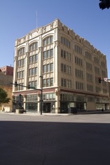 | S. H. Kress Company Building | under 500 feet | 1985 |
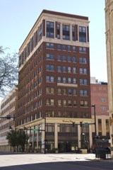 | Brown Building | under 500 feet | 2007 |
| Innes Department Store | under 500 feet | 2019 | |
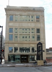 | Woolf Brothers Clothing Company | under 500 feet | 2013 |
 | Lassen Hotel | under 500 feet | 1984 |
| National Archives record | The nomination case file for reference 12000046 in Record Group 79. |
| Wikipedia article | Community-written account of this property, licensed CC BY-SA. |
| Sedgwick County | All 148 listed properties in this county. |