BlockBefore
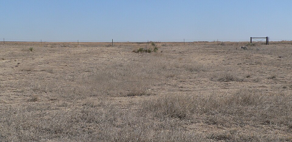
Photograph of Santa Fe Trail-Kearny County Segment 1
Photograph by Ammodramus, CC0 1.0. Via Wikimedia Commons.

Santa Fe Trail-Kearny County Segment 1

Built in 1821. Listed on the National Register of Historic Places in 2013.

From the record

“Santa Fe Trail-Kearny County Segment 1 is a historic site in Kearny County, Kansas which preserves a segment of the historic Santa Fe Trail. It is also known as Charlie's Ruts or Bentrup's Ruts.”

Wikipedia article Santa Fe Trail-Kearny County Segment 1, CC BY-SA 4.0.

One of 4 National Register listings published here for Kearny County · listed in 2013 · category: Site · built in 1821.

Sources: the Wikipedia article · the National Register database, National Park Service

The listing

  • Listed as. Santa Fe Trail--Kearny County Segment 1 - the National Register files a house under its owner's surname.
  • Address. N. side of US 50, Deerfield, 67838
  • When was it listed? July 2013
  • Category. site
  • Also known as. Santa Fe Trail MPS
  • Township. Deerfield township
  • When was it built? 1821
  • National Register reference number. 13000492 - assigned by the National Park Service when the property was listed.

Storms near this property

60 of 149 shown

Regional context, not property-specific evidence. The National Weather Service names Deerfield, the town this property stands in, in 149 storm reports between 1993 and 2025: 100 hail, 33 thunderstorm wind, 9 heavy rain, 6 tornado. No death or injury is recorded in these reports. Each account below is quoted exactly as the forecast office filed it, from the NOAA Storm Events Database, and each date opens the federal record of that event.

WhenEvent Place namedHarm What the report says
August 1993Thunderstorm WindDeerfield$500,000Winds blew off an awning to a gas station onto two trucks. The wind also blew out windows at some buildings in Deerfield. Large trees were uprooted in and around the Deerfield area.
April 2001Tornado (F1)Deerfield$150,000Two pivot spinklers were damaged, a 24 x 36 foot shed was blown down and 30 homes had minor roof damage.
June 1997Thunderstorm WindDeerfield$5,000Four inch "live" tree limbs blown down.
August 2025HailDeerfield-The Emergency Manager reported 1.75 inch hail.
May 2022Thunderstorm WindDeerfield-Irrigation pivot sprinklers were blown over by the high wind.
May 2021Heavy RainDeerfield-Rainfall of 2.00 inches was observed.
July 2018Heavy RainDeerfield-Rainfall of 1.91 inches was observed.
May 2016Tornado (EF1)Deerfield-This tornado moved northwest.
June 2014Tornado (EF0)Deerfield-A brief cone shaped tornado was reported briefly.
June 2014Tornado (EF0)Deerfield-This tornado did not strike anything.
June 2014Thunderstorm WindDeerfield-Tree limbs and a few windows were broken.
June 2014Thunderstorm WindDeerfield-Winds were estimated to be 70 MPH.
June 2013Thunderstorm WindDeerfield-Two to four inch diameter tree branches were broken by the high wind.
July 2013Thunderstorm WindDeerfield-Winds were estimated to be 60 MPH.
July 2013Heavy RainDeerfield-Rainfall of 3.70 was reported.
July 2013Thunderstorm WindDeerfield-Winds were estimated to be 60 MPH.
July 2012Heavy RainDeerfield-Rainfall of 1.10 was observed.
June 2011HailDeerfield-Winds were blowing as high as 55 mph with the hail.
July 2011Thunderstorm WindDeerfield-Winds were estimated to be 60 MPH.
August 2010Thunderstorm WindDeerfield-Winds were estimated to be 65 mph.
April 2009HailDeerfield-The hail was reported to be soft in nature.
September 2009HailDeerfield-One to two inch diameter tree branches were broken by 60 mph winds that accompanied the hail.
September 2009Thunderstorm WindDeerfield-One to two inch diameter tree limbs were broken. Quarter sized hail also accompanied the high wind.
May 2008HailDeerfield-Ground was covered by the hail.
October 2008Thunderstorm WindDeerfield-Two semi trucks were blown over on highway 50.
September 2008Heavy RainDeerfield-Rainfall of 1.18 inches was reported.
August 2007Thunderstorm WindDeerfield-A lot of tree limbs were blown down.
August 2007Thunderstorm WindDeerfield-Report from the KSN weatherlab.
August 2007Thunderstorm WindDeerfield-A tree was uprooted in the yard.
August 2007Heavy RainDeerfield-Rainfall of 2.75 inches fell overnight.
August 2007Heavy RainDeerfield-Rainfall of 2.30 inches fell overnight.
August 2007Heavy RainDeerfield-Rainfall of 2.50 fell overnight.
August 2007Heavy RainDeerfield-Rinfall of 3.80 inches fell overnight.
June 2006Thunderstorm WindDeerfield-Two inch diameter tree branches were broken.
June 2004Thunderstorm WindDeerfield-A small shed was blown over
June 2003Thunderstorm WindDeerfield-The wind gust was recorded by a weather lab
April 2001HailDeerfield-On the county line.
May 2000Thunderstorm WindDeerfield-6 inch tree limbs down
July 2000Thunderstorm WindDeerfield-KSN weatherlab
May 1999HailDeerfield-Hail covered the ground.
May 1999HailDeerfield-Also, had five inches of rain.
May 1999HailDeerfield-Window broken out a car.
June 1999HailDeerfield-On Finney/Kearny county line.
August 1995HailDeerfield-Hail piled in huge drifts and stripped corn in a two mile wide swath. Hail drifts were still evident 24 hours later.
September 1994Tornado (F0)Deerfield-Brief touchdown of a small tornado over open farmland.
May 1993Tornado (F0)Deerfield-Tornado reported in open farmland by Kansas Highway Patrol. Tornado remained nearly stationary with no damage reported.
June 2024HailDeerfield-no account filed
September 2023HailDeerfield-no account filed
May 2021HailDeerfield-no account filed
July 2019HailDeerfield-no account filed
May 2019HailDeerfield-no account filed
June 2017HailDeerfield-no account filed

Every storm recorded in Kearny County

Map coverage status

No historic map-sheet match is published for this property yet. That does not mean no map exists. This record needs a coordinate-quality review before it can be joined to a sheet boundary. Browse the county's mapped places while that work is pending.

Listed places nearby

2 within 8 miles

Other National Register properties close enough to walk or drive between, ordered by distance from this one. Both positions come from the same geocoding pass that matched these properties to their map sheets.

Photograph PropertyDistance Listed
Deerfield State Bank2.8 miles2018
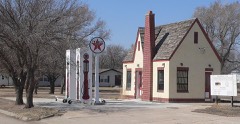
Deerfield Texaco Service Station2.9 miles2007

Sources for this property

National Archives recordThe nomination case file for reference 13000492 in Record Group 79.
Wikipedia articleCommunity-written account of this property, licensed CC BY-SA.
Kearny CountyAll 4 listed properties in this county.

Provenance

  • Listing record. National Park Service National Register of Historic Places, listed-properties dataset, current to 2026-05-22.
  • Map join. Address geocoded through the United States Census geocoder, then tested against the published boundary of every sheet in the USGS Historical Topographic Map Collection.
  • How this page is made. Listing fields come from federal records; map-sheet coverage is a labelled coordinate-to-boundary calculation, not a source-field claim.
  • Storms. NOAA National Centers for Environmental Information, Storm Events Database https://www.ncei.noaa.gov/stormevents/ A work of the United States government, no copyright under 17 U.S.C. 105. Narratives are quoted verbatim from the National Weather Service report and are not edited or summarised.