 Block
From the record
4 National Register listings published here.
Sources: the National Register database, National Park Service
18 topographic sheets cover 4 settlements here, and 4 properties are on the National Register of Historic Places.
4 National Register listings published here.
Sources: the National Register database, National Park Service
Every property in this county listed on the National Register of Historic Places, with the year it was listed and the federal nomination document.
| Photograph | Property | Type | Listed | Reference |
|---|---|---|---|---|
 | Deerfield State Bank | building | 2018 | 100002625 |
 | Deerfield Texaco Service Station | building | 2007 | 07000603 |
 | Indian Mound | site | 2013 | 13000491 |
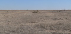 | Santa Fe Trail-Kearny County Segment 1 | site | 2013 | 13000492 |
The NOAA Storm Events Database holds 704 reports for this county, causing no deaths, 2 injuries and about $5,583,030 in recorded property damage. Each settlement page carries the reports that name it.
| Kind of event | Reports |
|---|---|
| Hail | 440 |
| Thunderstorm Wind | 177 |
| Tornado | 45 |
| Heavy Rain | 27 |
| Flash Flood | 10 |
| Flood | 3 |
| Funnel Cloud | 2 |
The most serious of them, by death, then injury, then recorded damage. The accounts are quoted exactly as the forecast office filed them.
| When | Event | Place named | Harm | What the report says |
|---|---|---|---|---|
| October 2008 | Thunderstorm Wind | Lakin | 2 hurt, $3,500,000 | Thunderstorm winds were estimated to be from 90 to 100 mph. A mobile home was destroyed and another was heavily damaged. Two occupants of the destroyed trailer were injured, on seriously. There were also 16 pivot irrigation sprinklers overturned in a 4 mile radius of this location. In addition, 20 power poles were snapped and a large grain bin was destroyed. Large hay bales were blown around and all windows in the machinery and vehicles were blown out. |
| August 1993 | Thunderstorm Wind | Deerfield | $500,000 | Winds blew off an awning to a gas station onto two trucks. The wind also blew out windows at some buildings in Deerfield. Large trees were uprooted in and around the Deerfield area. |
| September 1993 | Hail | Lakin | $500,000 | no account filed |
| May 1951 | Tornado (F3) | not stated | $250,000 | no account filed |
| April 2010 | Tornado (EF1) | Lakin | $180,000 | This tornado was a mile wide at it's maximum size as witnessed by storm chasers and storm spotters. It did minimal damage to pivot sprinklers and barns as this was a very sparsely populated area. |
| April 2001 | Tornado (F1) | Deerfield | $150,000 | Two pivot spinklers were damaged, a 24 x 36 foot shed was blown down and 30 homes had minor roof damage. |
| August 1997 | Flash Flood | Lakin | $100,000 | Widespread stratiform rain fell producing 5 to 10 inches. Flooding washed out a bridge on highway 25 between Lakin and Leoti. A watershed lake filled up to capacity...one that had not had water in it for over 30 years. Rainfall of 2 to 5 inches was widespread across the entire county and other parts of southwest and west central Kansas. |
| June 2009 | Thunderstorm Wind | Lakin White Arpt | $90,000 | High winds and hail of unknown size broke house windows and beat to a pulp fifth wheel travel trailer. Also the wheat crop was completely thrashed. Four inch diameter tree branches were brought down and an pivot irrigation sprinkler was overturned. |
| May 1995 | Tornado (F1) | not stated | $70,000 | One mobile home was completely destroyed. One pivot sprinkler was also destroyed. |
| June 1995 | Hail | Lakin | $50,000 | Water over Highway 25. |
| September 1993 | Thunderstorm Wind | Lakin | $50,000 | no account filed |
| June 1965 | Tornado (F1) | not stated | $25,000 | no account filed |
| June 1965 | Tornado (F1) | not stated | $25,000 | no account filed |
| June 1954 | Tornado (F2) | not stated | $25,000 | no account filed |
| May 1951 | Tornado (F2) | not stated | $25,000 | no account filed |
| June 1995 | Hail | Lakin Airport | $20,000 | no account filed |
| March 2001 | Thunderstorm Wind | Lakin | $7,000 | The roof was blown off a building, a semi was overturned and power lines were brought down. |
| June 1997 | Thunderstorm Wind | Deerfield | $5,000 | Four inch "live" tree limbs blown down. |
| April 1976 | Tornado (F0) | not stated | $2,500 | no account filed |
| May 1966 | Tornado (F1) | not stated | $2,500 | no account filed |
| June 1965 | Tornado (F1) | not stated | $2,500 | no account filed |
| June 2000 | Thunderstorm Wind | Lakin | $1,500 | Three power poles blown down. |
| July 2009 | Flood | Lakin | $1,000 | Several farm roads were washed out by the heavy rainfall. Amounts of 4 1/2 inches were reported in a span of 45 to 60 minutes. Damage estimates were never made available. |
| June 2000 | Thunderstorm Wind | Lakin | $1,000 | Several poles blown down. |
| June 1967 | Tornado (F3) | not stated | $30 | no account filed |
| September 2025 | Thunderstorm Wind | Lakin | - | Mesonet station DW5288 Kendall recorded a 64 mph wind gust. |
| May 2025 | Hail | Lakin | - | Kearny county emergency manager reported 1 inch hail. |
| August 2025 | Hail | Deerfield | - | The Emergency Manager reported 1.75 inch hail. |
| August 2025 | Thunderstorm Wind | Lakin | - | A public report of a 65 mph wind gust. |
| July 2025 | Thunderstorm Wind | Lakin White Arpt | - | Measured by Ambient Weather Network site NWKECounty. |
| July 2025 | Thunderstorm Wind | Lakin White Arpt | - | Measured by the personal weather station KKSLAKIN28. |
| July 2025 | Thunderstorm Wind | Lakin | - | Measured at the mesonet site D5288. |
| July 2025 | Thunderstorm Wind | Lakin White Arpt | - | Measured by AWOS station at 2 N Lakin. |
| May 2024 | Tornado (EF0) | Lake Mc Kinney | - | Spotter video of a brief landspout. |
| September 2024 | Thunderstorm Wind | Lakin White Arpt | - | Mesonet site recorded a wind gust of 60 MPH. |
| September 2024 | Thunderstorm Wind | Lakin White Arpt | - | Mesonet site recorded a wind gust of 79 MPH. |
| September 2024 | Thunderstorm Wind | Lakin White Arpt | - | Mesonet site recorded a wind gust of 79 MPH. |
| April 2023 | Thunderstorm Wind | Lakin White Arpt | - | Two adjacent power poles were snapped off at the base along County Road 180. |
| May 2023 | Heavy Rain | Lakin | - | NWS employee reported 2.77 inches of rain fell 6ESE of Kendall. |
| June 2023 | Thunderstorm Wind | Lakin | - | Numerous reports of tree limb damage across town. |
| June 2023 | Flash Flood | Lakin | - | Several stalled cars across town due to flooded streets. Many roads, including highway 50 through town were curb to curb with water. |
| June 2023 | Thunderstorm Wind | Lakin | - | Reported by a storm chaser. |
| July 2023 | Thunderstorm Wind | Lakin | - | Strong Winds. |
| July 2023 | Thunderstorm Wind | Lake Mc Kinney | - | Strong wind. |
| July 2023 | Thunderstorm Wind | Lakin White Arpt | - | Strong Winds. |
| July 2023 | Thunderstorm Wind | Lakin | - | Social Media reports of power out and tree limbs down in the city of Lakin. |
| July 2023 | Thunderstorm Wind | Lakin | - | Social media report of an enclosed trailer flipperd and center pivot down. |
| May 2022 | Thunderstorm Wind | Lake Mc Kinney | - | Winds were estimated to be 60 MPH. |
| May 2022 | Thunderstorm Wind | Deerfield | - | Irrigation pivot sprinklers were blown over by the high wind. |
| May 2022 | Thunderstorm Wind | Lake Mc Kinney | - | Winds were estimated to be 60 MPH. |
| May 2022 | Thunderstorm Wind | Lakin | - | Observed in Lakin. |
| May 2021 | Flash Flood | Lakin White Arpt | - | Over 5 inches of rainfall was observed. |
| May 2021 | Heavy Rain | Lakin | - | Rainfall of 2.64 was observed. |
| May 2021 | Heavy Rain | Deerfield | - | Rainfall of 2.00 inches was observed. |
| May 2020 | Tornado (EFU) | Lakin | - | This was a slow moving elephant trunk tornado but there was nothing for the tornado to damage as it moved across sagebrush and pastures. |
| July 2020 | Thunderstorm Wind | Lakin | - | A semi truck was blown over by high wind. |
| July 2020 | Thunderstorm Wind | Lakin | - | There were several reports of 6 to 8 inch diameter tree branches blown down. |
| July 2020 | Thunderstorm Wind | Lakin | - | Shingles were blown off several roofs and a few trees were blown down. |
| June 2020 | Hail | Lakin | - | The hail lasted 5 minutes. |
| July 2018 | Heavy Rain | Deerfield | - | Rainfall of 1.91 inches was observed. |
Named settlements recorded in the Geographic Names Information System, each with the topographic sheets covering it. Villages, hamlets and abandoned places alike. Each is shown with the nearest named watercourse or landform and the survey quadrangle it falls on.