 Block
From the record
One of 108 National Register listings published here for Shawnee County · listed in 2015 · category: Building · built in 1860, vernacular architecture.
Sources: the National Register database, National Park Service
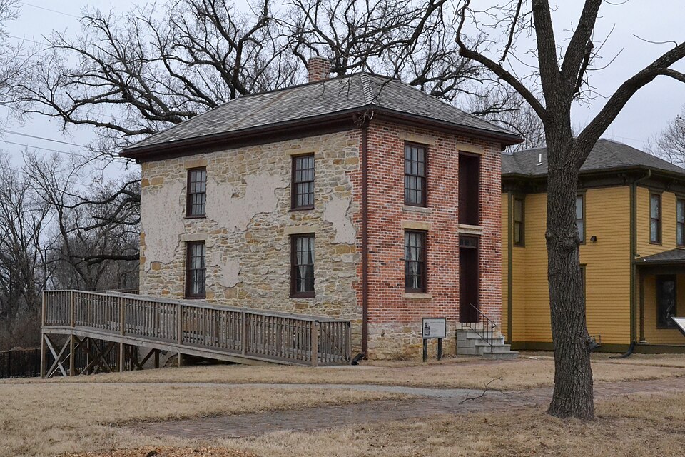
Built in 1860 (vernacular architecture). Listed on the National Register of Historic Places in 2015.
One of 108 National Register listings published here for Shawnee County · listed in 2015 · category: Building · built in 1860, vernacular architecture.
Sources: the National Register database, National Park Service
Regional context, not property-specific evidence. The federal wildfire occurrence database lists 541 fires within 5 miles of John and Mary Ritchie House between 2006 and 2020, burning about 200 acres in total. None started naturally. 115 were recorded as arson. Distance is straight-line from the map coordinates, so a fire counted here may appear on a neighbouring settlement's page as well.
| Reported cause | Fires |
|---|---|
| Missing data/not specified/undetermined | 256 |
| Arson/incendiarism | 115 |
| Debris and open burning | 107 |
| Smoking | 25 |
| Equipment and vehicle use | 18 |
| Fireworks | 5 |
| Misuse of fire by a minor | 5 |
| Power generation/transmission/distribution | 4 |
| Recreation and ceremony | 3 |
| Other causes | 3 |
The most recent of them, most recent first, with the day each was reported and the service that recorded it.
| Date | Cause | Size | Reported by | Name on the report |
|---|---|---|---|---|
| 8 September 2017 | Arson/incendiarism | under an acre | Shawnee County | 15240 |
| 3 September 2018 | Missing data/not specified/undetermined | 1.0 acres | Kansas Forest Service | 16182 |
| 29 September 2017 | Debris and open burning | 1.0 acres | Shawnee County | 127 |
| 29 September 2015 | Arson/incendiarism | under an acre | Kansas Forest Service | 15109 |
| 26 September 2015 | Missing data/not specified/undetermined | under an acre | Kansas Forest Service | 14941 |
| 22 September 2018 | Missing data/not specified/undetermined | under an acre | Kansas Forest Service | 17446 |
| 22 September 2015 | Arson/incendiarism | under an acre | Kansas Forest Service | 14677 |
| 20 September 2015 | Arson/incendiarism | under an acre | Kansas Forest Service | 14591 |
Regional context, not property-specific evidence. The federal mineral resources record lists 1 working within 5 miles of John and Mary Ritchie House: 1 producer. All of them still produce. What was taken out: Sand and Gravel, Construction. Distance is straight-line from the map coordinates, so a quarry counted here may appear on a neighbouring settlement's page as well.
| Where | Site | Commodity | Status | Recorded |
|---|---|---|---|---|
| Kansas Sand and Concrete Dredge | Sand and Gravel, Construction | Producer |
Regional context, not property-specific evidence. The National Weather Service names Topeka, the town this property stands in, in 357 storm reports between 1993 and 2026: 161 hail, 127 thunderstorm wind, 35 flash flood, 19 lightning. The reports record 1 death and 8 injuries. Each account below is quoted exactly as the forecast office filed it, from the NOAA Storm Events Database, and each date opens the federal record of that event.
| When | Event | Place named | Harm | What the report says |
|---|---|---|---|---|
| August 2007 | Lightning | Topeka | 1 killed, 1 hurt | A woman was struck by lightning near the 2700 block on SW Villa West Dr. in Topeka. She was originally taken to the hospital with life-threatening injuries, and later passed away as a reult of these injuries. A second man was struck by a lightning bolt in an open air garage next to his home. The bolt struck his house, traveled through a cord, and into the light the man was holding. He was knocked unconscious, needed to be recussitated, and ended up with injuries to his arm. |
| October 2005 | Flash Flood | Topeka | 6 hurt, $2,200,000 | Water rushing over the road as deep as mailboxes in the 3800 block of Tecumseh Rd. |
| June 2005 | Thunderstorm Wind | Topeka | 1 hurt, $5,000 | A fireworks tent was partially collapsed and a worker received minor injuries. Numerous fallen branches and debris were reported on a neighboring golf course where golf carts were also blown around. |
| May 2007 | Flash Flood | Topeka | $3,400,000 | Shawnee county dispatch reported water rescues were being conducted along the Shunganunga Creek. Water entering residences south of Washburn University. Almost 500 water rescues were completed in the city of Topeka. |
| October 2005 | Flash Flood | Topeka | $2,050,000 | A spotter reported Halfday Creek was out of it's banks and water was rushing at least 6 inches deep over several roads including 50th St. |
| April 2002 | Thunderstorm Wind | Topeka | $2,000,000 | A bow echo moved across Shawnee county and produced high winds in excess of 60 mph. The winds did extensive damage to many homes and businesses mainly in the northern half of Topeka. Preliminary damage estimates from officials in Shawnee county totaled 2 million dollars. |
| June 2004 | Thunderstorm Wind | Topeka | $1,000,000 | Strong winds moved across Topeka doing considerable damage. Numerous large tree branches were blown down. A K-DOT communications tower was blown down onto an apartment complex, but no injuries were reported. But significant damage was done to the apartment complex. Downed tree limbs damaged power lines and power transformers resulting in power outages to 26 thousand Topeka residents. On the outskirts of Topeka crops suffered considerable damage. Although 64 knots was officially measured at Topeka Billard Airport there were unofficial reports of much higher gusts across the city. It was the worst storm to hit Topeka in a number of years. |
| March 2002 | Thunderstorm Wind | Topeka | $1,000,000 | Strong downburst winds damaged 40 cars at a dealership in Topeka. Roof damage was also noted at the dealership salesroom. |
| May 2004 | Hail | Topeka | $500,000 | Large hail damaged windows, roofs, and vehicles near Topeka. The hail also knocked holes in the vinyl siding of a house. This was the worst hailstorm to strike Shawnee county in a number of years. The number of roofs and windows damaged was numerous. |
| July 1994 | Thunderstorm Wind | Topeka | $500,000 | Winds hit 62 mph at the National Weather Service Office at Billard Airport, but were clocked at 83 mph at WIBW TV, near 6th and Wannamaker Road. The high winds caused widespread and severe damage to many trees, power lines and some buildings in the city of Topeka and surrounding area. An estimated 35,000 people were without electricity for 6 to 12 hours with some areas not restored for three to four days. Some roads were blocked by fallen trees and limbs. Utility repair crews were brought in from neighboring states to help repair the widespread damage. The wind, heavy rain and hail also severely damaged area crops. |
| September 2005 | Flash Flood | Topeka | $400,000 | no account filed |
| June 2001 | Lightning | Topeka | $375,000 | Lightning struck a church and ignited a fire that totally destroyed the church. |
| June 2002 | Flash Flood | Topeka | $300,000 | Heavy rains from thunderstorms in the area produced flashflooding in Topeka for a time during the morning hours of the 4th. A number of intersections were flooded. Cars were abandoned at 39th and Atwood as water flowed by 2 to 3 feet deep. Cars were seen floating on the water at 16th and Tyler. Some basements were flooded in the southwest part of Topeka. |
| June 2005 | Flash Flood | Topeka | $200,000 | Six to 12 inches of water flowing over roads near intersection of I70 and I470 with some cars stalled or running through flowing water. |
| November 1998 | Flash Flood | Topeka | $200,000 | Heavy rains of late October continued into the first day or two of November and sent rivers and streams in east central Kansas out of their banks. Numerous roads and highways in the area were flooded and many were closed for a time. Many homes were severly damaged. The Neosho river at Emporia crested at 24.88 feet at 5am on the 2nd. This is the 8th highest crest on record of which the top 4 all occurred during the famous severe floods of Spring and Summer 1951. Flood stage is 19 feet. At Ottawa the Marias Des Cygnes River crested at 38.93 feet at 9pm of the 2nd. This crest was the third highest on record. The river remained in flood until late on the 4th. Flood stage is 31 feet. Runoff from the heavy rains sent John Redmond resevoir to the top of its dam. Water released from the resevoir kept the Neosho river downstream in flood for several days after most other rivers and streams had returned to their banks. Total property and crop damage was estimated near 10 million dollars. |
| May 2004 | Tornado (F1) | Topeka | $100,000 | A tornado touched down south of Topeka and moved to the eastnortheast for about a mile before lifting. A building and a shed were damaged. Power lines were downed and an unoccupied vehicle was rolled over. |
| August 2003 | Lightning | Topeka | $100,000 | Lightning struck the roof of a house and ignited a fire that did considerable damage to the structure and its contents. |
| June 1998 | Hail | Topeka | $100,000 | no account filed |
| September 1998 | Lightning | Topeka | $90,000 | Lightning struck a house and started a fire which did about 90 thousand dollars damage. |
| August 2005 | Flash Flood | Topeka | $80,000 | Fast flowing water across several low lying streets in the city. |
| May 1996 | Flash Flood | Topeka | $75,000 | no account filed |
| August 2006 | Flash Flood | Topeka | $50,000 | Local law enforcement needed to barricade several streets due to high water. Flooded roads caused traffic to be diverted to alternate routes. |
| August 2006 | Flash Flood | Topeka | $50,000 | Rainfall of at least two inches in less than an hour produced flash flooding in parts of Topeka. Traffic was diverted and some vehicles were stranded. Even the westbound lane of Interstate 70 was flooded. However, no injuries were reported. The 24-hour rainfall total for the calendar day at Topeka was 2.50 inches, setting a new daily rainfall total record. |
| June 2002 | Lightning | Topeka | $50,000 | Lightning struck a grain elevator and started a fire that damaged a filtering system. |
| June 2002 | Lightning | Topeka | $50,000 | Lightning struck a house and started a fire that destroyed the house. |
| April 1994 | Thunderstorm Wind | Topeka | $50,000 | Winds clocked to 61 mph caused roof damage at a lumber yard in north Topeka. |
| June 1994 | Thunderstorm Wind | Topeka | $50,000 | Downburst winds moved through much of northeast Kansas including the Topeka vicinity producing windspread wind damage, downed trees, and power lines. Some winds were estimated at 80 mph. Power was not restored in some areas for nearly 24 hours. The hardest hit area was in North Topeka near Garfield park. Hail up to 1.5 inches accompanied the storm. |
| May 1996 | Flash Flood | Topeka | $50,000 | no account filed |
| August 2003 | Lightning | Topeka | $40,000 | Lightning struck a house and ignited a fire that did considerable damage to the structure and its contents. |
| June 1999 | Flood | Topeka | $40,000 | One to 2 inches of rain in a short time period caused numerous reports of flooding in and around Topeka. Twenty cars in a used car lot were damaged or destroyed by the rushing water. A woman in her 60's was rescued after her car became stalled and flooded in southern Topeka. |
| August 2006 | Lightning | Topeka | $30,000 | A local newspaper reported that lightning struck a home, damaging the roof, eaves, and contents of the attic. |
| September 1998 | Thunderstorm Wind | Topeka | $30,000 | Winds to 78 mph destroyed several buildings and damaged a hanger at Forbes Field. |
| May 1995 | Hail | Topeka | $30,000 | Large hail and a wind gust to 59 mph damaged vehicles, roofs and tore down tree and tree limbs. |
| May 1999 | Lightning | Topeka | $8,000 | Lightning struck a home and started a fire that damaged the roof as well as an alarm system and electric meter box. |
| April 2026 | Flash Flood | Topeka | $5,000 | Intersection of 6th street and Tyler road reported impassable. |
| April 2026 | Flash Flood | Topeka | $5,000 | The area of 29th street and Kansas Ave. was reported to be impassable. |
| June 2010 | Thunderstorm Wind | Topeka | $5,000 | A strong mesovortex associated with a line of thunderstorms created a microburst that caused tree and structure damage in Topeka. A large Sycamore tree approximately 60 inches in diameter, with the center partially rotted out, was snapped. A large Oak tree was uprooted near 21st Avenue and Kansas Avenue. Other trees measuring 12 to 24 inches in diameter were snapped. A storm chaser took measurements of the wind and reported an 83 mph wind gust associated with the storm. |
| May 2006 | Heavy Rain | Topeka | $5,000 | 1.3 inches of rain in less than an hour caused a storm drain to become clogged. Water backed up from the clogged drain flooding interstate 70 in the western part of Topeka. Due to the ponded water, traffic was down to one lane eastbound and one lane westbound for several hours. Two pumps brought in by the city of Topeka and a fire engine from the Topeka Fire Department were used to remove about 75000 to 85000 gallons of water. The heavy rains caused at least one rollover accident. It is unknown whether this accident produced any indirect injuries. |
| May 2005 | Flash Flood | Topeka | $5,000 | Intense rains brought fast flowing water and stalled cars in streets in parts of Topeka. |
| June 2002 | Thunderstorm Wind | Topeka | $5,000 | Strong winds damaged a roof in Topeka. |
| June 2002 | Thunderstorm Wind | Topeka | $5,000 | Strong winds knocked down trees and limbs onto power lines causing some damage. |
| May 1999 | Lightning | Topeka | $5,000 | Lightning struck a house and started a fire that did an estimated 5 thousand dollars damage. |
| April 1993 | Hail | Topeka | $5,000 | Soft hail, mainly 0.25 to 0.50 inch, fell for nearly 30 minutes, causing significant accumulations, drifts, minor temporary flooding from heavy rains and several fender bender automobile accidents. |
| June 2002 | Thunderstorm Wind | Topeka | $3,000 | Strong winds knocked down trees onto power lines and disrupted power for a time. |
| August 2000 | Thunderstorm Wind | Topeka | $3,000 | Strong winds did some damage to the roof of a house. |
| October 1998 | Thunderstorm Wind | Topeka | $3,000 | Strong winds damaged several buildings and vehicles. |
| May 1998 | Thunderstorm Wind | Topeka | $3,000 | no account filed |
| May 2001 | Lightning | Topeka | $2,500 | Lightning struck the roof of a church in Topeka doing around 2,500 dollars in damage. |
| July 2002 | Thunderstorm Wind | Topeka | $2,000 | Strong winds broke some windows north of Topeka. |
| July 1997 | Lightning | Topeka | $2,000 | no account filed |
| June 2002 | Lightning | Topeka | $1,500 | Lightning struck a power line causing power outages for about a half hour. |
| April 2014 | Thunderstorm Wind | Topeka | $1,000 | Eight inch diameter tree limbs down at 10th and fillmore in topeka. Lightning strike to home on nw lyman road. Evacuations underway at residence. |
| March 2007 | Flash Flood | Topeka | $1,000 | A few cars were stalled in high water on the 200th block of SE Golden St. |
| May 2001 | Lightning | Topeka | $1,000 | Lightning struck a power line causing about 1,800 customers of KPL to lose power for about an hour. |
| May 2001 | Lightning | Topeka | $1,000 | Lightning struck the water treatment plant in Topeka causing power to be knocked out until around 00:30 on the 21st. As a result water supplies ran low in Topeka and some surrounding areas. The problem was corrected about midday on the 21st. |
| April 2000 | Thunderstorm Wind | Topeka | $1,000 | A dry microburst blew the shingles off several homes in the Lake Sherwood area southwest of Topeka. |
| May 2000 | Lightning | Topeka | $1,000 | Lightning struck electrical equipment and knocked out power to about 200 customers in Topeka for a time. |
| July 1996 | Lightning | Topeka | $500 | no account filed |
| April 2026 | Thunderstorm Wind | Topeka | - | Wind report was relayed by emergency manager. |
| July 2025 | Thunderstorm Wind | Topeka | - | Downed trees reported at 2800 and Massachusetts Ave. Delayed report. Time estimated radar. |
No historic map-sheet match is published for this property yet. That does not mean no map exists. This record needs a coordinate-quality review before it can be joined to a sheet boundary. Browse the county's mapped places while that work is pending.
Other National Register properties close enough to walk or drive between, ordered by distance from this one. Both positions come from the same geocoding pass that matched these properties to their map sheets.
| Photograph | Property | Distance | Listed |
|---|---|---|---|
 | Bowker House | 0.2 miles | 2007 |
 | Woman's Club Building | 0.3 miles | 1982 |
 | Tinkham Veale Building | 0.3 miles | 2006 |
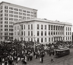 | Memorial Building | 0.3 miles | 1975 |
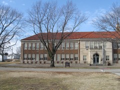 | Brown v. Board of Education National Historic Site | 0.4 miles | 1992 |
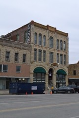 | Thacher Building | 0.4 miles | 1975 |
| National Archives record | The nomination case file for reference 15000939 in Record Group 79. |
| Shawnee County | All 108 listed properties in this county. |