 Block
From the record
One of 47 National Register listings published here for Wyandotte County · listed in 1975 · category: District.
Sources: the National Register database, National Park Service
Listed on the National Register of Historic Places in 1975.
One of 47 National Register listings published here for Wyandotte County · listed in 1975 · category: District.
Sources: the National Register database, National Park Service
Regional context, not property-specific evidence. The federal wildfire occurrence database lists 181 fires within 5 miles of Westheight Manor District between 2007 and 2020, burning about 72 acres in total. 1 started naturally. 15 were recorded as arson. Distance is straight-line from the map coordinates, so a fire counted here may appear on a neighbouring settlement's page as well.
| Reported cause | Fires |
|---|---|
| Missing data/not specified/undetermined | 114 |
| Smoking | 17 |
| Arson/incendiarism | 15 |
| Debris and open burning | 10 |
| Power generation/transmission/distribution | 8 |
| Equipment and vehicle use | 7 |
| Fireworks | 4 |
| Recreation and ceremony | 3 |
| Misuse of fire by a minor | 2 |
| Natural | 1 |
The most recent of them, most recent first, with the day each was reported and the service that recorded it.
| Date | Cause | Size | Reported by | Name on the report |
|---|---|---|---|---|
| 7 September 2007 | Missing data/not specified/undetermined | 1.0 acres | Missouri State Fire Marshal's Office | not named |
| 7 September 2007 | Missing data/not specified/undetermined | under an acre | Missouri State Fire Marshal's Office | not named |
| 29 September 2018 | Debris and open burning | under an acre | Kansas Forest Service | 24406 |
| 29 September 2017 | Missing data/not specified/undetermined | under an acre | Wyandotte County | 23456 |
| 27 September 2015 | Arson/incendiarism | under an acre | Kansas Forest Service | 5021337 |
| 20 September 2018 | Missing data/not specified/undetermined | under an acre | Kansas Forest Service | 23511 |
| 2 September 2017 | Arson/incendiarism | under an acre | Wyandotte County | 21119 |
| 14 September 2018 | Arson/incendiarism | under an acre | Kansas Forest Service | 22956 |
Regional context, not property-specific evidence. The federal mineral resources record lists 32 workings within 5 miles of Westheight Manor District: 27 past producers, 5 producers. 5 still produce. What was taken out: Stone, Crushed/Broken, Sand and Gravel, Construction, Clay, Perlite. Distance is straight-line from the map coordinates, so a quarry counted here may appear on a neighbouring settlement's page as well.
| Where | Site | Commodity | Status | Recorded |
|---|---|---|---|---|
| Lite Weight Products Perlite Plant | Perlite | Producer | ||
| Unknown-Ls and Shale | Clay, Stone, Crushed/Broken | Past Producer | ||
| Unknown | Clay | Past Producer | ||
| Unknown Clay | Clay | Past Producer | ||
| Unknown Clay | Clay | Past Producer | ||
| Builders #1 Dredge & Pit | Sand and Gravel, Construction | Producer | ||
| Muncie Creek Dredge & Plant | Sand and Gravel, Construction | Producer | ||
| Unknown-S&G | Sand and Gravel, Construction | Past Producer | ||
| Unknown-S&G | Sand and Gravel, Construction | Past Producer | ||
| Doarn Quarry and Brick Yard | Stone, Crushed/Broken | Past Producer |
Regional context, not property-specific evidence. The National Weather Service names Kansas City, the town this property stands in, in 106 storm reports between 1993 and 2026: 48 thunderstorm wind, 36 hail, 17 flash flood, 4 flood. No death or injury is recorded in these reports. Each account below is quoted exactly as the forecast office filed it, from the NOAA Storm Events Database, and each date opens the federal record of that event.
| When | Event | Place named | Harm | What the report says |
|---|---|---|---|---|
| October 1998 | Flash Flood | Kansas City | $2,000,000 | no account filed |
| August 2004 | Flash Flood | Kansas City | $500,000 | 4 to 6 inches across the area produced the worst flooding since 1998. Numerous water rescues were needed. Numerous businesses and homes had water damage. |
| July 1994 | Thunderstorm Wind | Kansas City | $500,000 | Thunderstorm winds broke power poles and downed trees into power lines knocking out power to over 26,000 homes. Damages were estimated to be around $100,000. |
| March 2006 | Hail | Kansas City | $100,000 | no account filed |
| May 2000 | Hail | Kansas City | $50,000 | An isolated thunderstorm tracked south-southeast across the Kansas side of the Kansas City metro area. Hail from quarter to golfball size was reported, and numerous vehicles were damaged at an automobile dealership in Kansas City, Kansas. |
| March 2006 | Hail | Kansas City | $50,000 | no account filed |
| July 2008 | Flash Flood | Kansas City | $30,000 | One to two feet of water was reported over roads, between 14th and 20th Streets on Washington Avenue. Several vehicles were reported submerged with water rescues needed. |
| May 2005 | Thunderstorm Wind | Kansas City | $25,000 | Roofs torn off 2 homes and church suffered wind damage |
| August 2004 | Thunderstorm Wind | Kansas City | $25,000 | 40 foot construction trailer destroyed at 118th and Parallel. Trees also downed. |
| May 1995 | Thunderstorm Wind | Kansas City | $20,000 | Strong winds knocked a tree down onto a Home at 14th street and Ohio Avenue. |
| September 2001 | Thunderstorm Wind | Kansas City | $10,000 | Tree fell on house and damaged roof. Garage door blown in. Numerous trees and power lines down. |
| July 1995 | Thunderstorm Wind | Kansas City | $3,000 | Numerous trees blown down from thunderstorm winds. |
| June 1995 | Thunderstorm Wind | Kansas City | $3,000 | A severe thunderstorm produced a wind gust of 60 mph in Kansas City along Interstate 435 just north of the Kansas River. Tree limbs were downed, knocking out power to about 100 customers. |
| May 1995 | Thunderstorm Wind | Kansas City | $2,000 | Severe thunderstorms produced damaging winds and torrential rainfall in the Kansas City area. Some trees were downed, and several roads were closed and under water across the southern part of the county. |
| May 2005 | Thunderstorm Wind | Kansas City | $1,000 | Trees and power lines down between 16th and Kansas Avenue and 8th Avenue. |
| April 2026 | Hail | Kansas City | - | Quarter sized hail in Kansas City KS. |
| May 2025 | Thunderstorm Wind | Kansas City | - | Downed trees at a residence near Everett Avenue. |
| June 2025 | Thunderstorm Wind | Kansas City | - | Semi blown over on I-635 near Parallel Parkway. |
| June 2025 | Thunderstorm Wind | Kansas City | - | Downed wires near Greeley Avenue. |
| June 2025 | Thunderstorm Wind | Kansas City | - | Downed tree and wires near Cleveland Avenue. |
| June 2025 | Thunderstorm Wind | Kansas City | - | Downed tree and wires near 17th Street and Interstate 70. |
| June 2025 | Thunderstorm Wind | Kansas City | - | Downed tree and wires near Osage Avenue. |
| June 2025 | Thunderstorm Wind | Kansas City | - | Downed trees near Leavenworth Road. |
| June 2025 | Thunderstorm Wind | Kansas City | - | Downed trees and wires near Troup Avenue near Interstate 635. |
| May 2025 | Thunderstorm Wind | Kansas City | - | Downed wires on Orville Ave. |
| July 2025 | Thunderstorm Wind | Kansas City | - | Downed tree limbs and wires near 30th Street. |
| July 2025 | Thunderstorm Wind | Kansas City | - | Downed wires near Greeley Avenue. |
| July 2025 | Thunderstorm Wind | Kansas City | - | Social media report of a large tree down at a residence. |
| July 2025 | Thunderstorm Wind | Kansas City | - | Downed tree limb and wires near Orville Avenue. |
| July 2025 | Thunderstorm Wind | Kansas City | - | Social media report of a large tree down onto a house. Time and location estimated from radar. |
| April 2024 | Thunderstorm Wind | Kansas City | - | Downed power lines and power outages in Kansas City, Kansas. |
| April 2024 | Thunderstorm Wind | Kansas City | - | Downed power lines and power outages in Kansas City, Kansas. |
| March 2024 | Thunderstorm Wind | Kansas City | - | Wind damage reported to a residence in Kansas City, KS. |
| March 2024 | Thunderstorm Wind | Kansas City | - | Downed trees and wires near Tenny Avenue. |
| March 2024 | Hail | Kansas City | - | Golf ball sized hail reported in Strawberry Hill neighborhood of Kansas City, KS. |
| May 2024 | Hail | Kansas City | - | Quarter size hail was reported in the Strawberry Hill neighborhood of Kansas City, Kansas. |
| May 2024 | Thunderstorm Wind | Kansas City | - | Downed tree and wires near Greeley Avenue. |
| July 2023 | Thunderstorm Wind | Kansas City | - | Estimated wind gusts up to 60 mph in Kansas City, Kansas. |
| July 2021 | Thunderstorm Wind | Kansas City | - | Several tree limbs up to 12 inches in diameter were down in Kansas City, Kansas. |
| July 2017 | Thunderstorm Wind | Kansas City | - | Large trees of unknown size or condition were blocking area roads after strong thunderstorm winds came through the area. Nearby damage of homes and estimated wind speed of 80 mph were used to estimate the wind in this area. |
| March 2017 | Thunderstorm Wind | Kansas City | - | Trained spotter in Kansas City, Kansas reported a 60-70 mph wind gust near 18th Street and I-70. |
| May 2016 | Hail | Kansas City | - | This report was gathered via social media. |
| May 2016 | Hail | Kansas City | - | This report was gathered via social media. |
| May 2016 | Flood | Kansas City | - | The intersection of 12th and Miami in Kansas City, Kansas had some significant flooding. |
| June 2015 | Thunderstorm Wind | Kansas City | - | Large oak trees were snapped. Report was received via social media. |
| June 2014 | Thunderstorm Wind | Kansas City | - | A tree was blown down onto a power line. |
| July 2009 | Thunderstorm Wind | Kansas City | - | Thunderstorm wind gusts were estimated to 60 mph, around Interstate 435 and State Avenue. |
| July 2008 | Flash Flood | Kansas City | - | Fire department had to perform water rescues with 4 cars, around 15th Street and Washington Street. |
| May 2007 | Flood | Kansas City | - | The Kansas River at the 23rd Street Bridge crested at 40.96 feet, or 7.96 feet above flood stage. |
| May 2007 | Flood | Kansas City | - | The Kansas River at the Turner Bridge crested at 43.45 feet, or 2.45 feet above flood stage. |
| May 2007 | Flash Flood | Kansas City | - | Six inches of water on several streets near Interstate 35 and 18th Street due to the heavy rains. |
| August 2006 | Flash Flood | Kansas City | - | Flooding at the intersection of 31st and Southwest Boulevard. |
| May 2005 | Flash Flood | Kansas City | - | Flooding in the Armourdale area closed roads from around 11 pm to 1 am. |
| May 2004 | Flash Flood | Kansas City | - | Heavy rains caused Southwest Blvd. to be closed due to high water. Also the east side of 7th Street was closed. |
| May 2004 | Flash Flood | Kansas City | - | Water covered 22nd St. and Shawnee Dr...Cheyenne St. and 10th St...and also Baltimore Street. |
| July 2004 | Flash Flood | Kansas City | - | Several street closed due to flooding from heavy rains. |
| August 2004 | Flash Flood | Kansas City | - | I-635 at the intersection of I-70 remains closed due to flash flooding. |
| August 2004 | Flash Flood | Kansas City | - | Water closed State Highway K32 and the intersection of 42nd Street and Kansas Avenue. |
| August 2004 | Flash Flood | Kansas City | - | Interstate 635 closed near Interstate 70 due to high water over the roadway. |
| June 2003 | Heavy Rain | Kansas City | - | Minor street flooding around Turkey Creek due to heavy rains. |
No historic map-sheet match is published for this property yet. That does not mean no map exists. This record needs a coordinate-quality review before it can be joined to a sheet boundary. Browse the county's mapped places while that work is pending.
Other National Register properties close enough to walk or drive between, ordered by distance from this one. Both positions come from the same geocoding pass that matched these properties to their map sheets.
| Photograph | Property | Distance | Listed |
|---|---|---|---|
| Westheight Manor Historic District (Boundary Increase) | 0.1 miles | 1982 | |
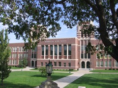 | Wyandotte High School | 0.4 miles | 1986 |
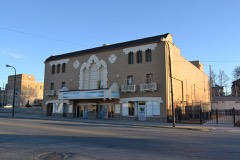 | Granada Theater | 0.9 miles | 2005 |
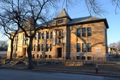 | Lowell Elementary School | 1.0 miles | 2008 |
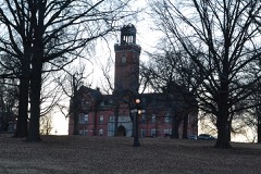 | St. Augustine Hall | 1.1 miles | 1971 |
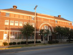 | Kansas City, Kansas High School Gymnasium and Laboratory | 1.1 miles | 2012 |
| National Archives record | The nomination case file for reference 75000729 in Record Group 79. |
| Wyandotte County | All 47 listed properties in this county. |