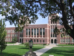
Block
From the record
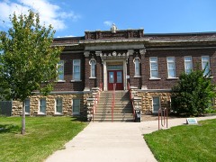
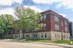
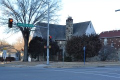
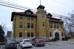
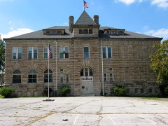
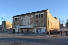
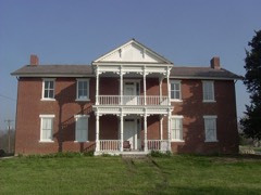
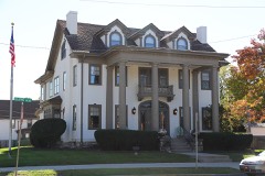
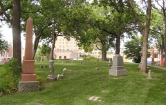
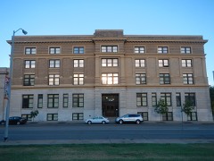
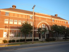
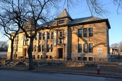
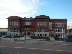
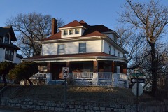
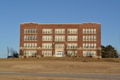
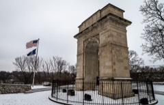
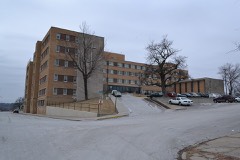
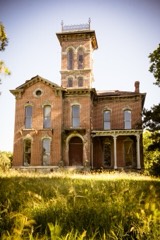
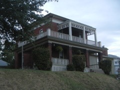
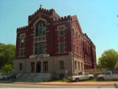
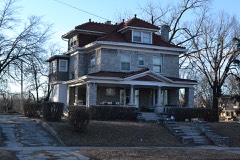
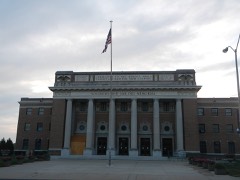
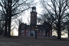
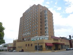
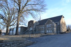
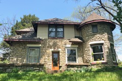
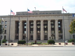
47 National Register listings published here, 1 of them a National Historic Landmark.
Sources: the National Register database, National Park Service
95 topographic sheets cover 29 settlements here, and 47 properties are on the National Register of Historic Places.
47 National Register listings published here, 1 of them a National Historic Landmark.
Sources: the National Register database, National Park Service
Every property in this county listed on the National Register of Historic Places, with the year it was listed and the federal nomination document.
Every wildfire the federal occurrence database records inside this county: 273 of them, burning about 537 acres. 1 started naturally and 19 were recorded as arson. Each settlement page carries the fires within five miles of it.
| Reported cause | Fires |
|---|---|
| Missing data/not specified/undetermined | 168 |
| Smoking | 31 |
| Debris and open burning | 22 |
| Arson/incendiarism | 19 |
| Equipment and vehicle use | 13 |
| Power generation/transmission/distribution | 9 |
| Fireworks | 5 |
| Misuse of fire by a minor | 3 |
| Natural | 1 |
| Other causes | 1 |
| Recreation and ceremony | 1 |
The five largest, by the area the report gives. None of them was recorded as arson.
| Date | Cause | Size | Reported by | Name on the report |
|---|---|---|---|---|
| 7 March 2015 | Missing data/not specified/undetermined | 300 acres | Kansas Forest Service | 5004716 |
| 17 February 2017 | Missing data/not specified/undetermined | 40 acres | Wyandotte County | 3790 |
| 12 February 2017 | Missing data/not specified/undetermined | 30 acres | Wyandotte County | 33 |
| 13 March 2018 | Missing data/not specified/undetermined | 25 acres | Kansas Forest Service | 6009 |
| 4 March 2017 | Missing data/not specified/undetermined | 15 acres | Wyandotte County | 4999 |
| 1 April 2015 | Missing data/not specified/undetermined | 10 acres | Kansas Forest Service | 72 |
| 4 March 2017 | Missing data/not specified/undetermined | 10 acres | Wyandotte County | 4959 |
| 31 January 2018 | Missing data/not specified/undetermined | 10 acres | Kansas Forest Service | 2539 |
Every settlement page carries the fires within five miles of it - see the settlement index below.
The NOAA Storm Events Database holds 442 reports for this county, causing 2 deaths, 47 injuries and about $29,071,530 in recorded property damage. Each settlement page carries the reports that name it.
| Kind of event | Reports |
|---|---|
| Thunderstorm Wind | 196 |
| Hail | 188 |
| Flash Flood | 32 |
| Tornado | 11 |
| Flood | 10 |
| Heavy Rain | 4 |
| Lightning | 1 |
The most serious of them, by death, then injury, then recorded damage. The accounts are quoted exactly as the forecast office filed them.
| When | Event | Place named | Harm | What the report says |
|---|---|---|---|---|
| May 2003 | Tornado (F4) | Bonner Spgs | 2 killed, 30 hurt, $15,500,000 | Tornado touched down just north-northwest of the Kansas Speedway around 318 pm CST. This tornado initially produced F0 to F1 damage, but produced F3 damage to 2 homes, just south of Parallel Parkway near I-435. The tornado grew to a width to near 500 yards in Kansas City, Kansas, where some marginal F4 damage was noted around 91st and Leavenworth Road. The tornado continued some F2 to F3 damage northeast near 84th Terrace north of Leavenworth Road. This is the location where an 82 year old man was killed in his residence. The tornado continued northeast through Wyandotte county, where another instance of marginal F4 damage was noted near 79th Street and Cernech. Considerable structural damage was noted in this location, along with four 150 foot-tall metal power poles engineered to withstand maximum winds over 200 mph. The tornado produced F1 to F2 damage up to the Missouri River before crossing into Platte county Missouri, near Riverside and Parkville around 335 pm CST. |
| May 1961 | Tornado (F4) | not stated | 12 hurt, $2,500,000 | no account filed |
| May 1966 | Tornado (F2) | not stated | 5 hurt, $25,000 | no account filed |
| May 1961 | Tornado (F4) | not stated | $2,500,000 | no account filed |
| May 1961 | Tornado (F4) | not stated | $2,500,000 | no account filed |
| October 1998 | Flash Flood | Kansas City | $2,000,000 | no account filed |
| August 2004 | Flash Flood | Bonner Spgs | $1,000,000 | Numerous homes and businesses reported water damage due to heavy rains in the area. Nearly 6 inches of rain feel across the town. |
| June 1999 | Flash Flood | Countywide | $1,000,000 | Damaging flash flooding occurred in and around Kansas City, Kansas on the morning of June 28. Emergency crews rescued residents from approximately 30 flooded cars and 15 to 20 flooded homes. Dozens of homes were evacuated due to the flood waters. A bridge in Kansas City was damaged by the fast-moving flood waters, and sections of Interstates 35 and 635 were closed due to high water. Three buildings in Kansas City collapsed, as walls and foundations gave way under the force of the water. |
| August 2004 | Flash Flood | Kansas City | $500,000 | 4 to 6 inches across the area produced the worst flooding since 1998. Numerous water rescues were needed. Numerous businesses and homes had water damage. |
| July 1994 | Thunderstorm Wind | Kansas City | $500,000 | Thunderstorm winds broke power poles and downed trees into power lines knocking out power to over 26,000 homes. Damages were estimated to be around $100,000. |
| March 2006 | Thunderstorm Wind | Edwardsville | $150,000 | Thunderstorm wind damage to the Great Wolf Lodge. |
| March 2006 | Hail | Bonner Spgs | $150,000 | no account filed |
| March 2006 | Hail | Bonner Spgs | $150,000 | no account filed |
| March 2006 | Hail | Kansas City | $100,000 | no account filed |
| June 1999 | Flood | Countywide | $100,000 | no account filed |
| May 2000 | Hail | Kansas City | $50,000 | An isolated thunderstorm tracked south-southeast across the Kansas side of the Kansas City metro area. Hail from quarter to golfball size was reported, and numerous vehicles were damaged at an automobile dealership in Kansas City, Kansas. |
| May 1999 | Thunderstorm Wind | Piper | $50,000 | Thunderstorm winds tore the roof off of the school superintendent's office in Piper. |
| March 2006 | Hail | Kansas City | $50,000 | no account filed |
| June 1996 | Thunderstorm Wind | Bonner Springs | $40,000 | no account filed |
| July 2008 | Flash Flood | Kansas City | $30,000 | One to two feet of water was reported over roads, between 14th and 20th Streets on Washington Avenue. Several vehicles were reported submerged with water rescues needed. |
| May 2005 | Thunderstorm Wind | Kansas City | $25,000 | Roofs torn off 2 homes and church suffered wind damage |
| August 2004 | Thunderstorm Wind | Kansas City | $25,000 | 40 foot construction trailer destroyed at 118th and Parallel. Trees also downed. |
| April 2006 | Hail | Piper | $25,000 | no account filed |
| April 1999 | Flood | Countywide | $25,000 | no account filed |
| May 1995 | Thunderstorm Wind | Kansas City | $20,000 | Strong winds knocked a tree down onto a Home at 14th street and Ohio Avenue. |
| April 1995 | Hail | Edwardsville | $20,000 | no account filed |
| September 2001 | Thunderstorm Wind | Kansas City | $10,000 | Tree fell on house and damaged roof. Garage door blown in. Numerous trees and power lines down. |
| July 2009 | Flash Flood | Pomeroy | $5,000 | People had to be rescued from their cars, at 14th Street and Washington Avenue. Cars were reported to have been nearly submerged, by the flood waters. |
| February 2007 | Lightning | Bonner Spgs | $5,000 | Lightning struck a transformer on the roof of a middle school. |
| August 1997 | Thunderstorm Wind | Bonner Spgs | $5,000 | Tree limbs, 3 to 6 inches in diameter were downed by thunderstorm winds in northwest Wyandotte County. The reports occurred about 12 miles north of Bonner Springs. |
| July 1995 | Thunderstorm Wind | Kansas City | $3,000 | Numerous trees blown down from thunderstorm winds. |
| June 1995 | Thunderstorm Wind | Kansas City | $3,000 | A severe thunderstorm produced a wind gust of 60 mph in Kansas City along Interstate 435 just north of the Kansas River. Tree limbs were downed, knocking out power to about 100 customers. |
| May 2010 | Thunderstorm Wind | Piper | $2,000 | Large trees and power lines were reported down. |
| May 1995 | Thunderstorm Wind | Kansas City | $2,000 | Severe thunderstorms produced damaging winds and torrential rainfall in the Kansas City area. Some trees were downed, and several roads were closed and under water across the southern part of the county. |
| May 2005 | Thunderstorm Wind | Kansas City | $1,000 | Trees and power lines down between 16th and Kansas Avenue and 8th Avenue. |
| July 2008 | Hail | Morris | $500 | A car window was busted out by the large hail. |
| April 1960 | Tornado | not stated | $30 | no account filed |
| March 2026 | Hail | Pomeroy | - | Social media report with photo of 3 inch hail south of Leavenworth Road. |
| March 2026 | Hail | Wolcott | - | Half dollar sized hail reported near I-435 and Leavenworth Road. |
| March 2026 | Hail | Piper | - | Half dollar size hail reported west of I-435 and Leavenworth Rd junction. |
| March 2026 | Hail | Muncie | - | Quarter sized hail reported east of the Legends. |
| March 2026 | Hail | Piper | - | Quarter sized hail north of the Legends. |
| March 2026 | Hail | Nearman | - | Half dollar sized hail reported along Parallel Pkwy. |
| April 2026 | Hail | Morris | - | Mping report of quarter sized hail. |
| April 2026 | Hail | Turner | - | Quarter sized hail in northern Shawnee. |
| April 2026 | Hail | Kansas City | - | Quarter sized hail in Kansas City KS. |
| May 2025 | Thunderstorm Wind | Turner | - | Downed wires near Hagemann Street. |
| May 2025 | Thunderstorm Wind | Kansas City | - | Downed trees at a residence near Everett Avenue. |
| August 2025 | Thunderstorm Wind | Turner | - | Social media report with photos showing large tree limbs downed at a residence near 14th Street and Steele Road. |
| June 2025 | Thunderstorm Wind | Muncie | - | Downed tree and wires near Elizabeth Avenue. |
| June 2025 | Thunderstorm Wind | Kansas City | - | Semi blown over on I-635 near Parallel Parkway. |
| June 2025 | Thunderstorm Wind | Kansas City | - | Downed wires near Greeley Avenue. |
| June 2025 | Thunderstorm Wind | Kansas City | - | Downed tree and wires near Cleveland Avenue. |
| June 2025 | Thunderstorm Wind | Turner | - | Downed tree onto a building near the KU Medical Center. |
| June 2025 | Thunderstorm Wind | Kansas City | - | Downed tree and wires near 17th Street and Interstate 70. |
| June 2025 | Thunderstorm Wind | Muncie | - | Trees downed near State Avenue in Kansas City. |
| June 2025 | Thunderstorm Wind | Muncie | - | Downed tree limbs near 71st Terrace. |
| June 2025 | Thunderstorm Wind | Edwardsville | - | Downed tree limbs near State Avenue near the Legends/Kansas Speedway area. |
| June 2025 | Thunderstorm Wind | Muncie | - | Trees down on 72nd and Riverview near the Turner Diagonal. |
| June 2025 | Thunderstorm Wind | Muncie | - | Several social media and spotter reports and photos of trees and power poles down near State Avenue between 78th and 94th Streets. |
The Survey's mineral resources record lists 9 workings inside this county. All of them still produce. Each settlement page carries the workings within five miles of it.
| Commodity | Workings |
|---|---|
| Sand and Gravel, Construction | 4 |
| Stone, Crushed/Broken | 4 |
| Perlite | 1 |
The least common of them first, because a county's hundredth gravel pit says nothing its first ten did not.
| Where | Site | Commodity | Status | Recorded |
|---|---|---|---|---|
| Lite Weight Products Perlite Plant | Perlite | Producer | ||
| Bonner Springs Cement Plant | Stone, Crushed/Broken | Producer | ||
| Builders #1 Dredge & Pit | Sand and Gravel, Construction | Producer | ||
| Lone Star Quarry & Mill | Stone, Crushed/Broken | Producer | ||
| Muncie Creek Dredge & Plant | Sand and Gravel, Construction | Producer | ||
| Muncie Plant #6 | Sand and Gravel, Construction | Producer | ||
| Superior Sand & Gravel Dredge | Sand and Gravel, Construction | Producer | ||
| Tobin Mine & Mill | Stone, Crushed/Broken | Producer | ||
| Underground Mine & Mill | Stone, Crushed/Broken | Producer |
Named settlements recorded in the Geographic Names Information System, each with the topographic sheets covering it. Villages, hamlets and abandoned places alike. Each is shown with the nearest named watercourse or landform and the survey quadrangle it falls on.
Kansas City city · 66104 · Near Malone Hollow · Parkville quadrangle
40 sheets, 1890 to 1996
Bonner Springs city · 66012 · On Spring Creek · Bonner Springs quadrangle
36 sheets, 1890 to 1983
Edwardsville city · 66111 · On West Mission Creek · Edwardsville quadrangle
38 sheets, 1890 to 1991
Kansas City city · 66115 · On Jersey Creek · North Kansas City quadrangle
40 sheets, 1890 to 1997
Bonner Springs city · 66012 · On Spring Creek · Bonner Springs quadrangle
36 sheets, 1890 to 1983
Kansas City city · 66103 · On Cottonwood Creek · Shawnee quadrangle
37 sheets, 1890 to 1991
Kansas City city · 66111 · On Little Turkey Creek · Edwardsville quadrangle
38 sheets, 1890 to 1991
Edwardsville city · 66111 · On Betts Creek · Edwardsville quadrangle
38 sheets, 1890 to 1991
Bonner Springs city · 66012 · On East Mission Creek · Edwardsville quadrangle
38 sheets, 1890 to 1991
Kansas City city · 66109 · On Marshall Creek · Wolcott quadrangle
37 sheets, 1890 to 1983
Kansas City city · 66103 · On Turkey Creek · Shawnee quadrangle
37 sheets, 1890 to 1991
Kansas City city · 66106 · On Little Turkey Creek · Edwardsville quadrangle
38 sheets, 1890 to 1991
Kansas City city · 66111 · On Mill Creek · Edwardsville quadrangle
38 sheets, 1890 to 1991
Bonner Springs city · 66012 · On East Mission Creek · Edwardsville quadrangle
38 sheets, 1890 to 1991