
BlockBefore
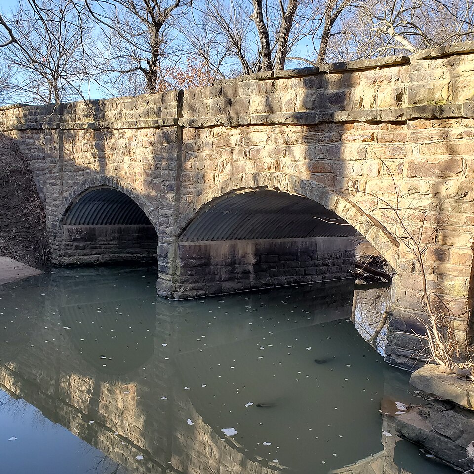
Photograph of Brush Creek Bridge
Photograph by Jwhiteker, CC BY-SA 4.0. Via Wikimedia Commons.

Brush Creek Bridge

Built in 1930. Listed on the National Register of Historic Places in 1985.

From the record

“The Brush Creek Bridge, near Coyville, Kansas, was built in 1930. It was listed on the National Register of Historic Places in 1985.”

Wikipedia article Brush Creek Bridge (Coyville, Kansas), CC BY-SA 4.0.

One of 10 National Register listings published here for Wilson County · listed in 1985 · category: Structure · built in 1930.

Sources: the Wikipedia article · the National Register database, National Park Service · the Wikipedia article

The listing

  • What is counted as historic. The nomination lists 1 structure as contributing to the listing.
  • Address. 0.5 mi. S of Coyville, Coyville, 66736
  • When was it listed? July 1985
  • Category. structure
  • Also known as. Masonry Arch Bridges of Kansas TR
  • Township. Verdigris township
  • When was it built? 1930
  • National Register reference number. 85001419 - assigned by the National Park Service when the property was listed.

Fires near this property

12 since 2001

Regional context, not property-specific evidence. The federal wildfire occurrence database lists 12 fires within 5 miles of Brush Creek Bridge between 2001 and 2018, burning about 1,166 acres in total. None started naturally. 1 was recorded as arson. Distance is straight-line from the map coordinates, so a fire counted here may appear on a neighbouring settlement's page as well.

Reported cause Fires
Missing data/not specified/undetermined5
Debris and open burning4
Arson/incendiarism1
Recreation and ceremony1
Equipment and vehicle use1

The most recent of them, most recent first, with the day each was reported and the service that recorded it.

DateCause SizeReported by Name on the report
3 August 2017Debris and open burning100 acresWilson County2017037
5 April 2018Debris and open burning375 acresKansas Forest Service2018009
23 April 2001Equipment and vehicle use1.0 acresWoodson Countynot named
14 April 2003Recreation and ceremony320 acresWoodson Countynot named
5 March 2016Arson/incendiarism80 acresKansas Forest Service1600034
5 March 2016Missing data/not specified/undetermined200 acresKansas Forest Service1600035
16 March 2015Debris and open burningunder an acreKansas Forest Service2015032
8 February 2015Missing data/not specified/undetermined3.0 acresKansas Forest Service2015014

Every fire recorded in Wilson County

Storms near this property

33 since 1996

Regional context, not property-specific evidence. The National Weather Service names Coyville, the town this property stands in, in 33 storm reports between 1996 and 2024: 12 hail, 8 thunderstorm wind, 4 flash flood, 4 heavy rain. No death or injury is recorded in these reports. Each account below is quoted exactly as the forecast office filed it, from the NOAA Storm Events Database, and each date opens the federal record of that event.

WhenEvent Place namedHarm What the report says
June 2008Thunderstorm WindCoyville$25,000A tractor trailer was overturned by high winds.
March 2006Tornado (F1)Coyville$20,000Damaged a barn, carport, and some trees.
May 2010Thunderstorm WindCoyville$10,000Several outbuildings were damaged by strong downburst winds.
April 2015Thunderstorm WindCoyville$7,500Half of a barn roof was blown off. Also eight inch diameter tree limbs were blown down.
August 2019Flash FloodCoyville$100Sections of Kansas highway 39 were flooded.
April 2024Tornado (EF0)Coyville-Rural fire department found the tornado track starting in Wilson County with most of the damage occurring in Woodson County.
May 2024Heavy RainCoyville-Twenty four hour rainfall from COOP observer of 2.25 inches.
April 2024FloodCoyville-Heavy rain from training thunderstorms produced a range from 3.27 to 8.9 inches of reported rainfall which led to continued flooding with rises along rivers, creeks and streams. High water from Fall River closed United States Highway 400 between Neodesha and Fredonia because of water flowing over it from 6:30AM on the 28th until 7PM that evening. Additionally part of a railroad track near Iola Road south of Fredonia was washed out from the rises along the river which eroded the embankment of the track. Other county roads had water over them well after the rain ended with damage to many of them.
July 2023Thunderstorm WindCoyville-A metal shed was crumpled and tossed.
August 2023Heavy RainCoyville-Rainfall in the past 24hours of 2.18 inches.
May 2022Heavy RainCoyville-A Coop observer in Coyville, Kansas reported a 24 hours total of 2.55 inches.
June 2022Heavy RainCoyville-The Coop observer 2 miles northwest of Coyville reported 3.25 inches of rainfall in 24 hours.
May 2019Flash FloodCoyville-Water flowed swiftly across Decatur Rd. between 1 and 1.33 miles north of Coyville.
July 2016Tornado (EF0)Coyville-Rural Fire Department reported a very brief touchdown in open country.
May 2015FloodCoyville-Reports of minor street flooding was noted at many low water crossings across the county.
July 2013Flash FloodCoyville-High water was flowing across highway 75 just north of Buffalo.
August 2009Flash FloodCoyville-Rainfall amounts of 3 to 5 inches during the late evening hours on the 19th and early morning hours on the 20th caused flooding across a good chunk of Wilson county. Even though the flooding was rather widespread, it was confined mainly to flood prone low-lying areas, flood prone county roads and low water crossings.
August 2006HailCoyville-Occurred along with 50 mph winds.
April 2023HailCoyville-no account filed
May 2014HailCoyville-no account filed
October 2007HailCoyville-no account filed
March 2006HailCoyville-no account filed
May 2006Thunderstorm WindCoyville-no account filed
May 2005HailCoyville-no account filed
May 2003HailCoyville-no account filed
July 2003Thunderstorm WindCoyville-no account filed
June 2001Thunderstorm WindCoyville-no account filed
March 1997HailCoyville-no account filed
June 1996HailCoyville-no account filed
April 1996HailCoyville-no account filed

Every storm recorded in Wilson County

Map coverage status

No historic map-sheet match is published for this property yet. That does not mean no map exists. This record needs a coordinate-quality review before it can be joined to a sheet boundary. Browse the county's mapped places while that work is pending.

Sources for this property

National Archives recordThe nomination case file for reference 85001419 in Record Group 79.
Wikipedia articleCommunity-written account of this property, licensed CC BY-SA.
Wilson CountyAll 10 listed properties in this county.

Provenance

  • Listing record. National Park Service National Register of Historic Places, listed-properties dataset, current to 2026-05-22.
  • Map join. Address geocoded through the United States Census geocoder, then tested against the published boundary of every sheet in the USGS Historical Topographic Map Collection.
  • How this page is made. Listing fields come from federal records; map-sheet coverage is a labelled coordinate-to-boundary calculation, not a source-field claim.
  • Wildfire. Short, Karen C. 2022. Spatial wildfire occurrence data for the United States, 1992-2020 [FPA_FOD_20221014]. 6th Edition. Fort Collins, CO: Forest Service Research Data Archive. https://doi.org/10.2737/RDS-2013-0009.6 Collected with United States Government funding and usable without additional permissions or fees.
  • Storms. NOAA National Centers for Environmental Information, Storm Events Database https://www.ncei.noaa.gov/stormevents/ A work of the United States government, no copyright under 17 U.S.C. 105. Narratives are quoted verbatim from the National Weather Service report and are not edited or summarised.