
BlockBefore
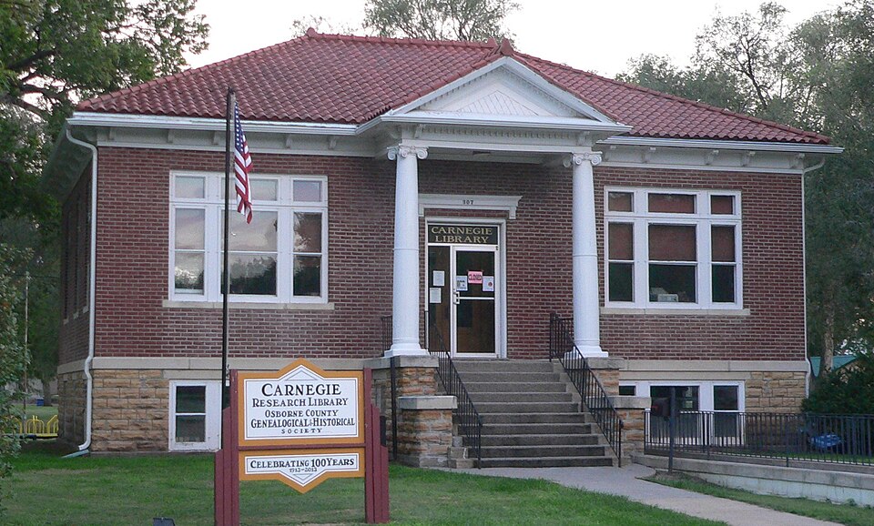
Photograph of Osborne Public Carnegie Library
Photograph by Ammodramus, CC0 1.0. Via Wikimedia Commons.

Osborne Public Carnegie Library

Built in 1913 (Neoclassical architecture). Listed on the National Register of Historic Places in 1987.

From the record

“The Osborne Public Carnegie Library is a historic Carnegie library in Osborne, Kansas. It was built around 1913 and was listed on the National Register of Historic Places in 1987.”

Wikipedia article Osborne Public Carnegie Library, CC BY-SA 4.0.

One of 7 National Register listings published here for Osborne County · listed in 1987 · category: Building · built in 1913, Neoclassical architecture.

Sources: the Wikipedia article · the National Register database, National Park Service
The listing

  • What is counted as historic. The nomination lists 1 building as contributing to the listing.
  • Address. Third and Main, Osborne, 67473
  • When was it listed? June 1987
  • Category. building
  • Also known as. Carnegie Libraries of Kansas TR
  • Township. Penn township
  • When was it built? 1913
  • Architectural style. Neoclassical architecture
  • National Register reference number. 87000967 - assigned by the National Park Service when the property was listed.

Storms near this property

60 of 142 shown

Regional context, not property-specific evidence. The National Weather Service names Osborne, the town this property stands in, in 142 storm reports between 1994 and 2024: 79 hail, 51 thunderstorm wind, 6 heavy rain, 3 tornado. The reports record 11 injuries. Each account below is quoted exactly as the forecast office filed it, from the NOAA Storm Events Database, and each date opens the federal record of that event.

WhenEvent Place namedHarm What the report says
May 2007Tornado (EF2)Osborne11 hurt, $150,000A tornado sat down south of Osborne and moved north into town. The twister destroyed 2 mobile homes, damaged roofs, fences, cars and windows, and damaged 2 restaurants. The Pizza Hut sustained minor damage and several employees car windows were blown out. Across the road, the Circle Inn lost a large part of their roof, a couple of outside walls, and substantial damage happened to the interior portion of the restaurant. A couple of semi-trailers were blown around and one ended up on top of another car. Eleven people were injured, none seriously, and were treated at the Osborne County Memorial Hospital. The Osborne County Sheriff's office reported the most severe injury was a broken arm. (sources: Osborne County Farmer newspaper, Osborne County Sheriff's office, and the Osborne County Emergency Management Agency).
May 2024HailOsborne$500,000no account filed
June 2011Thunderstorm WindOsborne$200,000A prolonged period of wind gusts generally between 45 and 60 MPH, but as high as 80 MPH, was reported in town. Trees up to 1 to 2 feet in diameter, and several smaller limbs, were knocked down across town. Two metal outbuildings were damaged. The first had a door and wall blown out, while the second was moved approximately 100 yards from its original location. Numerous homes across town suffered roof damage.
May 2013HailOsborne$150,000Hail ranging in size from quarters to golf balls was reported.
August 2020HailOsborne$100,000Hail of quarter to ping pong ball size was reported along this swath.
April 2008HailOsborne$100,000no account filed
June 1996Thunderstorm WindOsborne$80,000no account filed
September 2012Thunderstorm WindOsborne$60,000Wind gusts estimated near 70 mph, snapping a few power poles, blowing off a shed roof and heavily damaging a grain bin along the path.
August 2015Thunderstorm WindOsborne$50,000Wind gusts were both estimated and measured between 65 and 70 MPH in the area. There was notable tree damage in Osborne, including larger limbs and a few uprooted trees. An empty semi trailer at a local business was tipped over. A number of power poles were either damaged or snapped. There was damage to an outbuilding located at the airport approximately 1 mile east of town. An abandoned mobile home lost the majority of its roof. The 68 MPH wind gusts was measured by a KSU mesonet site located 1 mile north-northwest of Osborne.
July 2004Thunderstorm WindOsborne$50,0002.75 inch diameter hail was also reported at this time.
April 2012HailOsborne$50,000no account filed
April 2001Tornado (F1)Osborne$50,000no account filed
June 2014Thunderstorm WindOsborne$40,000Wind gusts were estimated to be near 70 MPH in Osborne, while a mesonet site 1 mile north of town measured a gust of 59 MPH. Several large tree limbs were downed, some between 12 and 18 inches in diameter, and at least one tree was uprooted. One limb landed on a wood post and lattice fence and partially crushed it.
May 1999Tornado (F1)Osborne$35,000no account filed
July 1996Thunderstorm WindOsborne$30,000no account filed
May 2023Thunderstorm WindOsborne$25,000A wind gust of 81 MPH was measured by a Kansas State Mesonet site located one mile north-northwest of Osborne. Received a report from television station KAKE of damage near this mesonet location, and confirmed with county dispatch that at least three power poles were damaged or destroyed.
May 2018Thunderstorm WindOsborne$25,000Wind gusts were estimated to be near 60 MPH. Wind was accompanied by quarter size hail.
June 2014HailOsborne$25,000Hail ranging from quarter to ping pong ball size hail was reported.
July 2009Thunderstorm WindOsborne$25,000Winds estimated at 60 to 70 mph.
August 2020HailOsborne$25,000no account filed
May 2013HailOsborne$25,000no account filed
July 2007HailOsborne$25,000no account filed
July 2005Thunderstorm WindOsborne$25,000no account filed
May 2004HailOsborne$25,000no account filed
July 2004HailOsborne$25,000no account filed
July 2007HailOsborne$20,000no account filed
May 2007HailOsborne$20,000no account filed
April 2008Thunderstorm WindOsborne$10,000This wind gust was measured by weather equipment at the Osborne Elementary School.
May 2007HailOsborne$10,000no account filed
June 1999HailOsborne$10,000no account filed
June 1998HailOsborne$10,000no account filed
June 1996HailOsborne$10,000no account filed
June 1996Thunderstorm WindOsborne$10,000no account filed
June 1996HailOsborne$10,000no account filed
May 2013Thunderstorm WindOsborne$5,000A measured wind gust of 71 mph was recorded by a home weather station.
August 2003HailOsborne$5,000no account filed
May 1998Thunderstorm WindOsborne$5,000no account filed
June 1996Thunderstorm WindOsborne$5,000no account filed
July 1994Thunderstorm WindOsborne$5,000no account filed
July 1994HailOsborne$5,000no account filed
July 1994Thunderstorm WindOsborne$5,000no account filed
May 2008HailOsborne$2,000no account filed
August 1996Thunderstorm WindOsborne$2,000no account filed
July 1995Thunderstorm WindOsborne$2,000no account filed
June 2013Thunderstorm WindOsborne$1,000A large tree was down, along with numerous branches.
June 1994Thunderstorm WindOsborne$500no account filed
June 1994HailOsborne$500no account filed
April 1994HailOsborne$500no account filed
June 1994Thunderstorm WindOsborne$500no account filed
May 2024HailOsborne-Delete me.
July 2024Thunderstorm WindOsborne-A wind gust of 58 MPH was measured by the Kansas State Mesonet station located one mile north-northwest of Osborne.
July 2023Thunderstorm WindOsborne-A wind gust of 58 MPH was measured by a mesonet station located one mile north-northwest of Osborne.
May 2022Thunderstorm WindOsborne-Wind gusts of 58 MPH and 60 MPH were measured by a KSU mesonet station located one mile north-northwest of Osborne.
May 2021HailOsborne-Quarter to half dollar size hail was reported.
July 2020Thunderstorm WindOsborne-Wind gusts of 60 and 65 MPH were recorded by a mesonet station located 8 miles southwest of Osborne.

Every storm recorded in Osborne County

Map coverage status

No historic map-sheet match is published for this property yet. That does not mean no map exists. This record needs a coordinate-quality review before it can be joined to a sheet boundary. Browse the county's mapped places while that work is pending.

Listed places nearby

1 within 8 miles

Other National Register properties close enough to walk or drive between, ordered by distance from this one. Both positions come from the same geocoding pass that matched these properties to their map sheets.

Photograph PropertyDistance Listed
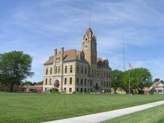
Osborne County Courthouse0.1 miles2002

Sources for this property

National Archives recordThe nomination case file for reference 87000967 in Record Group 79.
Wikipedia articleCommunity-written account of this property, licensed CC BY-SA.
Osborne CountyAll 7 listed properties in this county.

Provenance

  • Listing record. National Park Service National Register of Historic Places, listed-properties dataset, current to 2026-05-22.
  • Map join. Address geocoded through the United States Census geocoder, then tested against the published boundary of every sheet in the USGS Historical Topographic Map Collection.
  • How this page is made. Listing fields come from federal records; map-sheet coverage is a labelled coordinate-to-boundary calculation, not a source-field claim.
  • Storms. NOAA National Centers for Environmental Information, Storm Events Database https://www.ncei.noaa.gov/stormevents/ A work of the United States government, no copyright under 17 U.S.C. 105. Narratives are quoted verbatim from the National Weather Service report and are not edited or summarised.