 Block
From the record
One of 118 National Register listings published here for Douglas County · listed in 1990 · category: Structure · built in 1913.
Sources: the National Register database, National Park Service
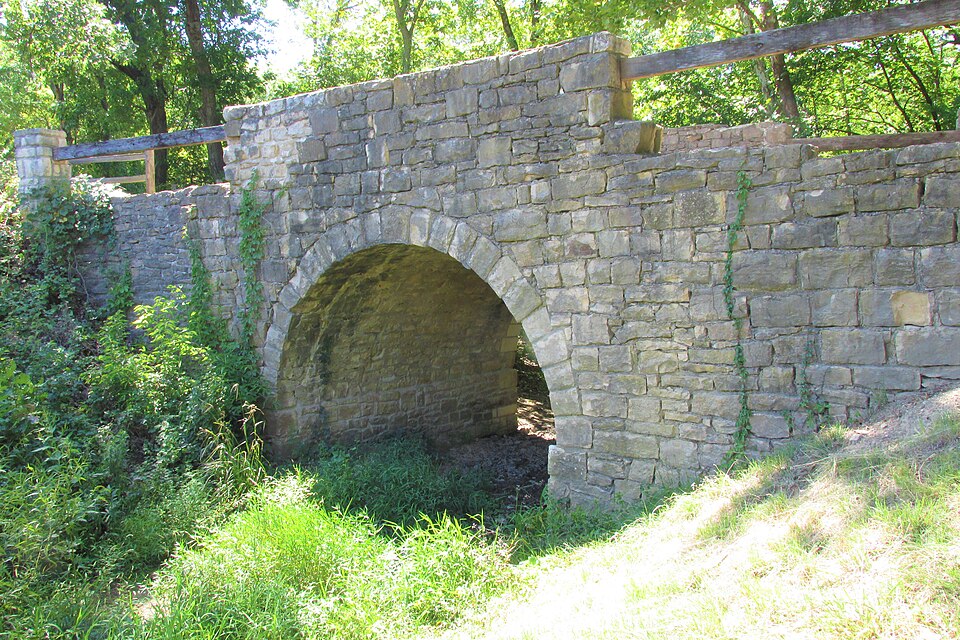
Built in 1913. Listed on the National Register of Historic Places in 1990.
One of 118 National Register listings published here for Douglas County · listed in 1990 · category: Structure · built in 1913.
Sources: the National Register database, National Park Service
Regional context, not property-specific evidence. The federal wildfire occurrence database lists 43 fires within 5 miles of Chicken Creek Bridge between 2015 and 2020, burning about 485 acres in total. None started naturally. 6 were recorded as arson. Distance is straight-line from the map coordinates, so a fire counted here may appear on a neighbouring settlement's page as well.
| Reported cause | Fires |
|---|---|
| Debris and open burning | 24 |
| Missing data/not specified/undetermined | 10 |
| Arson/incendiarism | 6 |
| Equipment and vehicle use | 3 |
The most recent of them, most recent first, with the day each was reported and the service that recorded it.
| Date | Cause | Size | Reported by | Name on the report |
|---|---|---|---|---|
| 16 September 2017 | Missing data/not specified/undetermined | under an acre | Douglas County | 297 |
| 7 July 2018 | Debris and open burning | under an acre | Kansas Forest Service | 707181 |
| 22 July 2017 | Debris and open burning | under an acre | Douglas County | 237 |
| 19 July 2018 | Debris and open burning | under an acre | Kansas Forest Service | 39 |
| 10 July 2018 | Equipment and vehicle use | 3.0 acres | Kansas Forest Service | 710182 |
| 23 June 2020 | Missing data/not specified/undetermined | under an acre | Kansas Forest Service | not named |
| 20 June 2015 | Equipment and vehicle use | under an acre | Kansas Forest Service | 620151 |
| 8 April 2018 | Debris and open burning | 9.0 acres | Kansas Forest Service | 407181 |
Regional context, not property-specific evidence. The National Weather Service names Lone Star, the town this property stands in, in 34 storm reports between 1997 and 2023: 14 hail, 11 thunderstorm wind, 6 flash flood, 3 tornado. The reports record 4 injuries. Each account below is quoted exactly as the forecast office filed it, from the NOAA Storm Events Database, and each date opens the federal record of that event.
| When | Event | Place named | Harm | What the report says |
|---|---|---|---|---|
| May 2019 | Tornado (EF3) | Lone Star | 4 hurt | This tornado appears to have formed just east of Lone Star Lake around 605 pm CDT where it absorbed a smaller circulation and associated tornado as it intensified and move northeast across Douglas county including areas just south and southeast of the city of Lawrence. The tornado became wide and intense as it moved south of Lawrence and crossed highway 10 before moving just north of Eudora and over the Kansas river into Leavenworth county. The damage path was one half to one mile at times with the most intense damage surveyed in the high end EF3 range which suggests winds of 150 to 160 mph. The tornado ended in Leavenworth county around 7 pm CDT with a path of around 28 miles total. The tornado did produce EF4 damage in Leavenworth county around Linwood Kansas. |
| August 2019 | Flash Flood | Lone Star | $250,000 | Serious flash flooding of 12 to 20 homes in lone star impacted by flood waters. 11 water rescues took place during the overnight hours across douglas county. Waters receded by midday. |
| August 2019 | Flash Flood | Lone Star | $100,000 | Report of several homes surrounded by water in the town of lone star. Pictures on social media suggest the water is several feet deep. |
| August 2019 | Flash Flood | Lone Star | $100,000 | Three water rescues have occurred near Washington creek south of lone star. The first was in a home, the second in a vehicle and the third was a citizen trapped on a bridge. In addition, numerous roads in southwestern Douglas county are closed. |
| June 2007 | Flash Flood | Lone Star | $100,000 | County road 1 closed one mile north of Globe. Water flowing over the road from the Lone Star spillway. Numerous reports of flash flooding over roadways east of Vinland to the Clinton Lake area including inundation of low water crossings. | |
| October 1998 | Thunderstorm Wind | Lone Star | $3,000 | Strong winds damaged several buildings south of Clinton Lake near Lone Star. |
| July 2023 | Thunderstorm Wind | Lone Star | - | Measured on a personal weather station. |
| July 2023 | Thunderstorm Wind | Lone Star | - | Measured on a personal weather station. |
| July 2020 | Thunderstorm Wind | Lone Star | - | A small chicken coop was blown over along with a small playground set. |
| May 2017 | Thunderstorm Wind | Lone Star | - | Estimated wind gust. |
| August 2015 | Hail | Lone Star | - | Small tree limbs down as well. |
| June 2014 | Flash Flood | Lone Star | - | Report of 1075 Rd closed due to rushing water across road from nearby creek behind the Wakarusa Valley school. |
| August 2011 | Thunderstorm Wind | Lone Star | - | A trained spotter near Lone Star estimated 70 mph wind gusts. |
| September 2010 | Thunderstorm Wind | Lone Star | - | A trained spotter near Lone Star reported a 60 mph wind gust. |
| September 2010 | Flash Flood | Lone Star | - | County Road 460 was closed near Vinland due to flash flooding. Water was reported running over Highway 59 near County Road 650. |
| August 2004 | Tornado (F0) | Lone Star | - | A tornado touched down westnorthwest of Lone Star and traveled a short distance before dissipating. |
| May 2003 | Tornado (F1) | Lone Star | - | A tornado touched down near Lone Star and moved nearly a quarter mile and damaged some trees before dissipating. |
| May 2018 | Hail | Lone Star | - | no account filed |
| July 2015 | Hail | Lone Star | - | no account filed |
| August 2015 | Hail | Lone Star | - | no account filed |
| September 2015 | Hail | Lone Star | - | no account filed |
| May 2011 | Hail | Lone Star | - | no account filed |
| April 2011 | Hail | Lone Star | - | no account filed |
| August 2003 | Hail | Lone Star | - | no account filed |
| August 2003 | Hail | Lone Star | - | no account filed |
| August 2003 | Thunderstorm Wind | Lone Star | - | no account filed |
| August 2003 | Thunderstorm Wind | Lone Star | - | no account filed |
| July 2003 | Hail | Lone Star | - | no account filed |
| May 2001 | Hail | Lone Star | - | no account filed |
| May 2001 | Hail | Lone Star | - | no account filed |
| April 2001 | Thunderstorm Wind | Lone Star | - | no account filed |
| June 2000 | Thunderstorm Wind | Lone Star | - | no account filed |
| May 2000 | Hail | Lone Star | - | no account filed |
| May 1997 | Hail | Lone Star | - | no account filed |
No historic map-sheet match is published for this property yet. That does not mean no map exists. This record needs a coordinate-quality review before it can be joined to a sheet boundary. Browse the county's mapped places while that work is pending.
Other National Register properties close enough to walk or drive between, ordered by distance from this one. Both positions come from the same geocoding pass that matched these properties to their map sheets.
| Photograph | Property | Distance | Listed |
|---|---|---|---|
| Lone Star Lake Civilian Conservation Corps (CCC) Camp | 2.0 miles | 2023 | |
| Lone Star Lake Dam | 2.2 miles | 2023 | |
 | Elmwood Stock Farm Barn | 2.5 miles | 2022 |
| Willow Springs Santa Fe Trail Segment and DAR Marker | 3.5 miles | 2019 | |
 | Marion Springs School | 4.8 miles | 2018 |
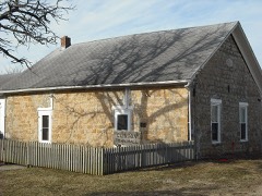 | Clinton School District 25 | 5.3 miles | 1998 |
| National Archives record | The nomination case file for reference 90000298 in Record Group 79. |
| Douglas County | All 118 listed properties in this county. |