 Block
From the record
11 National Register listings published here.
Sources: the National Register database, National Park Service
48 topographic sheets and 7 fire insurance atlases across 2 places.
11 National Register listings published here.
Sources: the National Register database, National Park Service
Every property in this county listed on the National Register of Historic Places, with the year it was listed and the federal nomination document.
| Photograph | Property | Type | Listed | Reference |
|---|---|---|---|---|
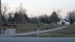 | Robert C. Beauchamp House | building | 1976 | 76000894 |
 | Hancock County Courthouse | building | 1975 | 75000765 |
| Hawesville Historic District | district | 1984 | 84001536 | |
 | Isaac R. Hayden House | building | 1984 | 84001539 |
 | Tom Henderson House | building | 1984 | 84001540 |
 | Immaculate Conception Church | building | 1975 | 75000766 |
 | Lewisport Masonic Lodge | building | 1984 | 84001541 |
| Samuel Pate House | building | 1978 | 78001335 | |
 | Horace Patterson House | building | 1984 | 84001543 |
 | Joe Pell Building | building | 1984 | 84001544 |
 | Taylor, J. B., and Son Feed Store | building | 1984 | 84001546 |
Drawn when these were printed as single large sheets: the town seen from the air, and the county divided into its farms with every owner named. Each opens the original at the Library of Congress.

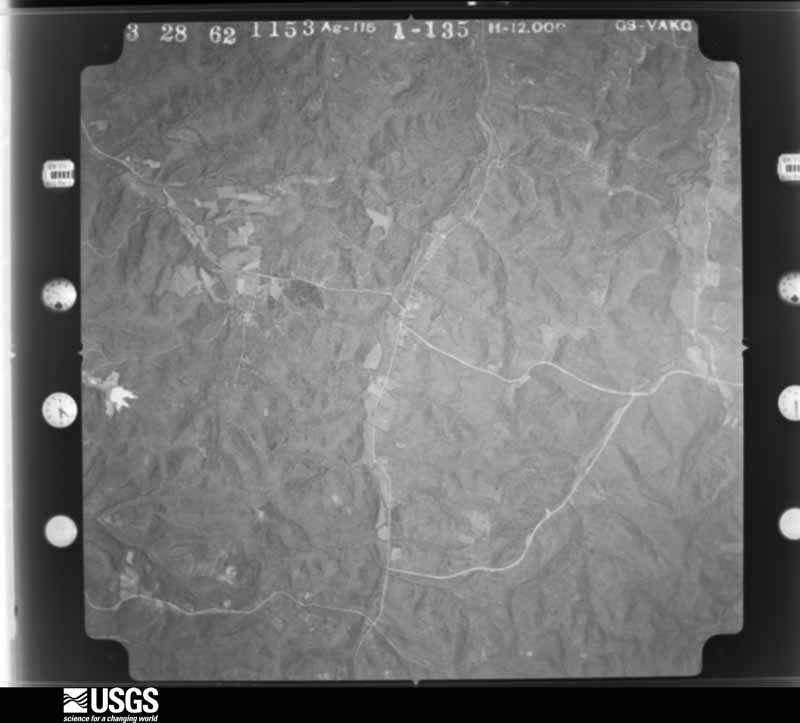
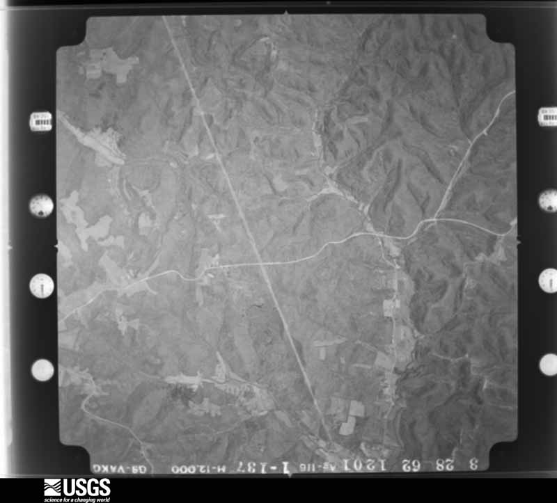
Flown by the U.S. Geological Survey between 1937 and 1989, the Aerial Photo Single Frames collection is the definitive mid-century view of the land: fields, roads and rivers as the camera saw them. The Survey holds 886 frames inside the rectangle that bounds this county; the 34 frames below were taken over the county itself, chosen across the decades of flights (at most four a year from that rectangle), so one flight cannot crowd out the rest. The full set is free to browse and download at EarthExplorer under the dataset Aerial Photo Single Frames.
































The thermometers that kept this county's weather, as the federal records hold them. The extremes below are measured values from those records, not estimates.
Who lived here in 1950, one enumeration district at a time, as the Census Bureau described each district. Each row opens its official National Archives result, with Population Schedules and ED Maps available there.
Every wildfire the federal occurrence database records inside this county: 29 of them, burning about 746 acres. None started naturally and 1 was recorded as arson. Each settlement page carries the fires within five miles of it.
| Reported cause | Fires |
|---|---|
| Missing data/not specified/undetermined | 10 |
| Recreation and ceremony | 9 |
| Debris and open burning | 5 |
| Railroad operations and maintenance | 2 |
| Smoking | 2 |
| Arson/incendiarism | 1 |
The five largest, by the area the report gives. One of them was set deliberately.
| Date | Cause | Size | Reported by | Name on the report |
|---|---|---|---|---|
| 13 November 1999 | Arson/incendiarism | 300 acres | Kentucky Division of Forestry | not named |
| 23 March 2016 | Recreation and ceremony | 100 acres | Kentucky Division of Forestry | TRUKEY NEST |
| 27 February 2006 | Missing data/not specified/undetermined | 98 acres | Kentucky Division of Forestry | not named |
| 27 March 2007 | Recreation and ceremony | 50 acres | Kentucky Division of Forestry | not named |
| 14 February 2006 | Missing data/not specified/undetermined | 40 acres | Kentucky Division of Forestry | not named |
| 3 March 2006 | Missing data/not specified/undetermined | 30 acres | Kentucky Division of Forestry | not named |
| 29 February 2004 | Missing data/not specified/undetermined | 30 acres | Kentucky Division of Forestry | not named |
| 28 February 2004 | Missing data/not specified/undetermined | 25 acres | Kentucky Division of Forestry | not named |
Every settlement page carries the fires within five miles of it - see the settlement index below.
The NOAA Storm Events Database holds 182 reports for this county, causing no deaths, 1 injury and about $562,500 in recorded property damage. Each settlement page carries the reports that name it.
| Kind of event | Reports |
|---|---|
| Thunderstorm Wind | 122 |
| Hail | 26 |
| Flash Flood | 21 |
| Tornado | 8 |
| Flood | 4 |
| Heavy Rain | 1 |
The most serious of them, by death, then injury, then recorded damage. The accounts are quoted exactly as the forecast office filed them.
| When | Event | Place named | Harm | What the report says |
|---|---|---|---|---|
| June 1987 | Thunderstorm Wind | not stated | 1 hurt | no account filed |
| October 2007 | Tornado (EF1) | Utility | $150,000 | The tornado crossed into Hancock County from Daviess County, KY, near Highway 1389. It continued northeast, with intermittent touchdowns, until it lifted in the southwest outskirts of Hawesville. A mobile home was destroyed along Highway 1389. Several barns and sheds were blown down near the intersection of highways 271 and 1389. Most of the damage, however, was in the form of large trees being uprooted or snapped. The parent thunderstorm crossed into Perry County, IN, where it later produced another tornado to the northeast of Cannelton. |
| June 2011 | Thunderstorm Wind | Waitman | $100,000 | Numerous trees were downed and several barns and other industrial buildings were damaged in a 1 1/2 mile wide swath that stretched for about 6 miles just west-southwest of Lockport. Evidence of both cyclonic and anti-cyclonic rotation of downed trees and debris was observed by the NWS damage surveyor at the eastern end of the area, where the greatest damage occurred, including the destruction of a large, well-built metal barn and another, smaller industrial outbuilding. Interior damage of walls occurred to living quarters attached to the metal barn. Farther west, a wooden barn was pushed eastward 3 feet off its foundation. |
| March 2012 | Tornado (EF1) | Chambers | $40,000 | This tornado had intermittent touchdowns along a long track that began 7 miles west of Cloverport. It traveled in Hancock County for 6 miles before entering Breckinridge County 1 mile west of Cloverport. The tornado first touched down along Route 2181. Vinyl siding was removed from a home and small outbuildings were damaged. It then continued eastward, intermittently touching down and crossing Route 69. Four miles west of Cloverport, additional minor damage was surveyed to a group of homes along Route 2169. This tornado brought EF-1 damage to Hancock County. |
| April 2016 | Thunderstorm Wind | Lewisport | $30,000 | A Hancock County official reported several trees down in the area, one of which fell on a truck. The majority of the storm damage was reported in the Lewisport area. |
| July 2017 | Thunderstorm Wind | Lewisport | $25,000 | State officials reported several trees down in the area due to severe thunderstorm winds. One tree fell onto a house. |
| July 2006 | Thunderstorm Wind | Hawesville | $25,000 | Shingles were blown off of roofs. A trained spotter estimated an 80 mph wind gust. |
| June 1990 | Tornado (F0) | not stated | $25,000 | no account filed |
| January 1999 | Thunderstorm Wind | Hawesville | $22,000 | Four trees down on a house, mobile home blown off foundation |
| July 2017 | Thunderstorm Wind | Utility | $20,000 | A 3 foot diameter tree fell onto a mobile home. |
| December 2013 | Thunderstorm Wind | Goering | $20,000 | A reporter from the Hawesville newspaper provided information about a home on Goering Road that was badly damaged by winds estimated at 70 mph. The home lost its front porch and a section of an attached roof. A nearby barn was destroyed. The house's attached garage had its door blown in, with a section of the garage's back wall bowed out. |
| July 2016 | Thunderstorm Wind | Lewisport | $15,000 | Local law enforcement reported a tree fell on a vehicle due to severe thunderstorm winds. |
| September 2012 | Thunderstorm Wind | Utility | $10,000 | A 9000 square foot metal building at a saw mill was damaged. |
| April 2006 | Thunderstorm Wind | Hawesville | $10,000 | Area homes suffered unspecified roof damage. |
| May 1995 | Thunderstorm Wind | Hawesville | $10,000 | Several trees and large limbs were blown down in Hawesville. |
| July 1995 | Thunderstorm Wind | Countywide | $10,000 | Numerous trees and power lines were blown down across the county. |
| July 1995 | Thunderstorm Wind | Hawesville | $10,000 | A garage and greenhouse was damaged three miles south of Hawesville. |
| September 2018 | Tornado (EF0) | Lewisport | $6,000 | This tree-top level tornado did all of its damage 20 to 30 feet above ground. Never more than 50 yards wide, the first evidence of the tornado touching down was one mile south of the water tower on Thomas Lane, where it downed several large branches that blocked the road. Moving northeast over forested land, the next evidence was more tree trunks and branches snapped on Poplar Grove Rd just north of the intersection with Hilldale Rd. The tornado then continued to skip northeast, snapping branches and trunks to the west of Frank Luttrell Rd, before crossing the road and causing minor roof damage to the metal roof of a barn and snapping more tree limbs a third of a mile southeast of North Hancock Elementary School. The tornado dropped small branches and leaves along its path as it continued northeast. The last major tree damage was observed around a home on Adair Rd, where trees were uprooted and trunks snapped in a cyclonic pattern around the home. The only damage to the home, however, was minor roof damage from a branch falling on it. The storm then crossed Adair Rd, lifting somewhere in a wooded area west of a large pond near Beauchamp Lane, where residents witnessed its dissipation. |
| July 2017 | Thunderstorm Wind | Lewisport | $5,000 | Severe thunderstorm winds peeled the roof off a home on Lake Street in Lewisport. |
| January 2012 | Thunderstorm Wind | Lewisport | $5,000 | Local law enforcement reported that a storage building was destroyed. Roof damage was noted with a few nearby homes. |
| January 2012 | Thunderstorm Wind | Lewisport | $5,000 | An amateur radio operator reported that a barn was destroyed along State Highway 334. |
| January 2008 | Thunderstorm Wind | Hawesville | $5,000 | Thunderstorm winds downed several trees, and blew over an outbuilding. |
| May 2003 | Thunderstorm Wind | Patesville | $5,000 | Several outbuildings were destroyed. Trees were uprooted. |
| June 1987 | Tornado (F0) | not stated | $2,500 | no account filed |
| June 1970 | Tornado (F1) | not stated | $2,500 | no account filed |
| July 2016 | Thunderstorm Wind | Lewisport | $2,000 | Local law enforcement reported trees down on a power line blocking Sand Hill Road. |
| April 1996 | Thunderstorm Wind | Weberstown | $2,000 | no account filed |
| November 1993 | Thunderstorm Wind | not stated | $500 | Thunderstorms blew down numerous trees around Roseville. |
| April 2026 | Thunderstorm Wind | Petrie | - | A tree fell across State Road 271 South. |
| March 2025 | Thunderstorm Wind | Chambers | - | A tree was down on power lines. |
| March 2025 | Hail | Hawesville | - | Quarter sized hail was reported in Hawesville. |
| March 2025 | Thunderstorm Wind | Utility | - | Trees were blown across Kentucky Route 1389 just south of the intersection with Kentucky Route 1403. |
| March 2025 | Thunderstorm Wind | Sunny Corner | - | A tree was down on Squirrel Tail Hollow Road. |
| March 2025 | Thunderstorm Wind | Utility | - | A tree fell on Lambert Schoolhouse Road and Scifres Ridge Road. |
| May 2025 | Thunderstorm Wind | Petrie | - | A tree was blown down onto power lines on Kentucky Route 271 west of Hawesville. |
| May 2025 | Thunderstorm Wind | Weberstown | - | A large tree was blown down across Kentucky Route 69 near Weberstown. |
| May 2025 | Thunderstorm Wind | Weberstown | - | Several trees were blown down by strong winds along Kentucky Route 144 between Weberstown and Arrington Corner. Some downed trees fell onto power lines. |
| May 2025 | Thunderstorm Wind | Goering | - | Multiple trees were downed by strong winds near the intersection of Pellville-Hawesville Road and Joe Powers Road. |
| May 2025 | Thunderstorm Wind | Goering | - | A tree was blown down on the 7200 block of Kentucky Route 69. |
| May 2025 | Thunderstorm Wind | Victoria Xrds | - | A tree was blown down along Hawesville Easton Road between Lamastus Road and Boling Hill. |
| May 2025 | Thunderstorm Wind | Chambers | - | A tree was blown down near the intersection of Middle Knottsville Road and Storm Road. |
| April 2025 | Thunderstorm Wind | Cabot | - | A tree fell down over the 800 block of Paul Baker Road. |
| April 2025 | Thunderstorm Wind | Waitman | - | There was a tree down on US 60. |
| April 2025 | Thunderstorm Wind | Lewisport | - | A tree was blocking the driveway of Heartland Villa. |
| February 2024 | Hail | Easton | - | There was a report of quarter size hail in Easton. |
| February 2024 | Thunderstorm Wind | Dukes | - | There was a large tree down on a garage. |
| February 2024 | Thunderstorm Wind | Utility | - | There was a tree down on a garage. |
| May 2024 | Thunderstorm Wind | Cabot | - | A tree was downed by strong winds on Easton Cabot Road. |
| May 2024 | Thunderstorm Wind | Hawesville | - | A tree was downed by strong winds on Tick Ridge Road south of Hawesville. |
| July 2024 | Thunderstorm Wind | Lewisport | - | Power lines were downed along McGill Lane in Lewisport. |
| July 2024 | Thunderstorm Wind | Hawesville | - | A tree was blown down over Indian Lake Drive. |
| June 2023 | Thunderstorm Wind | Lewisport | - | Scattered trees were down county wide. Some were impacting power lines. |
| June 2023 | Thunderstorm Wind | Chambers | - | Trees and power lines blew down. |
| June 2023 | Thunderstorm Wind | Weberstown | - | Trees and power lines were down. |
| June 2023 | Flash Flood | Lewisport | - | Flash flooding was identified around Riverview Drive and Holland Avenue. There were also flooding issues on US 60 about 1 mile east of Lewisport. |
| July 2023 | Hail | Weberstown | - | This report was from mPing. |
| July 2023 | Thunderstorm Wind | Roseville | - | There was a tree down on Bates Hollow Road. |
| July 2023 | Thunderstorm Wind | Chambers | - | A tree was blown down by strong thunderstorm winds. |
| July 2023 | Thunderstorm Wind | Hawesville | - | Strong thunderstorm winds resulted in multiple instances of wind damage across Hancock County. |
| September 2023 | Hail | Roseville | - | Golf ball size or larger hail fell in southern Hancock County. |
The Survey's mineral resources record lists 12 workings inside this county. 8 still produce and 4 are closed or unrecorded. Each settlement page carries the workings within five miles of it.
| Commodity | Workings |
|---|---|
| Clay | 9 |
| Silica | 1 |
| Sand and Gravel, Construction | 1 |
| Aluminum, Contained or Metal | 1 |
The least common of them first, because a county's hundredth gravel pit says nothing its first ten did not.
| Where | Site | Commodity | Status | Recorded |
|---|---|---|---|---|
| Hawesville | Aluminum, Contained or Metal | Producer | ||
| Indian Lake Sandstone Bluff | Silica | Prospect | ||
| No. 8 Dredge | Sand and Gravel, Construction | Producer | ||
| American Olean Tile Tract No. 1 | Clay | Producer | ||
| American Olean Tile Tract No. 1 | Clay | Producer | ||
| American Olean Tile Tract No. 2 | Clay | Producer | ||
| Can-Tex Pit | Clay | Producer | ||
| Cannelton Mine | Clay | Unknown | ||
| Lewisport Mine No. 3 | Clay | Unknown | ||
| Lewisport Shale Plant | Clay | Producer | ||
| Newton Springs Church Clay | Clay | Prospect | ||
| Owensboro Brick Plant | Clay | Producer |
Named settlements recorded in the Geographic Names Information System, each with the topographic sheets covering it. Villages, hamlets and abandoned places alike. Each is shown with the nearest named watercourse or landform and the survey quadrangle it falls on. The 2 places that were also surveyed for fire insurance come first, with the number of atlases and photographs held for them.
Hawesville census division · 42348 · On Lead Creek · Tell City quadrangle
22 sheets, 1903 to 1991
Fire insurance: 5 atlases
Lewisport census division · 42351 · On Yellow Creek · Lewisport quadrangle
18 sheets, 1903 to 1991
Fire insurance: 2 atlases
Patesville census division · 42343 · Near Bald Knob · Fordsville quadrangle
11 sheets, 1932 to 1991
Patesville census division · 42348 · Near Indian Hill · Pellville quadrangle
17 sheets, 1903 to 1991
Patesville census division · 42348 · On Little Caney Creek · Pellville quadrangle
17 sheets, 1903 to 1991
Hawesville census division · 42348 · On Muddy Gut · Tell City quadrangle
22 sheets, 1903 to 1991
Patesville census division · 42368 · Near Turkey Scratch Knob · Fordsville quadrangle
11 sheets, 1932 to 1991
Patesville census division · 42348 · Cloverport quadrangle
14 sheets, 1934 to 1991
No longer a settlement
Hawesville census division · 42348 · Near Sterretts Bottom · Cannelton quadrangle
17 sheets, 1934 to 1993
Hawesville census division · 42348 · On Faucett Creek · Cloverport quadrangle
14 sheets, 1934 to 1991
Lewisport census division · 42351 · On Tywhapity Bottoms · Maceo quadrangle
16 sheets, 1903 to 1991
No longer a settlement
Patesville census division · 42368 · Near Mullens Ridge · Fordsville quadrangle
11 sheets, 1932 to 1991
Patesville census division · 42348 · Near Bates Hollow · Pellville quadrangle
17 sheets, 1903 to 1991
The vanished settlements of Hancock County: the places named above that are no longer on the map.
22 topographic sheets and 5 fire insurance atlases, 1886 to 1925
18 topographic sheets and 2 fire insurance atlases, 1927