 Block
From the record
5 National Register listings published here.
Sources: the National Register database, National Park Service
66 topographic sheets cover 60 settlements here, and 5 properties are on the National Register of Historic Places.
5 National Register listings published here.
Sources: the National Register database, National Park Service
Taken for the Office of War Information and the Farm Security Administration, who photographed the country between 1935 and 1944. Works of United States government photographers, with no known restriction on use. Each opens its catalogue record.
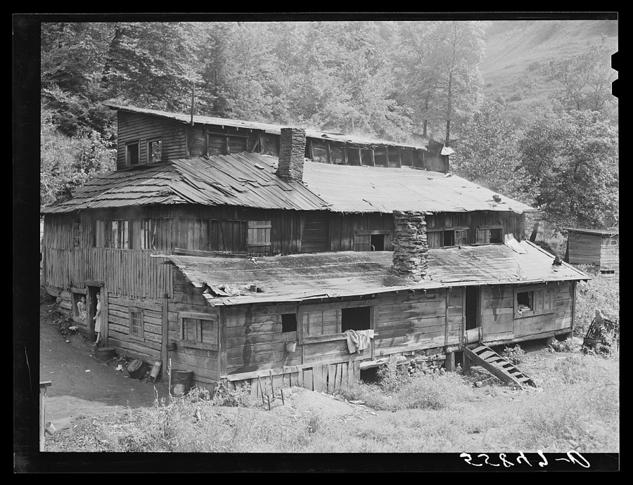
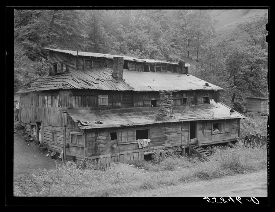
Every property in this county listed on the National Register of Historic Places, with the year it was listed and the federal nomination document.
| Photograph | Property | Type | Listed | Reference |
|---|---|---|---|---|
 | Bolen Building | building | 2007 | 07000676 |
 | Hindman Ben Franklin | building | 2007 | 07000675 |
 | Hindman Historic District | district | 2013 | 13000112 |
| Hiram and Art Stamper House | building | 2014 | 13001053 | |
| Wolfpen | building | 2014 | 12001200 |
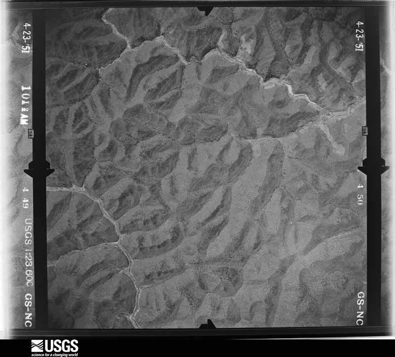
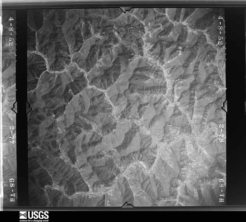
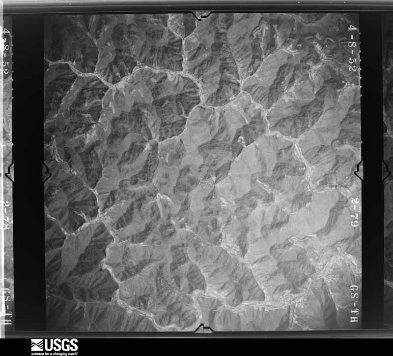
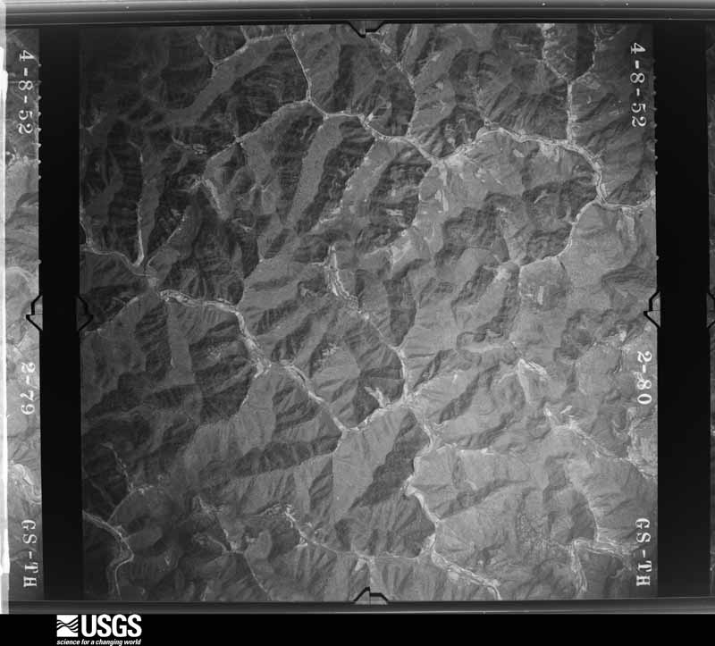
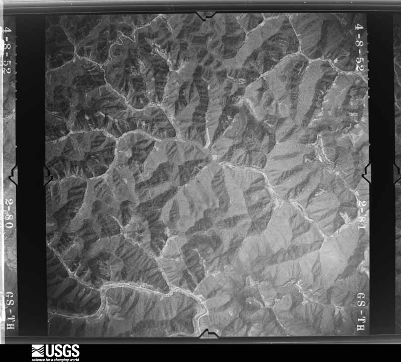
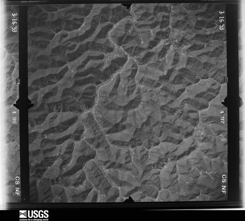
Flown by the U.S. Geological Survey between 1937 and 1989, the Aerial Photo Single Frames collection is the definitive mid-century view of the land: fields, roads and rivers as the camera saw them. The Survey holds 500 frames inside the rectangle that bounds this county; the 20 frames below were taken over the county itself, chosen across the decades of flights (at most four a year from that rectangle), so one flight cannot crowd out the rest. The full set is free to browse and download at EarthExplorer under the dataset Aerial Photo Single Frames.














The thermometers that kept this county's weather, as the federal records hold them. The extremes below are measured values from those records, not estimates.
Who lived here in 1950, one enumeration district at a time, as the Census Bureau described each district. Each row opens its official National Archives result, with Population Schedules and ED Maps available there.
Every wildfire the federal occurrence database records inside this county: 1,188 of them, burning about 75,976 acres. 2 started naturally and 244 were recorded as arson. Each settlement page carries the fires within five miles of it.
| Reported cause | Fires |
|---|---|
| Debris and open burning | 526 |
| Missing data/not specified/undetermined | 296 |
| Arson/incendiarism | 244 |
| Recreation and ceremony | 93 |
| Misuse of fire by a minor | 14 |
| Smoking | 6 |
| Equipment and vehicle use | 5 |
| Natural | 2 |
| Railroad operations and maintenance | 2 |
The five largest, by the area the report gives. 7 of them were set deliberately.
| Date | Cause | Size | Reported by | Name on the report |
|---|---|---|---|---|
| 8 November 1999 | Arson/incendiarism | 10,000 acres | Kentucky Division of Forestry | not named |
| 2 November 2001 | Arson/incendiarism | 4,070 acres | Kentucky Division of Forestry | not named |
| 3 November 2000 | Arson/incendiarism | 3,500 acres | Kentucky Division of Forestry | not named |
| 14 November 1999 | Arson/incendiarism | 2,500 acres | Kentucky Division of Forestry | not named |
| 2 November 2000 | Arson/incendiarism | 2,500 acres | Kentucky Division of Forestry | not named |
| 11 November 1999 | Arson/incendiarism | 2,000 acres | Kentucky Division of Forestry | not named |
| 31 October 2001 | Arson/incendiarism | 1,500 acres | Kentucky Division of Forestry | not named |
| 26 April 2009 | Debris and open burning | 1,160 acres | Kentucky Division of Forestry | ARNOLD FORK |
Every settlement page carries the fires within five miles of it - see the settlement index below.
The NOAA Storm Events Database holds 190 reports for this county, causing 16 deaths, no injuries and about $2,115,300 in recorded property damage. Each settlement page carries the reports that name it.
| Kind of event | Reports |
|---|---|
| Thunderstorm Wind | 95 |
| Hail | 37 |
| Flash Flood | 29 |
| Flood | 17 |
| Heavy Rain | 10 |
| Debris Flow | 2 |
The most serious of them, by death, then injury, then recorded damage. The accounts are quoted exactly as the forecast office filed them.
| When | Event | Place named | Harm | What the report says |
|---|---|---|---|---|
| July 2022 | Flash Flood | Fisty | 16 killed | Extensive flash flooding occurred in Knott County. Some of the reports included:||11:00 PM EST - Pictures on social media show flash flooding around the Big Branch Baptist Church. |11:56 PM EST - Broadcast media reported street flash flooding leaving KY-899 impassable in front of the Holly Hills Shopping Center. |12:38 AM EST - 4 children, ranging from 1 to 8 years old, perished in the flood waters of Montgomery and Troublesome Creeks after being swept away from their parents. Numerous news articles state that the family was awoken by the flash flood warning around 2:00 AM EDT (1:00 AM EST). The Considerable Tag that set off the WEA alerts as sent out at 1:38 AM EDT (12:38 AM EST), so this is likely what awakened the parents. The reports go on to state that it was a matter of minutes before the family was forced to escape to the roof of their mobile home once water started pouring in. They were not on the roof very long before they realized the mobile home was not stable, and they swam to a nearby tree. Strong currents in the water ripped the children away from the parent's grasp. It was around 8 hours before the parents were rescued. 2 of the 4 children were found deceased on Thursday (7/28). The other two were found deceased on Friday morning (7/29)|12:48 AM EST - A portion of Route 899 was flooded near the IGA store in Hindman.|1:00 AM EST - Pictures on social media show debris and rocks littered onto KY-1231 due to flash flooding.|1:30 AM EST - A house was destroyed and carried onto Steer Fork Road and KY-582 by flash flood waters.|2:00 AM EST - A fire truck from the Hindman Volunteer Fire Department was swept away and pinned underneath the Cowtown Road Bridge over Troublesome Creek.|2:00 AM EST - Picture on social media shows a car pinned under the pedestrian bridge in front of Alice Lloyd College after being swept away in the flood waters.|2:00 AM EST - Catastrophic flash flooding in the city of Hindman.|2:00 AM EST - Picture on social media shows the Hidden Treasure Shop along East Main Street (KY-550) in Hindman severely damaged by flash flood waters from Troublesome Creek. |2:00 AM EST - Homes on the lower side of KY-550 in the community of Fisty have been swept away by flash flooding along Troublesome Creek. |2:00 AM EST - Patriot Dairy Bar has been destroyed by flash flooding.|2:22 AM EST - A video on social media shows the Pine Top Post Office was 2/3 submerged by significant flash flood waters along Carr Fork. |2:27 AM EST - Highway 582 is flooded. Water is 3/4 of the way up the post office building at Pine Top. |2:30 AM EST - Camp Nathanael sustained significant damage to several structures in the community of Emmalena. |2:44 AM EST - Multiple cars were submerged and a house surrounded by water in the community of Emmalena. |8:00 AM EST - The cooperative observer located 1 mile East of Wiscoal reported a 24-hour total rainfall of 6.50 inches. |
| August 2001 | Flash Flood | Countywide | $800,000 | Several inches of rain fell in a short period of time across the county. This resulted in widespread flash flooding. The damage that resulted prompted the county to classified as a Presidentially declared disaster area. Most of the damage that resulted was to county roads and bridges although numerous homes were also affected. |
| April 1998 | Flash Flood | Countywide | $500,000 | no account filed |
| August 2014 | Flash Flood | Fisty | $234,000 | Over three inches of rainfall from slow moving thunderstorms produced flash flooding across the county. Troublesome Creek was reported out of its banks from Hindman to Carrie, six inches of flowing water was reported over Highway 80, flooding at the junction of Highway 550 and 160 made the roads impassable, flood waters surrounded a house in Garner, the Hazard Community & Technical School campus was flooded in Hindman, and water was reported over the bumper of an SUV between Leburn and Hindman. |
| April 1998 | Flash Flood | Countywide | $200,000 | no account filed |
| July 2012 | Flash Flood | Carr Creek | $70,000 | Heavy rainfall caused a coal slurry pond to fill up with water and runoff into pay lake below. The pay lake overflowed and the pay lake's dam was partially washed out. This caused flash flooding to occur along Breeding Creek Road and a narrow part of highway 15 near Redfox. Residents were stranded due to the flooding and several homes/mobile homes were flooded during the event. |
| April 2008 | Thunderstorm Wind | Elmrock | $50,000 | Trees and powerlines were blown down by thunderstorm wind gusts estimated at over 60 mpy on Highway 1098 near Elmrock. |
| February 1993 | Thunderstorm Wind | not stated | $50,000 | Strong winds destroyed a mobile home and downed several trees. |
| February 2009 | Thunderstorm Wind | Hindman | $30,000 | Numerous trees were blown down county wide by thunderstorm wind gusts. |
| May 2009 | Thunderstorm Wind | Hindman | $25,000 | Twenty two hundred people were reported without power across the county. |
| May 2020 | Flash Flood | Fisty | $20,000 | Local media relayed a report of water inundating residences on Clear Creek near Fisty. |
| February 2019 | Heavy Rain | Hindman | $10,000 | Local media reported mudslides across a large portion of the county, including Kentucky Highway 2029 southwest of Bolyn and Kentucky Highway 550 west of Hindman where a power pole was knocked down. This latter slide was near Hindman Elementary School, resulting in power to the school being knocked out. |
| August 2014 | Flash Flood | Hindman | $10,000 | Troublesome creek was reported to have come out of its banks in the Carrie area shortly after a public report of 1.78 inches of rain fell in 35 minutes. A trailer on Lick Branch Road was flooded. A foot of flowing water was reported over Highway 1102. Also, the Ball Creek Volunteer Fire Dept assisted several families that were trapped by flood waters in their homes near Highway 550 in Hindman between 730 pm EST and 800 pm EST. |
| June 2009 | Thunderstorm Wind | Hindman | $10,000 | Severals trees were blown down on Highways 550, 1393, and 160. |
| June 2009 | Thunderstorm Wind | Ritchie | $10,000 | The Knott county Highway Dept had to remove trees from the roadway on Highways 1102 and 1088 near Ritchie. |
| June 2008 | Thunderstorm Wind | Hindman | $10,000 | Numerous large limbs were torn from trees by thunderstorm wind gusts. A 14 inch diameter tree was also blown down. |
| January 2008 | Thunderstorm Wind | Carrie | $10,000 | Trees and power lines were blown down along KY 550 by wind gusts estimated at 62 mph. |
| January 2008 | Thunderstorm Wind | Hindman | $10,000 | Trees and power lines were blown down on Perkins Mountain Road and Big Branch Road in the Perkins Mountain area by wind gusts estimated at 62 mph. |
| January 2008 | Thunderstorm Wind | Carr Creek | $8,000 | Trees and power lines were blown down near the intersection of Highway 160 and KY 15 by wind gusts estimated at 62 mph. |
| August 2007 | Thunderstorm Wind | Mousie | $8,000 | Two trees and power lines down on Highway 550 between Mousie and Hindman. |
| July 2012 | Thunderstorm Wind | Emmalena | $5,000 | An NWS storm damage survey team found damage associated with 80-100 mph down burst winds at Camp Nathaniel near Emmalena. Numerous large diameter trees wre snapped or uprooted and were lying in a northwest to southeast direction. One large uprooted tree fell onto a building owned by the camp and other buildings received minor damage. |
| February 1997 | Thunderstorm Wind | Hindman | $5,000 | no account filed |
| August 2011 | Thunderstorm Wind | Mousie | $3,000 | Several large tree limbs were blown down in Mousie. |
| June 2010 | Thunderstorm Wind | Tina | $3,000 | A tree was blown down and onto a power line in Tina. |
| April 2008 | Thunderstorm Wind | Betty | $3,000 | A few trees were snapped just inside the Knott County line near Betty. |
| November 2000 | Thunderstorm Wind | Talcum | $3,000 | Strong winds brought several trees down in the area. Minor roof damage was also reported to several homes. |
| July 2023 | Thunderstorm Wind | Ivis | $2,000 | KYTC District 12 reported that KY-160 near the intersection with KY-899 was closed due to a tree that fell onto power and telephone lines. |
| August 2022 | Flash Flood | Hindman | $2,000 | Water was ponding onto the KY-2759 near Hindman. In addition, a mudslide also occurred, and a large tree is down. Power lines are also down in the area as a result. The road has been been closed. |
| September 2009 | Thunderstorm Wind | Pine Top | $2,000 | Trees were blown down on Highway 582 and Route 1393. |
| June 2008 | Thunderstorm Wind | Leburn | $2,000 | Two trees were blown down by thunderstorm wind gusts at 4692 Possum Trot Road. |
| July 2006 | Thunderstorm Wind | Carrie | $2,000 | Tree down on Highway 550. Power lines down in Carrie. |
| May 2020 | Flash Flood | Hindman | $1,000 | A local media outlet reported water of at least half a foot deep flowing over Ogden Branch Road northwest of Hindman. |
| March 2015 | Flood | Carrie | $1,000 | One lane of KY 550 at mile marker 9 was impassable due to flooding. |
| March 2015 | Flood | Hindman | $1,000 | Water was over Hwy 550. |
| March 2015 | Flood | Hindman | $1,000 | Kentucky 550 at mile marker 11.25 was impassable due to flooding. |
| March 2015 | Flood | Mousie | $1,000 | Highway 550E was covered by flood water. |
| July 2015 | Flash Flood | Ritchie | $1,000 | A culvert was washed away due to large amounts of swiftly moving water on Singleton Branch off Clear Creek Rd near Hwy 550. A picture was posted showing several feet of water rushing down the road and surrounding houses. |
| July 2015 | Flash Flood | Hindman | $1,000 | Flash flooding was occurring off Hwy 160 near Frogtown. |
| July 2015 | Flash Flood | Hindman | $1,000 | Flood waters were entering and surrounding peoples homes off Hwy 160 at Bear Branch. |
| April 2015 | Flash Flood | Mousie | $1,000 | A foot of water was observed flowing across Hwy 550 near Mousie. |
| December 2015 | Flood | Mousie | $1,000 | High water affected a road in Mousie. |
| December 2013 | Flood | Mousie | $1,000 | Water was over the road across sections Hwy 550 East between Mousie and Garrett. The road was impassable in places with anywhere between 2 and 12 inches of water flowing across it. The spotter witnessed a truck becoming submerged in the water and getting stuck. |
| December 2013 | Flood | Hindman | $1,000 | Water was over the road on KY 550 at WKCB radio station. |
| July 2012 | Flood | Brinkley | $1,000 | Troublesome Creek was out of its banks from Brinkley to Hindman. |
| July 2012 | Thunderstorm Wind | Hindman | $1,000 | A 55 mph wind gust was measured by the Knott count mesonet site. |
| August 2012 | Flash Flood | Cody | $1,000 | Defeated Creek was flooded and the flood waters pushed a vehicle partially off Defeated Creek Rd. |
| May 2010 | Thunderstorm Wind | Kite | $1,000 | A large tree was blown down along Highway 582 between Pine Top and Kite. |
| April 2008 | Thunderstorm Wind | Betty | $1,000 | One tree was blown down on Highway 550 by thunderstorm wind gusts estimated near 60 mph. |
| August 2007 | Thunderstorm Wind | Hindman | $1,000 | Large limbs down across Route 550. |
| February 2020 | Flood | Mousie | $200 | Dispatch relayed reports of water over Kentucky Highway 550 near Mousie and Carrie. |
| September 2021 | Thunderstorm Wind | Cordia | $100 | Kentucky State Police reported a tree down across KY-1088 (Lotts Creek Road/Yellow Creek Road), at about the halfway point, east of Hazard. |
| April 2025 | Hail | Decoy | - | A social media post showed pictures of large hail, approximately ping-pong ball size, in the community of Decoy, KY. |
| January 2025 | Flood | Hindman | - | Perkins Madden Road, south of the town Hindman was flooded, especially near the entrance to the Knott County Nursing Home, due to poor drainage. |
| January 2025 | Debris Flow | Hindman | - | A rockslide/debris flow was reported along KY-160 across from the Golden Apple Fruit Market, southeast of Hindman. |
| May 2025 | Hail | Fisty | - | A picture on social media showed hail accumulation on the ground in the community of Fisty. Stones between a quarter and half-dollar size were visible in the grass. |
| May 2025 | Thunderstorm Wind | Carrie | - | Knott County Dept of Highways reported a tree down between MM 9 and 10 on KY-550. |
| May 2024 | Thunderstorm Wind | Fisty | - | Trees were downed onto KY-550 near the Perry County line. |
| May 2024 | Thunderstorm Wind | Emmalena | - | Trees were reported down on KY-550 near Montgomery Creek and Montgomery Creek Road, in the community of Emmalena. |
| May 2024 | Thunderstorm Wind | Mousie | - | Trees were reported to have been downed on KY-550 near Jones Fork and the community of Mousie. |
| July 2024 | Thunderstorm Wind | Mousie | - | Hazard State Highway Patrol relayed a report of a tree down on the 3800 block of KY-1087 in Knott County, near the community of Mousie. |
The Survey's mineral resources record lists 1 working inside this county. It still produces. Each settlement page carries the workings within five miles of it.
| Commodity | Workings |
|---|---|
| Stone, Crushed/Broken | 1 |
The least common of them first, because a county's hundredth gravel pit says nothing its first ten did not.
| Where | Site | Commodity | Status | Recorded |
|---|---|---|---|---|
| Ogden Branch Stone | Stone, Crushed/Broken | Producer |
Named settlements recorded in the Geographic Names Information System, each with the topographic sheets covering it. Villages, hamlets and abandoned places alike. Each is shown with the nearest named watercourse or landform and the survey quadrangle it falls on.
Carr Fork census division · 41773 · On Left Fork Trace Fork · Hindman quadrangle
16 sheets, 1890 to 1992
Carr Fork census division · 41847 · On Perkins Branch · Blackey quadrangle
18 sheets, 1890 to 1992
Emmalena census division · 41640 · On Baker Branch · Vest quadrangle
17 sheets, 1891 to 1992
No longer a settlement
Carr Fork census division · 41836 · On Little Doubles Branch · Blackey quadrangle
18 sheets, 1890 to 1992
Emmalena census division · 41740 · On Sandlick Branch · Carrie quadrangle
16 sheets, 1891 to 1992
Mousie census division · 41643 · On Triplett Branch · Wayland quadrangle
17 sheets, 1890 to 1992
Emmalena census division · 41740 · On Beech Creek · Carrie quadrangle
16 sheets, 1891 to 1992
No longer a settlement
Carr Fork census division · 41847 · On Hale Branch · Blackey quadrangle
18 sheets, 1890 to 1992
No longer a settlement
Hindman census division · 41822 · On Trace Fork · Hindman quadrangle
16 sheets, 1890 to 1992
Emmalena census division · 41722 · On Cane Branch · Vest quadrangle
17 sheets, 1891 to 1992
No longer a settlement
Carr Fork census division · 41847 · On Deerlick Branch · Blackey quadrangle
18 sheets, 1890 to 1992
Carr Fork census division · 41759 · On Sassafras Creek · Vicco quadrangle
16 sheets, 1891 to 1992
No longer a settlement
Emmalena census division · 41725 · On Walkers Branch · Carrie quadrangle
16 sheets, 1891 to 1992
Carr Fork census division · 41701 · On Buzzard Den Branch · Carrie quadrangle
16 sheets, 1891 to 1992
No longer a settlement
Carr Fork census division · 41759 · On Defeated Creek · Blackey quadrangle
18 sheets, 1890 to 1992
No longer a settlement
Carr Fork census division · 41701 · On Jacks Branch · Carrie quadrangle
16 sheets, 1891 to 1992
Emmalena census division · 41722 · On Laurel Fork Quicksand Creek · Vest quadrangle
17 sheets, 1891 to 1992
Carr Fork census division · 41843 · On Buffalo Branch · Kite quadrangle
17 sheets, 1890 to 1992
Beaver Creek census division · 41862 · On Buck Branch · Kite quadrangle
17 sheets, 1890 to 1992
Emmalena census division · 41640 · On Baker Branch · Vest quadrangle
17 sheets, 1891 to 1992
Emmalena census division · 41740 · On Swiftshoal Branch · Carrie quadrangle
16 sheets, 1891 to 1992
Emmalena census division · 41701 · Near Shop Hollow · Carrie quadrangle
16 sheets, 1891 to 1992
Emmalena census division · 41722 · Near Upper Triplet Hollow · Vest quadrangle
17 sheets, 1891 to 1992
No longer a settlement
Mousie census division · 41640 · On Snag Fork · Handshoe quadrangle
17 sheets, 1890 to 1992
Hindman census division · 41822 · On Right Fork Troublesome Creek · Hindman quadrangle
16 sheets, 1890 to 1992
Beaver Creek census division · 41844 · On Left Fork Holly Bush Creek · Kite quadrangle
17 sheets, 1890 to 1992
Carr Fork census division · 41773 · On Irishman Creek · Blackey quadrangle
18 sheets, 1890 to 1992
No longer a settlement
Beaver Creek census division · 41828 · On Bates Branch · Kite quadrangle
17 sheets, 1890 to 1992
Mousie census division · 41817 · On Short Fork · Handshoe quadrangle
17 sheets, 1890 to 1992
Hindman census division · 41831 · On Possumtrot Branch · Hindman quadrangle
16 sheets, 1890 to 1992
Carr Fork census division · 41834 · On Little Carr Fork · Blackey quadrangle
18 sheets, 1890 to 1992
Carr Fork census division · 41701 · On Coles Fork · Carrie quadrangle
16 sheets, 1891 to 1992
No longer a settlement
Beaver Creek census division · 41828 · On Crager Fork · Kite quadrangle
17 sheets, 1890 to 1992
No longer a settlement
Carr Fork census division · 41836 · On Dead Mare Branch · Blackey quadrangle
18 sheets, 1890 to 1992
No longer a settlement
Emmalena census division · 41740 · On Sylvester Branch · Carrie quadrangle
16 sheets, 1891 to 1992
No longer a settlement
Mousie census division · 41839 · On Ball Branch · Handshoe quadrangle
17 sheets, 1890 to 1992
Hindman census division · 41822 · On Owens Branch · Hindman quadrangle
16 sheets, 1890 to 1992
Carr Fork census division · 41843 · On Meadow Branch · Kite quadrangle
17 sheets, 1890 to 1992
Carr Fork census division · 41843 · On Willard Branch · Hindman quadrangle
16 sheets, 1890 to 1992
Hindman census division · 41844 · On Trace Fork · Kite quadrangle
17 sheets, 1890 to 1992
Mousie census division · 41839 · On Motts Branch · Wayland quadrangle
17 sheets, 1890 to 1992
No longer a settlement
Beaver Creek census division · 41828 · On Hall Branch · Kite quadrangle
17 sheets, 1890 to 1992
Beaver Creek census division · 41861 · On Big Branch · Wayland quadrangle
17 sheets, 1890 to 1992
Carr Fork census division · 41847 · On Breeding Branch · Blackey quadrangle
18 sheets, 1890 to 1992
Emmalena census division · 41701 · Near Honey Gap Hollow · Carrie quadrangle
16 sheets, 1891 to 1992
Mousie census division · 41630 · On Sycamore Fork · Handshoe quadrangle
17 sheets, 1890 to 1992
No longer a settlement
Carr Fork census division · 41759 · On Yellow Creek · Vicco quadrangle
16 sheets, 1891 to 1992
Carr Fork census division · 41759 · On Little Smith Branch · Blackey quadrangle
18 sheets, 1890 to 1992
No longer a settlement
Mousie census division · 41831 · On Mine Branch · Handshoe quadrangle
17 sheets, 1890 to 1992
Carr Fork census division · 41843 · On Steer Fork · Hindman quadrangle
16 sheets, 1890 to 1992
Hindman census division · 41844 · Near Trace Mountain · Kite quadrangle
17 sheets, 1890 to 1992
No longer a settlement
Emmalena census division · 41740 · On Sylvester Branch · Carrie quadrangle
16 sheets, 1891 to 1992
Carr Fork census division · 41701 · On Sugar Branch · Vicco quadrangle
16 sheets, 1891 to 1992
The vanished settlements of Knott County: the places named above that are no longer on the map.