 Block
Fisty, Kentucky
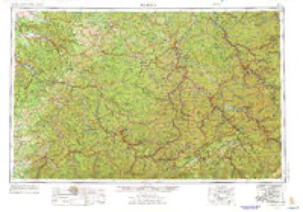
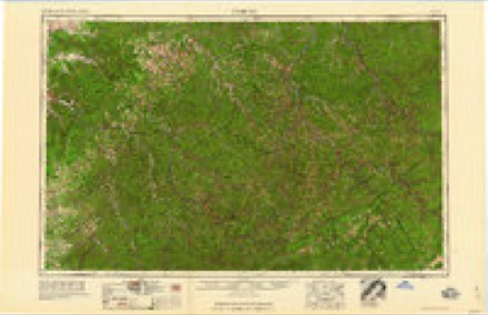
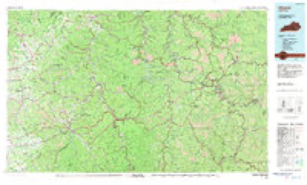
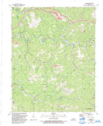
16 topographic sheets cover this place, the earliest surveyed in 1891 and the latest in 1992. It stands in the Emmalena census division. It lies in ZIP code area 41701. It lies near Shop Hollow. The Survey maps it on the Carrie quadrangle. It stands 902 feet above sea level.
Topographic sheets covering this place
7 surveys from 16 printed sheetsMatched by testing this settlement's coordinate against the published boundary of every sheet in the United States Geological Survey's historical collection. Each opens the scanned sheet at the Survey.
- 1891 USGS Hazard quadrangle1:125000, 5 printings
- 1914 USGS Troublesome quadrangle1:62500, 3 printings
- 1954 USGS Carrie quadrangle1:24000, 4 printings
- 1957 USGS Jenkins quadrangle1:250000
- 1960 USGS Jenkins quadrangle1:250000
- 1977 USGS Hazard quadrangle1:100000
- 1992 USGS Carrie quadrangle1:24000



Fires near this place
485 since 1997Regional context, not property-specific evidence. The federal wildfire occurrence database lists 485 fires within 5 miles of Fisty between 1997 and 2020, burning about 16,464 acres in total. None started naturally. 95 were recorded as arson. Distance is straight-line from the map coordinates, so a fire counted here may appear on a neighbouring settlement's page as well.
| Reported cause | Fires |
|---|---|
| Debris and open burning | 217 |
| Missing data/not specified/undetermined | 126 |
| Arson/incendiarism | 95 |
| Recreation and ceremony | 39 |
| Equipment and vehicle use | 4 |
| Smoking | 2 |
| Railroad operations and maintenance | 1 |
| Misuse of fire by a minor | 1 |
The most recent of them, most recent first, with the day each was reported and the service that recorded it.
| Date | Cause | Size | Reported by | Name on the report |
|---|---|---|---|---|
| 6 September 2007 | Missing data/not specified/undetermined | 2.0 acres | Kentucky Division of Forestry | not named |
| 3 September 2007 | Debris and open burning | 5.0 acres | Kentucky Division of Forestry | not named |
| 3 September 1999 | Arson/incendiarism | 25 acres | Kentucky Division of Forestry | not named |
| 29 September 2007 | Debris and open burning | 1.0 acres | Kentucky Division of Forestry | not named |
| 28 September 2007 | Debris and open burning | 148 acres | Kentucky Division of Forestry | not named |
| 28 September 2007 | Missing data/not specified/undetermined | 35 acres | Kentucky Division of Forestry | not named |
| 24 September 2008 | Debris and open burning | 8.0 acres | Kentucky Division of Forestry | not named |
| 2 September 1999 | Equipment and vehicle use | 1.0 acres | Kentucky Division of Forestry | not named |
Settlements close enough to share some of these fires:
Storms near this place
7 since 2003Regional context, not property-specific evidence. The National Weather Service names Fisty in 7 storm reports between 2003 and 2025: 3 flash flood, 2 hail, 1 debris flow, 1 thunderstorm wind. The reports record 16 deaths. Each account below is quoted exactly as the forecast office filed it, from the NOAA Storm Events Database, and each date opens the federal record of that event.
| When | Event | Place named | Harm | What the report says |
|---|---|---|---|---|
| July 2022 | Flash Flood | Fisty | 16 killed | Extensive flash flooding occurred in Knott County. Some of the reports included:||11:00 PM EST - Pictures on social media show flash flooding around the Big Branch Baptist Church. |11:56 PM EST - Broadcast media reported street flash flooding leaving KY-899 impassable in front of the Holly Hills Shopping Center. |12:38 AM EST - 4 children, ranging from 1 to 8 years old, perished in the flood waters of Montgomery and Troublesome Creeks after being swept away from their parents. Numerous news articles state that the family was awoken by the flash flood warning around 2:00 AM EDT (1:00 AM EST). The Considerable Tag that set off the WEA alerts as sent out at 1:38 AM EDT (12:38 AM EST), so this is likely what awakened the parents. The reports go on to state that it was a matter of minutes before the family was forced to escape to the roof of their mobile home once water started pouring in. They were not on the roof very long before they realized the mobile home was not stable, and they swam to a nearby tree. Strong currents in the water ripped the children away from the parent's grasp. It was around 8 hours before the parents were rescued. 2 of the 4 children were found deceased on Thursday (7/28). The other two were found deceased on Friday morning (7/29)|12:48 AM EST - A portion of Route 899 was flooded near the IGA store in Hindman.|1:00 AM EST - Pictures on social media show debris and rocks littered onto KY-1231 due to flash flooding.|1:30 AM EST - A house was destroyed and carried onto Steer Fork Road and KY-582 by flash flood waters.|2:00 AM EST - A fire truck from the Hindman Volunteer Fire Department was swept away and pinned underneath the Cowtown Road Bridge over Troublesome Creek.|2:00 AM EST - Picture on social media shows a car pinned under the pedestrian bridge in front of Alice Lloyd College after being swept away in the flood waters.|2:00 AM EST - Catastrophic flash flooding in the city of Hindman.|2:00 AM EST - Picture on social media shows the Hidden Treasure Shop along East Main Street (KY-550) in Hindman severely damaged by flash flood waters from Troublesome Creek. |2:00 AM EST - Homes on the lower side of KY-550 in the community of Fisty have been swept away by flash flooding along Troublesome Creek. |2:00 AM EST - Patriot Dairy Bar has been destroyed by flash flooding.|2:22 AM EST - A video on social media shows the Pine Top Post Office was 2/3 submerged by significant flash flood waters along Carr Fork. |2:27 AM EST - Highway 582 is flooded. Water is 3/4 of the way up the post office building at Pine Top. |2:30 AM EST - Camp Nathanael sustained significant damage to several structures in the community of Emmalena. |2:44 AM EST - Multiple cars were submerged and a house surrounded by water in the community of Emmalena. |8:00 AM EST - The cooperative observer located 1 mile East of Wiscoal reported a 24-hour total rainfall of 6.50 inches. |
| August 2014 | Flash Flood | Fisty | $234,000 | Over three inches of rainfall from slow moving thunderstorms produced flash flooding across the county. Troublesome Creek was reported out of its banks from Hindman to Carrie, six inches of flowing water was reported over Highway 80, flooding at the junction of Highway 550 and 160 made the roads impassable, flood waters surrounded a house in Garner, the Hazard Community & Technical School campus was flooded in Hindman, and water was reported over the bumper of an SUV between Leburn and Hindman. |
| May 2020 | Flash Flood | Fisty | $20,000 | Local media relayed a report of water inundating residences on Clear Creek near Fisty. |
| May 2025 | Hail | Fisty | - | A picture on social media showed hail accumulation on the ground in the community of Fisty. Stones between a quarter and half-dollar size were visible in the grass. |
| May 2024 | Thunderstorm Wind | Fisty | - | Trees were downed onto KY-550 near the Perry County line. |
| March 2021 | Debris Flow | Fisty | - | Part of KY-2102 is closed due to a mudslide which is blocking the road. |
| June 2003 | Hail | Fisty | - | Three quarter inch diameter hail was reported from a person at Clear Creek Free Church. |
Nearest settlements
The eight closest, with where each one stands in the county. Distances are straight-line, computed from the Geographic Names Information System coordinates.
| Map | Place | Distance | Sheets |
|---|---|---|---|
| Emmalena | 1.4 miles | 16 | |
| Ritchie | 1.8 miles | 16 | |
| Big Branch (historical) | 2.7 miles | 16 | |
| Bearville | 3.0 miles | 16 | |
| Clear Fork (historical) | 3.6 miles | 16 | |
| Carrie | 3.7 miles | 16 | |
| Cordia | 3.8 miles | 16 | |
| Lotts Creek (historical) | 4.4 miles | 16 |
Elsewhere
Matched on this settlement's Geographic Names Information System number rather than its name, so it cannot be a different place of the same name in another state.
| Wikipedia article on Fisty | An encyclopaedic summary. Its text is share-alike, so it is linked here rather than copied. |
| Wikidata item Q8563447 | The structured record the population and elevation above come from. Public domain (CC0). |
Provenance
This settlement is recorded in the Geographic Names Information System as feature 508000. The sheet list is computed by point-in-boundary test against the United States Geological Survey's historical topographic inventory. Both are works of the United States government and carry no copyright under 17 U.S.C. 105.
Wildfire. Short, Karen C. 2022. Spatial wildfire occurrence data for the United States, 1992-2020 [FPA_FOD_20221014]. 6th Edition. Fort Collins, CO: Forest Service Research Data Archive. https://doi.org/10.2737/RDS-2013-0009.6 Collected with United States Government funding and usable without additional permissions or fees.
Storms. NOAA National Centers for Environmental Information, Storm Events Database https://www.ncei.noaa.gov/stormevents/ A work of the United States government, no copyright under 17 U.S.C. 105. Narratives are quoted verbatim from the National Weather Service report and are not edited or summarised.