 Block
From the record
4 National Register listings published here.
Sources: the National Register database, National Park Service
29 topographic sheets and 6 fire insurance atlases across 1 place.
4 National Register listings published here.
Sources: the National Register database, National Park Service
Taken for the Office of War Information and the Farm Security Administration, who photographed the country between 1935 and 1944. Works of United States government photographers, with no known restriction on use. Each opens its catalogue record.
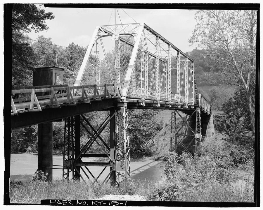
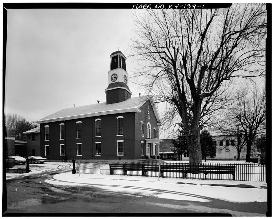
Every property in this county listed on the National Register of Historic Places, with the year it was listed and the federal nomination document.
| Photograph | Property | Type | Listed | Reference |
|---|---|---|---|---|
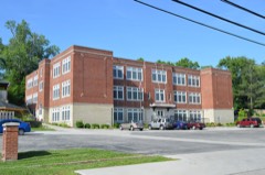 | Beattyville Grade School | building | 2008 | 08000010 |
| Beattyville Historic District | district | 2024 | 100010769 | |
 | St. Therese Church | building | 2012 | 12000045 |
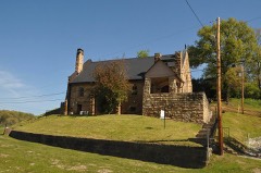 | St. Thomas Episcopal Church | building | 1976 | 76000911 |
Flown by the U.S. Geological Survey between 1937 and 1989, the Aerial Photo Single Frames collection is the definitive mid-century view of the land: fields, roads and rivers as the camera saw them. The Survey holds 456 frames inside the rectangle that bounds this county; the 23 frames below were taken over the county itself, chosen across the decades of flights (at most four a year from that rectangle), so one flight cannot crowd out the rest. The full set is free to browse and download at EarthExplorer under the dataset Aerial Photo Single Frames.























The thermometers that kept this county's weather, and the gages that measured the flow of its streams, as the federal records hold them. The extremes below are measured values from those records, not estimates.
Who lived here in 1950, one enumeration district at a time, as the Census Bureau described each district. Each row opens its official National Archives result, with Population Schedules and ED Maps available there.
Every wildfire the federal occurrence database records inside this county: 589 of them, burning about 15,885 acres. 1 started naturally and 141 were recorded as arson. Each settlement page carries the fires within five miles of it.
| Reported cause | Fires |
|---|---|
| Debris and open burning | 219 |
| Missing data/not specified/undetermined | 141 |
| Arson/incendiarism | 141 |
| Recreation and ceremony | 66 |
| Equipment and vehicle use | 7 |
| Railroad operations and maintenance | 5 |
| Smoking | 4 |
| Misuse of fire by a minor | 4 |
| Natural | 1 |
| Power generation/transmission/distribution | 1 |
The five largest, by the area the report gives. 6 of them were set deliberately.
| Date | Cause | Size | Reported by | Name on the report |
|---|---|---|---|---|
| 6 November 2016 | Debris and open burning | 3,500 acres | Kentucky Division of Forestry | JETTS CREEK ROAD |
| 19 March 2001 | Arson/incendiarism | 800 acres | Kentucky Division of Forestry | not named |
| 7 November 2001 | Arson/incendiarism | 506 acres | Daniel Boone National Forest | WILLOW II |
| 31 October 2001 | Arson/incendiarism | 500 acres | Kentucky Division of Forestry | not named |
| 1 November 2001 | Missing data/not specified/undetermined | 500 acres | Kentucky Division of Forestry | not named |
| 9 February 2001 | Arson/incendiarism | 400 acres | Kentucky Division of Forestry | not named |
| 8 November 1999 | Arson/incendiarism | 300 acres | Daniel Boone National Forest | BRUSHY MOUNTAIN |
| 12 November 1999 | Arson/incendiarism | 300 acres | Kentucky Division of Forestry | not named |
Every settlement page carries the fires within five miles of it - see the settlement index below.
The NOAA Storm Events Database holds 281 reports for this county, causing 1 death, 25 injuries and about $4,225,000 in recorded property damage. Each settlement page carries the reports that name it.
| Kind of event | Reports |
|---|---|
| Thunderstorm Wind | 184 |
| Hail | 33 |
| Flash Flood | 32 |
| Flood | 14 |
| Heavy Rain | 13 |
| Tornado | 2 |
| Debris Flow | 2 |
| Lightning | 1 |
The most serious of them, by death, then injury, then recorded damage. The accounts are quoted exactly as the forecast office filed them.
| When | Event | Place named | Harm | What the report says |
|---|---|---|---|---|
| June 1961 | Tornado (F3) | not stated | 1 killed, 25 hurt, $2,500,000 | no account filed |
| June 2011 | Flash Flood | Lower Buffalo | $500,000 | A bridge was washed out on Paw Paw Creek Road south of Beattyville. In fact, several roads in Lee county were damaged due to flash flooding on June 20th. The governor of Kentucky declared a state of emergency in Lee county. |
| June 2011 | Flash Flood | Beattyville | $500,000 | Significant damage occurred to roads in the Brushy Creek, Wide Creek, Paw Paw, and Primrose Lane areas in the June 20th flash floods. Kentucky Hwy 52S was also heavily damaged in the Sharp Rock area when the hillside below the road collapsed and slid away. |
| May 2009 | Flood | Fixer | $100,000 | A 40 to 50 foot section of one lane of Hwy 498 collapsed and dropped over the embankment next to the roadway resulting in the closure of the road. |
| November 2002 | Lightning | Heidelberg | $60,000 | A vacant house on Kentucky State Highway 399 burned early Sunday morning after being hit by lightning from a thunderstorm. The lightning jolted a breaker loose on a nearby transformer that also served another house. By the time fire departments arrived at the scene, the structure was fully engulfed in flames and was a total loss. |
| April 1998 | Flash Flood | Countywide | $60,000 | no account filed |
| February 2011 | Thunderstorm Wind | Beattyville | $50,000 | The Lee county superintendent reported that all of the schools across the county were without power. |
| April 1998 | Flash Flood | Countywide | $50,000 | no account filed |
| June 2005 | Thunderstorm Wind | Beattyville | $45,000 | A tree broke off and crashed into the side of a home, damaging the roof, the side of the house, the deck, and the garage. Also in Beattyville, a number of trees came down on another house. Power and telephone lines were also downed. |
| January 2008 | Thunderstorm Wind | Beattyville | $40,000 | Trees were blown down onto Highway 52. Numerous other reports of trees being blown down were received from throughout the county. All damage was caused by wind gusts estimated at 67 mph. |
| June 2008 | Thunderstorm Wind | Beattyville | $30,000 | Trees were blown down countywide by thunderstorm wind gusts. |
| August 1987 | Tornado (F1) | not stated | $25,000 | no account filed |
| June 2023 | Thunderstorm Wind | Proctor | $20,000 | Broadcast media reported that a tree had been blown down onto a home in Beattyville. |
| May 2008 | Thunderstorm Wind | Primrose | $20,000 | A large tree was blown down onto a tractor crushing it. Numerous large limbs and a couple of other large trees were also blown down. |
| February 1998 | Thunderstorm Wind | Primrose | $20,000 | Trees were downed, and a barn was destroyed. |
| February 2019 | Heavy Rain | Old Lndg | $10,000 | A local media outlet reported mud and rock slides from near the Estill County line on Kentucky Highway 52 to Blaines Branch Road in Beattyville. |
| May 2009 | Flash Flood | Mt Olive | $10,000 | Chapman road was impassable. The Tincher Hill Road culvert was washed out and the road closed. Silver Creek Road, KY Hwy 30 east and west of Jackson, Cathedral Domain Road, Spencer Ridge Hill, and Bufalo Zion road were all flooded and impassable. Some of the pavement on Main Street in Beattyville had been washed out. |
| July 2004 | Thunderstorm Wind | Beattyville | $10,000 | Trees and power lines were down across the county. |
| January 1997 | Thunderstorm Wind | Beattyville | $10,000 | no account filed |
| May 2008 | Thunderstorm Wind | Monica | $8,000 | Numerous tree branches between 2 and 5 inches in diameter were blown down on Highway 52. A couple of trees were also split down the middle and had to be removed from the roadway. |
| June 2008 | Thunderstorm Wind | Ida May | $8,000 | Several trees were blown down by thunderstorm wind gusts along Highway 399 near the Owsley County line. |
| June 2008 | Thunderstorm Wind | Beattyville | $7,000 | Trees were blown down by thunderstorm wind gusts near the Owsley county line. |
| July 2007 | Thunderstorm Wind | Beattyville | $7,000 | Trees down on Highway 1144 near Beattyville and trees down on Highway 52 West near Mt. Olive. |
| June 2021 | Debris Flow | Proctor | $6,000 | Several landslides occurred along KY-52 between Beattyville and the Breathitt County line (heading towards Jackson). Water was also reported across the road in a location. |
| May 2024 | Thunderstorm Wind | Beattyville | $5,000 | Numerous reports of trees down across roads throughout Lee County. A few phone lines were also down throughout the county. |
| June 2010 | Thunderstorm Wind | Beattyville | $5,000 | Several trees were blown down along High Point Road near Hopewell Church. The largest trees were about 6 inches in diameter. |
| July 2009 | Thunderstorm Wind | Williba | $5,000 | Trees were blown down and across Highway 2017. |
| May 2009 | Flash Flood | Banford | $5,000 | Four feet of water was in houses in the community of Ida May as the result of heavy rainfall. |
| April 2009 | Thunderstorm Wind | Old Lndg | $5,000 | Trees were down on Highway 52. |
| February 2008 | Thunderstorm Wind | Zachariah | $5,000 | Two large trees were blown down along Highway 11; one of the trees fell onto some powerlines. |
| January 2008 | Thunderstorm Wind | Beattyville | $5,000 | Trees were blown down onto Highway 11 by wind gusts estimated at 61 mph. |
| June 2007 | Thunderstorm Wind | Primrose | $5,000 | Two trees and a few large limbs down. Old shed blown down. |
| July 2007 | Thunderstorm Wind | Beattyville | $5,000 | Trees and limbs down near the Highway 52 and 498 intersection. |
| June 2008 | Thunderstorm Wind | Beattyville | $4,000 | A tree fell on a power line on South Fork Road near Highway 11 South. |
| May 2020 | Heavy Rain | Proctor | $3,000 | The Department of Highways reported a mudslide, due to previous heavy rainfall, on Proctor Road near Beattyville. This caused an extended closure of the road near the slide. |
| June 2011 | Thunderstorm Wind | Congleton | $3,000 | Trees were blown down in White Ash. |
| June 2011 | Thunderstorm Wind | Proctor | $3,000 | Trees were blown down on South Fork Rd. |
| June 2011 | Thunderstorm Wind | Tallega | $3,000 | Trees were blown down in Tallega. |
| June 2011 | Thunderstorm Wind | Zachariah | $3,000 | Trees were blown down in Zachariah. |
| June 2011 | Thunderstorm Wind | St Helens | $3,000 | Trees were blown down in St. Helens. |
| June 2008 | Thunderstorm Wind | Heidelberg | $3,000 | A few trees were blown down by thunderstorm wind gusts. |
| August 2000 | Thunderstorm Wind | Proctor | $3,000 | Strong winds blew trees and power lines down. |
| April 1998 | Flash Flood | Beattyville | $3,000 | Gravel roads were washed out, and mud and debris covered the main roads. |
| May 1998 | Thunderstorm Wind | Beattyville | $3,000 | Trees and utility lines were downed across the county. |
| April 1996 | Thunderstorm Wind | Beattyville | $3,000 | no account filed |
| February 2026 | Thunderstorm Wind | Cressmont | $2,000 | Local dispatch reported trees and powerlines blown down onto Crestmont Road between Todds Road and KY-399 resulting is a temporary closure of the road. |
| June 2021 | Debris Flow | Congleton | $2,000 | A landslide was reported on KY-11 heading towards Booneville. |
| August 2011 | Thunderstorm Wind | Yellow Rock | $2,000 | Two trees were blown down on Spencer Ridge Road. |
| February 2009 | Thunderstorm Wind | St Helens | $2,000 | A couple of trees were down on Highway 2016. |
| October 2009 | Thunderstorm Wind | Beattyville | $2,000 | Two trees were blown down on Highway 52 just outside of Beattyville. |
| August 2009 | Thunderstorm Wind | Primrose | $2,000 | Two trees were blown down on Route 2017. |
| March 2008 | Thunderstorm Wind | Beattyville | $2,000 | A tree fell on a utility pole on Route 2016. Another tree fell on Route 2017 near Saint Helens. |
| July 2008 | Thunderstorm Wind | Williba | $2,000 | Two trees were blown down on Highway 2017 close to the Breathitt County line. |
| June 2007 | Thunderstorm Wind | Monica | $2,000 | Large limbs down along Highway 52. |
| June 2000 | Thunderstorm Wind | Beattyville | $2,000 | Strong thunderstorm winds brought trees and power lines down. |
| July 2021 | Flash Flood | St Helens | $1,000 | Flashing flooding issues were reported along Blaines Branch just off of Hwy 52 past the intersection with Robinson Hollow Road. Roughly 2 feet of water was over the road and some of the black top was removed. The road had to be closed due to the flooding and damage to the road surface. A video was also shared with the NWS Jackson, KY weather office by the Lee County EM of a culvert being washed away. |
| February 2018 | Flood | Beattyville | $1,000 | A portion of Kentucky Highway 52 near downtown Beattyville was flooded due to the north fork of the Kentucky River overflowing its banks. |
| May 2017 | Flood | Williba | $1,000 | Water of an unknown depth was observed covering Blankey Branch Road. |
| July 2015 | Flood | Old Lndg | $1,000 | Water of unknown depth was across Highways 52 and 1476. |
| April 2015 | Flash Flood | Primrose | $1,000 | Blankey Branch Rd was flooded. |
The Survey's mineral resources record lists 2 workings inside this county. 1 still produces and 1 is closed or unrecorded. Each settlement page carries the workings within five miles of it.
| Commodity | Workings |
|---|---|
| Stone, Crushed/Broken | 1 |
| Clay | 1 |
The least common of them first, because a county's hundredth gravel pit says nothing its first ten did not.
| Where | Site | Commodity | Status | Recorded |
|---|---|---|---|---|
| Mud Tunnel Shale | Clay | Prospect | ||
| Yellow Rock Mine & Mill | Stone, Crushed/Broken | Producer |
Named settlements recorded in the Geographic Names Information System, each with the topographic sheets covering it. Villages, hamlets and abandoned places alike. Each is shown with the nearest named watercourse or landform and the survey quadrangle it falls on. The 1 place that was also surveyed for fire insurance comes first, with the number of atlases and photographs held for them.
Beattyville census division · 41311 · On South Fork Kentucky River · Beattyville quadrangle
13 sheets, 1892 to 1982
Fire insurance: 6 atlases
Beattyville census division · 41311 · On Log Shoal Branch · Beattyville quadrangle
13 sheets, 1892 to 1982
Southwest Lee census division · 40447 · Near Hale Ridge · Leighton quadrangle
13 sheets, 1892 to 1982
Beattyville census division · 41311 · On Dirksen Branch · Beattyville quadrangle
13 sheets, 1892 to 1982
St. Helens census division · 41311 · On Chapmans Fork · Tallega quadrangle
12 sheets, 1892 to 1982
Southwest Lee census division · 41311 · On Mikes Branch · Beattyville quadrangle
13 sheets, 1892 to 1982
Southwest Lee census division · 41311 · On Upper Sinking Creek · Heidelberg quadrangle
11 sheets, 1892 to 1982
Southwest Lee census division · 41311 · On Elkhorn Branch · Heidelberg quadrangle
11 sheets, 1892 to 1982
St. Helens census division · 41311 · On Pawpaw Creek · Beattyville quadrangle
13 sheets, 1892 to 1982
St. Helens census division · 41311 · Near Anvil Knob · Tallega quadrangle
12 sheets, 1892 to 1982
Beattyville census division · 41311 · On Huff Cave Branch · Zachariah quadrangle
13 sheets, 1892 to 1982
Beattyville census division · 41397 · On Zachariah Fork · Zachariah quadrangle
13 sheets, 1892 to 1982
Beattyville census division · 41301 · Near Moreland Hollow · Cobhill quadrangle
12 sheets, 1892 to 1982
Beattyville census division · 41311 · On Little Creek · Heidelberg quadrangle
11 sheets, 1892 to 1982
Southwest Lee census division · 41311 · On Elk Lick · Heidelberg quadrangle
11 sheets, 1892 to 1982
St. Helens census division · 41311 · On Mill Creek · Tallega quadrangle
12 sheets, 1892 to 1982
St. Helens census division · 41311 · On Pawpaw Creek · Beattyville quadrangle
13 sheets, 1892 to 1982
Beattyville census division · 41311 · On Puncheon Branch · Beattyville quadrangle
13 sheets, 1892 to 1982
St. Helens census division · 41311 · On Little Bear Creek · Tallega quadrangle
12 sheets, 1892 to 1982
Beattyville census division · 41311 · On Armine Branch · Cobhill quadrangle
12 sheets, 1892 to 1982
St. Helens census division · 41311 · On Log Shoal Branch · Tallega quadrangle
12 sheets, 1892 to 1982
Southwest Lee census division · 41311 · On South Fork Kentucky River · Beattyville quadrangle
13 sheets, 1892 to 1982
St. Helens census division · 41311 · On Big Branch · Beattyville quadrangle
13 sheets, 1892 to 1982
St. Helens census division · 41311 · On Wolfpen Branch · Tallega quadrangle
12 sheets, 1892 to 1982
St. Helens census division · 41311 · On Blankey Branch · Tallega quadrangle
12 sheets, 1892 to 1982
Beattyville census division · 41311 · On Dirksen Branch · Beattyville quadrangle
13 sheets, 1892 to 1982
St. Helens census division · 41311 · On Fraley Creek · Tallega quadrangle
12 sheets, 1892 to 1982
Beattyville census division · 41311 · On Willow Branch · Heidelberg quadrangle
11 sheets, 1892 to 1982
Beattyville census division · 41311 · On Cave Branch · Heidelberg quadrangle
11 sheets, 1892 to 1982
Beattyville census division · 41397 · On Cowan Fork · Zachariah quadrangle
13 sheets, 1892 to 1982
13 topographic sheets and 6 fire insurance atlases, 1893 to 1930
The complete index, with nothing left out. Each of these is a separate record with its own page: a federal survey report, or the case file that argued a property on to the National Register. Both are public domain and reproduced word for word.