 Block
From the record
One of 4 National Register listings published here for Lee County · listed in 2024 · category: District.
Sources: the National Register database, National Park Service
Listed on the National Register of Historic Places in 2024.
One of 4 National Register listings published here for Lee County · listed in 2024 · category: District.
Sources: the National Register database, National Park Service
Regional context, not property-specific evidence. The federal wildfire occurrence database lists 300 fires within 5 miles of Beattyville Historic District between 1997 and 2020, burning about 4,136 acres in total. 1 started naturally. 62 were recorded as arson. Distance is straight-line from the map coordinates, so a fire counted here may appear on a neighbouring settlement's page as well.
| Reported cause | Fires |
|---|---|
| Debris and open burning | 104 |
| Missing data/not specified/undetermined | 86 |
| Arson/incendiarism | 62 |
| Recreation and ceremony | 39 |
| Railroad operations and maintenance | 3 |
| Smoking | 2 |
| Misuse of fire by a minor | 2 |
| Equipment and vehicle use | 1 |
| Natural | 1 |
The most recent of them, most recent first, with the day each was reported and the service that recorded it.
| Date | Cause | Size | Reported by | Name on the report |
|---|---|---|---|---|
| 9 September 2005 | Missing data/not specified/undetermined | 2.0 acres | Kentucky Division of Forestry | not named |
| 7 September 2010 | Missing data/not specified/undetermined | 2.0 acres | Kentucky Division of Forestry | WHITE ASH |
| 4 September 1999 | Arson/incendiarism | 45 acres | Kentucky Division of Forestry | not named |
| 30 September 2019 | Arson/incendiarism | 1.0 acres | Kentucky Division of Forestry | HWY 52 WEST #2 |
| 27 September 2019 | Arson/incendiarism | 1.0 acres | Kentucky Division of Forestry | WHITE ASH |
| 22 September 2019 | Missing data/not specified/undetermined | 6.0 acres | Kentucky Division of Forestry | HIGHWAY 11 SOUTH |
| 18 September 1999 | Arson/incendiarism | 10 acres | Kentucky Division of Forestry | not named |
| 17 September 1999 | Arson/incendiarism | 20 acres | Kentucky Division of Forestry | not named |
Regional context, not property-specific evidence. The National Weather Service names Beattyville, the town this property stands in, in 101 storm reports between 1996 and 2025: 65 thunderstorm wind, 15 hail, 11 flash flood, 6 heavy rain. No death or injury is recorded in these reports. Each account below is quoted exactly as the forecast office filed it, from the NOAA Storm Events Database, and each date opens the federal record of that event.
| When | Event | Place named | Harm | What the report says |
|---|---|---|---|---|
| June 2011 | Flash Flood | Beattyville | $500,000 | Significant damage occurred to roads in the Brushy Creek, Wide Creek, Paw Paw, and Primrose Lane areas in the June 20th flash floods. Kentucky Hwy 52S was also heavily damaged in the Sharp Rock area when the hillside below the road collapsed and slid away. |
| February 2011 | Thunderstorm Wind | Beattyville | $50,000 | The Lee county superintendent reported that all of the schools across the county were without power. |
| June 2005 | Thunderstorm Wind | Beattyville | $45,000 | A tree broke off and crashed into the side of a home, damaging the roof, the side of the house, the deck, and the garage. Also in Beattyville, a number of trees came down on another house. Power and telephone lines were also downed. |
| January 2008 | Thunderstorm Wind | Beattyville | $40,000 | Trees were blown down onto Highway 52. Numerous other reports of trees being blown down were received from throughout the county. All damage was caused by wind gusts estimated at 67 mph. |
| June 2008 | Thunderstorm Wind | Beattyville | $30,000 | Trees were blown down countywide by thunderstorm wind gusts. |
| July 2004 | Thunderstorm Wind | Beattyville | $10,000 | Trees and power lines were down across the county. |
| January 1997 | Thunderstorm Wind | Beattyville | $10,000 | no account filed |
| June 2008 | Thunderstorm Wind | Beattyville | $7,000 | Trees were blown down by thunderstorm wind gusts near the Owsley county line. |
| July 2007 | Thunderstorm Wind | Beattyville | $7,000 | Trees down on Highway 1144 near Beattyville and trees down on Highway 52 West near Mt. Olive. |
| May 2024 | Thunderstorm Wind | Beattyville | $5,000 | Numerous reports of trees down across roads throughout Lee County. A few phone lines were also down throughout the county. |
| June 2010 | Thunderstorm Wind | Beattyville | $5,000 | Several trees were blown down along High Point Road near Hopewell Church. The largest trees were about 6 inches in diameter. |
| January 2008 | Thunderstorm Wind | Beattyville | $5,000 | Trees were blown down onto Highway 11 by wind gusts estimated at 61 mph. |
| July 2007 | Thunderstorm Wind | Beattyville | $5,000 | Trees and limbs down near the Highway 52 and 498 intersection. |
| June 2008 | Thunderstorm Wind | Beattyville | $4,000 | A tree fell on a power line on South Fork Road near Highway 11 South. |
| April 1998 | Flash Flood | Beattyville | $3,000 | Gravel roads were washed out, and mud and debris covered the main roads. |
| May 1998 | Thunderstorm Wind | Beattyville | $3,000 | Trees and utility lines were downed across the county. |
| April 1996 | Thunderstorm Wind | Beattyville | $3,000 | no account filed |
| October 2009 | Thunderstorm Wind | Beattyville | $2,000 | Two trees were blown down on Highway 52 just outside of Beattyville. |
| March 2008 | Thunderstorm Wind | Beattyville | $2,000 | A tree fell on a utility pole on Route 2016. Another tree fell on Route 2017 near Saint Helens. |
| June 2000 | Thunderstorm Wind | Beattyville | $2,000 | Strong thunderstorm winds brought trees and power lines down. |
| February 2018 | Flood | Beattyville | $1,000 | A portion of Kentucky Highway 52 near downtown Beattyville was flooded due to the north fork of the Kentucky River overflowing its banks. |
| January 2012 | Thunderstorm Wind | Beattyville | $1,000 | A tree was blown down on Tincher Hill Rd 3 miles southwest of Beattyville. |
| April 2011 | Thunderstorm Wind | Beattyville | $1,000 | A small outbuilding was blown over near the Community Christian Church. |
| August 2011 | Thunderstorm Wind | Beattyville | $1,000 | A downed tree temporarily blocked Hwy 52 East. |
| October 2009 | Thunderstorm Wind | Beattyville | $1,000 | A tree was blown down 6 miles west of Beattyville near the Estill County line. |
| July 2008 | Thunderstorm Wind | Beattyville | $1,000 | A tree was blown down on Highway 498 in Beattyville. |
| July 2008 | Thunderstorm Wind | Beattyville | $1,000 | A tree was blown down on Highway 2016 in Saint Helens. |
| July 2008 | Thunderstorm Wind | Beattyville | $1,000 | Two large tree branches were torn from a tree by a thunderstorm wind gust estimated at 58 mph. |
| June 2000 | Flood | Beattyville | $1,000 | Thunderstorms dropped heavy rain which caused water to flow across area roads. Water was reported on the bottom floor of the Community Action Office in Beattyville. A few mudslides also had to be cleared from roadways. |
| May 2025 | Thunderstorm Wind | Beattyville | - | Lee County dispatch reported that many individual trees were blown down across the county, but did not have any specific details on locations. |
| August 2024 | Thunderstorm Wind | Beattyville | - | Lee county dispatch reported a tree blown down and blocking Grand Avenue (Old State Hwy-11) in Beattyville, between the Minter & Moore Veterinary Clinic and the Beattyville & Lee County Fire Department. |
| July 2023 | Thunderstorm Wind | Beattyville | - | A tree was down over KY-11 near mile marker 5 in Beattyville. |
| July 2022 | Thunderstorm Wind | Beattyville | - | A tree was downed onto KY-1144 near Beattyville. |
| June 2021 | Flash Flood | Beattyville | - | KY-11 near the Three Forks Historical Center is experiencing ongoing flooding. |
| March 2017 | Thunderstorm Wind | Beattyville | - | High winds felled multiple trees along Highways 52, 399, and 498 in west central Lee county. Several homes in the area suffered roof damage. One tree located along a river bank had fallen into a nearby home. The majority of the wind damage occurred at elevated locations and along ridgetops. |
| March 2017 | Thunderstorm Wind | Beattyville | - | Multiple trees and power lines were blown down. |
| December 2017 | Flood | Beattyville | - | A department of highways official reported high water across Kentucky Highway 52 east of Beattyville. |
| May 2016 | Thunderstorm Wind | Beattyville | - | Wrist sized tree limbs were blown down. |
| July 2015 | Thunderstorm Wind | Beattyville | - | Multiple trees were blown down and across Highways 1144 and 587 just outside of Beattyville. |
| July 2015 | Thunderstorm Wind | Beattyville | - | A tree was blown down in Beattyville. |
| December 2013 | Thunderstorm Wind | Beattyville | - | Trees were blown down on Willard Johnson Road. |
| June 2013 | Heavy Rain | Beattyville | - | An inch of rain was received in less than 15 minutes. |
| June 2013 | Thunderstorm Wind | Beattyville | - | Winds gust estimated at 60 mph blew down two trees. One tree temporarily blocked Short Ridge Road. |
| January 2013 | Thunderstorm Wind | Beattyville | - | Numerous trees were reported down countywide. |
| July 2011 | Heavy Rain | Beattyville | - | A volunteer weather observer measured 1.5 inches of rainfall at his home in Beattyville over a one hour period. |
| November 2011 | Heavy Rain | Beattyville | - | The storm total rainfall near Beattyville was 1.26 inches as of 6 am. |
| March 2011 | Thunderstorm Wind | Beattyville | - | There was 12 to 14 inch diameter trees snapped off. Some pea sized hail was seen as well. Winds were reported at least 70 mph. |
| June 2010 | Heavy Rain | Beattyville | - | A volunteer weather observer reported that 1.52 inches of rain fell in 45 minutes north of Beattyville. |
| June 2010 | Heavy Rain | Beattyville | - | A coop weather observer reported that 1.40 inches of rain fell near Beattyville in a 30 minute period. At the time the report was phoned in there had been an inch of water flowing across the road. Ditches in the area were running full as well. |
| July 2010 | Heavy Rain | Beattyville | - | A weather observer reported that 0.92 inches of rain had fallen in Beattyville between 5 and 530 pm. |
| May 2010 | Flash Flood | Beattyville | - | The Beattyville Police Dept reported that Silver Creek Road was flooded by water from Silver Creek and was impassable. |
| May 2010 | Flash Flood | Beattyville | - | The Beattyville Police Dept reported that Blaines Branch Road was impassable due to flash flooding. |
| January 2006 | Flash Flood | Beattyville | - | Portions of Blaines Branch Road closed due to high water. |
| January 2006 | Flash Flood | Beattyville | - | One mile stretch of Highway 52 just west of Beattyville heading towards Irvine impassable due to high water. Portions of Gilliam Road also impassable due to high water. |
| January 2006 | Thunderstorm Wind | Beattyville | - | Three trees and one eight to ten inch diameter tree limb blown down. |
| January 2006 | Thunderstorm Wind | Beattyville | - | Two large tree limbs down and blocking Highway 52. |
| April 2006 | Thunderstorm Wind | Beattyville | - | Two tree's down in Bear Track area. |
| July 2006 | Thunderstorm Wind | Beattyville | - | Numerous large limbs down countywide. Several trees down on Highway 52 3 to 5 miles east of Beattyville. |
| June 2006 | Thunderstorm Wind | Beattyville | - | Few large limbs down. |
| April 2005 | Hail | Beattyville | - | Quarter size hail reported on Highway 11 near Beattyville. |
No historic map-sheet match is published for this property yet. That does not mean no map exists. This record needs a coordinate-quality review before it can be joined to a sheet boundary. Browse the county's mapped places while that work is pending.
Other National Register properties close enough to walk or drive between, ordered by distance from this one. Both positions come from the same geocoding pass that matched these properties to their map sheets.
| Photograph | Property | Distance | Listed |
|---|---|---|---|
 | Beattyville Grade School | 0.2 miles | 2008 |
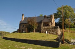 | St. Thomas Episcopal Church | 0.2 miles | 1976 |
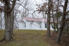 | St. Therese Church | 4.3 miles | 2012 |
| National Archives record | The nomination case file for reference 100010769 in Record Group 79. |
| Lee County | All 4 listed properties in this county. |