 Block
From the record
6 National Register listings published here.
Sources: the National Register database, National Park Service
40 topographic sheets cover 32 settlements here, and 6 properties are on the National Register of Historic Places.
6 National Register listings published here.
Sources: the National Register database, National Park Service
Every property in this county listed on the National Register of Historic Places, with the year it was listed and the federal nomination document.
| Photograph | Property | Type | Listed | Reference |
|---|---|---|---|---|
| Barlow Baxter House | building | 2001 | 01000795 | |
 | Thomas P. Evans House | building | 1992 | 92001488 |
| Clark C. Fowler House | building | 2001 | 01000794 | |
 | Mount Vernon A.M.E. Church | building | 1977 | 77000639 |
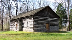 | Old Mulkey Meetinghouse | building | 1973 | 73000821 |
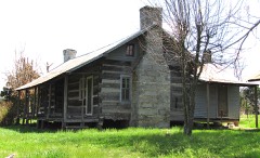 | George W. Proffitt Jr. House | building | 2001 | 01000793 |
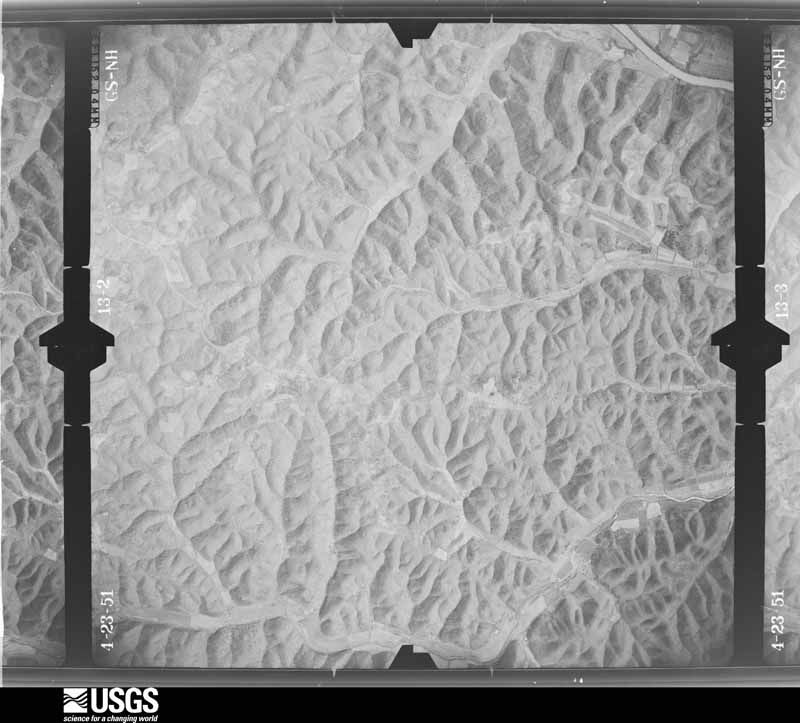
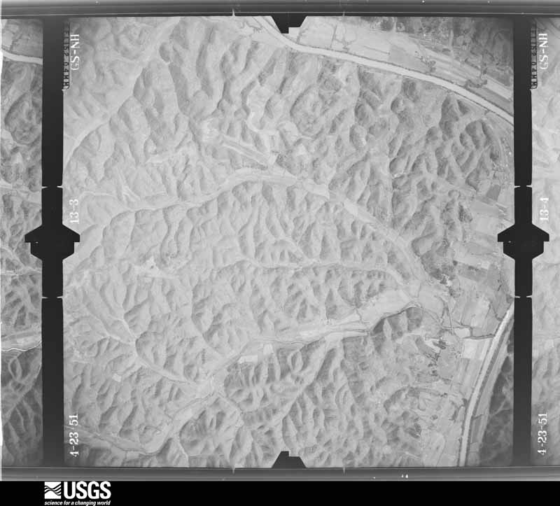
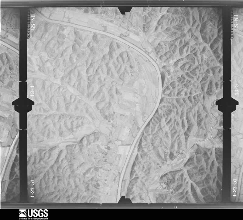
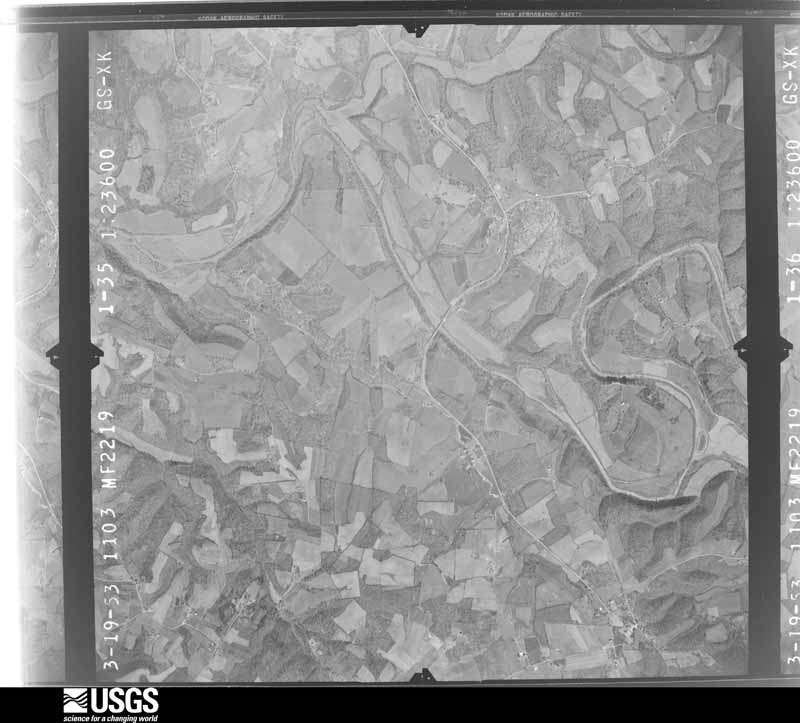
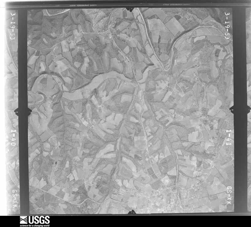
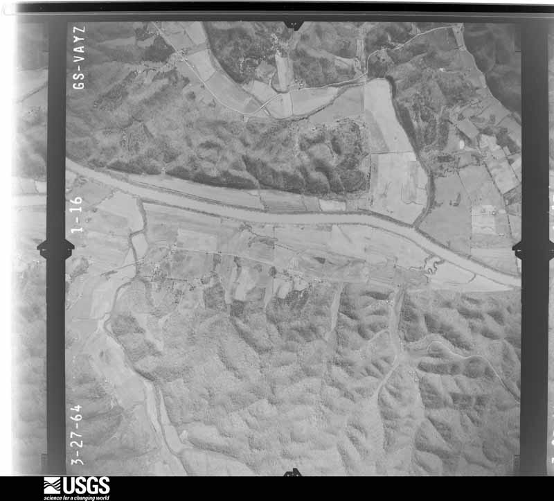
Flown by the U.S. Geological Survey between 1937 and 1989, the Aerial Photo Single Frames collection is the definitive mid-century view of the land: fields, roads and rivers as the camera saw them. The Survey holds 331 frames inside the rectangle that bounds this county; the 15 frames below were taken over the county itself, chosen across the decades of flights (at most four a year from that rectangle), so one flight cannot crowd out the rest. The full set is free to browse and download at EarthExplorer under the dataset Aerial Photo Single Frames.






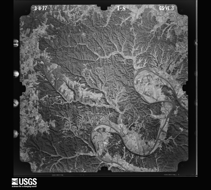
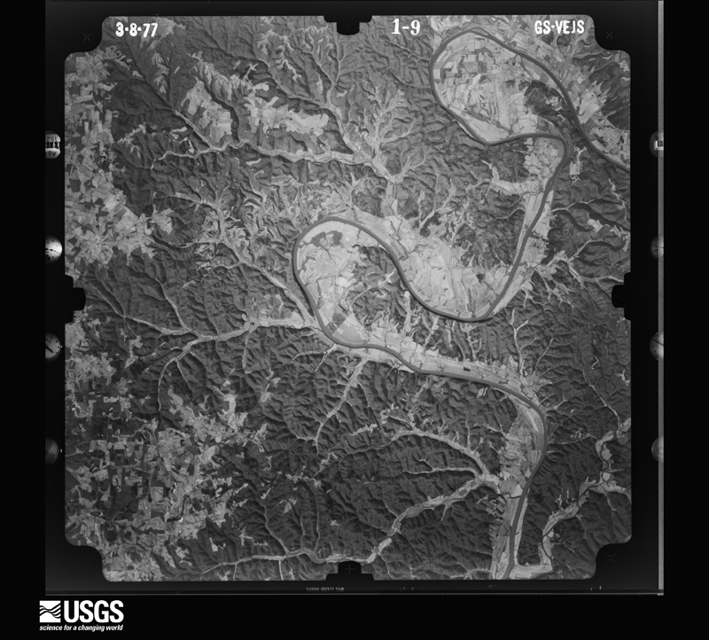
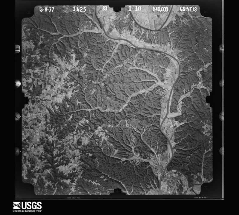
The thermometers that kept this county's weather, as the federal records hold them.
Who lived here in 1950, one enumeration district at a time, as the Census Bureau described each district. Each row opens its official National Archives result, with Population Schedules and ED Maps available there.
Every wildfire the federal occurrence database records inside this county: 174 of them, burning about 3,583 acres. 2 started naturally and 10 were recorded as arson. Each settlement page carries the fires within five miles of it.
| Reported cause | Fires |
|---|---|
| Debris and open burning | 81 |
| Missing data/not specified/undetermined | 42 |
| Recreation and ceremony | 25 |
| Arson/incendiarism | 10 |
| Railroad operations and maintenance | 8 |
| Smoking | 4 |
| Natural | 2 |
| Equipment and vehicle use | 2 |
The five largest, by the area the report gives. One of them was set deliberately.
| Date | Cause | Size | Reported by | Name on the report |
|---|---|---|---|---|
| 10 February 2000 | Arson/incendiarism | 457 acres | Kentucky Division of Forestry | not named |
| 21 March 2007 | Debris and open burning | 169 acres | Kentucky Division of Forestry | GORDON FIRE |
| 6 April 2010 | Debris and open burning | 133 acres | Kentucky Division of Forestry | LITTLE SULFUR |
| 28 November 2005 | Missing data/not specified/undetermined | 97 acres | Kentucky Division of Forestry | not named |
| 11 December 2006 | Missing data/not specified/undetermined | 90 acres | Kentucky Division of Forestry | not named |
| 2 April 2007 | Debris and open burning | 85 acres | Kentucky Division of Forestry | not named |
| 25 March 2007 | Debris and open burning | 80 acres | Kentucky Division of Forestry | not named |
| 28 May 2007 | Debris and open burning | 73 acres | Kentucky Division of Forestry | not named |
Every settlement page carries the fires within five miles of it - see the settlement index below.
The NOAA Storm Events Database holds 175 reports for this county, causing 1 death, no injuries and about $4,912,000 in recorded property damage. Each settlement page carries the reports that name it.
| Kind of event | Reports |
|---|---|
| Thunderstorm Wind | 109 |
| Hail | 30 |
| Flash Flood | 17 |
| Tornado | 13 |
| Flood | 2 |
| Lightning | 2 |
| Heavy Rain | 2 |
The most serious of them, by death, then injury, then recorded damage. The accounts are quoted exactly as the forecast office filed them.
| When | Event | Place named | Harm | What the report says |
|---|---|---|---|---|
| December 2018 | Flood | Gamaliel | 1 killed, $10,000 | A 19 year old female on Lyons Road attempted to drive through a low water crossing on the Rocky Branch of the East Fork of the Barren River just before 7 pm CST on New Year's Eve, but was washed away by the swollen creek's rising water. Her vehicle was carried downstream 500 yards, where it was discovered unoccupied the next day. After several days of searching, law enforcement located her body seven miles downstream on January 5, 2019. |
| February 2008 | Tornado (EF3) | Bugtussle | $3,700,000 | The tornado crossed into Monroe County, Kentucky from Macon County, Tennessee. About two miles west of Gamaliel, the tornado destroyed two conventional homes and two mobile homes. Thirteen residents of the four homes took shelter in the basement of one of the homes. They escaped without injury, although they were trapped in rubble for 30 minutes. Several other homes were damaged in a subdivision a mile north of Gamaliel. The tornado ripped the roof off a brick home there. It tracked across rural Monroe County, uprooting and snapping large trees. On the north side of Tompkinsville, it destroyed a large wood frame warehouse and twisted a large steel frame metal building off its foundation. A nearby well built brick home had its roof and exterior walls swept away. It also destroyed a detached three car garage. |
| May 1989 | Tornado (F0) | not stated | $250,000 | no account filed |
| January 2008 | Thunderstorm Wind | Mt Herman | $150,000 | Thunderstorm winds downed at least 20 tobacco barns and other outbuildings. At least one home was damaged. |
| January 2008 | Thunderstorm Wind | Fountain Run | $150,000 | Thunderstorm winds damaged several homes in the Fountain Run area. Elsewhere, numerous trees were downed. |
| April 2007 | Thunderstorm Wind | Mt Herman | $120,000 | Two barns were destroyed. Winds also damaged a house. |
| May 2010 | Flash Flood | Tompkinsville | $100,000 | Numerous roads across the county were closed due to flash flooding. A total of six to ten inches of rain fell across Monroe county from May 1-2. |
| March 1997 | Tornado (F2) | Bugtussle | $100,000 | no account filed |
| July 2006 | Thunderstorm Wind | Gamaliel | $75,000 | One barn was blown down and two other barns suffered roof damage. |
| March 2017 | Thunderstorm Wind | Mt Herman | $50,000 | State officials reported multiple trees and power lines down in the area due to severe thunderstorm winds. |
| March 2017 | Thunderstorm Wind | Rockbridge | $30,000 | State officials reported several trees and power lines down in the area. |
| February 2008 | Tornado (EF3) | Fountain Run | $30,000 | This EF3 tornado crossed into a wooded section of Monroe County from Allen County, and lifted near Highway 87 south of the town of Fountain Run. Several outbuildings were destroyed and a car was flipped on Circle D Lane. On Akersville Road, fences were downed and about 200,000 log feet of timber were knocked down. |
| July 2016 | Thunderstorm Wind | Tompkinsville | $25,000 | Local law enforcement reported trees and power lines down across the county. |
| June 2019 | Thunderstorm Wind | Tompkinsville | $20,000 | Multiple trees and power lines were reported down. |
| July 2013 | Lightning | Fountain Run | $20,000 | Local law enforcement relayed a report of a house in Fountain Run damaged by lightning. |
| May 2000 | Thunderstorm Wind | Gamaliel | $20,000 | A garage was destroyed by thunderstorm winds. |
| July 2010 | Lightning | Tompkinsville | $10,000 | Lightning sparked a house fire on Sixth Street. The time is approximate. |
| April 2007 | Thunderstorm Wind | Rockbridge | $10,000 | A barn was damaged about a quarter mile east of Rockbridge. |
| May 1995 | Thunderstorm Wind | Countywide | $10,000 | Several trees were blown down across the county. |
| March 1997 | Thunderstorm Wind | Gamaliel | $10,000 | no account filed |
| May 2000 | Thunderstorm Wind | Gamaliel | $7,500 | Trees were downed. One fell on a mobile home. |
| July 2012 | Thunderstorm Wind | Emberton | $5,000 | The local highway department reported a house damaged by winds along State Highway 63 west of Tompkinsville. |
| May 2010 | Tornado (EF0) | Tompkinsville | $5,000 | A NWS storm survey confirmed that a tornado touched down around 835 am CDT 4.3 miles west of Tompkinsville. A tobacco barn and several trees were damaged. The tornado then traveled east around 5.7 miles and lifted 1.4 miles east of Tompkinsville after damaging several trees. The tornado was rated EF-0 with estimated winds of 80 to 85 mph. |
| May 2003 | Thunderstorm Wind | Tompkinsville | $2,000 | A window was blown out of a house. Trees were blown down across city streets. |
| July 2009 | Thunderstorm Wind | Persimmon | $1,000 | Trees and large limbs were downed at Persimmon. |
| July 2009 | Thunderstorm Wind | Mt Herman | $750 | Trees were downed. |
| July 2009 | Thunderstorm Wind | Sulphur Lick | $750 | Trees were downed. |
| February 2025 | Flash Flood | Flippin | - | Multiple county and state roads were closed across Monroe County due to flash flooding and high water. |
| June 2025 | Thunderstorm Wind | Jeffrey | - | Several trees were blown over by strong thunderstorm winds in western Monroe County. |
| February 2025 | Thunderstorm Wind | Jeffrey | - | About one third of a barn roof was torn off by winds on Whitlow Road near Les Williams Road. |
| May 2024 | Thunderstorm Wind | Hestand | - | Several large trees, as well as power lines, were downed along Kentucky Route 163 in southern Monroe County. |
| May 2024 | Thunderstorm Wind | Vernon | - | Trees were downed across Vernon Road in southeastern Monroe County. |
| May 2024 | Thunderstorm Wind | Tompkinsville | - | Trees were downed in Tompkinsville as well as across Monroe County. |
| June 2024 | Thunderstorm Wind | Lamb | - | There was a report of a tree down on Jack Hunt Road. |
| May 2024 | Thunderstorm Wind | Fountain Run | - | Multiple trees were blown down in Fountain Run. |
| May 2024 | Tornado (EF1) | Persimmon | - | The National Weather Service conducted a storm survey and found a|tornado occurred on Sunday, May 26th, 2024. Despite the fact that the tornado was only on the ground for a little over one mile and one minute, it tracked very briefly through Monroe, Metcalfe, and Cumberland County. Starting in Monroe|County near the Bacon Branch of Leatherwood Creek on a rural|hillside, drone footage found a clearly defined path of uprooted|trees with a convergent signature to the damage consistent with|100 mph winds. The tornado then turned along the creek and|crossed into the intersection of Cumberland County and Metcalfe|County. |
| February 2023 | Hail | Grandview | - | Pictures from near Tompkinsville showed a few quarter-sized hailstones mixed with smaller hailstones on a deck. |
| June 2023 | Thunderstorm Wind | Fountain Run | - | There were trees down in Fountain Run. |
| June 2023 | Thunderstorm Wind | Gamaliel | - | There were trees down in Gamaliel. |
| June 2023 | Thunderstorm Wind | Bushong | - | Pictures showed metal siding and roofing blown off of a barn. Several trees were down along Meshack Creek Road and Lyons Chapel Road. |
| December 2023 | Tornado (EF1) | Harlan Xrds | - | A brief EF-1 tornado touched down just south of the Kentucky border in Clay County where it blew down a few trees on Barber Shop Road (EF-0). The tornado intensified to EF-1 as it moved northeast into Kentucky and caused significant roof and siding damage to several chicken barns in Harlan Crossroads. A home also lost its porch and part of its roof on Red Hill-Beech Grove Road. A few more trees were blown down west of of Beech Grove-Boles Road before the tornado lifted. |
| February 2022 | Thunderstorm Wind | Harlan Xrds | - | Trees were reported down on Gamaliel between Gamaliel and Tompkinsville. |
| January 2022 | Thunderstorm Wind | Emberton | - | Dispatch reported trees and power lines were down. |
| January 2022 | Thunderstorm Wind | Fountain Run | - | Dispatch reported trees and power lines down. |
| July 2022 | Thunderstorm Wind | Tompkinsville | - | Power lines were reported down on the west side of Tompkinsville. |
| February 2021 | Flash Flood | Tompkinsville | - | Water was over Watt Bridge on Kentucky 163. |
| January 2021 | Thunderstorm Wind | Fountain Run | - | A tree was blown down near Browns Ford Boat Ramp. |
| May 2021 | Tornado (EF1) | Tompkinsville | - | The National Weather Service determined an EF-1 tornado with maximum sustained winds of 95 mph caused a damage path 60 yards wide. ||The thunderstorm quickly became severe in southwest Monroe County. It quickly became severe in southwest Monroe County and became tornadic on the southwest side of Tompkinsville. The tornado touched down near the intersection of Second and Jackson Streets. Trees were lying in multiple directions and most of them were twisted, snapped, or uprooted. Power lines were down, and several power poles were snapped. Winds at that location were between 85 and 90 mph with a width of 50 yards. ||Farther to the northeast, between 5th Street and Carter Street, the tornado increased to 95 mph and the width expanded out to 60 yards. Several homes experienced roof damage with some windows blown out. One home had multiple large trees uprooted with a camper trailer and pontoon boat flipped over. There were several pieces of lumber that were impaled in the ground and pieces of sheet metal thrown into trees. ||The US Bank building received roof damage before the tornado briefly lifted before touching down near the intersection of Pedigo and White Streets. ||There was significant tree damage on the east of Main Street by Pedigo Street. Trees were facing multiple directions. Mud spatter was on the backside of homes and vehicles along Short Street to Monroe Street. Multiple power lines were down in the area. Winds decreased to 90 mph along Monroe Street. ||The National Weather Service drone found some twisted tree tops near Spring Valley Road and Woodhaven as a result of wind speeds of 85 mph. The tornado lifted at Jackie Crow Salvage Yard as it threw debris on top of a hill about 250 yards from the salvage yard. ||Several videos showed brief funnels coming down from the main storm, almost like a small skipping tornado. |
| May 2021 | Flash Flood | Jeffrey | - | Photos on social media showed flooding over Bethlehem Church Road. |
| May 2021 | Flash Flood | Emberton | - | Images on social media showed high water from East Fork Creek over the County House Road Bridge. |
| December 2021 | Tornado (EF0) | Boles | - | This tornado developed in Clay County, Tennessee, on the northeast side of Hermitage Springs, before tracking northeastward and crossing into Monroe County, Kentucky (see Storm Data from the Nashville, Tennessee office for more information on the beginning portion of this tornado in Tennessee). A barn and several trees were damaged along Beech Grove-Boles Road, with estimated maximum wind speeds of 85 mph. Additional trees were damaged along Rhoton Cave Road and near the intersection of Highways 163 and 216 in Hestand. The tornado damaged a barn near the intersection of Vernon Road and Bailey Cemetery Road before lifting. |
| February 2021 | Thunderstorm Wind | Grandview | - | One tree blew down. |
| January 2020 | Thunderstorm Wind | Tompkinsville | - | Broadcast media relayed a public picture of severe roof damage to a home near Tompkinsville. |
| January 2020 | Thunderstorm Wind | Center Pt | - | The National Weather Service in conjunction with Monroe County KY EMA conducted a storm damage survey across extreme northeast portions of Monroe County for storm damage on Saturday, January 11. A line of storms produced significant cedar tree damage at 12829 Center Point Road. Several cedar trees were uprooted and snapped across the cattle pasture. A very large barn had significant roof damage storing hay had metal roofing peeled back and thrown several hundred yards downwind. A carport at the one story family residence was lifted up with an inordinate amount of insulation and building material was blown up to 500 yards northeastward. The trailer portion of an 18- wheeler...full of family storage...was pushed over and moved 10 yards. The air conditioning unit was moved approximately 35 yards to the northeast. A wheelbarrow was wrapped around a power line and blown through a fence. The front porch roof fell and pillars were scattered in the yard. Part of the homes roof was peeled off and bricks were blown off the side of the house. A power line was wrapped around a tree. The type of damage is consistent with the radar imagery of a linear line of storms pushing the rough the area from the west southwest to east northeast. Witnesses said they felt a pressure drop that lasted about 20 seconds. |
| August 2020 | Flash Flood | Otia | - | Highway 100 East, approximately 3 miles east of Tompkinsville, was completely flooded. |
| February 2019 | Flash Flood | Otia | - | The Kentucky 214 ferry was closed due to flooding. |
| August 2019 | Hail | Gamaliel | - | The public reported hail the size of quarters at Gamaliel Shooting Supply. |
| June 2018 | Thunderstorm Wind | Gamaliel | - | Trees were reported down. |
| June 2018 | Thunderstorm Wind | Grandview | - | Two or three trees were blocking Center Point Road. |
| May 2018 | Thunderstorm Wind | Lamb | - | There were multiple reports of trees down near Lamb. |
The Survey's mineral resources record lists 9 workings inside this county. 1 still produces and 8 are closed or unrecorded. Each settlement page carries the workings within five miles of it.
| Commodity | Workings |
|---|---|
| Uranium, Oil Shale | 3 |
| Uranium | 3 |
| Oil Shale | 3 |
| Zinc | 2 |
| Dolomite | 1 |
| Stone, Crushed/Broken | 1 |
The least common of them first, because a county's hundredth gravel pit says nothing its first ten did not.
| Where | Site | Commodity | Status | Recorded |
|---|---|---|---|---|
| Fountain Run | Zinc, Dolomite | Prospect | 1970 | |
| Trico Stone Mine | Stone, Crushed/Broken | Producer | ||
| Gamaliel | Zinc | Prospect | ||
| Outcrop Sample For Uranium | Uranium, Oil Shale | Occurrence | ||
| Outcrop Sample For Uranium | Uranium, Oil Shale | Occurrence | ||
| Outcrop Sample For Uranium | Uranium, Oil Shale | Occurrence | ||
| Outcrop Sample For Uranium | Uranium, Oil Shale | Occurrence | ||
| Outcrop Sample For Uranium | Uranium, Oil Shale | Occurrence | ||
| Outcrop Sample For Uranium | Uranium, Oil Shale | Occurrence |
Named settlements recorded in the Geographic Names Information System, each with the topographic sheets covering it. Villages, hamlets and abandoned places alike. Each is shown with the nearest named watercourse or landform and the survey quadrangle it falls on.
Fountain Run census division · 42133 · Near Jack Edward Cosby Bottom · Fountain Run quadrangle
11 sheets, 1931 to 1985
Tompkinsville census division · 42167 · On Herd Branch · Vernon quadrangle
13 sheets, 1929 to 1985
Fountain Run census division · 42167 · On South Fork Indian Creek · Gamaliel quadrangle
11 sheets, 1931 to 1985
Fountain Run census division · 42140 · On Rocky Branch · Gamaliel quadrangle
11 sheets, 1931 to 1985
Fountain Run census division · 42140 · On Line Creek · Gamaliel quadrangle
11 sheets, 1931 to 1985
Tompkinsville census division · 42167 · Tompkinsville quadrangle
13 sheets, 1929 to 1985
Mount Hermon census division · 42157 · On Miller Branch · Freedom quadrangle
8 sheets, 1953 to 1985
Tompkinsville census division · 42167 · On Kings Branch · Blacks Ferry quadrangle
14 sheets, 1924 to 1985
No longer a settlement
Fountain Run census division · 42167 · On John Wilson Run · Tracy quadrangle
9 sheets, 1953 to 1985
Tompkinsville census division · 42167 · On Mary Scott Branch · Blacks Ferry quadrangle
14 sheets, 1924 to 1985
Tompkinsville census division · 42167 · On Little Meshack Creek · Vernon quadrangle
13 sheets, 1929 to 1985
Mount Hermon census division · 42167 · On Tyree Branch · Freedom quadrangle
8 sheets, 1953 to 1985
Tompkinsville census division · 42167 · On Andrews Branch · Vernon quadrangle
13 sheets, 1929 to 1985
Mount Hermon census division · 42167 · On John Wilson Run · Fountain Run quadrangle
11 sheets, 1931 to 1985
No longer a settlement
Tompkinsville census division · 42167 · Near Dodson Hollow · Blacks Ferry quadrangle
14 sheets, 1924 to 1985
Mount Hermon census division · 42166 · On Muncie Branch · Sulphur Lick quadrangle
9 sheets, 1953 to 1985
Tompkinsville census division · 42167 · On Curtis Branch · Tompkinsville quadrangle
13 sheets, 1929 to 1985
Tompkinsville census division · 42151 · On Little McFarland Creek · Vernon quadrangle
13 sheets, 1929 to 1985
The vanished settlements of Monroe County: the places named above that are no longer on the map.