 Block
From the record
3 National Register listings published here.
Sources: the National Register database, National Park Service
22 topographic sheets cover 12 settlements here, and 3 properties are on the National Register of Historic Places.
3 National Register listings published here.
Sources: the National Register database, National Park Service
Every property in this county listed on the National Register of Historic Places, with the year it was listed and the federal nomination document.
| Photograph | Property | Type | Listed | Reference |
|---|---|---|---|---|
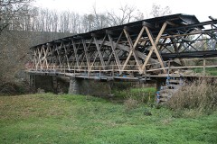 | Johnson Creek Covered Bridge | structure | 1976 | 76000941 |
 | Thomas Metcalf House | building | 1987 | 87000187 |
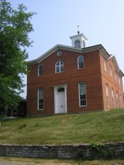 | Robertson County Courthouse | building | 1978 | 78001394 |
Robertson County has 1 covered bridge on the National Register. Each is a listed structure with a federal nomination on file.
| Johnson Creek Covered Bridge | Listed 1976 |
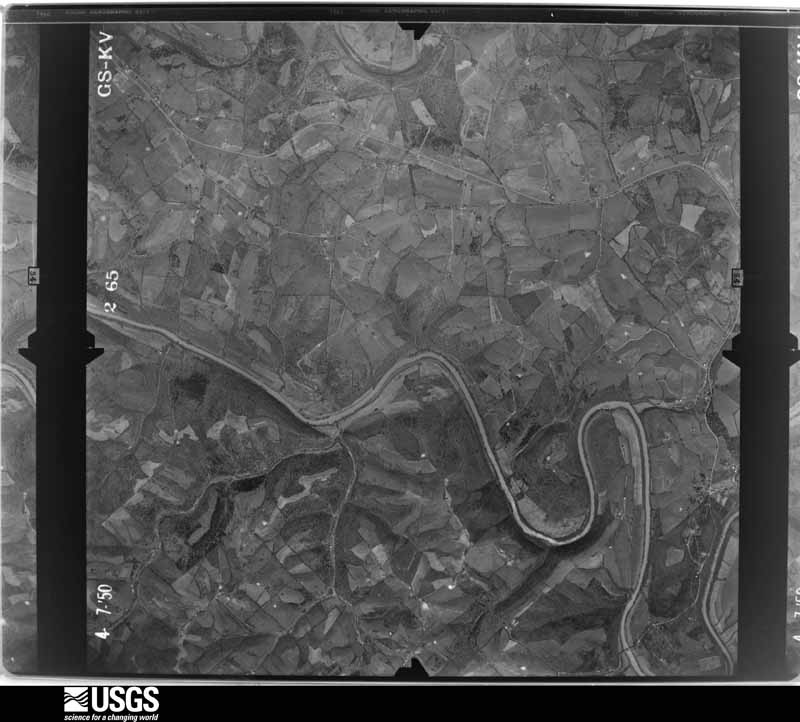
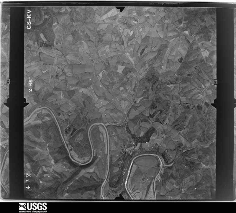
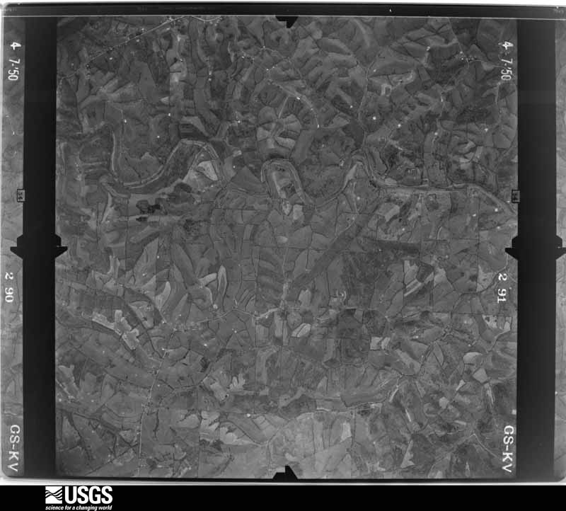
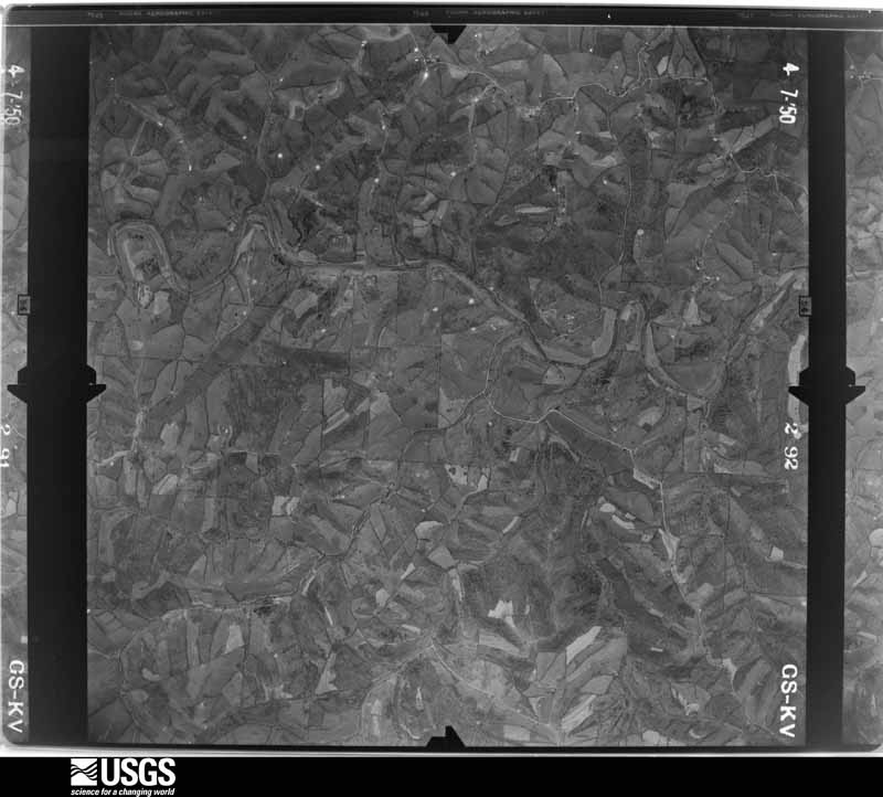
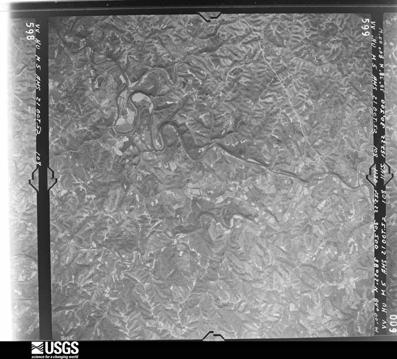
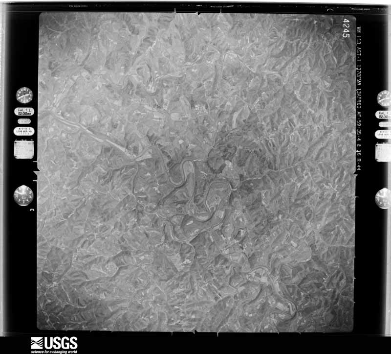
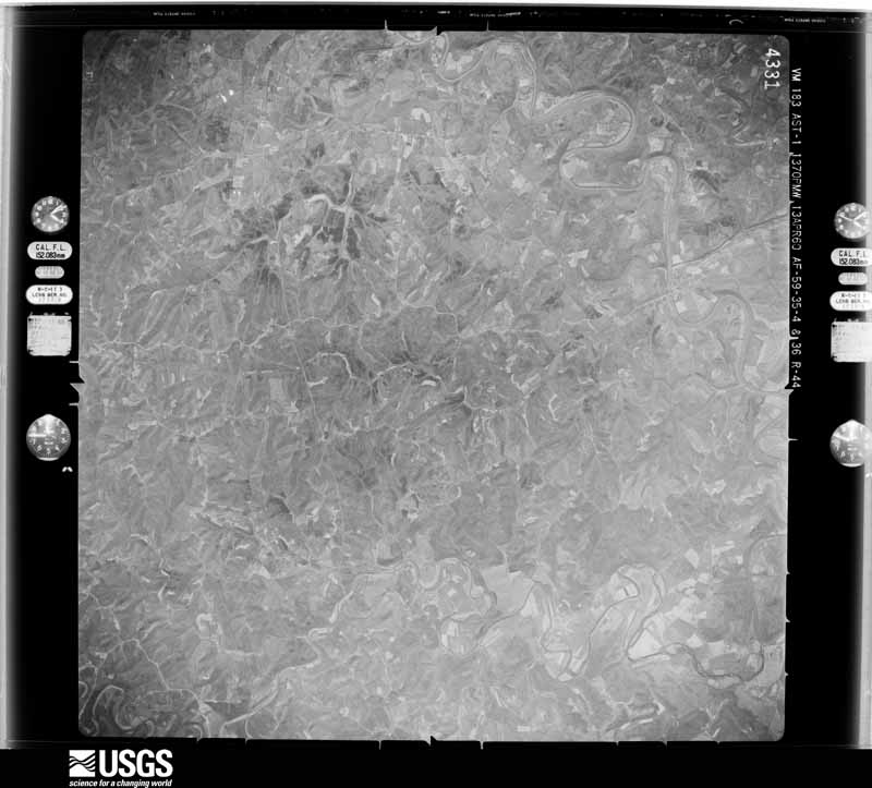
Flown by the U.S. Geological Survey between 1937 and 1989, the Aerial Photo Single Frames collection is the definitive mid-century view of the land: fields, roads and rivers as the camera saw them. The Survey holds 163 frames inside the rectangle that bounds this county; the 12 frames below were taken over the county itself, chosen across the decades of flights (at most four a year from that rectangle), so one flight cannot crowd out the rest. The full set is free to browse and download at EarthExplorer under the dataset Aerial Photo Single Frames.





The thermometers that kept this county's weather, as the federal records hold them.
Who lived here in 1950, one enumeration district at a time, as the Census Bureau described each district. Each row opens its official National Archives result, with Population Schedules and ED Maps available there.
Every wildfire the federal occurrence database records inside this county: 1 of them, burning about 1 acre. None started naturally and none was recorded as arson. Each settlement page carries the fires within five miles of it.
| Reported cause | Fires |
|---|---|
| Missing data/not specified/undetermined | 1 |
The five largest, by the area the report gives. None of them was recorded as arson.
| Date | Cause | Size | Reported by | Name on the report |
|---|---|---|---|---|
| 5 November 2006 | Missing data/not specified/undetermined | 1.0 acres | Kentucky Division of Forestry | not named |
Every settlement page carries the fires within five miles of it - see the settlement index below.
The NOAA Storm Events Database holds 59 reports for this county, causing no deaths, no injuries and about $833,000 in recorded property damage. Each settlement page carries the reports that name it.
| Kind of event | Reports |
|---|---|
| Thunderstorm Wind | 34 |
| Hail | 13 |
| Flash Flood | 6 |
| Flood | 3 |
| Tornado | 2 |
| Heavy Rain | 1 |
The most serious of them, by death, then injury, then recorded damage. The accounts are quoted exactly as the forecast office filed them.
| When | Event | Place named | Harm | What the report says |
|---|---|---|---|---|
| March 1997 | Flash Flood | Countywide | $500,000 | no account filed |
| June 2012 | Thunderstorm Wind | Hittville | $90,000 | One roof was completely ripped off of a barn with numerous reports of other barns also damaged due to thunderstorm winds. Trees were downed across the county. |
| April 2020 | Thunderstorm Wind | Mt Olivet | $60,000 | Trees, limbs and electric lines were downed and power was out throughout the county. There were multiple reports of damage to roofs. |
| June 2008 | Thunderstorm Wind | Abigail | $40,000 | Several homes sustained roof damage and the loss of vinyl siding to the northeast of Mount Olivet. One home has a second story window with broken glass with the window frame blown inwards. Several barns had outer walls collapsed with the loss of metal roof panels. These barns appeared to be older and poorly constructed. Numerous trees were snapped at the trunk or completely uprooted. Investigation determined this damage was caused by a microburst with maximum winds at 85 mph. |
| April 2020 | Tornado (EF0) | Mt Olivet | $25,000 | The tornado first touched down north of Mt. Olivet and damaged structures along Highway 165 north of town, and then east across Brierly Ridge Road. A state highway barn was damaged. Tree damage was also seen along the path damage. |
| February 2000 | Flash Flood | Piqua | $15,000 | Many hours of heavy rainfall caused the closing of State Route 168. Also, rising water forced the evacuation of a retirement home. |
| July 2015 | Thunderstorm Wind | Mt Olivet | $10,000 | A new roof was torn off of a barn and several large trees were downed. |
| August 2007 | Thunderstorm Wind | Mt Olivet | $10,000 | Several trees were downed. A shed along US Route 62 sustained minor damage. |
| July 2007 | Thunderstorm Wind | Mt Olivet | $7,000 | Large tree limbs were downed, and a barn sustained some minor damage. |
| May 2004 | Thunderstorm Wind | Countywide | $7,000 | Trees and large limbs were downed. |
| October 2022 | Thunderstorm Wind | Abigail | $5,000 | A few trees were downed along U.S. 62, just west of Sardis. A barn roof was also damaged. |
| March 2017 | Thunderstorm Wind | Mt Olivet | $5,000 | A barn was destroyed on Henson Ridge Road. |
| July 2001 | Thunderstorm Wind | Mt Olivet | $5,000 | Trees knocked down. |
| October 2001 | Thunderstorm Wind | Countywide | $5,000 | Large trees were downed across the county, causing numerous power outages. |
| December 2000 | Flash Flood | Countywide | $5,000 | Several hours of very heavy rainfall caused many roads to be closed across the county. |
| November 2000 | Thunderstorm Wind | Countywide | $5,000 | Numerous large limbs knocked down. |
| November 1998 | Thunderstorm Wind | Mt Olivet | $5,000 | Trees and power lines down. |
| May 1996 | Thunderstorm Wind | Mt Olivet | $5,000 | no account filed |
| May 1995 | Thunderstorm Wind | North half | $4,000 | Several trees downed, some bringing down power |
| June 2008 | Thunderstorm Wind | Piqua | $3,000 | Several trees were knocked down. |
| May 2006 | Thunderstorm Wind | Mt Olivet | $3,000 | Several trees were knocked down. |
| May 2006 | Thunderstorm Wind | Abigail | $3,000 | Trees were downed. |
| June 1998 | Thunderstorm Wind | Mt Olivet | $3,000 | Many trees downed. |
| July 1997 | Thunderstorm Wind | Piqua | $3,000 | Trees downed. |
| June 2019 | Thunderstorm Wind | Hittville | $2,000 | A few trees were reported knocked down. |
| May 2011 | Flood | Piqua | $2,000 | A creek overflowed and covered parts of the road due to heavy rainfall. |
| October 2010 | Thunderstorm Wind | Mt Olivet | $2,000 | Trees were reported down along Old Pin Hook Road due to damaging thunderstorm winds. |
| May 1996 | Thunderstorm Wind | Mt Olivet | $2,000 | no account filed |
| June 2015 | Thunderstorm Wind | Hittville | $1,000 | A tree was knocked down at the intersection of John England Road and Kentucky 165. |
| August 2010 | Thunderstorm Wind | Mt Olivet | $1,000 | Multiple trees were reported down in the area. |
| January 2023 | Flash Flood | Piqua | - | State Route 617 was closed due to high water. |
| January 2023 | Flood | Mt Olivet | - | Central Ridge Road was closed due to high water. |
| May 2022 | Flash Flood | Alhambra | - | Five Lick Road was impassable due to high water flowing across it. |
| March 2017 | Flood | Piqua | - | Piqua Kentontown Road was underwater due to Johnson Creek overflowing. |
| April 2015 | Heavy Rain | Kentontown | - | Flooding was reported in the Johnson Creek and North Fork areas. |
| January 2002 | Flash Flood | Countywide | - | Swift moving water covered several main roads throughout the county. Creeks were rising quickly, and local law enforcement had at least one evacuation. |
| April 2015 | Hail | Abigail | - | no account filed |
| December 2013 | Thunderstorm Wind | Mt Olivet | - | no account filed |
| May 2011 | Hail | Piqua | - | no account filed |
| May 2011 | Hail | Mt Olivet | - | no account filed |
| April 2010 | Hail | Mt Olivet | - | no account filed |
| April 2010 | Hail | Kentontown | - | no account filed |
| April 2010 | Hail | Mt Olivet | - | no account filed |
| November 2002 | Hail | Mt Olivet | - | no account filed |
| August 2000 | Hail | Kentontown | - | no account filed |
| May 1998 | Hail | Mt Olivet | - | no account filed |
| March 1995 | Hail | Sardis | - | no account filed |
| June 1995 | Hail | Union | - | no account filed |
| June 1995 | Hail | Mount Olivet | - | no account filed |
| August 1989 | Thunderstorm Wind | not stated | - | no account filed |
| April 1989 | Hail | not stated | - | no account filed |
| July 1987 | Thunderstorm Wind | not stated | - | no account filed |
| May 1987 | Thunderstorm Wind | not stated | - | no account filed |
| July 1983 | Thunderstorm Wind | not stated | - | no account filed |
| July 1983 | Thunderstorm Wind | not stated | - | no account filed |
| June 1981 | Thunderstorm Wind | not stated | - | no account filed |
| April 1974 | Tornado (F3) | not stated | - | no account filed |
| April 1970 | Thunderstorm Wind | not stated | - | no account filed |
| February 1959 | Thunderstorm Wind | not stated | - | no account filed |
Named settlements recorded in the Geographic Names Information System, each with the topographic sheets covering it. Villages, hamlets and abandoned places alike. Each is shown with the nearest named watercourse or landform and the survey quadrangle it falls on.
Mount Olivet census division · 41044 · On Wolf Run · Sardis quadrangle
10 sheets, 1915 to 1991
Mount Olivet census division · 41064 · On Salt Lick · Mount Olivet quadrangle
6 sheets, 1952 to 1986
Mount Olivet census division · 41004 · On Brierly Ridge · Mount Olivet quadrangle
6 sheets, 1952 to 1986
No longer a settlement
Mount Olivet census division · 41064 · Sardis quadrangle
10 sheets, 1915 to 1991
No longer a settlement
Mount Olivet census division · 41004 · On Islands Run · Mount Olivet quadrangle
6 sheets, 1952 to 1986
Mount Olivet census division · 41064 · On North Branch Cedar Creek · Piqua quadrangle
5 sheets, 1952 to 1986
Mount Olivet census division · 41004 · Near Brierly Ridge · Mount Olivet quadrangle
6 sheets, 1952 to 1986
No longer a settlement
Mount Olivet census division · 41064 · Near Cow Hollow · Piqua quadrangle
5 sheets, 1952 to 1986
No longer a settlement
Mount Olivet census division · 41064 · On Ogden Ridge · Sardis quadrangle
10 sheets, 1915 to 1991
No longer a settlement
The vanished settlements of Robertson County: the places named above that are no longer on the map.