 Block
From the record
2 National Register listings published here.
Sources: the National Register database, National Park Service
40 topographic sheets cover 33 settlements here, and 2 properties are on the National Register of Historic Places.
2 National Register listings published here.
Sources: the National Register database, National Park Service
Every property in this county listed on the National Register of Historic Places, with the year it was listed and the federal nomination document.
| Photograph | Property | Type | Listed | Reference |
|---|---|---|---|---|
| H.M. Smith General Merchandise and Fonthill Post Office | building | 2024 | 100009730 | |
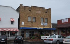 | Russell Lodge No. 284 | building | 1994 | 93001586 |
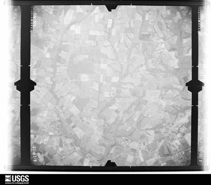
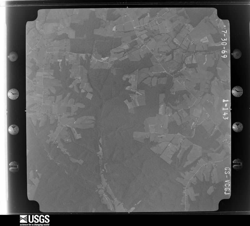
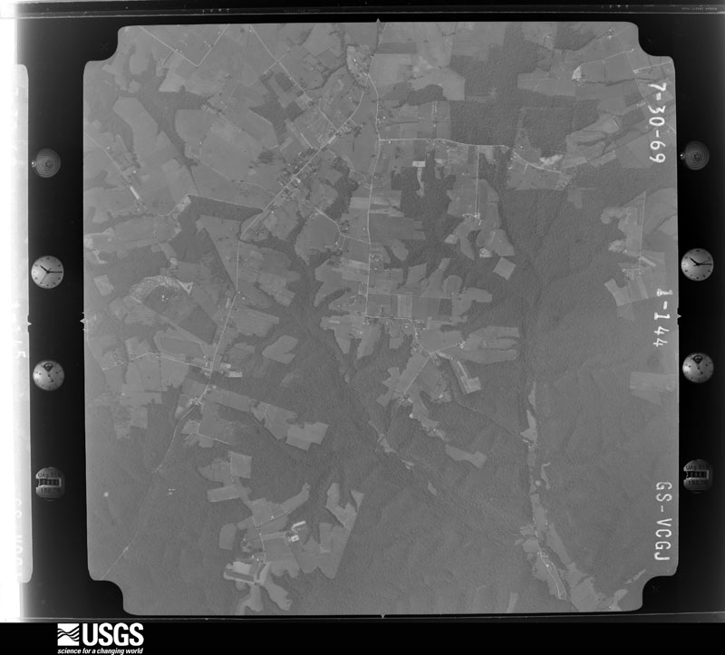
Flown by the U.S. Geological Survey between 1937 and 1989, the Aerial Photo Single Frames collection is the definitive mid-century view of the land: fields, roads and rivers as the camera saw them. The Survey holds 553 frames inside the rectangle that bounds this county; the 20 frames below were taken over the county itself, chosen across the decades of flights (at most four a year from that rectangle), so one flight cannot crowd out the rest. The full set is free to browse and download at EarthExplorer under the dataset Aerial Photo Single Frames.



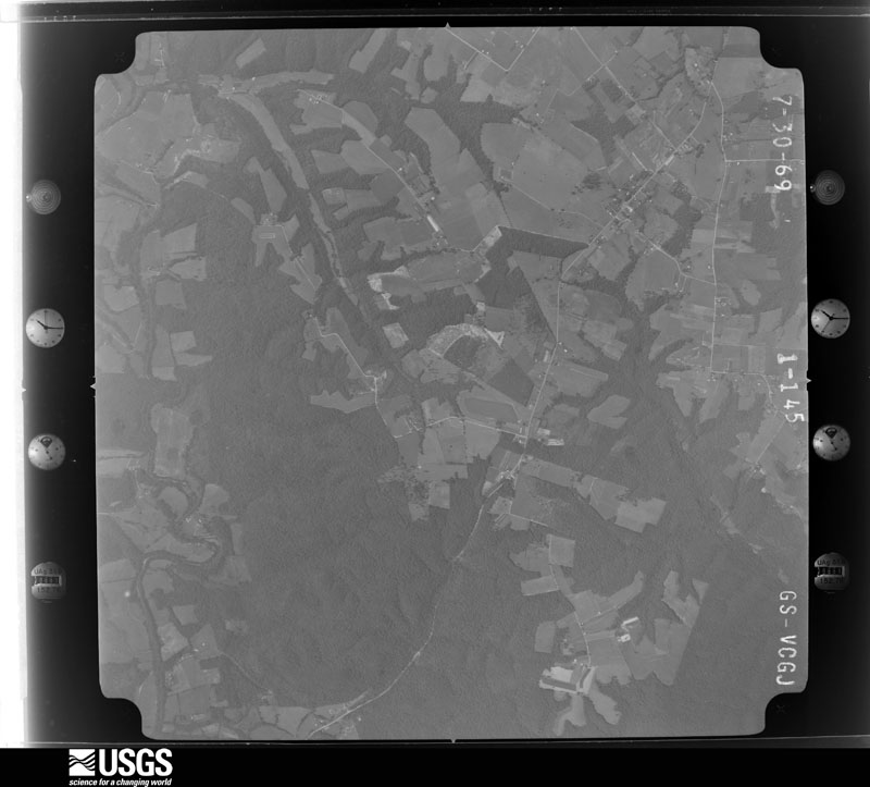
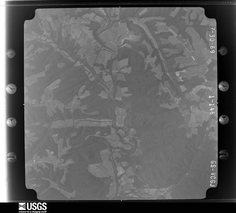












The thermometers that kept this county's weather, and the gages that measured the flow of its streams, as the federal records hold them. The extremes below are measured values from those records, not estimates.
Who lived here in 1950, one enumeration district at a time, as the Census Bureau described each district. Each row opens its official National Archives result, with Population Schedules and ED Maps available there.
Every wildfire the federal occurrence database records inside this county: 44 of them, burning about 2,400 acres. None started naturally and 11 were recorded as arson. Each settlement page carries the fires within five miles of it.
| Reported cause | Fires |
|---|---|
| Debris and open burning | 12 |
| Arson/incendiarism | 11 |
| Missing data/not specified/undetermined | 9 |
| Recreation and ceremony | 6 |
| Equipment and vehicle use | 3 |
| Smoking | 2 |
| Railroad operations and maintenance | 1 |
The five largest, by the area the report gives. Three of them were set deliberately.
| Date | Cause | Size | Reported by | Name on the report |
|---|---|---|---|---|
| 10 November 2001 | Arson/incendiarism | 1,000 acres | Kentucky Division of Forestry | not named |
| 13 October 2007 | Debris and open burning | 370 acres | Kentucky Division of Forestry | INDIAN CREEK |
| 30 October 2010 | Missing data/not specified/undetermined | 300 acres | Kentucky Division of Forestry | SALT LICK CREEK |
| 13 March 2007 | Missing data/not specified/undetermined | 215 acres | Kentucky Division of Forestry | CHARLES GIBBS |
| 20 September 2007 | Equipment and vehicle use | 150 acres | Kentucky Division of Forestry | WHIPPOORWILL FIRE |
| 9 November 2001 | Arson/incendiarism | 100 acres | Kentucky Division of Forestry | not named |
| 4 December 2017 | Arson/incendiarism | 30 acres | Kentucky Division of Forestry | CAVE SPRINGS RD. |
| 22 March 2011 | Recreation and ceremony | 30 acres | Kentucky Division of Forestry | LUTTRELL CREEK |
Every settlement page carries the fires within five miles of it - see the settlement index below.
The NOAA Storm Events Database holds 199 reports for this county, causing 2 deaths, 74 injuries and about $4,739,050 in recorded property damage. Each settlement page carries the reports that name it.
| Kind of event | Reports |
|---|---|
| Thunderstorm Wind | 139 |
| Hail | 30 |
| Flash Flood | 16 |
| Tornado | 9 |
| Flood | 4 |
| Lightning | 1 |
The most serious of them, by death, then injury, then recorded damage. The accounts are quoted exactly as the forecast office filed them.
| When | Event | Place named | Harm | What the report says |
|---|---|---|---|---|
| April 1971 | Tornado (F4) | not stated | 2 killed, 70 hurt, $2,500,000 | no account filed |
| May 1995 | Thunderstorm Wind | Russell Springs | 2 hurt, $50,000 | Winds blew a tractor-semitrailer over, injuring two people. Four barns were destroyed and two mobile homes damaged. |
| April 1983 | Tornado (F1) | not stated | 1 hurt, $25,000 | no account filed |
| March 1974 | Tornado (F2) | not stated | 1 hurt, $25,000 | no account filed |
| March 1997 | Tornado (F0) | Jamestown | $1,000,000 | no account filed |
| April 2007 | Thunderstorm Wind | Jamestown | $250,000 | Boat storage structures were damaged near Jamestown. Outbuildings and barns were damaged. A tree was blown on to a mobile home. Numerous trees were down along Highway 379. |
| May 1984 | Tornado (F1) | not stated | $250,000 | no account filed |
| February 2012 | Tornado (EF2) | Humble | $200,000 | An EF-2 tornado touched down just north of Russell Springs west of Route 127. The complete track of the tornado was 7.2 miles across Russell and Casey Counties. It intensified east of Route 127 with the worst damage occurring along a 1.5 mile stretch from Route 76 east over Oak Grove Road to Pattie Ridge Road. On Route 76, two mobile homes were totally destroyed and a modular built home was heavily damaged and moved off its foundation. The tornado tracked for a total of 5.8 miles before crossing the border into Casey County.||The tornado first touched down north of Russell Springs in northern Russell County west of Highway 127 where it did minor damage to trees, barns, and outbuildings. It intensified as it moved east, with the worst damage occurring along a 1.5 mile stretch from Highway 76 eastward over Oak Grove Road to Pattie Ridge Road. On Highway 76 a mobile home was destroyed and a nearby modular home was rotated 30-80 feet counterclockwise off its foundation, with a quarter of the home blown away. Two residents survived in an underground tornado shelter where they took refuge. One quarter mile east of these two homes, a modular home was completely destroyed when it became airborne and crashed to the ground 50 yards away. Residents were not home at the time of the tornado at this or any of the other homes destroyed along its path. ||On Pattie Ridge Road, another mobile home was completely destroyed along with two outbuildings. An east-facing exterior sidewall of a neighboring single-story brick home collapsed, with extensive roof damage to a large metal outbuilding at this location. Just before exiting the county, the tornado tore 80 feet of roofing off a large dairy barn and scattered debris through a nearby grove of trees. |||The tornado weakened as it moved into southern Casey County where it damaged more trees, barns, and outbuildings. The tornado lifted west-southwest of Windsor. |
| May 2010 | Flash Flood | Esto | $100,000 | Numerous roads across the county were closed due to flash flooding. A total of eight to ten inches of rain fell across Russell county from May 1-2. |
| January 2008 | Thunderstorm Wind | Russell Spgs | $100,000 | Thunderstorm winds blew the roof off a building. |
| November 2006 | Thunderstorm Wind | Russell Spgs | $25,000 | A boat storage building near the town of Russell Springs was partially destroyed. The roof of the building was blown off. Some 2 by 6 boards from the building were driven 18 inches deep into the ground. One boat in the building was destroyed, and several others were damaged. Numerous trees were downed. |
| May 2002 | Flash Flood | Russell Spgs | $25,000 | Three vehicles were washed downstream at Russell Springs. There were no injuries. |
| May 2017 | Thunderstorm Wind | Jamestown | $20,000 | State officials reported numerous trees down along with a few power lines. |
| July 2015 | Thunderstorm Wind | Dallo | $20,000 | A public report was received of trees down on cars in the area due to severe thunderstorm winds. |
| June 2019 | Thunderstorm Wind | Horntown | $15,000 | Trees and power lines were down. |
| June 2019 | Thunderstorm Wind | Ribbon | $15,000 | Trees were reported down across power lines. |
| May 2018 | Thunderstorm Wind | Eller | $15,000 | There was a power line down blocking the Road on East Highway 619 near Indian Caves Hill. |
| July 2015 | Thunderstorm Wind | Russell Spgs Arpt | $15,000 | The Russell County emergency manager reported that a roof was blown off of a barn due to severe thunderstorm winds. |
| June 2007 | Thunderstorm Wind | Eli | $15,000 | A mobile home was blown off its foundation. Several trees were downed. |
| June 2013 | Thunderstorm Wind | Jamestown | $10,000 | The Jamestown local fire department reported a tree blown on a house trailer. |
| May 2006 | Thunderstorm Wind | Russell Spgs | $10,000 | Trees were downed and a barn was damaged. |
| July 2001 | Thunderstorm Wind | Bryan | $10,000 | A few mobile homes were damaged at Bryan. |
| November 2000 | Thunderstorm Wind | Russell Spgs | $10,000 | no account filed |
| June 1998 | Thunderstorm Wind | Russell Spgs | $10,000 | no account filed |
| May 2004 | Thunderstorm Wind | Russell Spgs | $5,000 | Numerous trees were downed. A car port at a private residence was damaged. |
| May 2004 | Thunderstorm Wind | Russell Spgs | $5,000 | Trees were downed. A car port at a private residence was damaged. |
| May 2002 | Thunderstorm Wind | Jamestown | $5,000 | Trees were downed. There was minor wind damage to mobile homes. |
| July 2022 | Lightning | Dent | $3,000 | Lightning struck a tree near Beckham Ridge Road 1 mile from West Highway 80. The homeowner had just entered their car when lightning struck. Bark was blown off the tree, and the tree snapped and fell on the car. Cost of damage is unknown. |
| June 2013 | Thunderstorm Wind | Longstreet | $2,000 | The local media relayed a report that a roof was removed from a barn in the town of Salem. |
| February 2024 | Thunderstorm Wind | Humble | $1,000 | A carport and a few trees blew down. One tree fell on a vehicle. A nearby weather station measured a 47 mph wind gust. Damage costs are unknown. |
| July 2016 | Thunderstorm Wind | Olga | $1,000 | The public reported a radio antenna snapped from its base due to severe thunderstorm winds. |
| June 2015 | Thunderstorm Wind | Jabez | $1,000 | An employee at Harris Grocery reported two trees down due to severe thunderstorm winds. One large tree had to be removed from the roadway. Also, 1 inch diameter hail was observed during the thunderstorm. |
| July 2009 | Thunderstorm Wind | Russell Spgs | $750 | Trees were downed and pea to dime size hail was falling. |
| June 2009 | Hail | Russell Spgs | $300 | Quarter sized hail reported falling for around five minutes. Some minor damage to a vehicle was reported. |
| April 2026 | Thunderstorm Wind | Russell Spgs | - | A section of roof was removed from a storage building along Land Fill Road. The section was blown about 40 feet before landing on two vehicles. Both vehicles were totaled as a result of the damage. |
| May 2025 | Thunderstorm Wind | Gum Corners | - | Multiple barns were damaged near Cabin Creek Road and V Blakey Road. Radar signatures suggest damage was associated with a rear flank downdraft surge. |
| May 2025 | Tornado (EF3) | Eller | - | The tornado first touched down along Kentucky Highway 619 about two and a half miles northeast of Jamestown, causing damage to a garage, two antenna towers and several trees. Sporadic damage east of Highway 619 seems to suggest that the tornado may have briefly lifted for a few hundred yards after its initial touchdown point before touching back down in a grove of trees between 619 and John Streat Road. EF-1 damage was observed in this area, with winds estimated between 95 and 100 mph. The tornado then caused roofing damage to a house along John Streat Road as it continued east, also producing a swath of uprooted trees as it crossed a finger of Lake Cumberland. The tornado gradually intensified as it crossed Parks Ridge, causing a mobile home to turn over along Lynch Road. As the tornado went through Eli, it continued to intensify, snapping and uprooting swaths of trees and causing destruction of multiple mobile homes. The damage in this area was consistent with high end EF-1 and EF-2 levels, between 100 and 130 mph. The most severe damage from the tornado in Russell County occurred as it crossed Gosser Ridge before going into Pulaski County. Multiple brick homes on Gosser Ridge Road had their roofs removed and exterior walls collapse. Swaths of trees were snapped and uprooted, with some debarking noted. Damage from the tornado as it crossed into Pulaski County was consistent with EF-3 levels, with maximum winds estimated at 145 mph. |
| May 2024 | Thunderstorm Wind | Russell Spgs | - | Power lines were downed by strong winds in Russell Springs. |
| August 2024 | Thunderstorm Wind | Catherine | - | A couple of open faced barns were destroyed. Power poles were also broken. |
| February 2023 | Thunderstorm Wind | Russell Spgs | - | Straight-line wind damage occurred at two buildings in Russell Springs. A portion of the roof of a hardware store was blown off, and damage occurred to an adjacent building as well. |
| February 2023 | Thunderstorm Wind | Humble | - | Trees were blown onto a mobile home along West Road near Kentucky Route 80. |
| June 2023 | Tornado (EF1) | Jamestown | - | A tornado touched down just east of US 127, north of Woolen Mill Road, in an area of mostly open fields with patches of trees along fence rows. Damage could be seen in the tree tops lowering until reaching the ground. The tornado moved eastward towards |West Cumberland Avenue in western Jamestown. While plowing through clusters of trees, tree damage was highly focused with many mature healthy trees being snapped. As the tornado approached a set of apartment buildings on the 1100 block of West Cumberland Avenue, views from an aerial drone showed heavy tree damage with trees falling in several directions. A roof from one of the buildings blew off to a southwest direction. A large window from across the street at the auto museum got sucked out and ended up in the roadway. To the north, large sections of the roof at Jamestown Auto Sales got peeled back from the northwest to the southeast. ||The main tornado track continued east while a small suction vortex fed into the main rotation near Telephone Drive. Along Telephone Drive, a large tree was uprooted and fell to the southeast while two well built buildings had their gable porch roofs blown to the north. One remained attached to the roof while the other was blown to the northeast over the building, coming to rest behind C&W Auto Parts which had its own |southeast facing window blown out. All three of these buildings had mud splattered on their southeast facing exterior wall. ||Farther east in the main tornado track, the tornado damaged a large area of the Carpet Center's roof. Just to the south, a single family home had half of its roof blown off. To the north and east of the Carpet Center, the strongest damage was done at a residence. A garage made out of cinder blocks was completely leveled by 110 mph winds on two sides while the other two sides saw nothing remain above the windows. Every tree in the area was severely damaged. Multiple trees fell on the house and the |owners vehicles. A limb of a tree punched through the wall and was in the house. Multiple large trees continued to get uprooted as the tornado traveled eastward before lifting near Brown Road. |
| June 2023 | Thunderstorm Wind | Jamestown | - | A very pronounced bowing segment cut southeast across Russell County during the early morning hours on Monday. This area of surging wind caused widespread tree damage in the Jamestown area.||The survey team focused on areas with the heaviest damage which were all south of Jamestown. The first area of considerable damage was at Jamestown Boat Storage on the west side of State Road 92. One of their large multi bay buildings had 5 southwest |facing oversized garage doors damaged. This allowed wind to get into the structure causing parts of the roof to collapse and other parts to blow off. The southeast wall sheet metal was also blown out. Half of the roof was completely gone over 9 bays, and |on the northeast side of the building the whole roof was down over 5 bays. Another storage building, to the southeast, on the same property had a few damaged garage doors and a small area of roof damage above the doors. ||Less than a mile farther south on State Road 92, Stripers Boat Storage had 4 northwest facing garage doors blown in and damaged. Wind that made it into the building blew out 2 southeast facing doors. On the southwest side of the building, there were a couple snapped and uprooted mature trees facing to the southeast. Across the road on Lily Creek Ramp Road, Cumberland Boat Storage had at least 9 bays of their western most building completely destroyed. Wind blew in the doors on the northwest side of the building before blowing off the roof structure and walls. Nothing was left standing on the southwest side of the building. ||A little farther south, a concentrated area of tree damage stretched along a southwest to northeast axis which was along area ridge tops. Along these ridges many roads including Oak Road, Carriage Lane, Pumpkin Creek Road, Harbor Springs and a few |others there were hundreds of large mature trees that were snapped and uprooted, many of which brought down area power lines and poles. Many trees fell on houses causing major damage. A few houses on Pumpkin Creek Road were completely destroyed due to multiple trees falling on them. All the downed trees in the area |fell to the southeast. No definitive convergence was observed.||The last of the damage was observed just under a mile farther south on Harbor Springs Road. Large uprooted trees were a common sight. This brought down power lines and poles, but the damage wasn't nearly as concentrated as that along Pumpkin Creek Road. |
| July 2023 | Thunderstorm Wind | Middletown | - | A tree was blown down by strong winds on Fox Lane in Jamestown. |
| July 2023 | Thunderstorm Wind | Eller | - | A tree blown over by strong winds fell onto a light pole, bringing it down as well along Stephens Ridge Road. |
| July 2023 | Thunderstorm Wind | Middletown | - | A tree was blown down by strong winds and fell across Half Acre Road near the Jamestown Waste Water Treatment plant. |
| May 2022 | Thunderstorm Wind | Long Bottom | - | Power lines were blown down at the entrance to Lake Cumberland State Park. |
| August 2022 | Thunderstorm Wind | Eli | - | Large tree limbs fell on Highway 76 in Eli. A barn also had its roof metal peeled back. |
| August 2022 | Flash Flood | Eli | - | South Highway 76 was closed due to flash flooding. |
| July 2022 | Flash Flood | Big Oak | - | Water was rushing over Jericho Road, approximately 1.5 miles east of town. |
| July 2022 | Thunderstorm Wind | Long Bottom | - | There were six trees down along South Highway 127 near Wolf Creek Dam. |
| July 2022 | Thunderstorm Wind | Olga | - | Trees were down along Highway 55 near Mills Road. |
| June 2022 | Thunderstorm Wind | Dent | - | A branch fell on a camper. There were two people inside that were extricated by EMS. It's unknown if there were any injuries. |
| June 2022 | Thunderstorm Wind | Jamestown | - | A tree blew down. |
| January 2021 | Hail | Big Oak | - | The report was made through mPING. |
| July 2021 | Thunderstorm Wind | Manntown | - | There were multiple trees down on power lines, mainly along and near Highway 127 North. |
| July 2021 | Thunderstorm Wind | Sewellton | - | A houseboat flipped over on Lake Cumberland near State Dock. |
| February 2021 | Flood | Humble | - | South Highway 76 was flooded in several places. |
| February 2019 | Flash Flood | Whittle | - | Several roads throughout the county had to be closed due to high water. |
| August 2018 | Thunderstorm Wind | Whittle | - | Multiple trees were reported down. |
The Survey's mineral resources record lists 1 working inside this county. It is closed or unrecorded. Each settlement page carries the workings within five miles of it.
| Commodity | Workings |
|---|---|
| Sand and Gravel, Construction | 1 |
The least common of them first, because a county's hundredth gravel pit says nothing its first ten did not.
| Where | Site | Commodity | Status | Recorded |
|---|---|---|---|---|
| Mcclure Dredge | Sand and Gravel, Construction | Past Producer |
Named settlements recorded in the Geographic Names Information System, each with the topographic sheets covering it. Villages, hamlets and abandoned places alike. Each is shown with the nearest named watercourse or landform and the survey quadrangle it falls on.
Bryan census division · 42629 · On Millers Creek · Creelsboro quadrangle
9 sheets, 1953 to 1985
Russell Springs census division · 42642 · On Turkey Fork · Phil quadrangle
7 sheets, 1953 to 1982
Jamestown census division · 42629 · On Perkins Creek · Russell Springs quadrangle
9 sheets, 1954 to 1986
Eli census division · 42642 · On Salem Branch · Russell Springs quadrangle
9 sheets, 1954 to 1986
Eli census division · 42642 · Near McClendon Ridge · Russell Springs quadrangle
9 sheets, 1954 to 1986
Eli census division · 42642 · On Puckett Branch · Jabez quadrangle
14 sheets, 1911 to 1981
Jamestown census division · 42629 · On Big Lily Creek · Jamestown quadrangle
9 sheets, 1953 to 1985
Russell Springs census division · 42642 · On Jones Branch · Russell Springs quadrangle
9 sheets, 1954 to 1986
Jamestown census division · 42629 · On Big Lily Creek · Jamestown quadrangle
9 sheets, 1953 to 1985
Jamestown census division · 42629 · On Little Indian Creek · Creelsboro quadrangle
9 sheets, 1953 to 1985
Bryan census division · 42629 · On Rock Lick Creek · Creelsboro quadrangle
9 sheets, 1953 to 1985
Russell Springs census division · 42642 · Russell Springs quadrangle
9 sheets, 1954 to 1986
Bryan census division · 42629 · On Blakey Branch · Jamestown quadrangle
9 sheets, 1953 to 1985
Jamestown census division · 42629 · On Little Indian Creek · Jamestown quadrangle
9 sheets, 1953 to 1985
Russell Springs census division · 42642 · Near Beckham Ridge · Russell Springs quadrangle
9 sheets, 1954 to 1986
Russell Springs census division · 42642 · Near Beckham Ridge · Russell Springs quadrangle
9 sheets, 1954 to 1986
Russell Springs census division · 42642 · On Hudson Creek · Russell Springs quadrangle
9 sheets, 1954 to 1986
Jamestown census division · 42629 · On Bethel Creek · Jamestown quadrangle
9 sheets, 1953 to 1985
Russell Springs census division · 42642 · Near Foley Ridge · Russell Springs quadrangle
9 sheets, 1954 to 1986
Russell Springs census division · 42642 · Near Foley Ridge · Russell Springs quadrangle
9 sheets, 1954 to 1986