 Block
From the record
11 National Register listings published here.
Sources: the National Register database, National Park Service
67 topographic sheets and 6 fire insurance atlases across 1 place.
11 National Register listings published here.
Sources: the National Register database, National Park Service
Taken for the Office of War Information and the Farm Security Administration, who photographed the country between 1935 and 1944. Works of United States government photographers, with no known restriction on use. Each opens its catalogue record.
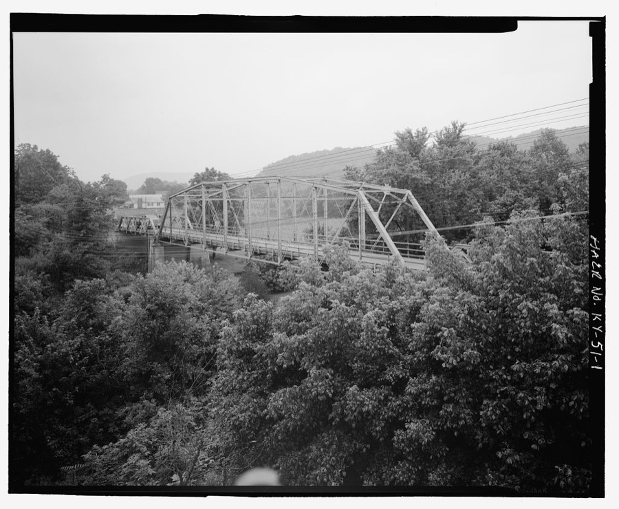
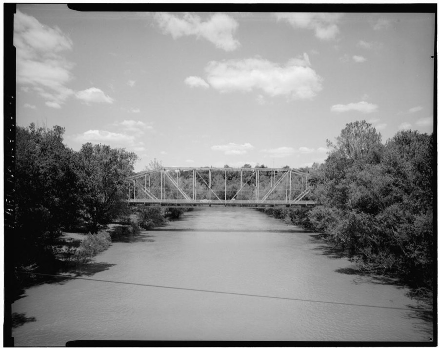
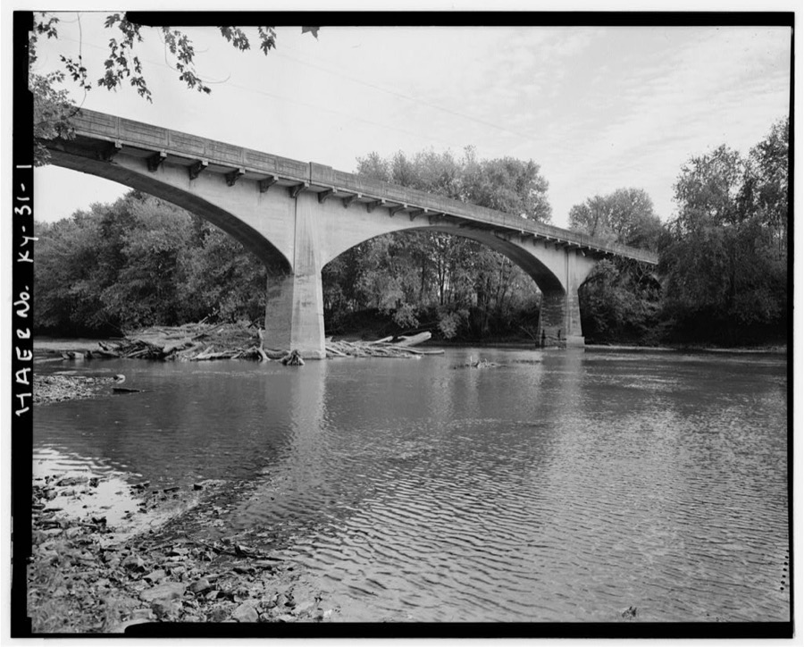

Every property in this county listed on the National Register of Historic Places, with the year it was listed and the federal nomination document.
| Photograph | Property | Type | Listed | Reference |
|---|---|---|---|---|
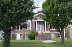 | Carnegie Library | building | 1986 | 86000603 |
 | Corbin Bank Building | building | 1986 | 86000604 |
 | First Christian Church | building | 1986 | 86000693 |
 | Dr. Ancil Gatliff House | building | 1980 | 80001689 |
 | J. B. Gatliff House | building | 1977 | 77000663 |
| Gordon Hill Road Historic District | district | 1986 | 86000692 | |
| L&N Railroad Depot | building | 2019 | 100003683 | |
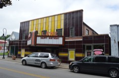 | Lane Theater | building | 2004 | 04001255 |
 | Louisville and Nashville Railroad Depot | building | 1978 | 78001414 |
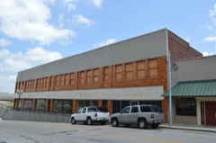 | Mershon Building | building | 1986 | 86000606 |
 | Williamsburg Armory | building | 2002 | 02000930 |
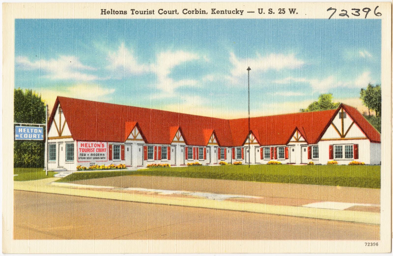
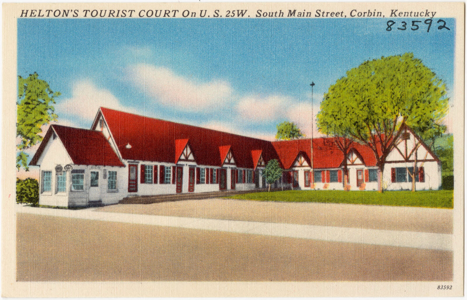
Selected from the Digital Public Library of America's 5 image records catalogued for this county. Every one shown here carries a public-domain status or a licence that permits reuse on a site that carries advertising; non-commercial, share-alike and restricted images are excluded. The selection is spread across the county's towns (at most eight per town), so no single institution's bulk upload crowds out the rest. Each opens the holding library's record, and the complete set at the Digital Public Library of America is one click away.

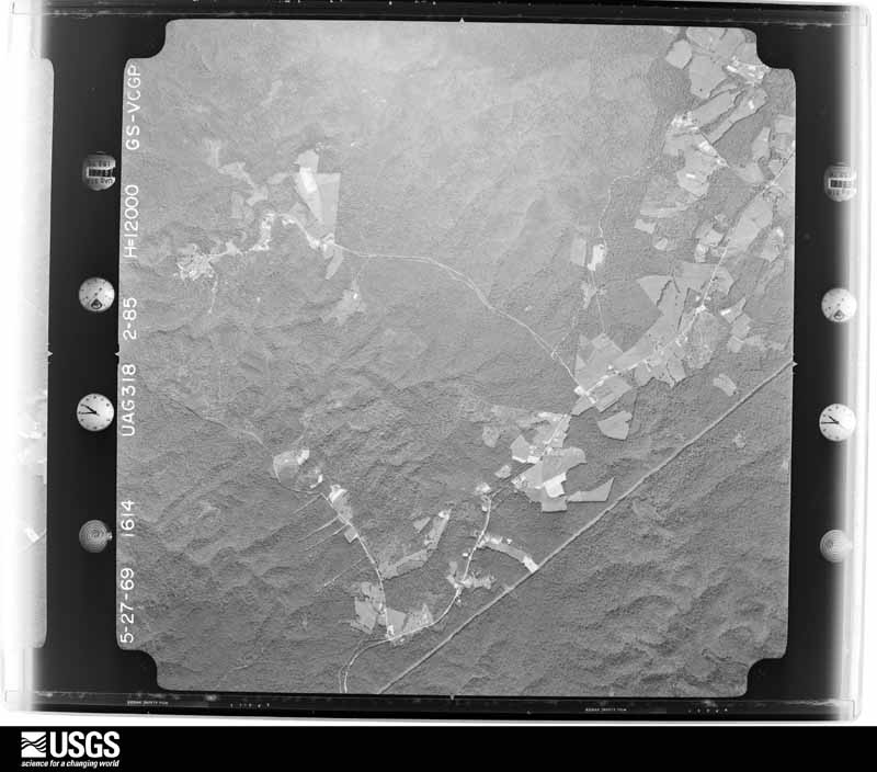
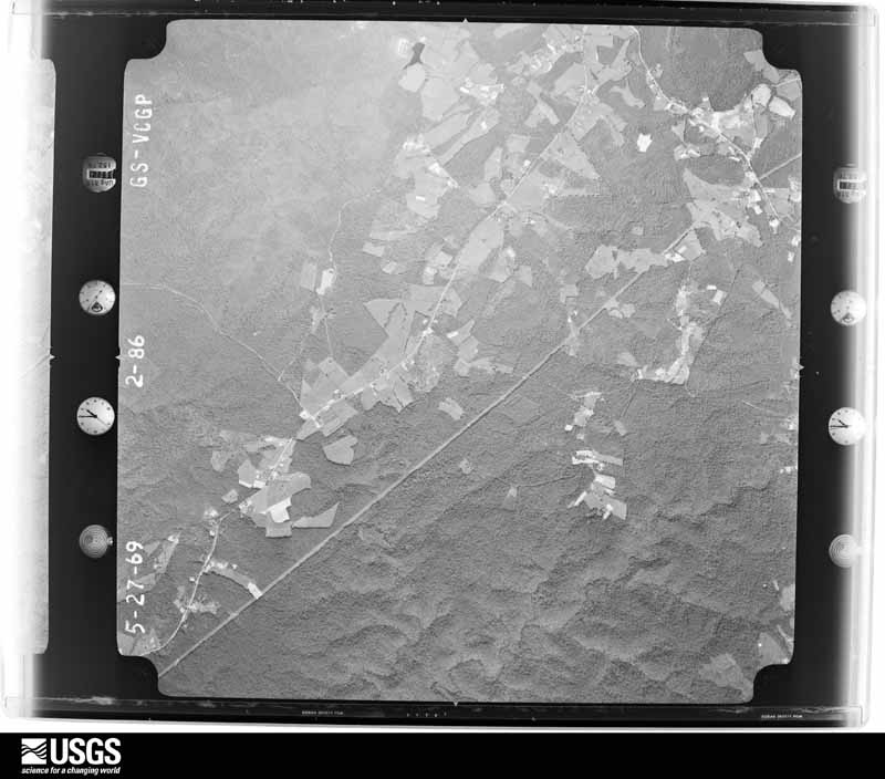
Flown by the U.S. Geological Survey between 1937 and 1989, the Aerial Photo Single Frames collection is the definitive mid-century view of the land: fields, roads and rivers as the camera saw them. The Survey holds 654 frames inside the rectangle that bounds this county; the 28 frames below were taken over the county itself, chosen across the decades of flights (at most four a year from that rectangle), so one flight cannot crowd out the rest. The full set is free to browse and download at EarthExplorer under the dataset Aerial Photo Single Frames.


























The thermometers that kept this county's weather, and the gages that measured the flow of its streams, as the federal records hold them. The extremes below are measured values from those records, not estimates.
Who lived here in 1950, one enumeration district at a time, as the Census Bureau described each district. Each row opens its official National Archives result, with Population Schedules and ED Maps available there.
Every wildfire the federal occurrence database records inside this county: 932 of them, burning about 54,603 acres. 5 started naturally and 293 were recorded as arson. Each settlement page carries the fires within five miles of it.
| Reported cause | Fires |
|---|---|
| Debris and open burning | 411 |
| Arson/incendiarism | 293 |
| Missing data/not specified/undetermined | 150 |
| Recreation and ceremony | 55 |
| Equipment and vehicle use | 7 |
| Smoking | 5 |
| Natural | 5 |
| Railroad operations and maintenance | 3 |
| Misuse of fire by a minor | 2 |
| Power generation/transmission/distribution | 1 |
The five largest, by the area the report gives. 6 of them were set deliberately.
| Date | Cause | Size | Reported by | Name on the report |
|---|---|---|---|---|
| 2 November 2000 | Arson/incendiarism | 4,700 acres | Kentucky Division of Forestry | not named |
| 31 October 2000 | Arson/incendiarism | 3,675 acres | Kentucky Division of Forestry | not named |
| 9 November 2016 | Debris and open burning | 2,146 acres | Kentucky Division of Forestry | GATLIFF #1 |
| 6 February 2001 | Arson/incendiarism | 1,696 acres | Kentucky Division of Forestry | not named |
| 4 November 2000 | Arson/incendiarism | 1,026 acres | Kentucky Division of Forestry | not named |
| 6 April 2002 | Arson/incendiarism | 990 acres | Daniel Boone National Forest | CANE CREEK |
| 30 October 2000 | Debris and open burning | 959 acres | Daniel Boone National Forest | SANDER'S |
| 15 November 1999 | Arson/incendiarism | 958 acres | Daniel Boone National Forest | BUZZARD CREEK |
Every settlement page carries the fires within five miles of it - see the settlement index below.
The NOAA Storm Events Database holds 479 reports for this county, causing 4 deaths, 9 injuries and about $6,556,200 in recorded property damage. Each settlement page carries the reports that name it.
| Kind of event | Reports |
|---|---|
| Thunderstorm Wind | 244 |
| Flash Flood | 92 |
| Hail | 71 |
| Flood | 52 |
| Funnel Cloud | 6 |
| Heavy Rain | 6 |
| Tornado | 5 |
| Lightning | 2 |
| Debris Flow | 1 |
The most serious of them, by death, then injury, then recorded damage. The accounts are quoted exactly as the forecast office filed them.
| When | Event | Place named | Harm | What the report says |
|---|---|---|---|---|
| February 2014 | Flash Flood | Parkers | 3 killed, $1,000 | A vehicle containing a deceased family of three was found submerged in Jellico Creek off Newman Campbell Rd. The family went missing late Thursday night and the vehicle was found early Saturday morning. It is likely based off evidence from the scene that the driver drove into swiftly flowing water at least 3 feet deep and was swept away. Time of the event is a general estimate. |
| February 2020 | Flood | Williamsburg | 1 killed, $4,000,000 | Emergency Management reported extensive flooding in Williamsburg and elsewhere across Whitley County, especially east of town. Several swift water rescues were performed with one woman being diagnosed with hyperthermia. At least 38 homes were inundated with water, with six of these being completely under water. Many businesses also sustained extensive water damage, especially along the Cumberland River basin. Several local residents rate this as the second worst flood in their memory, right behind that of the April 1977 flood.||On February 10th, a man was found dead inside his vehicle on Kentucky Highway 779. He apparently attempted to drive through flood waters on his way to work on February 6th. |
| March 1967 | Tornado (F3) | not stated | 5 hurt, $250,000 | no account filed |
| August 2013 | Thunderstorm Wind | Highland Park | 1 hurt, $10,000 | A tree fell destroying a fence, playhouse and hitting a child. The child suffered back and head injuries. |
| April 2011 | Thunderstorm Wind | Corbin | 1 hurt, $1,000 | A tree fell down on a vehicle. The driver was injured. |
| April 2011 | Thunderstorm Wind | Faber | 1 hurt | A large tree fell on a man while he was mowing his lawn 4 miles southwest of Corbin. |
| June 1997 | Lightning | Williamsburg | 1 hurt | A man received minor injuries when he was struck by lightning. |
| April 2024 | Thunderstorm Wind | Youngs Creek | $200,000 | The NWS Survey team determined that damage incurred near the community of Deering was consistent with straight line winds, with maximum wind gusts estimated to be between 80 and 90 mph. The most significant damage occurred to a barn just off Akins Lane, about 7 miles SW of Corbin - in which the barn was destroyed. There were numerous trees uprooted between Frankfort School Road and Bee Creek Road, and from there to Linda Lane, just off Casey Road. Several homes sustained damage from trees that fell on roofs. Of notable interest were eyewitness reports of a circulation that tracked across a small pond in one of the residential areas. Based on the description of the circulation not being in contact with the cloud base, and the location of this event over a pond approximately 300 years off the flanking (west) side of the core of the most destructive winds, the NWS believes this may have been a book-end vortex. |
| April 2011 | Tornado (EF1) | Clio | $200,000 | The tornado touched down northwest of Williamsburg Kentucky along Brays Chapel Road and remained on the ground until just west of Airport Road. The tornado crossed highway 25W and Kentucky 204 while downing and uprooting many trees and causing significant damage to several barns and outbuildings along its path. Additional straight line wind damage occurred just east of where the tornado lifted from around airport road east over Interstate 75. The tornado's maximum wind speeds were estimated between 90 and 95 mph. |
| April 1998 | Flash Flood | Countywide | $150,000 | no account filed |
| May 2024 | Thunderstorm Wind | Woodbine | $100,000 | Widespread wind damage occurred in the Woodbine community, with many trees uprooted and snapped - specifically along Perkins Street. One mobile home suffered significant damage when a large tree fell onto it. |
| April 2024 | Thunderstorm Wind | Youngs Creek | $100,000 | The survey team surveyed a RV park along Rosetown Church Road near the community of Youngs Creek. The park had multiple trees uprooted, and RVs that were toppled and/or destroyed. |
| February 2009 | Thunderstorm Wind | Williamsburg | $100,000 | Roofs were blown off of 5 homes by thunderstorm wind gusts. Trees and power lines were also blown down county wide. An estimated 90 percent of Williamsburg was without power. |
| May 2008 | Tornado (EF1) | Krupp | $100,000 | An EF-1 tornado touched down 1 mile west of the Cumberland Falls State Park on Highway 90 and continued into Whitley County and across the park. Wind speeds with this tornado were estimated at 105 mph. Significant damage was done to the park supervisor's residence. Extensive numbers of large trees were blown across roads which made access to parts of the park impossible until they were cleared away. Numerous trees were snapped or uprooted with some of the trees falling on cars and powerlines. |
| June 2011 | Thunderstorm Wind | Goins | $75,000 | Sixty to ninety trees were blown down on Hwy 92E near the Knox county line. |
| June 2009 | Thunderstorm Wind | Williamsburg | $75,000 | Trees down and power out across the county. |
| May 2008 | Thunderstorm Wind | Clio | $75,000 | Park officials reported that numerous trees had been blown down by straight line winds. Some trees fell on occupired cabins, cars, and the Cumberland Falls State Park gift shop. Numerous minor injuries were reported, none of which required medical attention. |
| April 2024 | Thunderstorm Wind | Youngs Creek | $50,000 | A large tree fell onto a roof of a house located on Akins Lane near the intersection with Bee Creek Road. Several trees of various sizes in adjacent yards were uprooted as well. |
| March 2013 | Thunderstorm Wind | Corbin | $50,000 | Damage occurred on Fairfield Avenue. The roof was torn from a doublewide trailer and several trees were downed. An uprooted tree fell across a house and car. Several power poles were also snapped off. |
| July 2008 | Thunderstorm Wind | Williamsburg | $50,000 | A large swath of trees was blown down along Savoy Road. The trees that were left standing were stripped of leaves. |
| March 2002 | Flash Flood | Williamsburg | $50,000 | Heavy rains that fell on March 17 and 18 resulted in numerous road closures and evacuations across Whitley County. Part of Highway 92W, near the McCreary County line, was washed away. |
| June 2021 | Thunderstorm Wind | Faber | $40,000 | A tree was blown down onto a house along Corinth Cemetery Road. |
| June 2021 | Thunderstorm Wind | Faber | $40,000 | A tree was blown down onto a house along Corinth Cemetery Road. |
| April 2011 | Thunderstorm Wind | Williamsburg | $40,000 | There were trees, power lines, and buildings damaged at Tacket Creek road. |
| June 2008 | Thunderstorm Wind | Krupp | $35,000 | Numerous trees blown down in the western portion of the county. |
| May 2024 | Thunderstorm Wind | Youngs Creek | $30,000 | A handful of trees were snapped on a property off of Frankfort School Road in the Youngs Creek community. In addition to the snapped trees, two large trees (one softwood, one hardwood) were uprooted and blown onto a mobile home, destroying the home. |
| July 2012 | Thunderstorm Wind | Corbin | $30,000 | The Save A Lot store in Corbin suffered roof damage. |
| January 2008 | Thunderstorm Wind | Williamsburg | $30,000 | Trees were blown down in the Wolf Creek, Tackett Creek, and Corn Creek areas. Trees were also down along the Cumberland Falls Highway and north of Williamsburg. Other trees were blown down on Highway 204 east of Williamsburg and Highway 1804 in the south part of the county. All damage caused by wind gusts estimated at 63 mph. |
| April 2007 | Thunderstorm Wind | Corbin | $30,000 | Lots of trees down. |
| April 2024 | Thunderstorm Wind | Youngs Creek | $25,000 | A metal garage next to a house off Akins Lane was completely destroyed. The opening to the garage was facing the swath of winds, creating it's weak point. A single floor anchor existed on the concrete pad in the NE corner of the garage building, but it did not appear to have been attached to the structure. Posts and poles of the structure were set in gravel below the pad on sides and corners. The roof was lifted off and all sides collapsed. |
| April 2024 | Thunderstorm Wind | Youngs Creek | $25,000 | Multiple trees were uprooted along a ravine and wooded area on Akins Road. At least two homes in this location received damage from the fallen trees. |
| June 2021 | Flash Flood | Meadorsville | $25,000 | A house was inundated by flash flood waters along KY-478 near the Jellico Creek/Cumberland River junction. |
| April 2011 | Thunderstorm Wind | Krupp | $25,000 | A roof was blown completely off a house 5 miles northwest of Williamsburg. |
| February 2009 | Thunderstorm Wind | Woodbine | $25,000 | A tree was blown down on a house. Numerous trees were blown down along Highway 25 between Williamsburg and Corbin. |
| May 2024 | Thunderstorm Wind | Woodbine | $20,000 | A tree was reported down and on a vehicle along Meadow Creek Road near the community of Woodbine. |
| July 2022 | Flash Flood | Burk Hollow | $20,000 | Whitley County 911 dispatch reported that Kensee Hollow Road near Red Ash was washed out and active rescues were taking place for people who were trapped on the other side of the washed out road. |
| June 2021 | Flash Flood | Williamsburg | $20,000 | A portion of N 6th Street was washed away by flood waters. |
| July 2003 | Thunderstorm Wind | Countywide | $20,000 | There were numerous reports of trees down. Many power lines were down. One tree fell on an occupied car. Most wind damage occurred in western, northern, and central portions of Whitley County. |
| January 1997 | Thunderstorm Wind | Corbin | $20,000 | no account filed |
| April 2024 | Thunderstorm Wind | Youngs Creek | $15,000 | Multiple trees were uprooted on a property along Frankfort School Road. One of the trees fell onto the house on the property, causing considerable damage. However, the house was vacant at the time and already in a deteriorating shape. |
| June 2021 | Flash Flood | Bon | $15,000 | Williamsburg Fire Department reported a temporary closure of Penny Lane and inundation of the Kentucky Splash Waterpark and Campground due to flash flooding. The Campground was evacuated due to rising water. |
| April 2011 | Thunderstorm Wind | Williamsburg | $15,000 | A barn was leveled on Bray Chapel Road in Williamsburg, possibly by a tornado. |
| September 2024 | Thunderstorm Wind | Barton | $11,600 | Pictures on social media showed trees down on power lines along with a broken power pole in the vicinity of Riva Ridge Trail. |
| July 2022 | Flash Flood | Mountain Ash | $10,000 | Whitley County 911 dispatch reported that a water rescue took place along Little Wolf Creek Road near Mountain Ash. |
| February 2012 | Thunderstorm Wind | Goldbug | $10,000 | Trees and large limbs were blown down in Cumberland Falls State Park. |
| April 2011 | Thunderstorm Wind | Corbin | $10,000 | Power lines were blown down and power poles broken by thunderstorm wind gusts. |
| April 2011 | Thunderstorm Wind | Corbin | $10,000 | Trees and power lines were blown down in Corbin. |
| April 2011 | Thunderstorm Wind | Corbin | $10,000 | A large air conditioner unit on top of department was picked up and slammed back down. |
| April 2011 | Thunderstorm Wind | Williamsburg Arpt | $10,000 | Just north of mile marker 17 along interstate 75 there were several large trees down. There was also a roof that was partially blown off a barn. |
| June 2009 | Thunderstorm Wind | Carpenter | $10,000 | Trees were blown down near the intersection of KY Highways 11 and 92 near the Knox and Whitley county line. |
| June 2009 | Thunderstorm Wind | Williamsburg | $10,000 | Trees were blown down on the north side of Williamsburg along 5th Street and Falls Highway. |
| May 2008 | Thunderstorm Wind | Corbin | $10,000 | Utility poles and power lines were blown down along Cumberland Falls Highway or 18th Street. |
| July 2008 | Thunderstorm Wind | Williamsburg | $10,000 | A roof was blown off a church in Williamsburg during a severe thunderstorm. |
| April 1998 | Flash Flood | Countywide | $10,000 | no account filed |
| November 1996 | Flash Flood | Williamsburg | $10,000 | no account filed |
| August 2023 | Thunderstorm Wind | Woodbine | $9,000 | Whitley County dispatch reported a tree knocked down on powerlines near the community of Woodbine. This then in turn pulled the powerlines off a house and caused damage to the house. |
| May 2022 | Flood | Barton | $8,000 | Images from a social media report show a flooded roadway near 2665 Cumberland Falls Highway in Corbin, KY. The image shows a car trapped in a roadside ditch. |
| April 2011 | Thunderstorm Wind | Rye | $8,000 | There were power lines down on Lakeside road. |
| June 2009 | Thunderstorm Wind | Rockholds | $8,000 | A few trees were blown down and roofing was blown off of a home. |
| June 2020 | Lightning | Pleasant View | $7,000 | The Kentucky Transportation Cabinet reported a commercial vehicle struck by lightning just south of Williamsburg on Interstate 75. This resulted in the vehicle taking out 150 feet of guardrail before going into an embankment and blocking the right southbound lane. |
The Survey's mineral resources record lists 6 workings inside this county. 2 still produce and 4 are closed or unrecorded. Each settlement page carries the workings within five miles of it.
| Commodity | Workings |
|---|---|
| Clay | 6 |
The least common of them first, because a county's hundredth gravel pit says nothing its first ten did not.
| Where | Site | Commodity | Status | Recorded |
|---|---|---|---|---|
| Cave Creek-Jowl Mt Shale | Clay | Prospect | ||
| Hog Jowl Mountain Roadcut | Clay | Prospect | ||
| Junction Roadcut | Clay | Prospect | ||
| Louden Shale | Clay | Prospect | ||
| No. 1 Mill | Clay | Plant | ||
| No. 1 Mine | Clay | Producer |
Named settlements recorded in the Geographic Names Information System, each with the topographic sheets covering it. Villages, hamlets and abandoned places alike. Each is shown with the nearest named watercourse or landform and the survey quadrangle it falls on. The 1 place that was also surveyed for fire insurance comes first, with the number of atlases and photographs held for them.
Williamsburg census division · 40769 · On Clear Fork · Williamsburg quadrangle
15 sheets, 1890 to 1981
Fire insurance: 6 atlases
Williamsburg census division · 40769 · On Ross Branch · Williamsburg quadrangle
15 sheets, 1890 to 1981
Williamsburg census division · 40769 · Near Hurricane Hollow · Williamsburg quadrangle
15 sheets, 1890 to 1981
Williamsburg census division · 40769 · Near Staniford Hollow · Williamsburg quadrangle
15 sheets, 1890 to 1981
Corbin census division · 40701 · On Little Spruce Creek · Vox quadrangle
16 sheets, 1890 to 1981
No longer a settlement
Corbin census division · 40701 · On East Fork Lynn Camp Creek · Corbin quadrangle
17 sheets, 1890 to 1981
Siler census division · 40769 · Near Bowling Mountain · Saxton quadrangle
15 sheets, 1890 to 1981
Siler census division · 40769 · Near Powers Hollow · Saxton quadrangle
15 sheets, 1890 to 1981
Williamsburg census division · 40769 · On Bee Shoals Creek · Hollyhill quadrangle
16 sheets, 1890 to 1981
Saxton census division · 40769 · Near Happy Hollow · Williamsburg quadrangle
15 sheets, 1890 to 1981
Corbin census division · 40701 · Near McNeil Hollow · Wofford quadrangle
16 sheets, 1890 to 1981
Saxton census division · 40769 · On Mud Creek · Jellico East quadrangle
17 sheets, 1890 to 1981
Siler census division · 40769 · On Miller Branch · Barbourville quadrangle
17 sheets, 1886 to 1977
Siler census division · 40763 · On Puncheon Branch · Frakes quadrangle
16 sheets, 1886 to 1977
Cumberland Falls census division · 40769 · On Cripple Creek · Wofford quadrangle
16 sheets, 1890 to 1981
Cumberland Falls census division · 40701 · On Whippoorwill Creek · Vox quadrangle
16 sheets, 1890 to 1981
Williamsburg census division · 40769 · On Watts Creek · Williamsburg quadrangle
15 sheets, 1890 to 1981
Williamsburg census division · 40769 · On Corn Bread Branch · Williamsburg quadrangle
15 sheets, 1890 to 1981
Williamsburg census division · 40769 · On Deep Branch · Saxton quadrangle
15 sheets, 1890 to 1981
Williamsburg census division · 40769 · On Rough Shoals Creek · Wofford quadrangle
16 sheets, 1890 to 1981
Saxton census division · 40769 · Near Boston Hill · Jellico East quadrangle
17 sheets, 1890 to 1981
Williamsburg census division · 40769 · On Whetstone Creek · Rockholds quadrangle
16 sheets, 1890 to 1981
Williamsburg census division · 40769 · On Whetstone Creek · Rockholds quadrangle
16 sheets, 1890 to 1981
No longer a settlement
Saxton census division · 40769 · On Wolf Creek · Williamsburg quadrangle
15 sheets, 1890 to 1981
Siler census division · 40769 · On Bennetts Branch · Saxton quadrangle
15 sheets, 1890 to 1981
Siler census division · 40769 · Near Powers Mountain · Saxton quadrangle
15 sheets, 1890 to 1981
Williamsburg census division · 40769 · Near Jones Hollow · Rockholds quadrangle
16 sheets, 1890 to 1981
Saxton census division · 40769 · Near Sawmill Hollow · Williamsburg quadrangle
15 sheets, 1890 to 1981
Saxton census division · 40769 · On Pigeon Roost Creek · Jellico East quadrangle
17 sheets, 1890 to 1981
Saxton census division · 40769 · Near Proctor Hollow · Jellico West quadrangle
16 sheets, 1890 to 1981
No longer a settlement
Williamsburg census division · 40769 · On Rough Shoals Creek · Wofford quadrangle
16 sheets, 1890 to 1981
Williamsburg census division · 40759 · On Stoles Fork · Rockholds quadrangle
16 sheets, 1890 to 1981
Williamsburg census division · 40769 · On Brier Creek · Williamsburg quadrangle
15 sheets, 1890 to 1981
Saxton census division · 40769 · Near Bunkers Hill · Saxton quadrangle
15 sheets, 1890 to 1981
Corbin census division · 40701 · On Bingham Branch · Vox quadrangle
16 sheets, 1890 to 1981
Williamsburg census division · 40769 · Near Shelly Hollow · Williamsburg quadrangle
15 sheets, 1890 to 1981
No longer a settlement
Siler census division · 40763 · On Coalstone Branch · Frakes quadrangle
16 sheets, 1886 to 1977
Williamsburg census division · 40769 · On Bunch Creek · Saxton quadrangle
15 sheets, 1890 to 1981
No longer a settlement
Siler census division · 40769 · On Patterson Creek · Saxton quadrangle
15 sheets, 1890 to 1981
Williamsburg census division · 40769 · On Idiot Branch · Rockholds quadrangle
16 sheets, 1890 to 1981
No longer a settlement
Williamsburg census division · 40769 · On Idiot Branch · Wofford quadrangle
16 sheets, 1890 to 1981
Corbin census division · 40701 · On Eaton Branch · Corbin quadrangle
17 sheets, 1890 to 1981
Corbin census division · 40701 · On Frozen Camp Creek · Vox quadrangle
16 sheets, 1890 to 1981
Cumberland Falls census division · 40701 · On Spice Mortar Branch · Wofford quadrangle
16 sheets, 1890 to 1981
The vanished settlements of Whitley County: the places named above that are no longer on the map.
15 topographic sheets and 6 fire insurance atlases, 1895 to 1943
The complete index, with nothing left out. Each of these is a separate record with its own page: a federal survey report, or the case file that argued a property on to the National Register. Both are public domain and reproduced word for word.
The vanished settlements of Whitley County, the places these records name that are no longer on the map.