 Block
Allegre, Kentucky
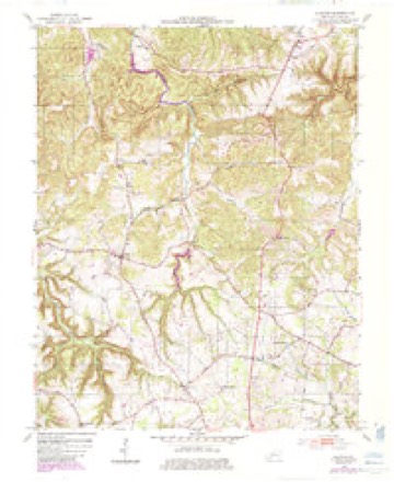
7 topographic sheets cover this place, the earliest surveyed in 1952 and the latest in 1980. It stands in the Kirkmansville census division. It lies in ZIP code area 42220. The Survey maps it on the Allegre quadrangle.
Topographic sheets covering this place
4 surveys from 7 printed sheetsMatched by testing this settlement's coordinate against the published boundary of every sheet in the United States Geological Survey's historical collection. Each opens the scanned sheet at the Survey.
- 1952 USGS Allegre quadrangle1:24000, 3 printings
- 1956 USGS Nashville quadrangle1:250000, 2 printings
- 1959 USGS Nashville quadrangle1:250000
- 1980 USGS Hopkinsville quadrangle1:100000
Fires near this place
10 since 2001Regional context, not property-specific evidence. The federal wildfire occurrence database lists 10 fires within 5 miles of Allegre between 2001 and 2016, burning about 48 acres in total. None started naturally. 1 was recorded as arson. Distance is straight-line from the map coordinates, so a fire counted here may appear on a neighbouring settlement's page as well.
| Reported cause | Fires |
|---|---|
| Missing data/not specified/undetermined | 4 |
| Recreation and ceremony | 2 |
| Debris and open burning | 1 |
| Equipment and vehicle use | 1 |
| Arson/incendiarism | 1 |
| Railroad operations and maintenance | 1 |
The most recent of them, most recent first, with the day each was reported and the service that recorded it.
| Date | Cause | Size | Reported by | Name on the report |
|---|---|---|---|---|
| 27 September 2004 | Missing data/not specified/undetermined | under an acre | Kentucky Division of Forestry | not named |
| 18 September 2010 | Debris and open burning | 6.0 acres | Kentucky Division of Forestry | SHED FIRE |
| 11 March 2001 | Arson/incendiarism | 3.0 acres | Kentucky Division of Forestry | not named |
| 14 February 2002 | Recreation and ceremony | 2.0 acres | Kentucky Division of Forestry | not named |
| 23 November 2005 | Missing data/not specified/undetermined | 5.0 acres | Kentucky Division of Forestry | not named |
| 20 November 2005 | Missing data/not specified/undetermined | 1.0 acres | Kentucky Division of Forestry | not named |
| 12 November 2016 | Missing data/not specified/undetermined | 1.0 acres | Kentucky Division of Forestry | 1 MILE SPOT |
| 9 October 2007 | Recreation and ceremony | 1.0 acres | Kentucky Division of Forestry | not named |
Settlements close enough to share some of these fires:
Storms near this place
20 since 1995Regional context, not property-specific evidence. The National Weather Service names Allegre in 20 storm reports between 1995 and 2025: 7 thunderstorm wind, 4 flood, 3 tornado, 3 hail. The reports record 6 injuries. Each account below is quoted exactly as the forecast office filed it, from the NOAA Storm Events Database, and each date opens the federal record of that event.
| When | Event | Place named | Harm | What the report says |
|---|---|---|---|---|
| April 2006 | Tornado (F2) | Allegre | 6 hurt, $2,500,000 | The tornado continued into Todd County from Christian County, crossing the county line near Pilot Rock. The tornado passed less than a mile north of the communities of Allegre and Cedar Grove, then dissipated about 2.5 miles before entering Logan County. Although damage was extensive in Todd County, the tornado was at its strongest and widest in Christian County. In Todd County, the tornado produced mainly F1 damage, although the tornado intensified into the lower F2 range near Allegre. A mobile home was destroyed in Allegre, and buildings were destroyed on Highway 171 about two miles north of Allegre. There was extensive damage to a church in Cedar Grove. Half of its roof was blown off, and windows were blown out. A total of two homes in Todd County were destroyed, and 28 other houses were significantly damaged. Close to two dozen sheds and barns were damaged or destroyed, along with at least one grain bin. Numerous trees were uprooted. Some farm machinery and vehicles were damaged or destroyed, including tractors and combines. |
| May 2025 | Tornado (EF2) | Allegre | $1,100,000 | An EF2 tornado started along Shaw Ovil Road in Christian County, continuing east into Todd County, crossing Hwy 189 and eventually lifting to the west of Hwy 181. The worst damage occurred along Blue Hole Road where several chicken houses were completely destroyed and a mobile home was swept away. Dozens of trees were snapped or uprooted and a few outbuildings were damaged. Peak winds for the Todd County portion of the tornado, and the tornado as a whole, were 120mph. |
| January 2013 | Thunderstorm Wind | Allegre | $300,000 | The path of damage averaged about one-third mile wide. The downburst damage exited the northeast corner of Todd County into Muhlenberg County near Lake Malone State Park. A few thousand trees were uprooted by winds estimated near 110 mph. Numerous barns and other sheds were levelled or heavily damaged. Several homes and other buildings had roofs, including decking, partially removed. A couple of homes received damage to walls of attached garages. Many other homes received minor damage, including loss of shingles and siding. |
| June 2014 | Thunderstorm Wind | Allegre | $80,000 | A broad area of scattered wind damage continued southeast from northern Christian County across northern and central Todd County. The main area of damage in Todd County was across the western half of the county, along and west of Highway 181. This includes Elkton. Just north of Elkton, a large machine shed a couple hundred feet in length had all of its roofing blown off, including the rafters. The damage consisted mostly of downed tree limbs averaging 3 to 6 inches in diameter. There were occasional uprooted trees, generally small in size. Tin roofing was peeled off a few barns and outbuildings. Peak winds were around 95 mph where the machine shed was unroofed. |
| February 2014 | Thunderstorm Wind | Allegre | $40,000 | A tree was blown down and landed on a parked vehicle. There was roof damage to a home. |
| May 1995 | Tornado (F1) | Allegre | $30,000 | A tornado touchdown over rural northern Todd county produced substantial damage at a farm. A barn and several smaller buildings were destroyed, and numerous trees in the vicinity were blown down. |
| May 2011 | Flood | Allegre | $30,000 | no account filed |
| May 2025 | Thunderstorm Wind | Allegre | $10,000 | Trees and power lines were downed near Allegre as part of the rear flank downdraft region of a tornado that passed by to the north. |
| July 2016 | Flash Flood | Allegre | $10,000 | The county 911 dispatch center reported 70 percent of county and state roads were flooded in northern Todd County. Nearly half of those roads were impassable. Debris was strewn on some roads. Four feet of water got inside a garage near Sharon Grove. |
| August 2016 | Thunderstorm Wind | Allegre | $1,000 | A tree was down over a road near the Christian County line. |
| January 2022 | Flash Flood | Allegre | - | Emergency management in Todd County reported some flooding over roadways. Between 2 and 4 inches of rain fell. |
| August 2016 | Flood | Allegre | - | Water was over several roads. |
| August 2003 | Thunderstorm Wind | Allegre | - | A few trees were blown down. |
| July 2003 | Funnel Cloud | Allegre | - | A funnel cloud was reported along the Christian/Todd County line near Pilot Rock. The storm showed strong rotation on doppler weather radar. |
| July 2003 | Thunderstorm Wind | Allegre | - | Numerous tree limbs and a tree were blown down. |
| December 2011 | Flood | Allegre | - | no account filed |
| April 2011 | Flood | Allegre | - | no account filed |
| April 2007 | Hail | Allegre | - | no account filed |
| June 2006 | Hail | Allegre | - | no account filed |
| May 2000 | Hail | Allegre | - | no account filed |
Nearest settlements
The eight closest, with where each one stands in the county. Distances are straight-line, computed from the Geographic Names Information System coordinates.
| Map | Place | Distance | Sheets |
|---|---|---|---|
| Mount Tabor | 2.1 miles | 7 | |
| Liberty | 3.1 miles | 7 | |
| Flat Rock (historical) | 3.1 miles | 7 | |
| Cedar Grove | 3.3 miles | 7 | |
| Tuckertown (historical) | 3.7 miles | 7 | |
| Tabernacle | 3.8 miles | 7 | |
| Britmart | 4.6 miles | 7 | |
| Kirkmansville | 5.8 miles | 14 |
Provenance
This settlement is recorded in the Geographic Names Information System as feature 485843. The sheet list is computed by point-in-boundary test against the United States Geological Survey's historical topographic inventory. Both are works of the United States government and carry no copyright under 17 U.S.C. 105.
Wildfire. Short, Karen C. 2022. Spatial wildfire occurrence data for the United States, 1992-2020 [FPA_FOD_20221014]. 6th Edition. Fort Collins, CO: Forest Service Research Data Archive. https://doi.org/10.2737/RDS-2013-0009.6 Collected with United States Government funding and usable without additional permissions or fees.
Storms. NOAA National Centers for Environmental Information, Storm Events Database https://www.ncei.noaa.gov/stormevents/ A work of the United States government, no copyright under 17 U.S.C. 105. Narratives are quoted verbatim from the National Weather Service report and are not edited or summarised.