 Block
Bancroft, Kentucky
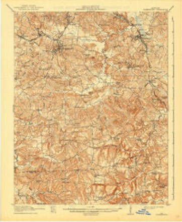
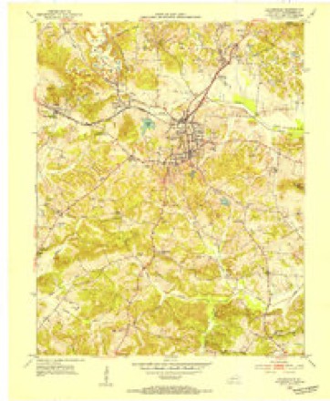
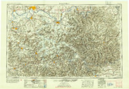
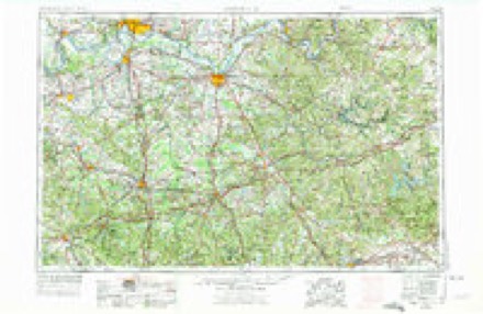
16 topographic sheets cover this place, the earliest surveyed in 1911 and the latest in 1997. It stands in the Greenville census division. It lies in ZIP code area 42345. It stands on Drake Creek. The Survey maps it on the Greenville quadrangle.
Topographic sheets covering this place
9 surveys from 16 printed sheetsMatched by testing this settlement's coordinate against the published boundary of every sheet in the United States Geological Survey's historical collection. Each opens the scanned sheet at the Survey.
- 1911 USGS Drakesboro quadrangle1:48000
- 1913 USGS Drakesboro quadrangle1:62500, 2 printings
- 1952 USGS Greenville quadrangle1:24000
- 1954 USGS Evansville quadrangle1:250000
- 1957 USGS Evansville quadrangle1:250000, 3 printings
- 1961 USGS Evansville quadrangle1:250000, 2 printings
- 1963 USGS Greenville quadrangle1:24000, 4 printings
- 1983 USGS Madisonville quadrangle1:100000
- 1997 USGS Greenville quadrangle1:24000

Fires near this place
36 since 1998Regional context, not property-specific evidence. The federal wildfire occurrence database lists 36 fires within 5 miles of Bancroft between 1998 and 2019, burning about 720 acres in total. 1 started naturally. 3 were recorded as arson. Distance is straight-line from the map coordinates, so a fire counted here may appear on a neighbouring settlement's page as well.
| Reported cause | Fires |
|---|---|
| Missing data/not specified/undetermined | 15 |
| Recreation and ceremony | 9 |
| Debris and open burning | 5 |
| Arson/incendiarism | 3 |
| Railroad operations and maintenance | 2 |
| Equipment and vehicle use | 1 |
| Natural | 1 |
The most recent of them, most recent first, with the day each was reported and the service that recorded it.
| Date | Cause | Size | Reported by | Name on the report |
|---|---|---|---|---|
| 7 September 2002 | Recreation and ceremony | 4.0 acres | Kentucky Division of Forestry | not named |
| 24 August 2007 | Railroad operations and maintenance | 2.0 acres | Kentucky Division of Forestry | not named |
| 24 August 2007 | Missing data/not specified/undetermined | 8.0 acres | Kentucky Division of Forestry | not named |
| 19 August 1999 | Natural | 2.0 acres | Kentucky Division of Forestry | not named |
| 15 August 2007 | Debris and open burning | 6.0 acres | Kentucky Division of Forestry | not named |
| 17 July 2012 | Recreation and ceremony | 2.0 acres | Kentucky Division of Forestry | LUCKETT CE |
| 9 April 2017 | Debris and open burning | 5.0 acres | Kentucky Division of Forestry | GRAHAM |
| 9 April 2000 | Arson/incendiarism | under an acre | Kentucky Division of Forestry | not named |
Settlements close enough to share some of these fires:
Storms near this place
11 since 2006Regional context, not property-specific evidence. The National Weather Service names Bancroft in 11 storm reports between 2006 and 2021: 3 flash flood, 3 tornado, 2 hail, 2 flood. No death or injury is recorded in these reports. Each account below is quoted exactly as the forecast office filed it, from the NOAA Storm Events Database, and each date opens the federal record of that event.
| When | Event | Place named | Harm | What the report says |
|---|---|---|---|---|
| May 2016 | Tornado (EF1) | Bancroft | $125,000 | The tornado entered Muhlenberg County from Christian County along Highway 189, where downed trees blocked the road along a stretch one-half mile long. A house near the county line sustained minor damage. Utility lines and trees were brought down across Highway 189. A few barns were destroyed. A couple dozen trees were down. A home sustained considerable damage to the roof, including a few rafters that were blown away. The back deck of the home was destroyed. Another home near the end of the damage path sustained minor roof damage. The tornado was witnessed by a number of people, including at least two witnesses who videotaped it. Peak winds were estimated near 105 mph. |
| November 2013 | Tornado (EF1) | Bancroft | $100,000 | This fast-moving tornado touched down near two older mobile homes, tearing parts of the roof off both homes and toppling trees. The tornado then moved east-southeast up a knoll, where it buckled the west-facing door of an attached garage. The side walls of the garage were blown out, including part of the cinder block foundation. Several large trees around the home were either uprooted or snapped. Patio furniture was scattered up to 100 yards to the east. The tornado continued over open pasture before tearing the roof and two walls off a metal outbuilding and uprooting several trees. Just before crossing Highway 189, the patio roof of a brick home was torn off and blown 100 yards to the northeast, along with tree damage. The tornado continued 200 yards east of Highway 189, where it snapped several tree trunks. Peak winds were estimated near 100 mph. This tornado was spawned by a supercell that originated over southeast Missouri and produced a 42-mile long EF-3 tornado from the Paducah area to Lyon County, Kentucky. |
| May 2021 | Flash Flood | Bancroft | $75,000 | Several roads were flooded, including a few main roads. Several water rescues were conducted. Water was close to four feet deep over Kentucky 181 near Highway 601, where at least one car stalled out. County schools were virtual instead of on-site. At the county high school, water entered the gym, and the parking lot was extensively flooded. In the Graham area, a couple of mobile homes were evacuated due to flooding. The porch was torn off one of the mobile homes. A rainfall measurement of 5.01 inches was received from a weather station six miles southwest of Greenville. |
| July 2016 | Flash Flood | Bancroft | $40,000 | Widespread flash flooding of streets was reported in Central City. Several feet of water covered some streets in downtown Central City. Many of the streets were impassable, and several vehicles were completely submerged. The worst conditions were in Central City, but roadways were flooded in numerous other locations across the county. |
| August 2009 | Thunderstorm Wind | Bancroft | $30,000 | A 16-by-80 foot mobile home was blown over. A woman and her young son were at home at the time. Both people received only minor cuts. The mobile home was a total loss. |
| May 2011 | Flood | Bancroft | $30,000 | no account filed |
| March 2016 | Tornado (EF0) | Bancroft | $3,000 | This weak tornado crossed into a forested area of Muhlenberg County from Christian County. Several tree tops were snapped, and numerous large limbs were blown down. Some tin was blown off an outbuilding. Much of the path was along Highway 189. The average path width was 50 yards. Peak winds were estimated near 75 mph. |
| April 2011 | Flash Flood | Bancroft | - | Kentucky Highway 1379 was closed due to high water. |
| June 2006 | Hail | Bancroft | - | Hail ranging from the size of golf balls to hen eggs was reported. |
| May 2016 | Hail | Bancroft | - | no account filed |
| April 2011 | Flood | Bancroft | - | no account filed |
Nearest settlements
The eight closest, with where each one stands in the county. Distances are straight-line, computed from the Geographic Names Information System coordinates.
| Map | Place | Distance | Sheets |
|---|---|---|---|
| Sharon (historical) | 1.0 miles | 16 | |
| Vernal Grove (historical) | 2.9 miles | 13 | |
| Depoy | 3.5 miles | 16 | |
| Weir | 3.5 miles | 14 | |
| Jarrells | 3.6 miles | 13 | |
| Luzerne | 4.1 miles | 16 | |
| Greenville | 4.4 miles | 16 | |
| Gordon (historical) | 4.8 miles | 13 |
Provenance
This settlement is recorded in the Geographic Names Information System as feature 507447. The sheet list is computed by point-in-boundary test against the United States Geological Survey's historical topographic inventory. Both are works of the United States government and carry no copyright under 17 U.S.C. 105.
Wildfire. Short, Karen C. 2022. Spatial wildfire occurrence data for the United States, 1992-2020 [FPA_FOD_20221014]. 6th Edition. Fort Collins, CO: Forest Service Research Data Archive. https://doi.org/10.2737/RDS-2013-0009.6 Collected with United States Government funding and usable without additional permissions or fees.
Storms. NOAA National Centers for Environmental Information, Storm Events Database https://www.ncei.noaa.gov/stormevents/ A work of the United States government, no copyright under 17 U.S.C. 105. Narratives are quoted verbatim from the National Weather Service report and are not edited or summarised.