 Block
Beech Bottom, Kentucky
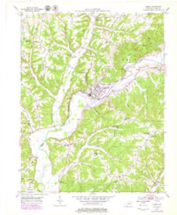
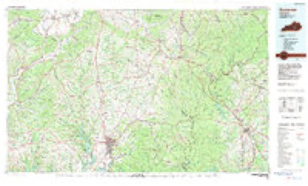
7 topographic sheets cover this place, the earliest surveyed in 1952 and the latest in 1982. It stands in the Liberty census division. It lies in ZIP code area 42539. It stands on Reynold Creek. The Survey maps it on the Liberty quadrangle.
Topographic sheets covering this place
4 surveys from 7 printed sheetsMatched by testing this settlement's coordinate against the published boundary of every sheet in the United States Geological Survey's historical collection. Each opens the scanned sheet at the Survey.
- 1952 USGS Liberty quadrangle1:24000, 2 printings
- 1957 USGS Winchester quadrangle1:250000, 3 printings
- 1960 USGS Winchester quadrangle1:250000
- 1982 USGS Somerset quadrangle1:100000


Fires near this place
44 since 1999Regional context, not property-specific evidence. The federal wildfire occurrence database lists 44 fires within 5 miles of Beech Bottom between 1999 and 2020, burning about 524 acres in total. None started naturally. 7 were recorded as arson. Distance is straight-line from the map coordinates, so a fire counted here may appear on a neighbouring settlement's page as well.
| Reported cause | Fires |
|---|---|
| Debris and open burning | 18 |
| Missing data/not specified/undetermined | 14 |
| Arson/incendiarism | 7 |
| Recreation and ceremony | 3 |
| Railroad operations and maintenance | 2 |
The most recent of them, most recent first, with the day each was reported and the service that recorded it.
| Date | Cause | Size | Reported by | Name on the report |
|---|---|---|---|---|
| 25 September 2008 | Debris and open burning | 8.0 acres | Kentucky Division of Forestry | not named |
| 17 August 2008 | Recreation and ceremony | 6.0 acres | Kentucky Division of Forestry | not named |
| 7 April 2001 | Debris and open burning | 1.0 acres | Kentucky Division of Forestry | not named |
| 3 April 2003 | Missing data/not specified/undetermined | 20 acres | Kentucky Division of Forestry | not named |
| 3 April 2003 | Missing data/not specified/undetermined | 100 acres | Kentucky Division of Forestry | not named |
| 25 April 2001 | Arson/incendiarism | 2.0 acres | Kentucky Division of Forestry | not named |
| 24 April 2014 | Debris and open burning | 41 acres | Kentucky Division of Forestry | WATSON SAWMILL |
| 24 April 1999 | Arson/incendiarism | 5.0 acres | Kentucky Division of Forestry | not named |
Settlements close enough to share some of these fires:
Mines and quarries near this place
1 within 5 milesRegional context, not property-specific evidence. The federal mineral resources record lists 1 working within 5 miles of Beech Bottom: 1 prospect. None of them still produces. What was taken out: Clay. Distance is straight-line from the map coordinates, so a quarry counted here may appear on a neighbouring settlement's page as well.
| Where | Site | Commodity | Status | Recorded |
|---|---|---|---|---|
| Roadcut Bench Clay Bed | Clay | Prospect |
Storms near this place
18 since 2008Regional context, not property-specific evidence. The National Weather Service names Beech Bottom in 18 storm reports between 2008 and 2025: 10 thunderstorm wind, 3 hail, 2 flood, 2 flash flood. No death or injury is recorded in these reports. Each account below is quoted exactly as the forecast office filed it, from the NOAA Storm Events Database, and each date opens the federal record of that event.
| When | Event | Place named | Harm | What the report says |
|---|---|---|---|---|
| September 2020 | Flood | Beech Bottom | $250,000 | Cale Brown Road was closed at Caney Fork due to a bridge being out due to flooding. |
| February 2018 | Thunderstorm Wind | Beech Bottom | $75,000 | NWS Storm Survey found damage consistent of straight line winds in northern Casey County. A porch awning was ripped off a home and thrown over the roof into a free standing antenna. A breezeway also had damage to its ceiling and a door was pushed inward off the frame. Downstream, a fifth wheel RV was knocked over, falling into some dirt. Part of the house roof ended up downstream a quarter mile, where a forest along a downhill slope showed several trees snapped. |
| April 2016 | Hail | Beech Bottom | $50,000 | Golf ball sized hail was reported. |
| February 2008 | Thunderstorm Wind | Beech Bottom | $25,000 | Straight line winds blew shingles off roofs and downed trees along Arnold Hale Road. |
| December 2019 | Flash Flood | Beech Bottom | $15,000 | A swift water rescue was successfully performed in Brush Creek near Highway 49 in Liberty, Kentucky. The event time is estimated based on rainfall in the area. |
| August 2019 | Thunderstorm Wind | Beech Bottom | $10,000 | The media reported a tree and power lines were down along Caney Fork Road. |
| May 2025 | Thunderstorm Wind | Beech Bottom | - | A tree was blown down along Sharp Road. |
| July 2023 | Hail | Beech Bottom | - | Hail ranging from pea to quarter size was observed northwest of Liberty. |
| July 2023 | Tornado (EF1) | Beech Bottom | - | The National Weather Service conducted a storm survey of damage to a |property off of Wilson Ridge Road. There a well-built home with a metal roof |had its roof peeled off in the middle section of the home. In that same area, |an attached back porch awning was also lifted and completely detached from |the house. Some thick siding was removed from the home as well. Damage |in this area was consistent with an EF-1 tornado with winds of 100-105 mph. |The homeowner stated the damage occurred a little before eight o`clock, |which is important given multiple storms moving across the area over that hour. |Time that the tornado was on the ground was brief. Homeowner noted a small |gap in the tree line north of the house which we believe was the starting point. |Damage went downstream into a field of soybeans, but there was no apparent|path in the soybeans themselves. |
| May 2022 | Thunderstorm Wind | Beech Bottom | - | Multiple large trees were blown down and multiple barns experienced roof damage on Smith Road and Woodrum Ridge Road. |
| May 2022 | Thunderstorm Wind | Beech Bottom | - | A portion of the roof of a mobile home on Denson Road was blown off. |
| June 2021 | Thunderstorm Wind | Beech Bottom | - | Trees fell down. |
| July 2020 | Thunderstorm Wind | Beech Bottom | - | There were trees down on Highway 49 and Highway 70. |
| September 2020 | Flash Flood | Beech Bottom | - | Upper Brush Creek Road flooded in multiple locations. Flowing debris was observed near the intersection of Highway 1552. |
| March 2017 | Thunderstorm Wind | Beech Bottom | - | The public reported trees down over Caney Fork Road near Cale Brown Road. |
| July 2016 | Thunderstorm Wind | Beech Bottom | - | Trained spotters reported a tree snapped near its base, along with large limbs down between Liberty and the Marion County line. Another large tree was blocking Highway 49 northwest of Liberty. |
| February 2008 | Flood | Beech Bottom | - | Water covered highway 49 north of Liberty. |
| April 2016 | Hail | Beech Bottom | - | no account filed |
Nearest settlements
The eight closest, with where each one stands in the county. Distances are straight-line, computed from the Geographic Names Information System coordinates.
| Map | Place | Distance | Sheets |
|---|---|---|---|
| Snake Ridge (historical) | 1.1 miles | 8 | |
| Moore | 3.2 miles | 7 | |
| Caney Fork (historical) | 3.4 miles | 7 | |
| Stapp (historical) | 3.5 miles | 8 | |
| Liberty | 3.6 miles | 7 | |
| Lanhamtown | 3.7 miles | 7 | |
| Martin Creek (historical) | 3.8 miles | 8 | |
| Dogwood (historical) | 4.2 miles | 8 |
Provenance
This settlement is recorded in the Geographic Names Information System as feature 507475. The sheet list is computed by point-in-boundary test against the United States Geological Survey's historical topographic inventory. Both are works of the United States government and carry no copyright under 17 U.S.C. 105.
Wildfire. Short, Karen C. 2022. Spatial wildfire occurrence data for the United States, 1992-2020 [FPA_FOD_20221014]. 6th Edition. Fort Collins, CO: Forest Service Research Data Archive. https://doi.org/10.2737/RDS-2013-0009.6 Collected with United States Government funding and usable without additional permissions or fees.
Mines and quarries. USGS Mineral Resources Data System (MRDS) https://mrdata.usgs.gov/mrds/ A work of the United States government, no copyright under 17 U.S.C. 105.
Storms. NOAA National Centers for Environmental Information, Storm Events Database https://www.ncei.noaa.gov/stormevents/ A work of the United States government, no copyright under 17 U.S.C. 105. Narratives are quoted verbatim from the National Weather Service report and are not edited or summarised.