 Block
Beechburg, Kentucky
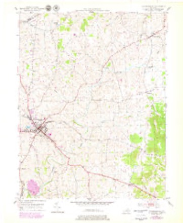
8 topographic sheets cover this place, the earliest surveyed in 1951 and the latest in 1982. It stands in the Flemingsburg census division. It lies in ZIP code area 41093. The Survey maps it on the Flemingsburg quadrangle.
Topographic sheets covering this place
4 surveys from 8 printed sheetsMatched by testing this settlement's coordinate against the published boundary of every sheet in the United States Geological Survey's historical collection. Each opens the scanned sheet at the Survey.
- 1951 USGS Flemingsburg quadrangle1:24000, 3 printings
- 1957 USGS Huntington quadrangle1:250000, 3 printings
- 1960 USGS Huntington quadrangle1:250000
- 1982 USGS Morehead quadrangle1:100000
Fires near this place
10 since 1997Regional context, not property-specific evidence. The federal wildfire occurrence database lists 10 fires within 5 miles of Beechburg between 1997 and 2016, burning about 114 acres in total. None started naturally. None was recorded as arson. Distance is straight-line from the map coordinates, so a fire counted here may appear on a neighbouring settlement's page as well.
| Reported cause | Fires |
|---|---|
| Recreation and ceremony | 3 |
| Missing data/not specified/undetermined | 3 |
| Debris and open burning | 2 |
| Railroad operations and maintenance | 2 |
The most recent of them, most recent first, with the day each was reported and the service that recorded it.
| Date | Cause | Size | Reported by | Name on the report |
|---|---|---|---|---|
| 24 June 2009 | Railroad operations and maintenance | 1.0 acres | Kentucky Division of Forestry | not named |
| 6 April 1999 | Missing data/not specified/undetermined | 8.0 acres | Kentucky Division of Forestry | not named |
| 18 April 2016 | Recreation and ceremony | 40 acres | Kentucky Division of Forestry | BEECHY CREEK |
| 24 March 2009 | Recreation and ceremony | 1.0 acres | Kentucky Division of Forestry | not named |
| 21 February 2009 | Railroad operations and maintenance | 20 acres | Kentucky Division of Forestry | not named |
| 22 December 2005 | Missing data/not specified/undetermined | 4.0 acres | Kentucky Division of Forestry | not named |
| 29 November 1997 | Recreation and ceremony | 6.0 acres | Kentucky Division of Forestry | not named |
| 27 November 1997 | Debris and open burning | 5.0 acres | Kentucky Division of Forestry | not named |
Settlements close enough to share some of these fires:
Storms near this place
4 since 1995Regional context, not property-specific evidence. The National Weather Service names Beechburg in 4 storm reports between 1995 and 2023: 2 thunderstorm wind, 1 hail, 1 tornado. No death or injury is recorded in these reports. Each account below is quoted exactly as the forecast office filed it, from the NOAA Storm Events Database, and each date opens the federal record of that event.
| When | Event | Place named | Harm | What the report says |
|---|---|---|---|---|
| August 2023 | Tornado (EF0) | Beechburg | $150,000 | Actual storm survey determined that tornado likely started and ended within the same minute, only traveling 0.3 miles in that time span. Starting location was 38.4464/-83.6408 and ending location was 38.4482/-83.6352. Due to limitations within the Storm Data interface, could not track the path of the storm since it shows the same start/end time. ||Damage was first observed on a property at the intersection of |Beechburg Road and Colgan Road, where the tornado directly |impacted several structures, including a wooden barn, a mobile |home, a shed, and a larger open barn located behind. All sides of |the mobile home sustained damage, including a large board impaled|into the roof, and some blunt force impacts from pieces of the |nearby barn that collapsed. Vehicles parked to the north and |northeast of the barn sustained heavy damage as it collapsed and |sections became airborne. Next the tornado hit a larger open- air|barn housing heavy equipment. Roof panels were torn off the west |side of the barn and sent up to 200 yards to the ENE. A little |ways down the road, another mobile home sustained blunt force |damage, including a large hole that punctured through into the |interior, as well as wind damage to all sides. Metal roofing from |the barn was found in a grove of trees to the northeast of this |house. The next door neighbor to the east faired better, but it |had debris from the metal barn in their yard, minor wind damage, |and a flagpole which was bent at the base laying northward. |Slightly farther up the road, the next property sustained major |tree damage, including several snapped trees and an uprooted tree,|though no structural damage. The tornado picked up a goat |enclosure in a grove of trees, lifted it over a fence, leaving the|fence untouched, and then tore the structure apart and twisted it|across the front yard of the property. Additional tree damage was|witnessed just past this location before the tornado lifted and |dissipated. |
| June 2021 | Thunderstorm Wind | Beechburg | - | The Fleming County dispatch reported that a strong thunderstorm gust front blew down a tree near the intersection of Maddox and Beechtree Pikes. |
| July 2000 | Thunderstorm Wind | Beechburg | - | Numerous trees down. |
| July 1995 | Hail | Beechburg | - | Three-quarters inch hail reported by Department of Emergency Services. |
Nearest settlements
The eight closest, with where each one stands in the county. Distances are straight-line, computed from the Geographic Names Information System coordinates.
| Map | Place | Distance | Sheets |
|---|---|---|---|
| Pea Ridge (historical) | 2.2 miles | 8 | |
| Dalesburg | 2.3 miles | 8 | |
| Mount Carmel | 2.6 miles | 8 | |
| Pleasureville | 2.9 miles | 8 | |
| Carpentersville (historical) | 3.2 miles | 8 | |
| Foxport | 3.2 miles | 8 | |
| Wallingford | 3.2 miles | 8 | |
| Poplar Grove | 4.4 miles | 12 |
Elsewhere
Matched on this settlement's Geographic Names Information System number rather than its name, so it cannot be a different place of the same name in another state.
| Wikidata item Q122569544 | The structured record the population and elevation above come from. Public domain (CC0). |
Provenance
This settlement is recorded in the Geographic Names Information System as feature 507477. The sheet list is computed by point-in-boundary test against the United States Geological Survey's historical topographic inventory. Both are works of the United States government and carry no copyright under 17 U.S.C. 105.
Wildfire. Short, Karen C. 2022. Spatial wildfire occurrence data for the United States, 1992-2020 [FPA_FOD_20221014]. 6th Edition. Fort Collins, CO: Forest Service Research Data Archive. https://doi.org/10.2737/RDS-2013-0009.6 Collected with United States Government funding and usable without additional permissions or fees.
Storms. NOAA National Centers for Environmental Information, Storm Events Database https://www.ncei.noaa.gov/stormevents/ A work of the United States government, no copyright under 17 U.S.C. 105. Narratives are quoted verbatim from the National Weather Service report and are not edited or summarised.