 Block
Burdick, Kentucky
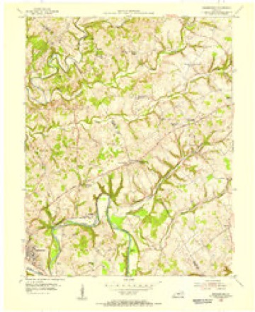
9 topographic sheets cover this place, the earliest surveyed in 1954 and the latest in 1986. It stands in the Campbellsville census division. It lies in ZIP code area 42718. The Survey maps it on the Greensburg quadrangle.
On record in Burdick
Buildings and businesses the archive holds for this place. Each opens its own page, with the source record it came from.
On the National Register within a mile 1 record
The National Register names another town for these. They stand within one mile of this settlement's coordinate.
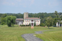 James Caldwell Houselisted 2011 · 0.8 miles away
Topographic sheets covering this place
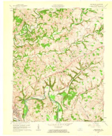
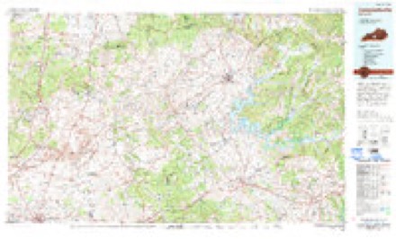
5 surveys from 9 printed sheetsMatched by testing this settlement's coordinate against the published boundary of every sheet in the United States Geological Survey's historical collection. Each opens the scanned sheet at the Survey.
- 1954 USGS Greensburg quadrangle1:24000
- 1957 USGS Winchester quadrangle1:250000, 3 printings
- 1960 USGS Winchester quadrangle1:250000
- 1961 USGS Greensburg quadrangle1:24000, 2 printings
- 1986 USGS Campbellsville quadrangle1:100000, 2 printings


Fires near this place
28 since 1998Regional context, not property-specific evidence. The federal wildfire occurrence database lists 28 fires within 5 miles of Burdick between 1998 and 2019, burning about 101 acres in total. 2 started naturally. 2 were recorded as arson. Distance is straight-line from the map coordinates, so a fire counted here may appear on a neighbouring settlement's page as well.
| Reported cause | Fires |
|---|---|
| Missing data/not specified/undetermined | 12 |
| Debris and open burning | 6 |
| Recreation and ceremony | 3 |
| Natural | 2 |
| Arson/incendiarism | 2 |
| Equipment and vehicle use | 1 |
| Smoking | 1 |
| Railroad operations and maintenance | 1 |
The most recent of them, most recent first, with the day each was reported and the service that recorded it.
| Date | Cause | Size | Reported by | Name on the report |
|---|---|---|---|---|
| 24 August 1999 | Natural | 1.0 acres | Kentucky Division of Forestry | not named |
| 5 June 2002 | Natural | 1.0 acres | Kentucky Division of Forestry | not named |
| 23 June 2005 | Missing data/not specified/undetermined | under an acre | Kentucky Division of Forestry | not named |
| 9 April 1999 | Arson/incendiarism | 1.0 acres | Kentucky Division of Forestry | not named |
| 7 April 1999 | Arson/incendiarism | 5.0 acres | Kentucky Division of Forestry | not named |
| 9 March 2010 | Recreation and ceremony | 20 acres | Kentucky Division of Forestry | not named |
| 9 March 2006 | Missing data/not specified/undetermined | under an acre | Kentucky Division of Forestry | not named |
| 8 March 2017 | Debris and open burning | under an acre | Kentucky Division of Forestry | LEMONS BEND RD. FIRE |
Settlements close enough to share some of these fires:
Storms near this place
10 since 2000Regional context, not property-specific evidence. The National Weather Service names Burdick in 10 storm reports between 2000 and 2026: 6 thunderstorm wind, 2 tornado, 1 hail, 1 flash flood. The reports record 2 injuries. Each account below is quoted exactly as the forecast office filed it, from the NOAA Storm Events Database, and each date opens the federal record of that event.
| When | Event | Place named | Harm | What the report says |
|---|---|---|---|---|
| April 2025 | Tornado (EF1) | Burdick | 2 hurt | A storm damage team surveyed EF1 tornado damage with a max wind speed around 110 mph and a max width of 125 yards in Taylor County Kentucky. The tornado touched down southwest of Burdick along Milder Creek Road and Lemon Bend Road where cedar tree damage occurred. The tornado then continued between Joe Kerr Road and Gilpin Road, twisting trees and damaging a roof structure. The tornado then continued to Joe Kerr Road and Milder Creek Road, where it took a roof off a garage barn and did|damage to several trees. ||The tornado continued across KY Highway 55 and did tree damage along Lone Valley Road with several trees uprooted and large branches damaged. Damage continued to be observed to the northeast along Strawberry Farm Road where several trees were snapped for a max width of 125 yards. Nearby Tuckers Tiki Bar and Restaurant had significant roof damage where an estimated peak wind speed of 110 mph occurred with this tornado. ||The tornado moved to the east where tree damage occurred along State Park Road in Green River Lake State Park. The tornado continued skipping across mainly rural areas of Green River Lake State Park before significant damage occurred on County Park Road |in Taylor County Park, where several trees had been topped off or snapped. The tornado lifted after doing more tree damage at the end of Capps Road, just before going back over Green River Lake. |
| December 2015 | Thunderstorm Wind | Burdick | $400,000 | A NWS storm survey team concluded that a series of microbursts with a fast moving storm produced straight line wind damage in a swath up to 1/2 mile wide south of Campbellsville. Winds were estimated to be between 90 and 100 mph. Six barns or metal outbuildings received extensive damage, ranging from loss of roof panels to complete collapse of structures, with debris generally fanned out to the northeast. An RV was also destroyed when it was lifted off its blocks and pushed down a hill. |
| June 2018 | Thunderstorm Wind | Burdick | $50,000 | The emergency manager reported a downburst went through and caused damage roughly from Highway 55 to the Green River Marina. Part of the roof came off a garage and landed on a truck. A few trees were also snapped. Several houseboats had damage as well. |
| May 2000 | Tornado (F0) | Burdick | $5,000 | The NWS survey team concluded that there was a sign of a circulation and that an F0 tornado had touched down briefly. A shed was destroyed. The siding on a house was damaged. A portion of a roof was blown off a commercial building. |
| May 2000 | Hail | Burdick | $5,000 | Hail damaged siding on a home. |
| April 2026 | Thunderstorm Wind | Burdick | - | There was a tree blocking Lemon Bend Road between Antle Lane and Stubbs Road. |
| July 2024 | Thunderstorm Wind | Burdick | - | Multiple trees down along Kentucky Route 55 south of Campbellsville. |
| April 2023 | Thunderstorm Wind | Burdick | - | A tree was down on Lyle Road about 5 miles south of Campbellsville. |
| February 2021 | Flash Flood | Burdick | - | Taylor County had multiple roads closed with ongoing water rescues. |
| July 2016 | Thunderstorm Wind | Burdick | - | The Taylor County emergency manager reported several trees down blocking east Lemon Bend Road. |
Nearest settlements
The eight closest, with where each one stands in the county. Distances are straight-line, computed from the Geographic Names Information System coordinates.
| Map | Place | Distance | Sheets |
|---|---|---|---|
| Hatcher | 1.5 miles | 11 | |
| Romine | 3.0 miles | 12 | |
| Wrights | 3.0 miles | 9 | |
| Atchison | 4.6 miles | 11 | |
| South Campbellsville | 4.9 miles | 11 | |
| Campbellsville | 5.1 miles | 11 | |
| Sweeneyville | 5.6 miles | 9 | |
| Elk Horn | 5.6 miles | 11 |
Provenance
This settlement is recorded in the Geographic Names Information System as feature 507620. The sheet list is computed by point-in-boundary test against the United States Geological Survey's historical topographic inventory. Both are works of the United States government and carry no copyright under 17 U.S.C. 105.
Wildfire. Short, Karen C. 2022. Spatial wildfire occurrence data for the United States, 1992-2020 [FPA_FOD_20221014]. 6th Edition. Fort Collins, CO: Forest Service Research Data Archive. https://doi.org/10.2737/RDS-2013-0009.6 Collected with United States Government funding and usable without additional permissions or fees.
Storms. NOAA National Centers for Environmental Information, Storm Events Database https://www.ncei.noaa.gov/stormevents/ A work of the United States government, no copyright under 17 U.S.C. 105. Narratives are quoted verbatim from the National Weather Service report and are not edited or summarised.