 Block
Clinton, Kentucky
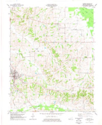
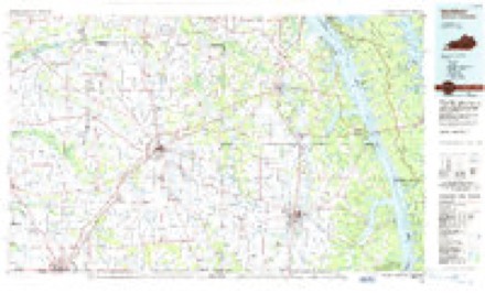
10 topographic sheets cover this place, the earliest surveyed in 1952 and the latest in 1986. It stands in the Clinton census division. It lies in ZIP code area 42031. The Survey maps it on the Clinton quadrangle. 1,222 people lived here at the 2020 count. It stands 371 feet above sea level.
Research this city
On record in Clinton
Buildings and businesses the archive holds for this place. Each opens its own page, with the source record it came from.
On the National Register 3 records
 First Christian Churchlisted 2016
 Hickman County Courthouselisted 1975
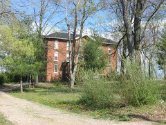 Marvin College Boys Dormitorylisted 1976
Population over time
2 figuresClinton fell from 1,388 to 1,222 between 2010 and 2020. These are the recorded population figures Wikidata holds for this place, reached through the Geographic Names Information System number this page is keyed on rather than by name, so they belong to this place and not to another of the same name. Most are census counts, but not all are: an early figure may be a founding or settlement estimate, and an estimate published within five years of a census is left out. The change column is computed, and is left blank where more than 20 years separate a figure from the one before it, because a gap that long is not a change between two counts.
| Year | People | Change |
|---|---|---|
| 2010 | 1,388 | |
| 2020 | 1,222 | -166 (-12%) |
Topographic sheets covering this place
5 surveys from 10 printed sheetsMatched by testing this settlement's coordinate against the published boundary of every sheet in the United States Geological Survey's historical collection. Each opens the scanned sheet at the Survey.
- 1952 USGS Clinton quadrangle1:24000
- 1952 USGS Water Valley quadrangle1:62500
- 1956 USGS Dyersburg quadrangle1:250000, 4 printings
- 1977 USGS Clinton quadrangle1:24000, 2 printings
- 1986 USGS Murray quadrangle1:100000, 2 printings
Fires near this place
15 since 2004Regional context, not property-specific evidence. The federal wildfire occurrence database lists 15 fires within 5 miles of Clinton between 2004 and 2018, burning about 55 acres in total. None started naturally. 1 was recorded as arson. Distance is straight-line from the map coordinates, so a fire counted here may appear on a neighbouring settlement's page as well.
| Reported cause | Fires |
|---|---|
| Missing data/not specified/undetermined | 6 |
| Recreation and ceremony | 3 |
| Debris and open burning | 2 |
| Railroad operations and maintenance | 2 |
| Smoking | 1 |
| Arson/incendiarism | 1 |
The most recent of them, most recent first, with the day each was reported and the service that recorded it.
| Date | Cause | Size | Reported by | Name on the report |
|---|---|---|---|---|
| 4 September 2018 | Missing data/not specified/undetermined | 5.0 acres | Kentucky Division of Forestry | POWERLINE |
| 28 September 2004 | Missing data/not specified/undetermined | under an acre | Kentucky Division of Forestry | not named |
| 15 September 2010 | Recreation and ceremony | 3.0 acres | Kentucky Division of Forestry | MOON BURN |
| 26 July 2012 | Missing data/not specified/undetermined | 1.0 acres | Kentucky Division of Forestry | KALER |
| 16 June 2015 | Railroad operations and maintenance | 6.0 acres | Kentucky Division of Forestry | COMBINE |
| 9 February 2009 | Railroad operations and maintenance | 15 acres | Kentucky Division of Forestry | not named |
| 8 February 2017 | Debris and open burning | 1.0 acres | Kentucky Division of Forestry | HARPER HAMS |
| 12 February 2009 | Recreation and ceremony | 1.0 acres | Kentucky Division of Forestry | not named |
Settlements close enough to share some of these fires:
Storms near this place
60 of 77 shownRegional context, not property-specific evidence. The National Weather Service names Clinton in 77 storm reports between 1995 and 2025: 35 thunderstorm wind, 14 hail, 13 flash flood, 9 flood. No death or injury is recorded in these reports. Each account below is quoted exactly as the forecast office filed it, from the NOAA Storm Events Database, and each date opens the federal record of that event.
| When | Event | Place named | Harm | What the report says |
|---|---|---|---|---|
| April 2006 | Thunderstorm Wind | Clinton | $100,000 | In downtown Clinton, the front of a building containing three stores on Kentucky 123 collapsed into the street. The road was closed until debris could be cleared. Roofs were blown off four other structures. Seven poles were blown over. |
| May 1996 | Thunderstorm Wind | Clinton | $100,000 | no account filed |
| October 2007 | Thunderstorm Wind | Clinton | $35,000 | A shed and a barn were blown away. Two roads were impassable due to trees across them. Several other trees were down in the same area. A power pole was broken. |
| March 2017 | Thunderstorm Wind | Clinton | $30,000 | In Clinton, a tower over 180 feet tall was blown down. Portions of a 16-by-20 foot shed were blown into a field. A wind gust to 67 mph was measured by a Davis weather station a couple of miles south of Clinton. |
| July 2016 | Thunderstorm Wind | Clinton | $25,000 | Numerous trees were blown down. A tin roof was blown off an equipment shed and another business in Clinton. Most of the damage was on the north side of Clinton or in Clinton. |
| May 2024 | Thunderstorm Wind | Clinton | $15,000 | Four trees were downed on the north and west city limits of Clinton as an early morning thunderstorm moved northeastward through the area. Power outages occurred on the northeastern side of the county. |
| September 2012 | Thunderstorm Wind | Clinton | $15,000 | Several trees were blown down on U.S. Highway 51. The county road maintenance building lost part of its roof. |
| September 2025 | Flash Flood | Clinton | $10,000 | Significant flash flooding occurred in Clinton with several streets flooded and water rising to near entrances of multiple structures. Hourly rainfall rates peaked at Clinton at 2-2.5in from 1615-1715CST with total rainfall rates of 2.5-4in during the afternoon to early evening hours. |
| March 2006 | Thunderstorm Wind | Clinton | $10,000 | Trees and six power poles were blown down on Highway 58. |
| May 1995 | Thunderstorm Wind | Clinton | $10,000 | A tree blew down, falling on a business. |
| March 1997 | Flash Flood | Clinton | $10,000 | no account filed |
| March 1997 | Flash Flood | Clinton | $10,000 | no account filed |
| January 1996 | Thunderstorm Wind | Clinton | $10,000 | no account filed |
| October 2001 | Thunderstorm Wind | Clinton | $8,000 | A vacant mobile home was blown across a field and demolished. A mobile home and an outbuilding were damaged on County Road 703. |
| April 2007 | Thunderstorm Wind | Clinton | $7,000 | Damaging winds downed trees and branches. A business sign was destroyed. |
| November 1996 | Flash Flood | Clinton | $6,000 | no account filed |
| July 2022 | Thunderstorm Wind | Clinton | $5,000 | The wall was bowed in on a metal workshop in Clinton. In the southeast corner of the county near Beelerton, a tree limb was down and corn was flattened. |
| May 2020 | Thunderstorm Wind | Clinton | $5,000 | Larger limbs and small trees were down west of Clinton. |
| February 2019 | Flood | Clinton | $5,000 | Two vehicles were stalled in floodwaters at a railroad underpass in Clinton. Multiple highways were covered by water around the county, especially near flood-prone creeks. |
| May 2016 | Thunderstorm Wind | Clinton | $5,000 | Numerous trees were blown down. |
| June 2015 | Thunderstorm Wind | Clinton | $5,000 | Trees were blown down. |
| July 2014 | Thunderstorm Wind | Clinton | $5,000 | Trees were down along Highway 123. |
| February 2011 | Thunderstorm Wind | Clinton | $5,000 | Kentucky Highway 58 was closed between the 10 and 12 mile markers due to a downed tree entangled in power lines. A power pole was down along Highway 58 in Clinton, and the southeast section of town was without power. |
| August 2003 | Thunderstorm Wind | Clinton | $5,000 | A highway department garage was partially unroofed. At an ambulance building next door, a 2-by-4 piece of wood was driven through the side of the building, causing damage to furniture and appliances inside. Several large trees were blown down. A window was blown out of a business. |
| March 2006 | Thunderstorm Wind | Clinton | $4,000 | A 60-foot long wooden pole barn with metal roof and sides was blown onto Highway 703 just outside Clinton. The barn landed upside down in the middle of the roadway. |
| April 2001 | Thunderstorm Wind | Clinton | $4,000 | Trees and power lines were blown down. |
| May 2007 | Thunderstorm Wind | Clinton | $3,000 | Trees were blown down, mainly to the east of Clinton. |
| July 2018 | Thunderstorm Wind | Clinton | $2,000 | Two trees were blown down over a roadway in the city limits of Clinton. |
| April 2011 | Thunderstorm Wind | Clinton | $2,000 | A carport was destroyed. |
| August 2011 | Thunderstorm Wind | Clinton | $2,000 | Wind gusts near 60 mph were reported by the general public near Clinton. At least one large tree was blown down. |
| January 2000 | Thunderstorm Wind | Clinton | $2,000 | Trees were down. |
| July 2023 | Thunderstorm Wind | Clinton | $1,000 | A tree was down along U.S. Highway 51. |
| July 2002 | Lightning | Clinton | $1,000 | A tree at the county courthouse was struck by lightning and caught fire. |
| January 2025 | Flash Flood | Clinton | - | Flooding occurred near Cane Creek with water over US-51 between Gin Rd and KY-1540 and over KY-58 between KY1475 and KY-1540. Approximately 2 inches of rainfall had fallen over the area when road closures were reported, with an additional half inch of rain through the evening hours. |
| August 2020 | Flood | Clinton | - | A few inches of water covered U.S. Highway 51 between Arlington and Clinton. Storm total rainfall was 2.30 inches. |
| March 2019 | Flood | Clinton | - | A low spot was flooded in a typical problem area. The highway department was dispatched to provide traffic control. |
| February 2019 | Flash Flood | Clinton | - | Highway 58 was flooded in Clinton. |
| April 2015 | Heavy Rain | Clinton | - | Water was over a few streets. |
| April 2014 | Flood | Clinton | - | Creeks remained well out of their banks, and some back roads were still underwater. U.S. Highway 51 was underwater but passable over the Bayou Du Chien Creek. State highway crews flagged traffic across the bridge. The flooding was due to thunderstorms the previous night combined with light to moderate rain the next day. |
| January 2013 | Thunderstorm Wind | Clinton | - | A grain bin was heavily damaged. The contents of the nearly full grain bin spilled onto surrounding areas, including U.S. Highway 51. The highway was closed. |
| June 2013 | Flood | Clinton | - | Kentucky Highway 58 was closed by floodwaters at the 10 mile marker near Clinton. Kentucky 1820 was closed by floodwaters at the Graves-Hickman County line. |
| March 2012 | Flash Flood | Clinton | - | Water covered the road on Kentucky Highway 58 between mile marker 6 and 8 as well as on Kentucky Highway 307 between mile marker 13 and 15. |
| September 2012 | Heavy Rain | Clinton | - | A trained spotter measured a rainfall total of 3.3 inches since midnight. |
| May 2010 | Flash Flood | Clinton | - | Several streets and nearby state highways were impassable due to flooding in and near Clinton and Oakton. U.S. Highway 51 was closed in several locations south of Clinton. |
| May 2010 | Flood | Clinton | - | U.S. Highway 51 was closed between mile markers 4 and 6. |
| October 2009 | Flood | Clinton | - | Kentucky Highway 58 was under water at the railroad underpass in the city of Clinton. Kentucky 80 was closed between Columbus and Arlington, where water was two feet deep. |
| January 2008 | Funnel Cloud | Clinton | - | The funnel cloud was rotating at the time that it was observed. |
| December 2007 | Flood | Clinton | - | A portion of U.S. Highway 51 was flooded near the Bayou De Chien bridge. Message boards were placed along the road to warn of the hazard. |
| May 2007 | Flash Flood | Clinton | - | Localized street flooding occurred. Six inches of water was reported across one street. Minor viaduct flooding occurred. The county emergency management office reported 2.2 inches of rain from the storm. |
| May 2004 | Tornado (F1) | Clinton | - | A damage survey found numerous trees down along the tornado path. There were no known structures within the damage area. Peak winds based on tree damage were estimated near 80 MPH. The tornado tracked from about 4 miles southwest of the small community of Fulgham to 2 miles east of Fulgham. |
| May 2003 | Tornado (F1) | Clinton | - | The tornado path began on Highway 944 about 2.5 miles southeast of Fulgham. Some trees were blown down. Most of the tornado's path was in Graves County. |
| June 2003 | Thunderstorm Wind | Clinton | - | Several trees were blown down in and just east of Clinton. One of the trees landed on a trailer. Power lines were down in Clinton. |
| July 2003 | Hail | Clinton | - | Nickel-size hail fell on Highway 58. |
| May 2002 | Flash Flood | Clinton | - | U.S. Highway 51 was barricaded south of Clinton. Highway 239 was closed. Thunderstorms produced radar-estimated rainfall of 2 to 3 inches over sections of southern Hickman County. |
| June 2001 | Thunderstorm Wind | Clinton | - | Numerous trees were blown down along Highway 58. |
| September 2001 | Thunderstorm Wind | Clinton | - | Four trees were blown down. |
| April 2000 | Flash Flood | Clinton | - | Water covered several roads in town that don't normally flood. Rainfall was measured between 2.5 and 3 inches from thunderstorms that persisted for 2 to 3 hours. |
| April 2000 | Hail | Clinton | - | One-inch hail fell in the "Shilo" area. |
| June 1997 | Thunderstorm Wind | Clinton | - | Trees were blown down. |
| June 1997 | Flash Flood | Clinton | - | Thunderstorms repeatedly affected areas that were drenched with heavy rain earlier in the day. Radar estimated 1 to 2 inches of rain fell within an hour. Street flooding was fairly common. |
Nearest settlements
The eight closest, with where each one stands in the county. Distances are straight-line, computed from the Geographic Names Information System coordinates.
| Map | Place | Distance | Sheets |
|---|---|---|---|
| New Chapel (historical) | 2.9 miles | 18 | |
| Oakton | 3.9 miles | 18 | |
| Scott | 4.0 miles | 18 | |
| Tar Heel | 4.4 miles | 18 | |
| Midway (historical) | 4.4 miles | 18 | |
| Bugg | 4.6 miles | 10 | |
| Moscow | 4.7 miles | 18 | |
| Spring Hill | 5.0 miles | 10 |
Elsewhere
Matched on this settlement's Geographic Names Information System number rather than its name, so it cannot be a different place of the same name in another state.
| Wikipedia article on Clinton | An encyclopaedic summary. Its text is share-alike, so it is linked here rather than copied. |
| Wikidata item Q2684795 | The structured record the population and elevation above come from. Public domain (CC0). |
Provenance
This settlement is recorded in the Geographic Names Information System as feature 489694. The sheet list is computed by point-in-boundary test against the United States Geological Survey's historical topographic inventory. Both are works of the United States government and carry no copyright under 17 U.S.C. 105.
Wildfire. Short, Karen C. 2022. Spatial wildfire occurrence data for the United States, 1992-2020 [FPA_FOD_20221014]. 6th Edition. Fort Collins, CO: Forest Service Research Data Archive. https://doi.org/10.2737/RDS-2013-0009.6 Collected with United States Government funding and usable without additional permissions or fees.
Storms. NOAA National Centers for Environmental Information, Storm Events Database https://www.ncei.noaa.gov/stormevents/ A work of the United States government, no copyright under 17 U.S.C. 105. Narratives are quoted verbatim from the National Weather Service report and are not edited or summarised.