 Block
Cunningham, Kentucky
10 topographic sheets cover this place, the earliest surveyed in 1951 and the latest in 1986. It stands in the Cunningham census division. It lies in ZIP code area 42035. It stands on Lick Creek. The Survey maps it on the Blandville quadrangle. 272 people lived here at the 2020 count. It stands 371 feet above sea level.
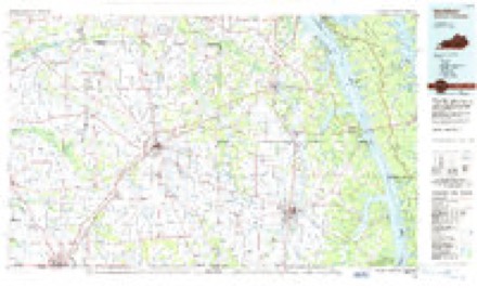
Topographic sheets covering this place
5 surveys from 10 printed sheetsMatched by testing this settlement's coordinate against the published boundary of every sheet in the United States Geological Survey's historical collection. Each opens the scanned sheet at the Survey.
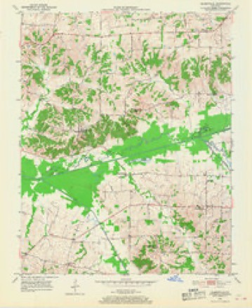
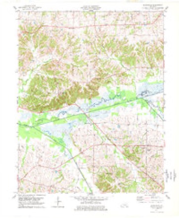
- 1951 USGS Blandville quadrangle1:24000, 2 printings
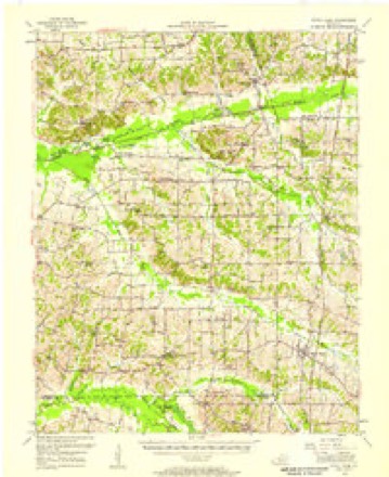
- 1952 USGS Fancy Farm quadrangle1:62500
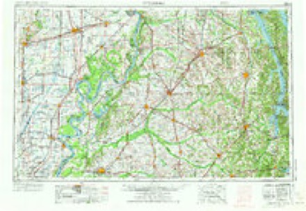
- 1956 USGS Dyersburg quadrangle1:250000, 4 printings
- 1977 USGS Blandville quadrangle1:24000
- 1986 USGS Murray quadrangle1:100000, 2 printings
Fires near this place
11 since 1998Regional context, not property-specific evidence. The federal wildfire occurrence database lists 11 fires within 5 miles of Cunningham between 1998 and 2010, burning about 41 acres in total. None started naturally. None was recorded as arson. Distance is straight-line from the map coordinates, so a fire counted here may appear on a neighbouring settlement's page as well.
| Reported cause | Fires |
|---|---|
| Missing data/not specified/undetermined | 5 |
| Debris and open burning | 3 |
| Recreation and ceremony | 2 |
| Railroad operations and maintenance | 1 |
The most recent of them, most recent first, with the day each was reported and the service that recorded it.
| Date | Cause | Size | Reported by | Name on the report |
|---|---|---|---|---|
| 25 September 1999 | Debris and open burning | 6.0 acres | Kentucky Division of Forestry | not named |
| 15 September 1999 | Missing data/not specified/undetermined | 2.0 acres | Kentucky Division of Forestry | not named |
| 27 August 2010 | Railroad operations and maintenance | 2.0 acres | Kentucky Division of Forestry | ROSS CROSSING |
| 30 June 2005 | Missing data/not specified/undetermined | 5.0 acres | Kentucky Division of Forestry | not named |
| 5 April 2006 | Missing data/not specified/undetermined | 1.0 acres | Kentucky Division of Forestry | not named |
| 5 March 2010 | Recreation and ceremony | 1.0 acres | Kentucky Division of Forestry | not named |
| 27 March 1999 | Debris and open burning | 1.0 acres | Kentucky Division of Forestry | not named |
| 20 March 2009 | Missing data/not specified/undetermined | 12 acres | Kentucky Division of Forestry | not named |
Settlements close enough to share some of these fires:
Storms near this place
36 since 1996Regional context, not property-specific evidence. The National Weather Service names Cunningham in 36 storm reports between 1996 and 2025: 14 thunderstorm wind, 7 hail, 5 flash flood, 5 flood. No death or injury is recorded in these reports. Each account below is quoted exactly as the forecast office filed it, from the NOAA Storm Events Database, and each date opens the federal record of that event.
| When | Event | Place named | Harm | What the report says |
|---|---|---|---|---|
| October 2013 | Tornado (EF1) | Cunningham | $200,000 | The damage began just south of the intersection of U.S. Highway 62 and County Road 1015. At that location, a very large but shallow-rooted tree was uprooted. A glass door to a home was destroyed. This home along with other homes in the immediate area had minor roof and siding damage. A mobile home was blown off its foundation. Two sheds were destroyed. Further northeast, along the south side of U.S. Highway 62, there were several homes with shingles missing and one home with the garage door blown in. On the north side of Highway 62, a large well-built barn sustained partial roof loss. Following U.S. Highway 62 northeast, there were many trees snapped or uprooted, large branches broken off, and bean fields flattened. An amateur radio tower was bent over, and more homes had minor roof damage. A mobile home was flipped over. Peak winds were estimated near 105 mph. The tornado path continued northeast into McCracken County just south of Lovelaceville. |
| February 2008 | Thunderstorm Wind | Cunningham | $75,000 | One mobile home was destroyed, with the roof blown off another. Sheds and outbuildings were damaged. Several homes received shingle damage. Numerous trees were blown down. The roof was off a large chicken house. The microburst was about one-half mile wide. |
| April 1999 | Thunderstorm Wind | Cunningham | $75,000 | A thunderstorm downburst with winds estimated near 70 MPH produced a 3-mile long damage swath through the Cunningham area. One barn, two sheds, and numerous trees were blown down. A vehicle was damaged by debris. Elsewhere in Carlisle County, ten trees were down in the Bardwell and Berkley communities. |
| June 2000 | Thunderstorm Wind | Cunningham | $50,000 | Numerous trees were blown down. The hardest hit area was Cunningham. A tree blew over on a vehicle. The intersection of Kentucky 121 and U.S. 62 was closed for about 30 to 45 minutes. A tree fell on a couple of poles, knocking out a primary line. |
| June 2018 | Thunderstorm Wind | Cunningham | $45,000 | Widespread wind damage occurred around the county. Numerous trees were blown down, including some trees on power lines. A tree fell on a house in Milburn and also in the Cunningham area on County Road 1054. U.S. Highway 62 between Cunningham and Bardwell was impassable due to downed trees on the road. A 67-year-old man was killed when he lost control of his motorcycle due to a fallen tree on Highway 121 near County Road 1031 (indirect fatality). |
| March 2019 | Tornado (EF1) | Cunningham | $20,000 | This multi-county tornado first touched down near the intersection of Highways 1820 and 1628 in northeast Carlisle County. Only a very small portion of the track occurred in Carlisle County. The tornado proceeded northeast, passing mostly over undeveloped wetlands along Mayfield Creek. The damage path started with spotty tree damage and minor shingle damage. As the tornado approached the Ballard County line, a wider and more definitive path of snapped and uprooted trees became evident. Peak winds in Carlisle County were estimated near 105 mph as it was entering Ballard County. |
| March 2024 | Thunderstorm Wind | Cunningham | $10,000 | Trees were reported down in the Cunningham area, with power outages occurring. |
| May 2024 | Thunderstorm Wind | Cunningham | $10,000 | As a result of thunderstorm downdraft winds, trees were downed near Cunningham with power outages reported. |
| January 1997 | Hail | Cunningham | $10,000 | no account filed |
| July 2023 | Thunderstorm Wind | Cunningham | $5,000 | Trees were down. |
| June 2004 | Flash Flood | Cunningham | $5,000 | no account filed |
| May 1999 | Thunderstorm Wind | Cunningham | $3,000 | Trees were down. |
| July 2022 | Thunderstorm Wind | Cunningham | $1,000 | A large tree was snapped. |
| June 2015 | Thunderstorm Wind | Cunningham | $1,000 | A couple of trees were blown down on a farm. |
| June 2015 | Thunderstorm Wind | Cunningham | $1,000 | A large tree was blown down. |
| February 2025 | Flash Flood | Cunningham | - | Flash flooding along Mayfield Creek closed a portion of U.S. 62 east of Cunningham. |
| February 2025 | Flood | Cunningham | - | Flood waters from Mayfield Creek closed a portion of Highways 1820 and 1628 north and northeast of Cunningham. |
| March 2018 | Hail | Cunningham | - | The hail occurred near U.S. Highway 62 between Cunningham and the Ballard County line. |
| November 2018 | Flood | Cunningham | - | Several state roads were closed in flood-prone areas. The roads were lesser-travelled secondary roads. A 24-hour rainfall amount of 5.56 inches was reported by the public near Cunningham. |
| March 2016 | Flash Flood | Cunningham | - | Kentucky Highway 1628 was closed from the 3 to 4 mile marker. Kentucky Highway 1820 was closed from the 1 to 3 mile marker. Both roads were flooded by backwater from Mayfield Creek. |
| June 2015 | Flash Flood | Cunningham | - | Many roads quickly became water-covered and hazardous. |
| March 2015 | Flood | Cunningham | - | In the northeast corner of Carlisle County, Kentucky Highway 1820 was closed due to creek flooding. Water was over Highway 1628. |
| December 2015 | Heavy Rain | Cunningham | - | A couple of roads were closed that routinely become covered with water in heavy rain events. This included Kentucky Highway 1820 near the 1 mile marker. |
| May 2012 | Hail | Cunningham | - | Ping-pong ball size hail was reported on Highway 307. |
| March 2012 | Flash Flood | Cunningham | - | Flash Flooding produced 1 to 3 feet of water over Kentucky Highway 1820 at mile marker 1, and over Kentucky Highway 1628 between mile marker 3 and 4. |
| September 2006 | Flood | Cunningham | - | Flooding of Mayfield Creek and its tributaries inundated many acres of bottomland woods and fields. A few state roads were closed, including U.S. Highway 62 at the west fork of Mayfield Creek. Highways 1628 and 1820 near Cunningham were closed. |
| August 2006 | Tornado (F0) | Cunningham | - | A trained spotter witnessed a brief tornado touchdown in a field behind the Cunningham bank. Some trees were blown down. |
| June 2003 | Heavy Rain | Cunningham | - | Water was over a few roads, including Kentucky Highway 80 and U.S. Highway 62. Highway 62 was closed at mile marker 3. A rural road near Cunningham that frequently floods during heavy rain was also closed. |
| July 2003 | Thunderstorm Wind | Cunningham | - | Trees were blown down on Highways 62, 1012, and 1820 near Cunningham. |
| June 2015 | Hail | Cunningham | - | no account filed |
| May 2012 | Hail | Cunningham | - | no account filed |
| October 2006 | Flood | Cunningham | - | no account filed |
| May 2000 | Hail | Cunningham | - | no account filed |
| April 1998 | Hail | Cunningham | - | no account filed |
| January 1996 | Thunderstorm Wind | Cunningham | - | no account filed |
| October 1996 | Thunderstorm Wind | Cunningham | - | no account filed |
Nearest settlements
The eight closest, with where each one stands in the county. Distances are straight-line, computed from the Geographic Names Information System coordinates.
| Map | Place | Distance | Sheets |
|---|---|---|---|
| Wilson | 1.3 miles | 7 | |
| Old Mayfield (historical) | 2.1 miles | 10 | |
| Magee Springs | 2.7 miles | 10 | |
| California Hills | 2.8 miles | 7 | |
| Yellow Dog Road | 3.1 miles | 7 | |
| Scotts Corner | 3.2 miles | 7 | |
| Zoar (historical) | 3.3 miles | 7 | |
| Morris Valley (historical) | 4.8 miles | 10 |
Elsewhere
Matched on this settlement's Geographic Names Information System number rather than its name, so it cannot be a different place of the same name in another state.
| Wikipedia article on Cunningham | An encyclopaedic summary. Its text is share-alike, so it is linked here rather than copied. |
| Wikidata item Q15212192 | The structured record the population and elevation above come from. Public domain (CC0). |
Provenance
This settlement is recorded in the Geographic Names Information System as feature 490489. The sheet list is computed by point-in-boundary test against the United States Geological Survey's historical topographic inventory. Both are works of the United States government and carry no copyright under 17 U.S.C. 105.
Wildfire. Short, Karen C. 2022. Spatial wildfire occurrence data for the United States, 1992-2020 [FPA_FOD_20221014]. 6th Edition. Fort Collins, CO: Forest Service Research Data Archive. https://doi.org/10.2737/RDS-2013-0009.6 Collected with United States Government funding and usable without additional permissions or fees.
Storms. NOAA National Centers for Environmental Information, Storm Events Database https://www.ncei.noaa.gov/stormevents/ A work of the United States government, no copyright under 17 U.S.C. 105. Narratives are quoted verbatim from the National Weather Service report and are not edited or summarised.